January 2026
How to make a custom printable map
A simple guide to create beautiful printable maps with PamPam
Printable maps are still one of the simplest ways to share information. They work offline, they’re easy to hand out, and they fit naturally into flyers, postcards, brochures, and welcome packets. Whether you’re making a city guide, an event handout, or a small business map, a custom printable map gives people context at a glance.
The tricky part is making one that looks good without needing design software or technical mapping tools.
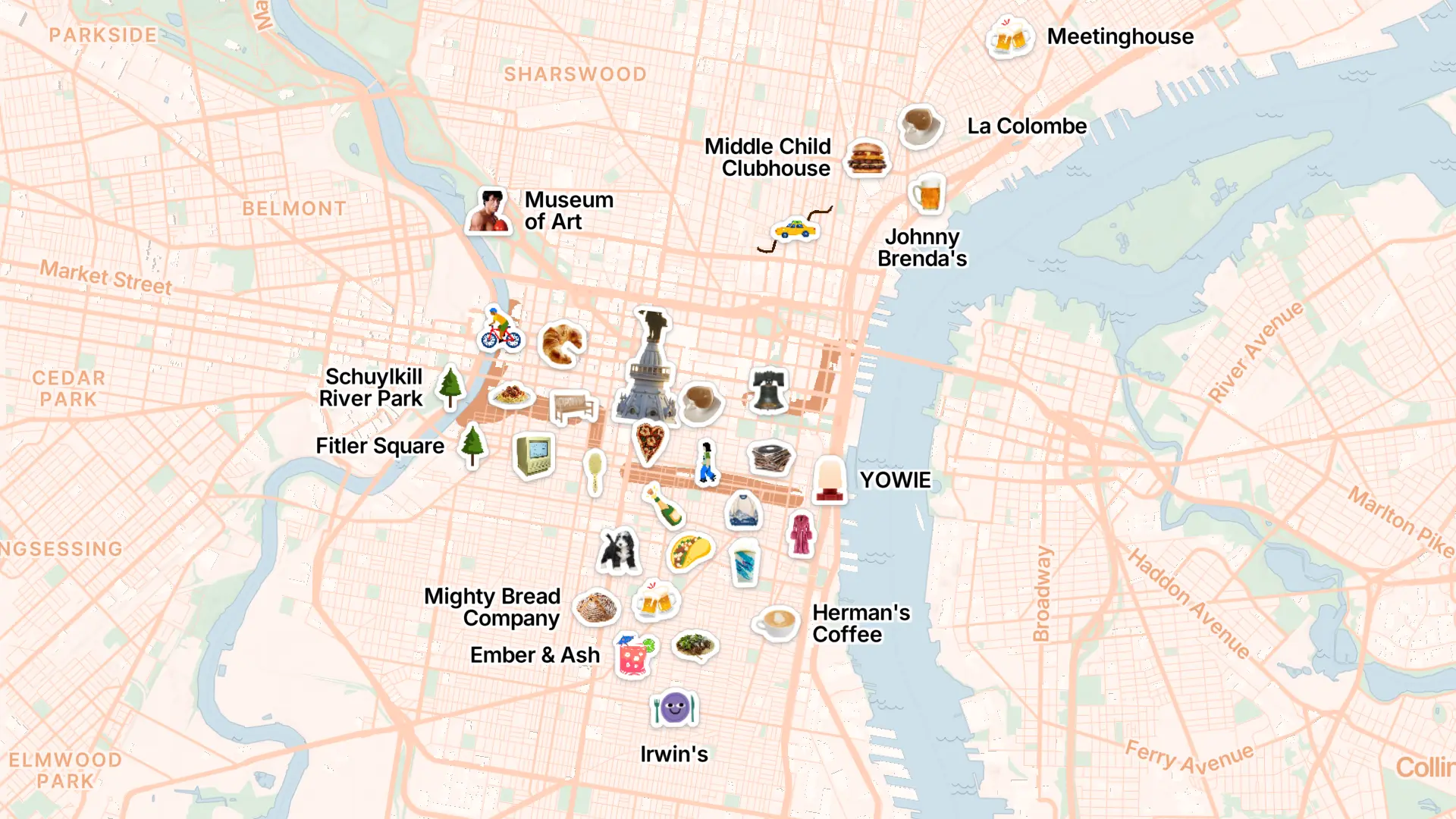
PamPam is an AI map maker that helps you make your own custom maps. You can make interactive maps, travel maps, and simple map animations in seconds, all designed to look beautiful and easy to share. PamPam also makes it easy to create clean, custom printable maps you can export and use right away.
You can explore printable map examples here:
https://www.pampam.city/printable-maps
Or see other custom map types here:
https://www.pampam.city/custom-maps
Here’s how to make a custom printable map with PamPam.
Start by adding your spots
Every printable map starts with the places you want to show. That might be locations for an event, a list of recommended restaurants, shops around a neighborhood, or important landmarks.
In PamPam, you add spots directly to the map by searching for them one by one. Each place becomes a pin, and you can decide exactly what belongs on the final map. Because PamPam focuses on adding and arranging places — not data visualization — the map stays clear and easy to read.
This works well for:
- Event maps
- City or neighborhood guides
- Business directories
- Welcome maps for guests or customers
Customize the look of your map
Once your places are in, you can adjust the design so the map feels intentional. PamPam lets you choose your colors, update pin icons, and fine-tune the layout before exporting.
Most people focus on:
- A limited color palette that prints well
- Clear icons that are easy to recognize
- A balanced zoom level so nothing feels crowded
Because everything updates instantly, you can experiment until the map feels right.
Choose your print size
Before exporting, you can choose the size that fits your use case. PamPam’s printable maps work best for small-format prints like flyers, cards, or inserts.
Common uses include:
- Handouts at events
- Postcards or rack cards
- Small folded guides
- One-page flyers
PamPam exports printable maps as PNG files, which makes them easy to drop into design tools or print directly. At the moment, there’s no SVG export, and the resolution is designed for small prints — not large posters or wall-sized displays.
The idea is to keep printable maps simple and practical.
Export and print
Once you’re happy with the design and size, you can export your map as a PNG. From there, you can:
- Print it at home or through a local printer
- Add it to a flyer or postcard layout
- Include it in a welcome packet or brochure
Because the map is an image, it works well across different tools and printing workflows.
Pair print with digital maps
Many people use printable maps alongside interactive ones. You might hand out a printed map, then include a link or QR code to the interactive version so people can explore further on their phones.
Since PamPam supports both printable exports and interactive sharing, you don’t need to rebuild anything — it’s the same map, used in different ways.
Make your printable map today
If you need a simple, good-looking map for print, PamPam keeps the process approachable. Add your spots, choose your colors, pick a print size, and export a PNG you can use right away.
You can start here:
https://www.pampam.city/printable-maps
Or explore more custom map ideas here:
https://www.pampam.city/custom-maps
If you try printing your map, we’d love to see how you use it. Every use case helps us shape how printable maps should work.