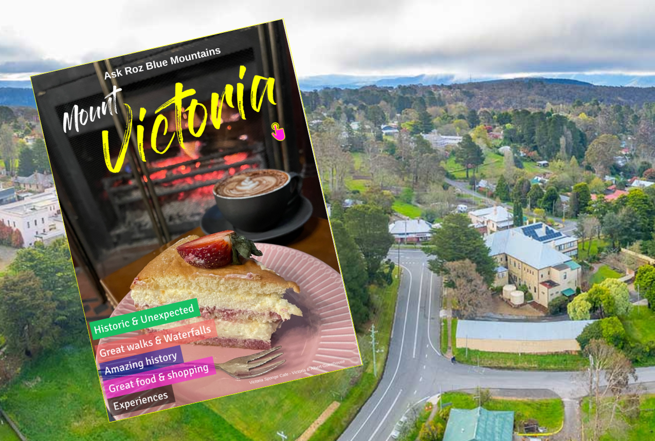
Mount Victoria - eMag
Mount Victoria unites historic charm with natural attractions. Originally a stockade for convict chain-gangs, and later an important staging post for Cobb & Co coaches, the town became known as Mount Victoria in the 1860s when the railway came to town. Enjoy scenic lookouts, grand guesthouses and a rich history. Mount Victoria eMag: www.askroz.news/Mount-Victoria-NSW
Ask Roz Blue Mountains
Mount Vic eMag
Find great things to see and do in Mount Victoria
Stays
Great places in Mount Victoria to stay
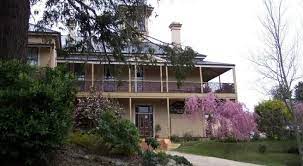
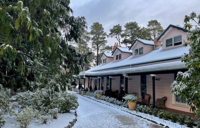
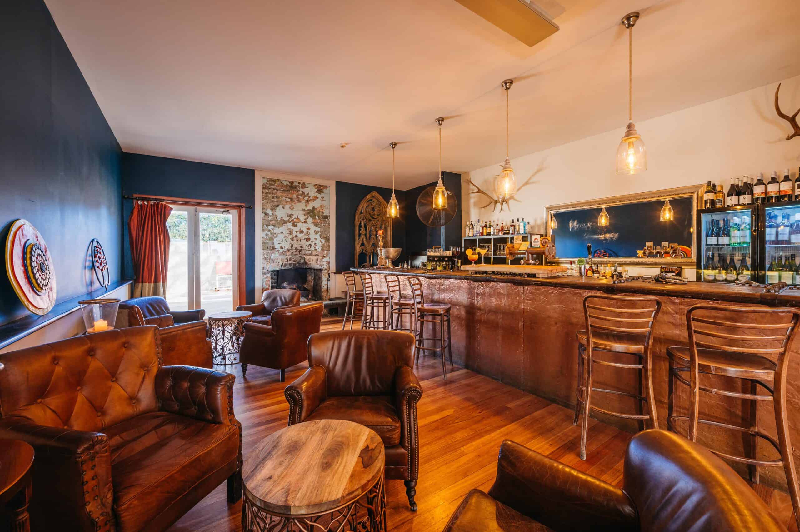
Victoria & Albert Guesthouse
The Victoria and Albert Guesthouse is a historic property in Mount Victoria. Key points: • Built in 1868, originally as the Royal Hotel Located near Mount Victoria's train station Offers various room types with period decor • Amenities include shared lounges, fireplaces, and a restaurant • New owners began renovations in 2023 to blend historic charm with modern comforts • Hosts special events like "Glitzmas" and Sunday roasts • Known for its friendly staff and unique atmosphere • Popular base for exploring Blue Mountains attractions The guesthouse provides a blend of history and comfort for visitors to the Blue Mountains region. https://vaguesthouse.com (02) 4787 1348

Hotel Etico
Hotel Etico is the place where holidays create opportunities... We provide a fantastic holiday experience to guests through beautiful and comfortable accommodation in one of the most welcoming villages of the Blue Mountains, delicious and wholesome food from Niccolo's restaurant and a wide selection of drinks from our bar within a unique and warm atmosphere. All of this, while powering a program that provides employment and independent living opportunities to young people with disability, helping them to achieve their independence goals. https://hoteletico.com.au 0438 511 352
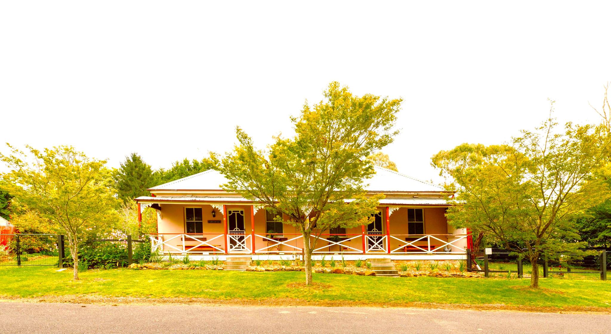
Closeburn House
Closeburn House was built in the late 1800’s by Mrs Mary Theresa Alice Kirkpatrick. Mary named her home Closeburn House after the village of Closeburn in Dumfries and Galloway, Scotland where Closeburn Castle still stands and was the family seat of the Kirkpatrick family until 1783. Closeburn House has periodically operated as an upmarket guesthouse for more than a century. In the early 1900’s, Closeburn House laid on what became the main western highway route with the opening of Berghofer’s Pass, which became popular with the new motor vehicles that baulked at the steep gradient of Victoria Pass. Closeburn House was extensively restored and extended in 1990. It later changed ownership but then suffered from a decade of neglect. In 2018 it was brought back to life after an extensive renovation of the house and grounds, and now Closeburn House Boutique Guesthouse continues its rich history of hospitality offering a beautiful mountain retreat to all of its guests and visitors. https://closeburnhouse.com.au 0490 831 451
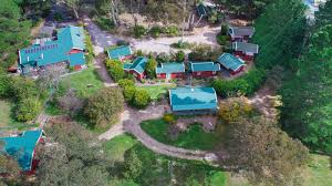
Cedar Lodge Cabins
Escape to your own Blue Mountains piece of paradise. Cedar Lodge Cabins are set high in the village of Mount Victoria and, being centrally located to all the major attractions, are the perfect place to base your mountain adventure. Nestled in a beautiful bushland garden, you can visit the Jenolan Caves (55km), the Three Sisters (20km), Scenic Railway (20km), Mt Tomah Botanical Gardens (30km), or the Zig-Zag Railway (17km), go bushwalking, abseiling, horse riding, or, for the less energetic, explore the local history and scenic picnic spots, stroll through the village galleries and shops or sample the cuisine in the local cafés and restaurants, or just relax in one of our individual air-conditioned cabins. https://cedarlodgecabins.net (02) 4787 1256
Larsens Cottages
These wonderful cottages are ideal for guests, be they friends, couples, families or individuals with a love of our natural surroundings wishing to have a relaxing and memorable stay in these comfortable historical cottages.
Mount York Campground
5km from Mt Victoria village at the end of Mt York Rd - small camping area (limited sites) suitable for tents. A popular climbing area with historic roads. Please note: Campground stays are limited to a maximum of ten days only (four days only at Mt York). Water is not available – you must bring your own washing and drinking water. Pack a gas or fuel stove for cooking. If planning to cook on an open fire, purchase firewood from local outlets beforehand. Collecting timber from bushland is prohibited. Check fire ban danger ratings and total fire ban information at the NSW Rural Fire Service website for fire safety information. Use rubbish bins provided or take your rubbish out with you. https://www.bmcc.nsw.gov.au/camping (02) 4780 5000
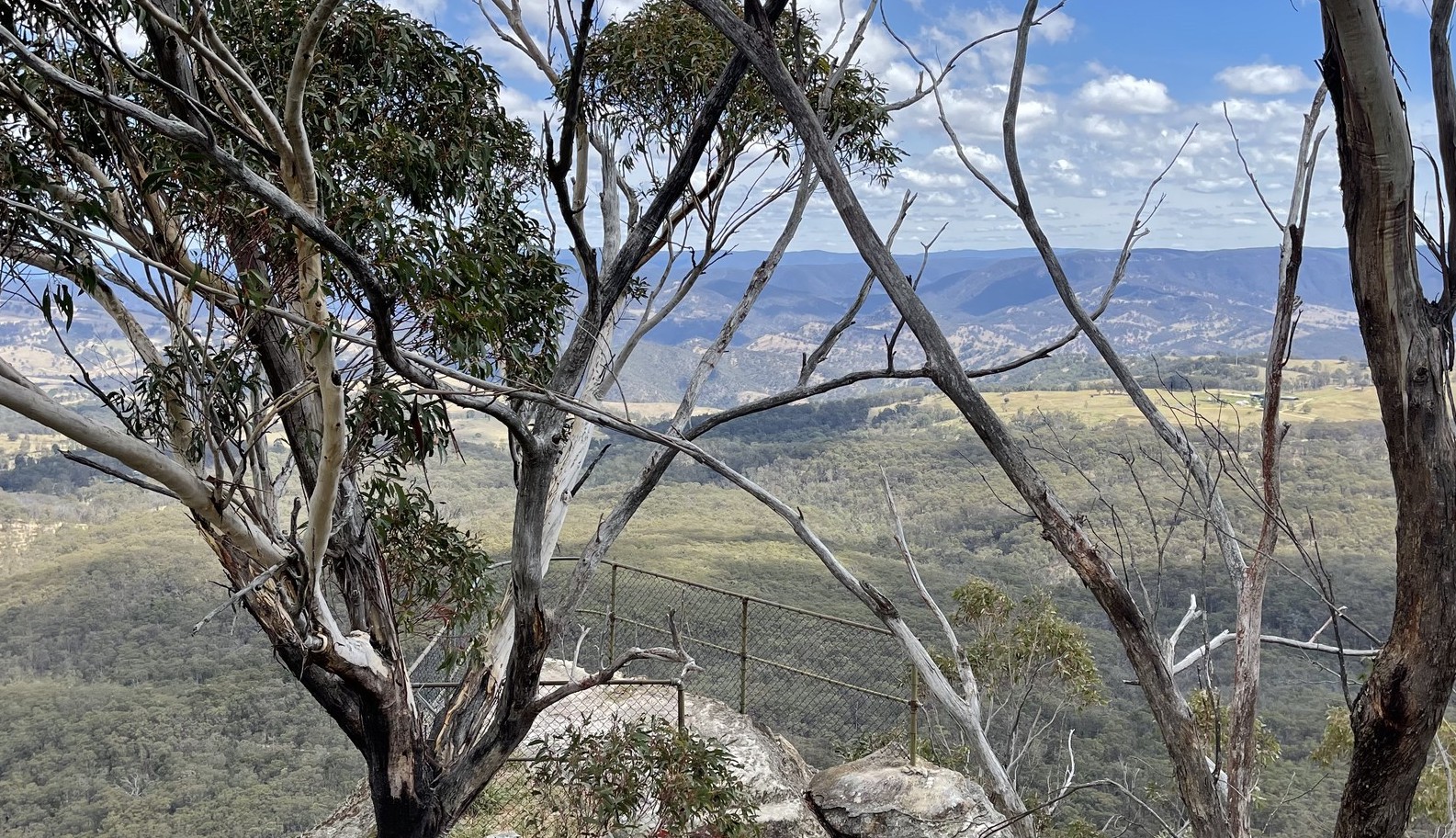
One Tree Hill
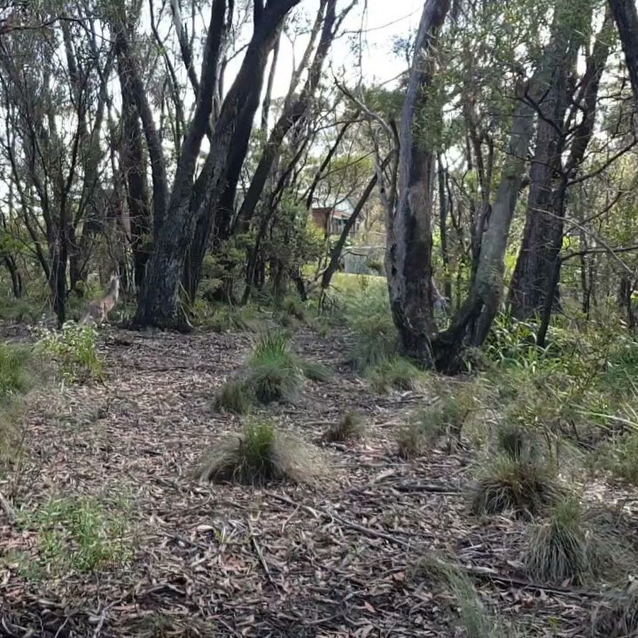
One Tree Hill was originally originally mapped by surveyor General Thomas Mitchell and then when the railway line came through to the village, the town was given the name of Mount Victoria in 1868 after the young Princess Victoria. Highest Point in the Blue Mountains at 1,111m.
Shopping
Mount Vic & Me
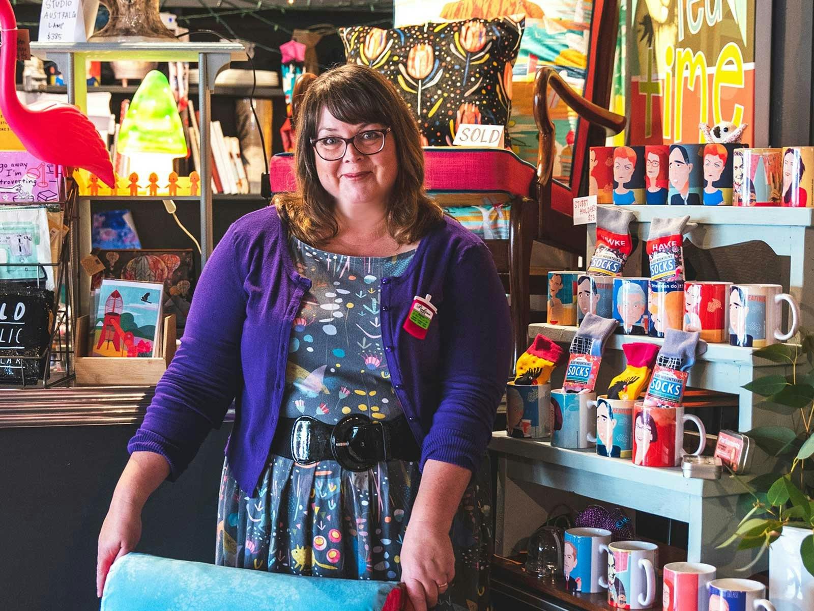
In 2017 a little shop in Mt Vic came up and was shared. Within 3 months it was clear it was too small. In 2019, the big shop next door came up for rent (the old Mountain Top Café). Our studio shop is totally fun. It's quirky, outrageous, filled with treasures with themes including Australiana, political goodies, feminist and vintage finds. Discover the fabulously fun world of Mount Vic and Me at the top of the Blue Mountains in the historic village of Mount Victoria. Check out our goodies online or visit us at our studio shop on days when we are open. Mount Victoria is very much a ‘long weekend’ destination and a sweet little visit. Midweek it can be pretty quiet. That’s why the studio shop is not always open to the public. https://mountvicandme.com TF N/A
Mountain Style
Features include rustic furniture, railway furniture, antiquarian books with fishing being a feature, contemporary jewellery, haberdashery, beads, vintage clothing, vintage and modern Bric a Brac, to the unexpected treasure.
Eats
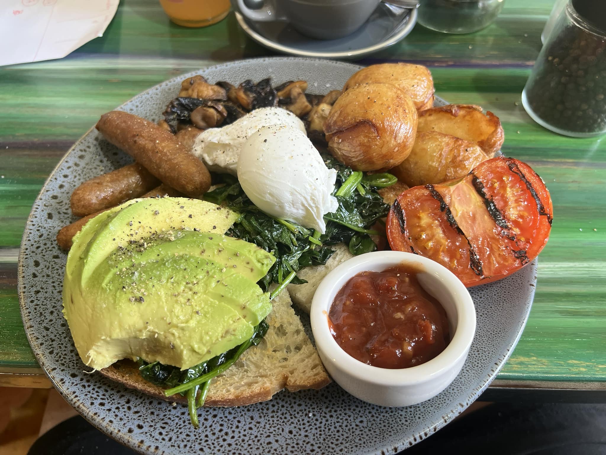
V&A Cafe
The V&A Cafe is open - 10am - 2.30pm - Monday, Thursday, Friday, Saturday & Sunday They have a delicious selection of cakes and pastries, toasties and pies, coffee and teas, breakfast, lunch and dinner options. Sit outside on the verandah or inside in the beautiful dining room. https://vaguesthouse.com https://www.facebook.com/vaguesthouse 0459 844 345
 facebook.comvaguesthouse.com
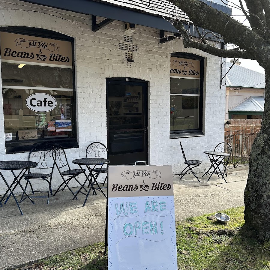
Mt Vic Beans & Bites
Local family run cafe in Mount Victoria, serving up delicious home made food and great coffee. Open Wed - Fri 7am - 3pm and Sat - Sun 9am - 4pm
Niccolo's Restaurant and Bar
Opening hours: Wednesday 5pm-8pm (pizza and antipasto ONLY) Thursday - Saturday 5pm - 8:30pm Call 0438 511 352 to book. Live music every Friday! Happy hour 5-6pm https://hoteletico.com.au/niccolos-restaurant-bar/ 0438 511 352
One Tree Hill Cafe & Kitchen
Cosy café in the heart of mount Victoria Dog friendly veranda. Locally roasted coffee and homestyle cooking. Catering available. https://www.facebook.com/profile.php?id=61562913604854
Attractions
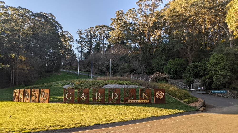
Blue Mountains Botanic Garden - Mount Tomah
Discover a showcase of local and imported cool climate plants and basalt cap forests, surrounded by UNESCO World Heritage Area wilderness. Enjoy the tranquillity on the walking trails, wander the plant displays, or take a pitstop at the restaurant with views of the scenic mountains. https://www.botanicgardens.org.au/blue-mountains-botanic-garden-mount-tomah
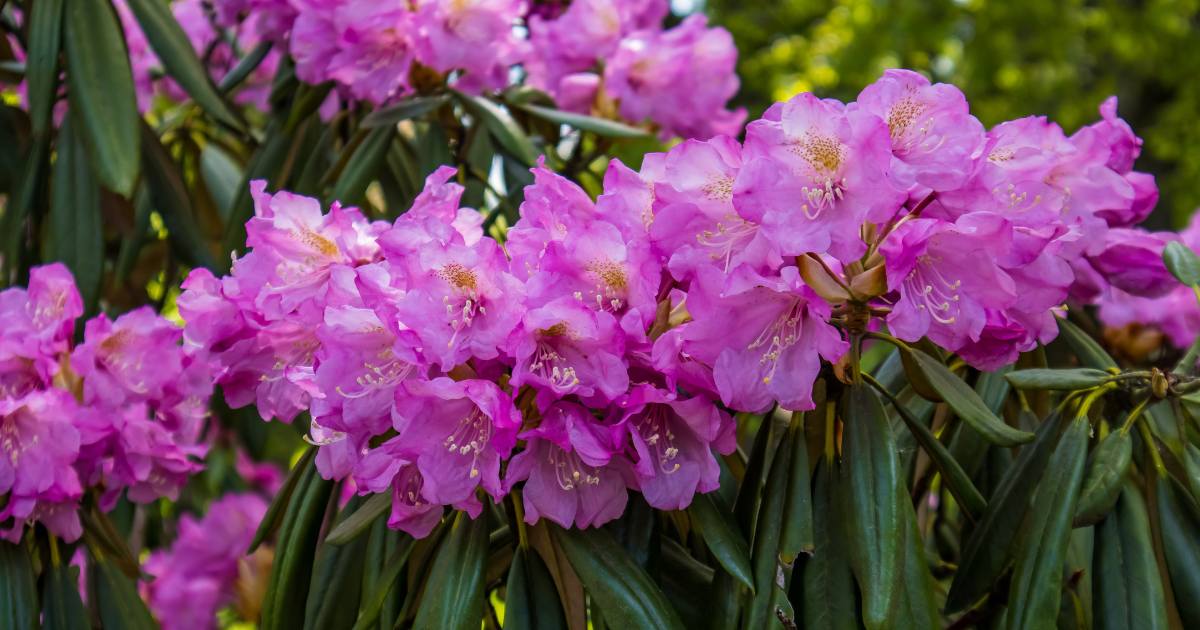
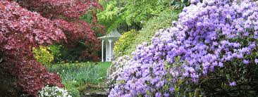
Campbell Rhododendron Gardens
A unique garden - with exotics planted underneath and amongst the existing native eucalyptus trees and shrubs over 18.3 hectares, featuring: Ponds, lake, garden bridges, specific plantings of rhododendron, azaleas and other exotics Walking tracks Native plants and animals Visitor facilities include toilets, picnic benches and shelters, parking Garden locations available for weddings Group bookings for clubs and societies https://www.rhodogarden.org.au
Dryridge Estate Winery
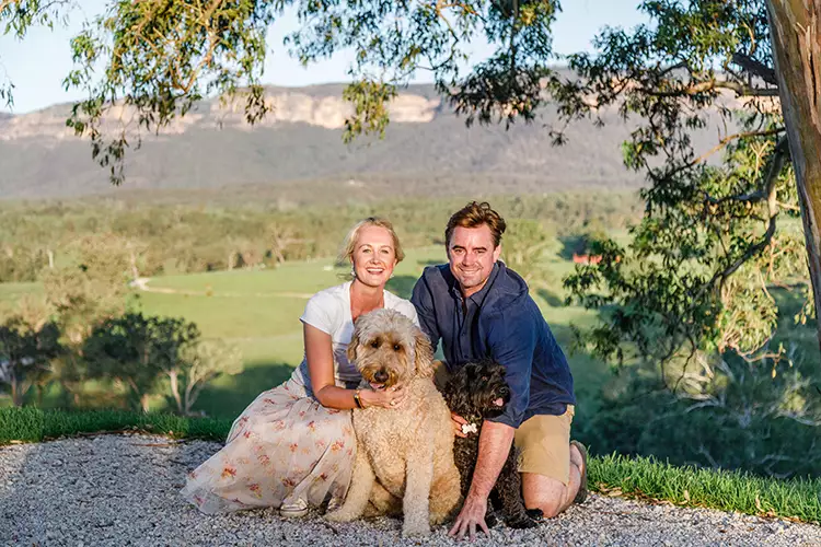
Dryridge Estate was founded by Bob and Barbara Tyrrell in 2000. It was a challenging growing environment, struggling for many years against drought, to produce the first commercial wines in the Megalong Valley. Their hard work and persistence paid off as the pink granite soil that the vineyard was built on adds a unique crisp minerality to the wines. Tragically in 2013 Bob suffered a fatal heart attack on the property aged 75. His determination was inspiring to locals, friends and family. After Bob passed away, the Tyrrell family decided to sell their beautiful property and business. They were hoping the vineyard would sell to enthusiastic new owners, which is exactly what they got! Emma and Simon took over the business in July 2015 and could not have been more thrilled to be in the Megalong Valley starting a new life. They moved their little family from a terrace house in Bondi to Dryridge, where George (Groodle), Angus (Cavoodle) and Charlie Cat have a vast amount of room to run around and play! https://dryridge.com.au 0403 118 990
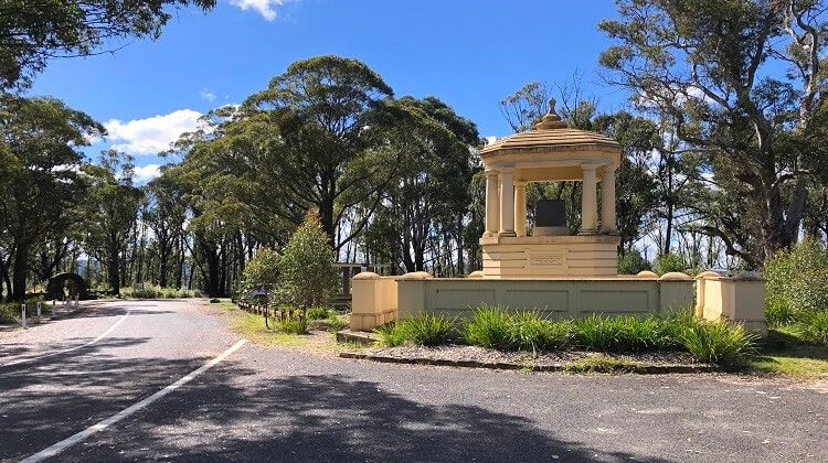
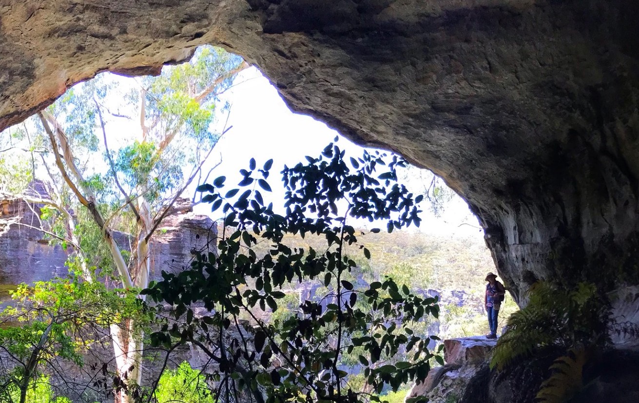
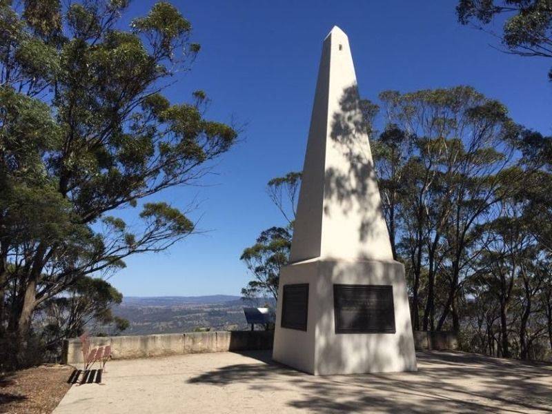
Explorers Monument - Mount York Obelisk
The Mount York Obelisk was erected by public subscription to commemorate the crossing of the Blue Mountains by Blaxland, Lawson and Wentworth in 1813. It was suggested that the obelisk should commemorate not only Blaxand, Lawson and Wentworth but also those others who had assisted in pioneering the route over the Mountains, including Evans, Cox and Macquarie. It stands towards the extremity of the mountain spur, just before the cliff line. The base of the obelisk has inscriptions on all four sides. These commemorate the Explorers, Blaxland, Lawson and Wentworth; the Surveyor, Evans; the Road-builder, Cox; and the Governor, Macquarie. The Macquarie inscription was added during the centenary celebrations in 1913. The names of the Reserve Trustees at the time: Berghofer, Howell and Rienits, are also recorded on the monument. The obelisk was completed in 1900. https://www.facebook.com/search/top?q=mount%20york%20obelisk

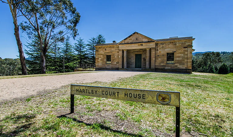
Hartley Courthouse
Hartley Courthouse was designed by colonial architect Mortimer Lewis in the Grecian Revival style. Still largely intact and constructed solidly of locally quarried sandstone, it is an imposing building, as it was designed to be. The three doorways provided entrances for prisoners, the public and magistrates and visitors can examine the cellblock that housed prisoners and convicts. Many notorious bushrangers and cattle thieves were kept here and inside the cells, with their bars and bolts still in position, you can imagine the thoughts of men used to roaming the country locked up tight in this remote prison. As the convict system faded into history, and Hartley was bypassed by the new railway, the need for a courthouse here diminished. Benefits were held in this grand old building during World War II, and nowadays visitors can wander through, reading the interpretive signs and imagining the building’s vivid colonial past. https://www.nationalparks.nsw.gov.au/things-to-do/historic-buildings-places/hartley-courthouse
Hartley Vale & Mount Blaxland Reserve Trust Cemetery
Also know as Mount York Cemetery. Hartley Vale Cemetery is a heritage listed site in the care of a Trust. The cemetery is approximately 300 metres from the road and pedestrian access only is available as the lane and burial ground at the end of it are guarded by three locked gates with a squeezy opening for people. A small roadside parking area at the entrance is sufficient for two vehicles. At the entrance to the cemetery itself is an informative sign that graphically illustrates the cemetery layout and lists the basic details of all known burials. A picnic bench and seats are provided but there is no reticulated water available. Unfortunately, the site is overgrown with a spiny native sedge that inhibits access to some of the graves and care needs to be taken to avoid rabbit holes. This long closed cemetery contains the graves of many of the district's pioneer families, the earliest inscription extant being dated 1837. There are many sandstone monuments, some of which are now somewhat difficult to read, a larger number of marble and even a few granite stones that have probably been erected in more recent times to replace earlier markers. Generally speaking, the monuments are in good order having regard to their age. https://austcemindex.com/cemetery.php?cemid=493

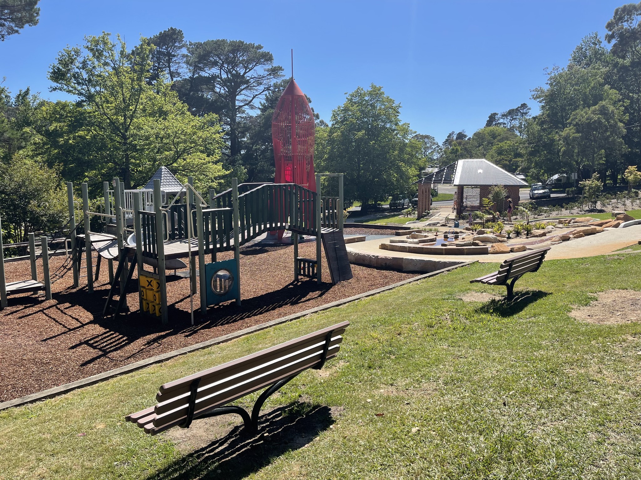
Blackheath Memorial Park & Heritage Playground
The iconic red rocket is in the Blackheath Soldiers Memorial Park, providing a unique experience for children of the Blue Mountains and beyond. Blue Mountains City Council, the Rotary Club of Blackheath and the community worked together to get the new replica rocket installed at Blackheath Memorial Park. The original rocket was the first in Australia and was built in the early 1960s by Blue Mountains City Council and was funded by The Rotary Club of Blackheath after John Yeaman. John Yeaman was a Council engineer and past President of the Blackheath Rotary Club, sourced designs in America.Copies of the Rocket became an iconic feature of playgrounds throughout the country. https://www.askroz.com.au/index.php/event_detail/index/blackheath-rocket
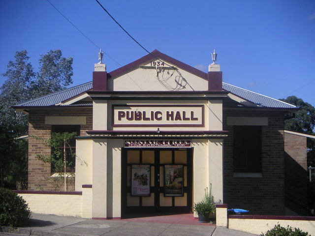
Mount Vic Flicks
For session times and movie information, use the web link listed below ... Old fashioned movie theatre. Check movie times by clicking web link below. Movies may not be on every day of the week. Mount Vic Flicks is located in heritage-listed Mount Victoria, one of the highest towns in the Blue Mountains and is a much loved and treasured icon of the Upper Blue Mountains.Built in 1934, the cinema is a window into the golden age of Australian country picture theatre culture. https://mountvicflicks.com.au/sessions/
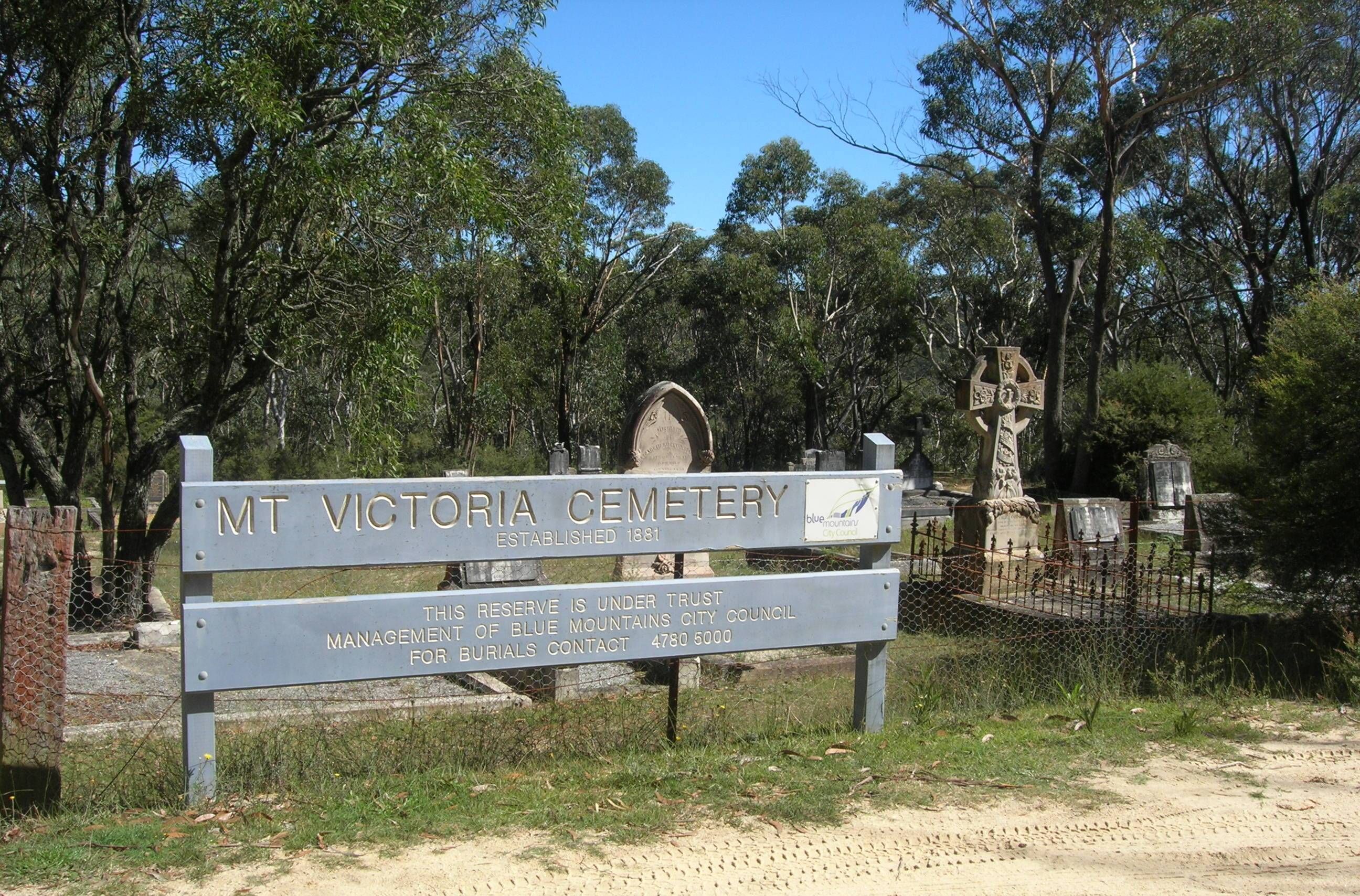
Mount Victoria Cemetery
This is one of three cemeteries near the Great Western Highway and possibly the oldest according to Blue Mountains City Council. Located on 3.25 hectares, the earliest known burial is 1881. https://www.bmcc.nsw.gov.au/community/cemeteries/our-cemeteries#Victoria
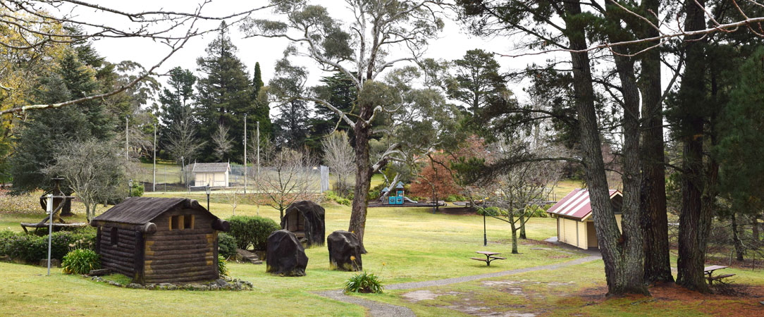
Mount Victoria Memorial Park
The Mt. Victoria Memorial Park has a high degree of historical and social significance, a beautiful place to stop and rest and a great place for the kids to play. There is a bbq on the north side of the tennis court (our tennis court is free by the way), play equipment, bubblers, picnic tables and toilets. You will see the old grottos that once housed a zoo belonging to the Imperial Hotel, the first War Memorial in the Blue Mountains and a great old bandstand. It has become a valued recreational resource, which has been utilized by many generations of tourists and residents alike. Just off the Highway, turn into Station St. https://mountvictoria.nsw.au/our-great-places/the-imperial-park-zoo/
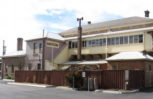
Mount Victoria Museum
OPEN: Saturdays: 12:00 pm to 3:00 pm. Set in sixteen rooms of the heritage-listed 1868 Mount Victoria Railway Station. It is part of the railway to the west which was built across the rough terrain of the Blue Mountains. Entry fee: $8 adults and $1 children A display to commemorate the bicentenary of the crossing of the Blue Mountains has sketches, paintings, and artifacts showing the work of the explorers, road builders, tradesmen, and convicts. The struggle of the settlers is shown by the nature of the tools and farm equipment, whose construction, use and maintenance required enormous physical effort.The changing domestic scene is illustrated by costumes and accessories, pottery, historic railway tableware, musical instruments, and furniture. Development of the area as a tourism destination and industries such as mining are also depicted. Displays and information on unique local schools are a highlight. Many natural history items depict local and exotic wildlife. Groups are welcome out of hours, by arrangement. https://www.askroz.com.au/index.php/event_detail/index/mount-victoria-museum
Mount Wilson
Mt Wilson is in the World Heritage Blue Mountains, only 2 hours from Sydney. The area has magnificent natural bushland and rainforest, walks and canyons as well as historic houses and grand exotic gardens, some of which are open to the public. Mt Irvine is adjacent to Mt Wilson, about 15 minutes further drive. It has a mountain rural setting of farms and fine gardens, bushland and rainforest, with magnificent views over the mountains and canyons of the Blue Mountains. https://www.mtwilson.com.au
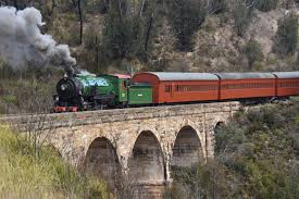
Zig Zag Railway
The Zig Zag Railway has reopened. Steam train rides every 2nd weekend. The Zig Zag Railway is a family-friendly venue offering visitors different experiences related to heritage steam travel Relive the magical era of steam trains as you explore the remarkable scenery of the Blue Mountains. Be prepared for the romantic sights, sounds and smells of a steam locomotive hauling you over the Great Lithgow Zig Zag. The Zig Zag Railway offers visitors a range of different travel options providing a unique opportunity to step back in time and experience the thrill of traveling by rail as it was done in the past. Travel on our restored steam-hauled passenger service through tunnels and across stone viaducts. Enjoy our picnic facilities, shop for mementos of your visit at our retail outlet or purchase food and drinks at our iconic container café. Free parking and bathroom facilities are available. https://www.askroz.com.au/index.php/event_detail/index/zig-zag-steam-train
Bushwalks and Lookouts
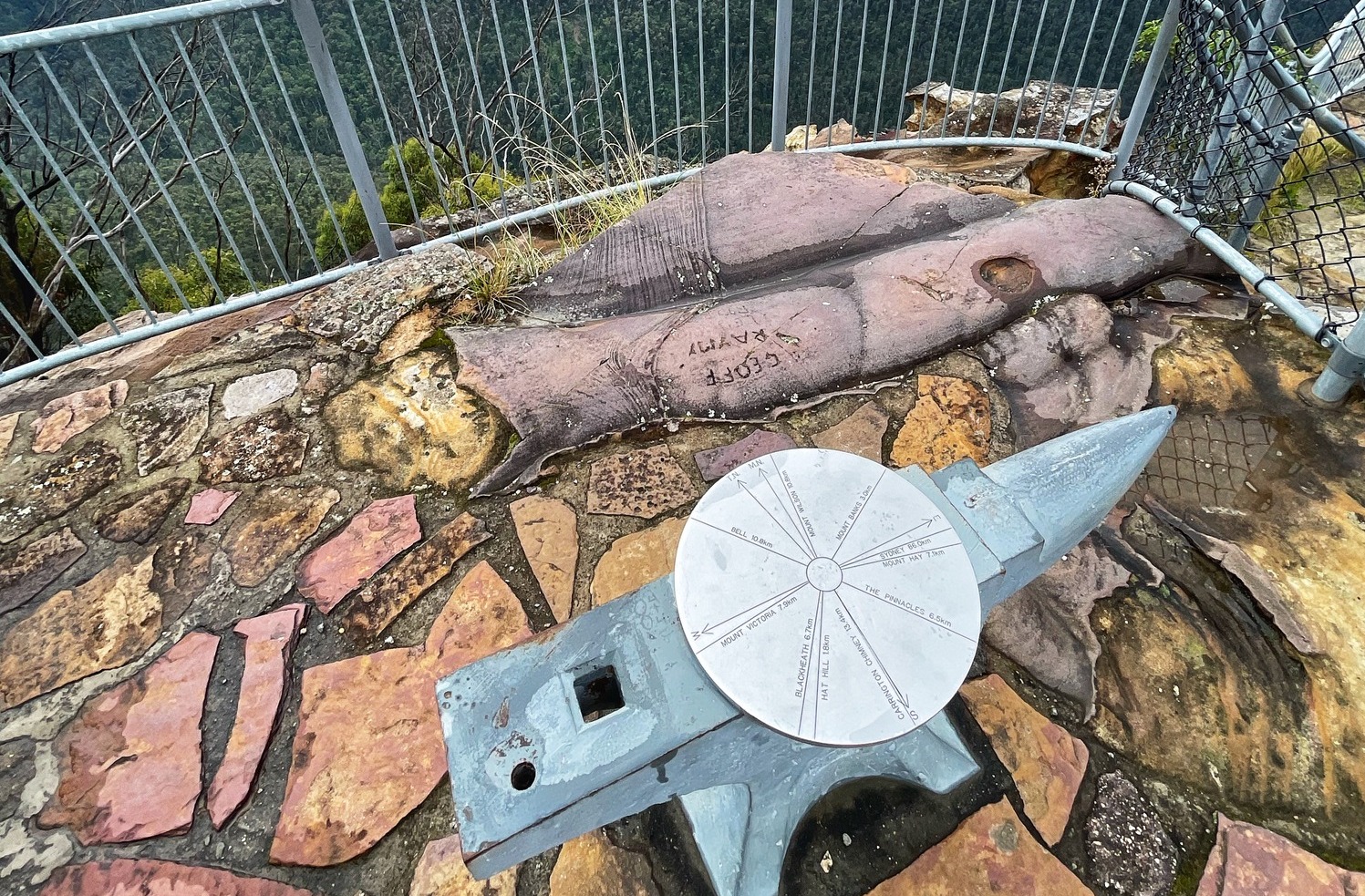
Anvil Rock Track
Anvil Rock was so named as this rock formation resembles the shape of an anvil. Blackheath Council had named this rock formation, Anvil Rock in 1938 - the same year that an access road was constructed to this picnic area. In 1948 an anvil was donated by Stan Miller, Company Secretary, Bradford Kendall Industries Pty Ltd. Stan was an ardent bushwalker and used to take his holidays at Blackheath. Sometime in 1970 the anvil disappeared, probably pushed over the cliff. 20 mins for the return walk.In 2008, thanks to a joint effort by NPWS, Blackheath Rotary, local police and community members, the anvil was retrieved, restored and re-bolted to the Rock. Anvil Rock Lookout is a popular spot for photography, as well as for picnics and short walks in the surrounding bushland. It's a great place to take in the natural beauty of the Blue Mountains and get a sense of the area's history and geology. https://www.askroz.com.au/index.php/event_detail/index/anvil-rock-lookout
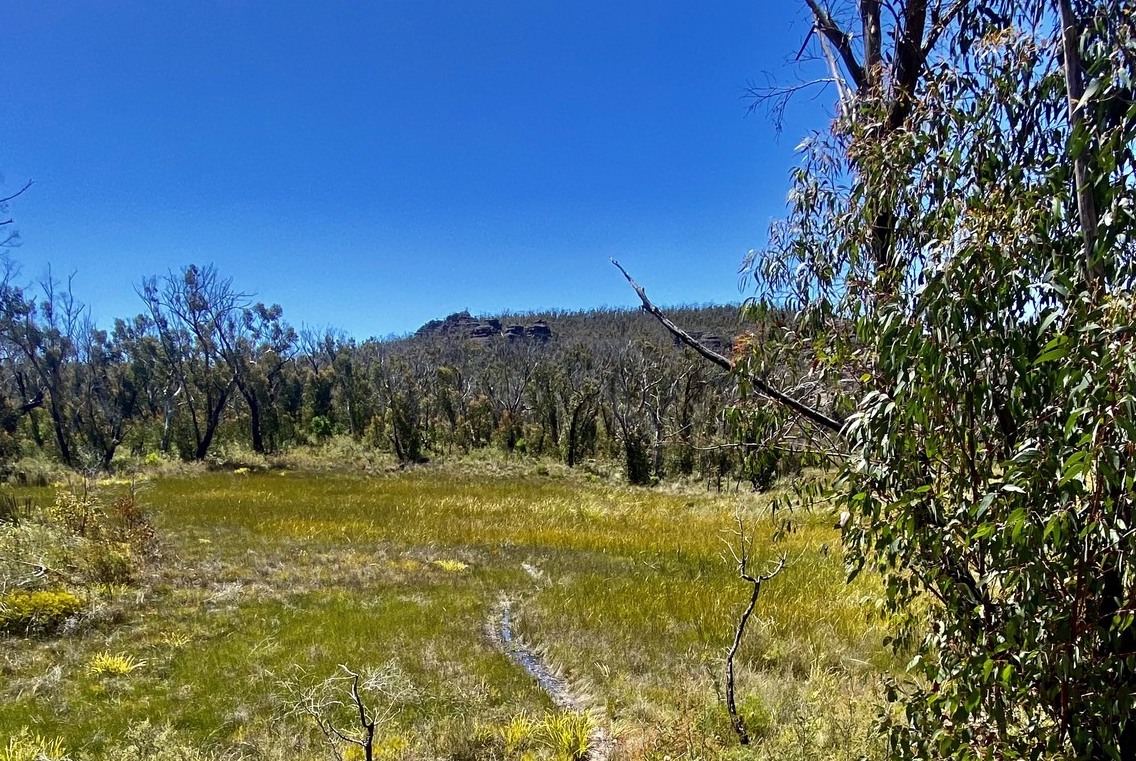
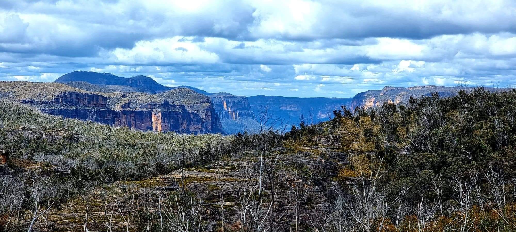
Asgard Mine Track
This is a medium grade and quiet walk through lovely bushland. Head in from the highway at Victoria Falls Road. About 4.5 klm down this road, there is a locked gate and this is where the walk begins. Asgard Plateau is the part of the Grose Valley north of Mt Victoria, between the upper Grose River, and Victoria Creek. While not a large area, there are many interesting features and excellent lookouts that can be visited. This walk has several short off track sections, though the navigation is fairly straightforward. The tracks themselves are not signposted, but are mostly not hard to find or follow. https://www.askroz.com.au/index.php/event_detail/index/asgard-swamp
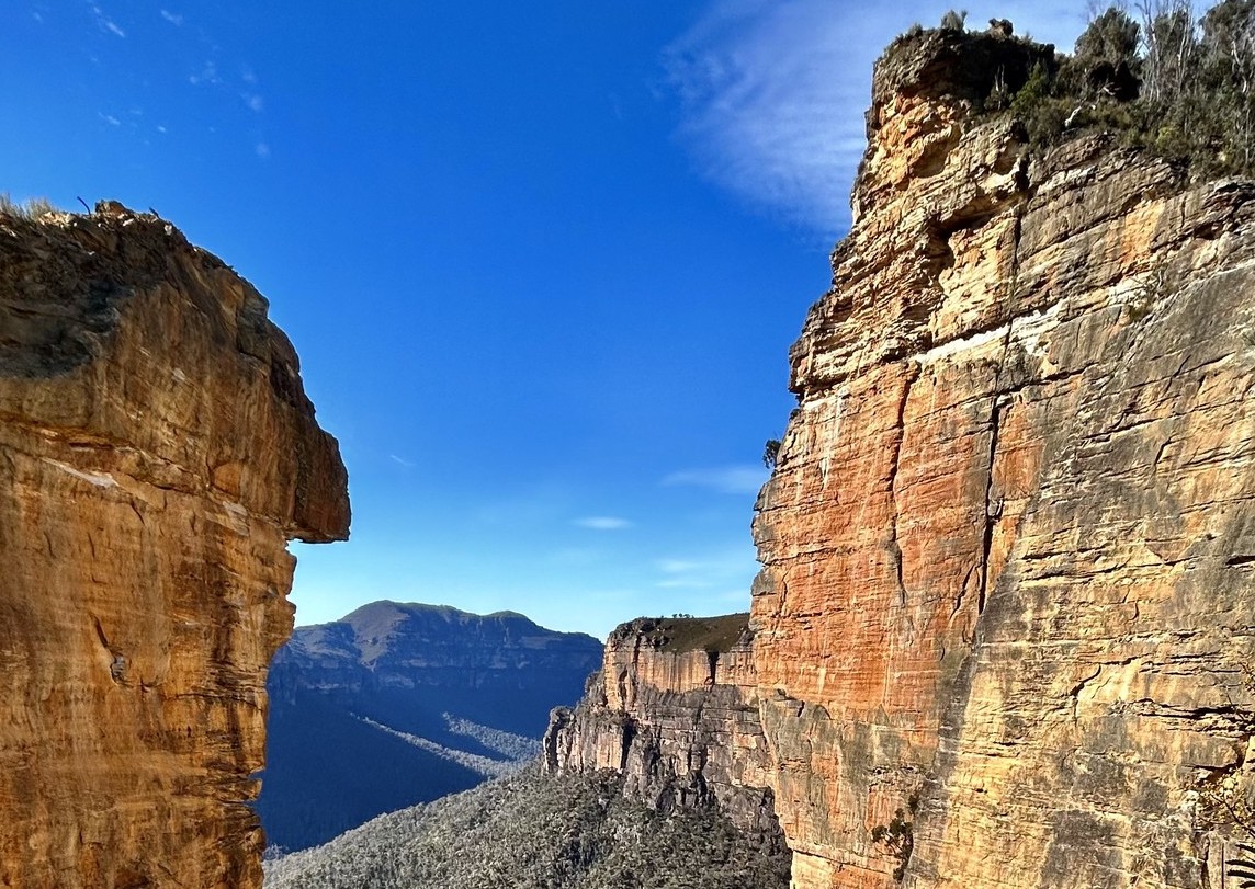
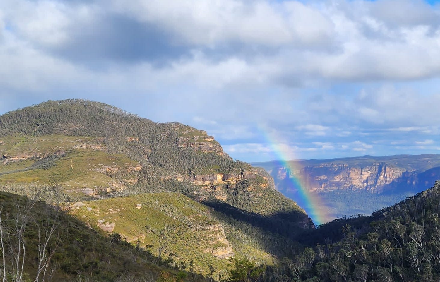
Baltzer Lookout
This walk to Baltzer Lookout (Burramoko Ridge) is a 3-4hrs walk and rewards you with excellent scenery and a view over the stunning Hanging Rock. The track is mainly management trail, and would be great on a mountain bike (to the end of the management trail). The large cliff edges are unfenced and quite exposed, so do take care. Although short and relatively unchanging in scenery, the walk to Baltzer Lookout is well worth it. Hanging Rock is an outstanding feature near the Lookout, at the end it has become detached from the main cliff.It has featured in many calendars and climbing photos, and ... ... Ridgewell Road, Blackheath. A huge, overhanging block of sandstone over 100m high, jutting out into the Grose Valley, was also the site of the main climbing scene in "The Edge" movie. For an awe-inspiring day walk or mountain bike ride to view the magnificent Grose Wilderness, Burramoko trail leads along a ridge to a dramatic rocky bluff. This medium difficulty trail is a great nature day trip in the Blue Mountains for bushwalkers and cyclists. Easily accessed from Blackheath via Ridgewell Road, the trail meanders through heathland and open forest. In spring, look out for distinctive red waratahs, and grass trees that bloom with creamy coloured flowers. If you're cycling, leave your bike at the turning circle at the end of the trail to walk up the short, bush track to the unfenced Baltzer lookout, also known as Hanging Rock. Please take extreme care around the cliff edge drop off. Breathe in the pure mountain air as you enjoy the sublime views of Hanging Rock and the Grose Valley. https://www.askroz.com.au/index.php/event_detail/index/walk-med-4hrs-hanging-rock
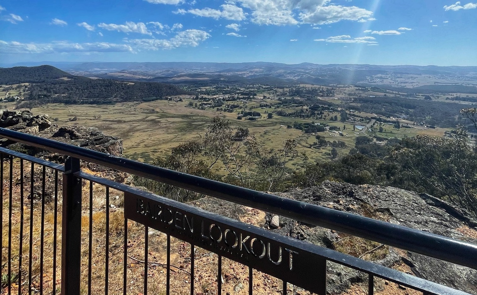
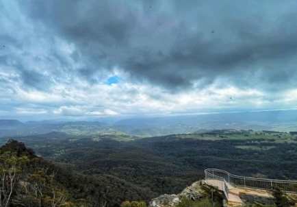
Bardens Lookout
Bardens Lookout is a popular vantage point that offers stunning panoramic views of the Blue Mountains and the surrounding landscape. The lookout provides an excellent opportunity for visitors to take in the natural beauty of the area, including the vast eucalyptus forests and rugged terrain. The lookout provides a peaceful and serene environment for appreciating the natural wonders of the Blue Mountains. The lookout is located on Mount York Road, less than 1 km before the Mount York lookout area. You can, in fact, walk between these two locations and leave your car parked at one end. https://www.askroz.com.au/index.php/event_detail/index/bardens-lookout
Braeside Trail
The Braeside Track follows Govetts Leap Brook down to Barrow Lookout Junction. At that point, you can either turn right and head up to Barrow Lookout and on to Evans Lookout or turn left and go up to Govetts Leap Lookout, or return the same way. There are 2 picnic tables near the dam as you start the walk. This work is great for kids as you can complete it in about 60 mins or less. https://www.askroz.com.au/index.php/event_detail/index/braeside-track
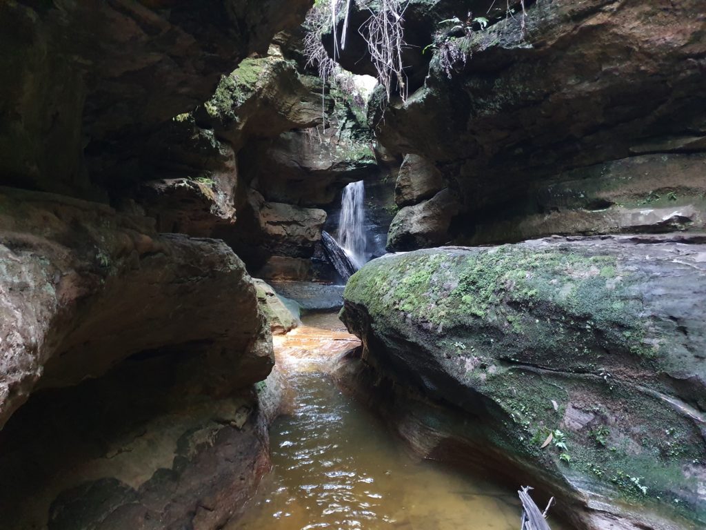
Bushrangers Cave
The cave displays spectacular honeycomb weathering and is a vantage point for spectacular views framed by trees to the Kanimbla Valley below. The last part of the track is not well sign-posted. It offers a wonderful photographic opportunity. It is quite a scramble to climb up to and it's not for the faint-hearted. The site is characterised by an overhanging rock with bands of deposits, which are rich in red iron oxide and large flakes of this litter the cave floor in parts and give the path an unusual and attractive pink appearance. The site is characterised by an overhanging rock with bands of deposits, which are rich in red iron oxide and large flakes of this litter the cave floor in parts and give the path an unusual and attractive pink appearance. The cave displays spectacular honeycomb weathering and is a vantage point for spectacular views framed by trees to the Kanimbla Valley below. The last part of the track is not well sign-posted. It offers a wonderful photographic opportunity. https://www.askroz.com.au/index.php/event_detail/index/bush-rangers-cave-mount-victoria
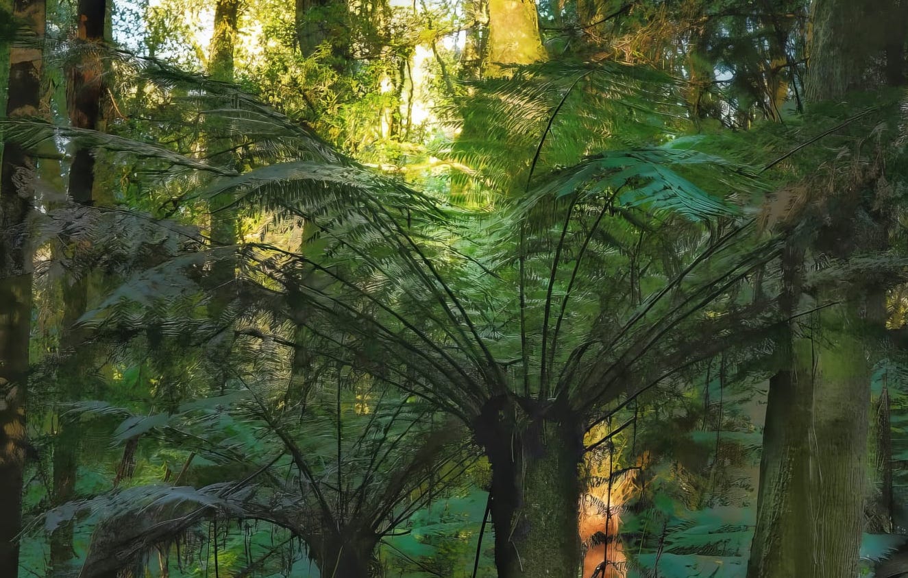
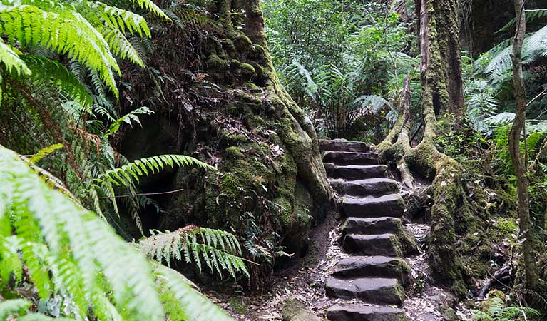
Cathedral of Ferns
Thankfully, much of Mount Wilson escaped the 2019/20 fires and places like the Cathedral of Ferns today offers visitors a very special experience. The KIDS WILL LOVE IT. NB: There are no shops or water, so bring in your food and water. From the Cathedral Reserve Picnic Ground, it only takes about 10 minutes to walk through to the Cathedral of Ferns. It is another must for all visitors to Mount Wilson. Allow half an hour to do the complete walk. The Cathedral walk is lovely in the mist.There are lovely wildflowers here in October and November. It is described as "Genuine rainforest with tree-ferns in abundance under a high canopy is now rare in Mount Wilson Conservation Area and such lush forest in an easily accessible location is rare in the state." The best time of day would be mid-morning as mid-afternoon as the light enters at an angle through the ferns. MtWilson.com.au say: "Starting at the Picnic Ground, walk into the Cathedral of Ferns and watch out for the Giant Tree. This is a massive Messmate or Fastigata, which was sadly hit by lightning recently and has died. Wander up beyond it and the path will come out on a track. PICNIC: There is a large area nearby for a picnic. Thank you Gary Sims for the photo. https://www.askroz.com.au/index.php/event_detail/index/walk-easy-short-cathedral-of-ferns
Centennial Grove Grotto "Canyon"
This circuit walk covers many of the tracks just to the west of Blackheath. The walk follows the cliff lines, both above and below, with amazing views of the Kanimbla Valley, rock features and waterfalls. The walk takes in a cross section of plants, with defined changes through the cliff passes. The walk takes 3-3/12 hours is 5.4 klm circuit and is a hard walking track. https://www.askroz.com.au/index.php/event_detail/index/centennial-grove-grotto-canyon
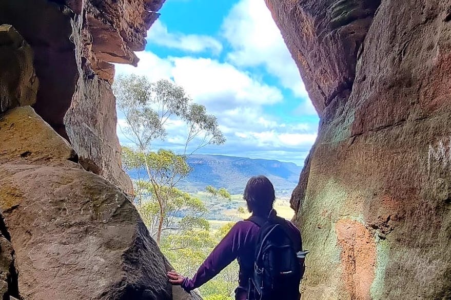
Coxs Cave and Fairy Bower Reserve Circuit
This is a wonderful adventurous circuit walk and takes about 90 minutes. Park your car at the Mount Piddington Lookout carpark. Follow the sign to Coxs cave. Coxs Cave, almost certainly named after George Henry Cox, who was a fellow member of Parliament with William Piddington, was reached by a wooden ladder and track after 1879, while the track north along Fairy Bower Creek to the Toll House was formed between 1888 and 1898. Today, you access the cave via a 20 pipe-like rung steel ladder, the view from the cave is great.This involves a potentially perilous climb up the 20 pipe-like rungs of a steel ladder. When you get to the top, crawl around and up into the cave and around to the main ledge. https://www.askroz.com.au/index.php/event_detail/index/coxs-cave-circuit-walk-90-minutes
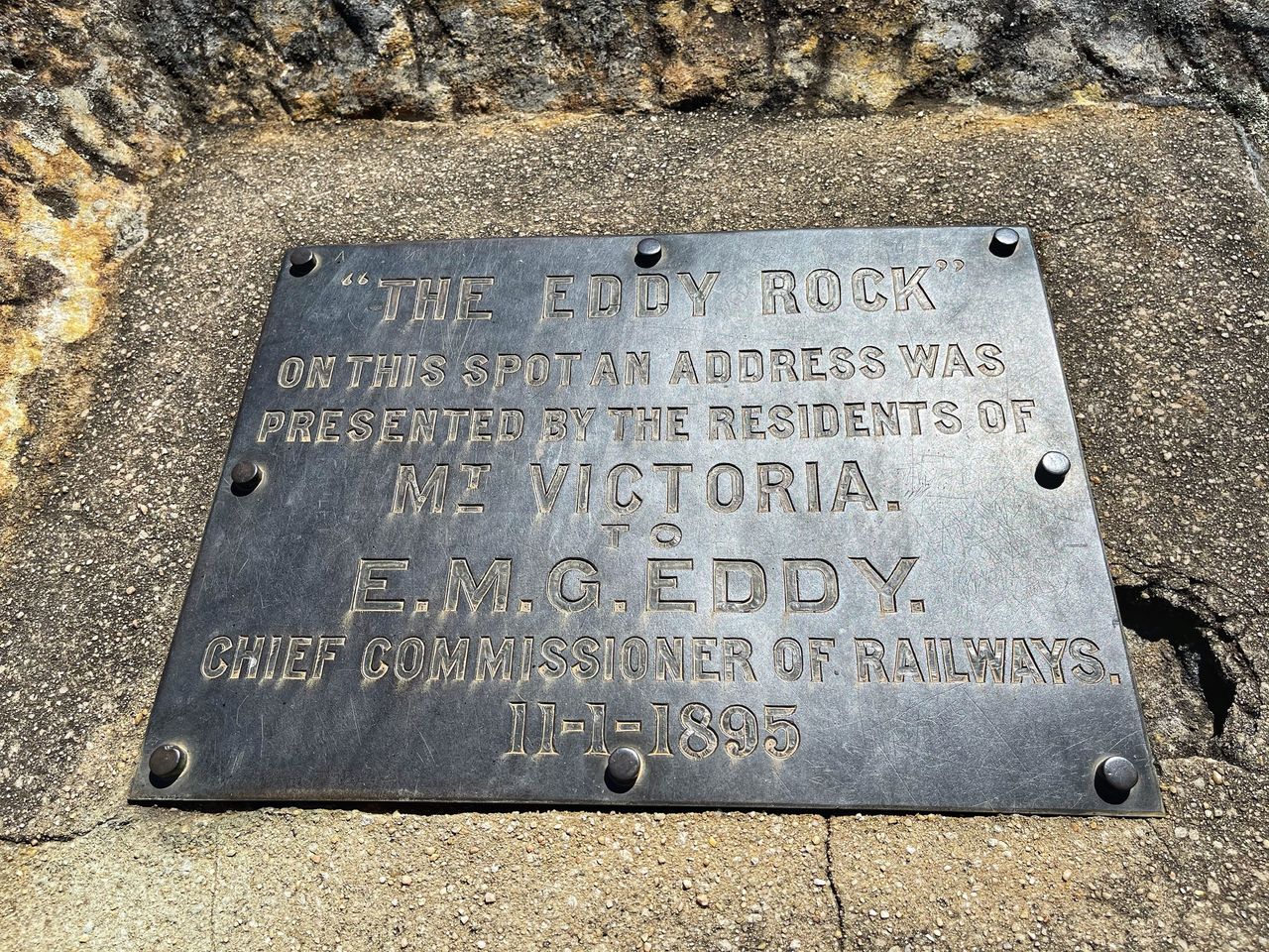
The Eddy Rock
'The Eddy Rock' at Eddy Lookout Eddy Lookout, Mount Victoria was named after Mr E. M. G. Eddy, Chief Commissioner of Railways, in recognition of his management of Mountain railway traffic. ACCESS: If you visit Mount York Lookout and walk down the hill on the round walk, the lookout of on your left after about 100m. https://www.facebook.com/profile/100064323152639/search/?q=eddy
Evans Lookout
Evans Lookout is renowned for its stunning views, particularly at sunrise and sunset when the sandstone cliffs glow with a warm, orange hue. The lookout is easily accessible, with well-maintained paths and facilities, including accessible toilets and parking spaces for those with mobility challenges. The lookout itself is step-free, ensuring that everyone can enjoy the magnificent scenery. This lookout is a must-visit for nature enthusiasts and hikers alike, providing both accessible paths for casual visitors and challenging trails for avid adventurers.Hiking Trails and Outdoor Activities For those eager to explore further, Evans Lookout serves as a gateway to several remarkable hiking trails: Grand Canyon Track: This popular trail takes you through lush rainforests, past waterfalls, and along creeks, offering a challenging yet rewarding experience. The track has been a favourite since 1907 and includes a tunnel and opportunities for abseiling. Cliff Top Walking Track: This moderately challenging trail connects Evans Lookout to Govetts Leap, providing breathtaking views along the valley rim and opportunities for birdwatching and wildflower spotting. https://www.askroz.com.au/index.php/event_detail/index/evans-lookout
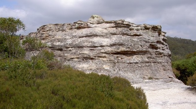
Fort Rock
Park your car at the end of Bundarra Street. The track to Fort Rock is a short walk and gives a taste of what lies beneath the cliff line. The walk is a return journey from the end of Bundarra St, directly to Fort Rock. From the top of the rock you can see into the Kanimbla Valley, and, by taking the side trip out to the cliff line west of Fort Rock, you get even better views over the valley and the cliffs around Porters Pass. Return the same way. https://www.askroz.com.au/index.php/event_detail/index/fort-rock
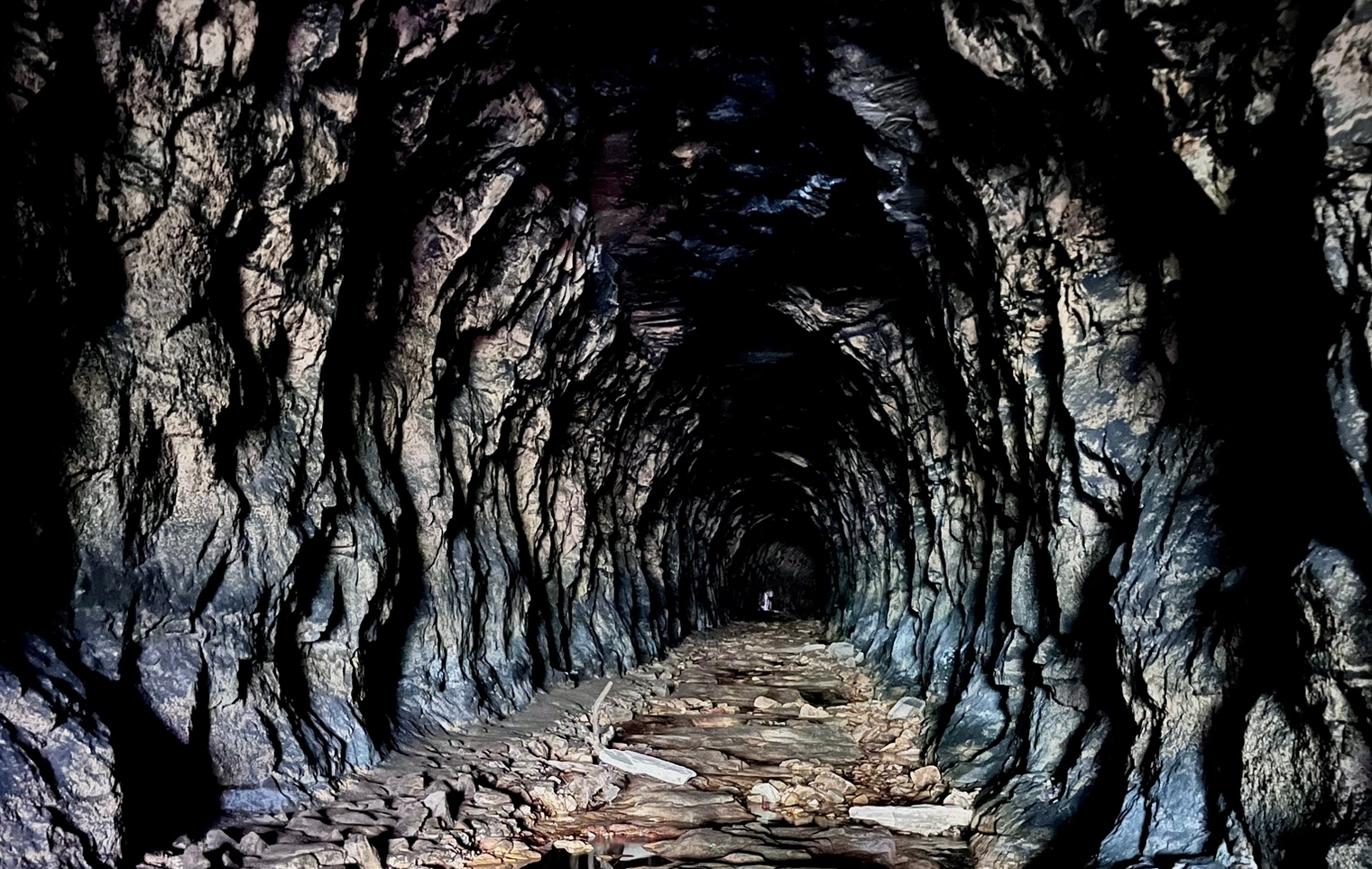
Glow Worm Tunnel
Glow Worm Tunnel walking track is the fastest and easiest way to experience the wonder of this historic tunnel, lit by thousands of glow worms. It’s a favourite with visitors to Wollemi National Park, near Lithgow. https://www.nationalparks.nsw.gov.au/things-to-do/walking-tracks/glow-worm-tunnel-walking-track
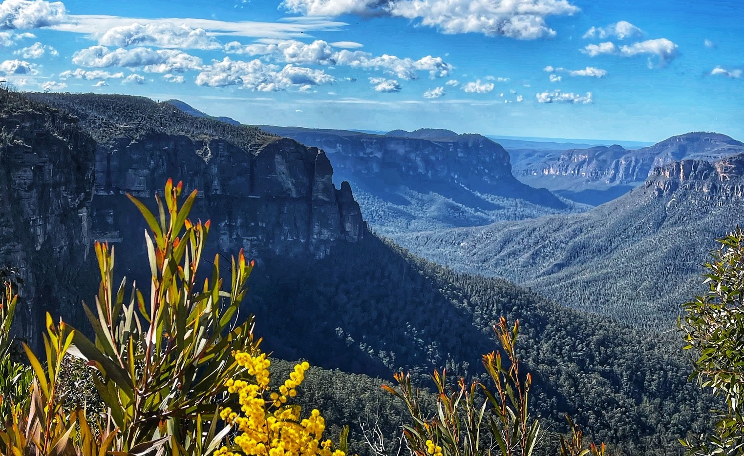
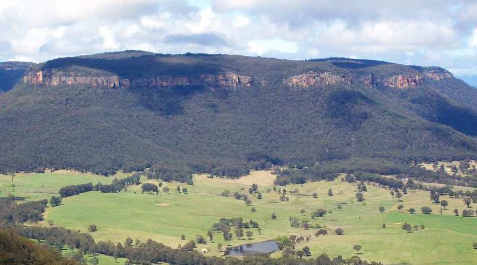
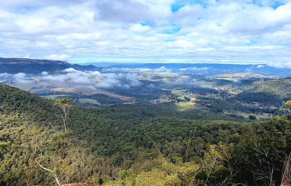
Govetts Leap lookout
Once you clap your eyes on the view from Govetts Leap you’ll know why it’s one of the most famous lookouts in Australia. The magnificent Bridal Veil Falls drops a whopping 180m to the base of the cliff. The ‘ozone-laden’ air of the Blue Mountains was promoted as a health tonic since the early 1800s, and when you get there, you’ll realise why. If you’re not mesmerised by the dancing waves of water spray, you’ll be transfixed by the sweeping views down the valley to the Grose Wilderness.Early bushwalkers saved this rare patch of majestic mountain blue gums for future generations. Keep your eyes peeled for the vibrant king parrot and listen for the ‘weela weela’ cry of the yellow tailed black cockatoo. Remember to take your binoculars if you want to birdwatch. https://www.askroz.com.au/index.php/event_detail/index/govetts-leap-lookout
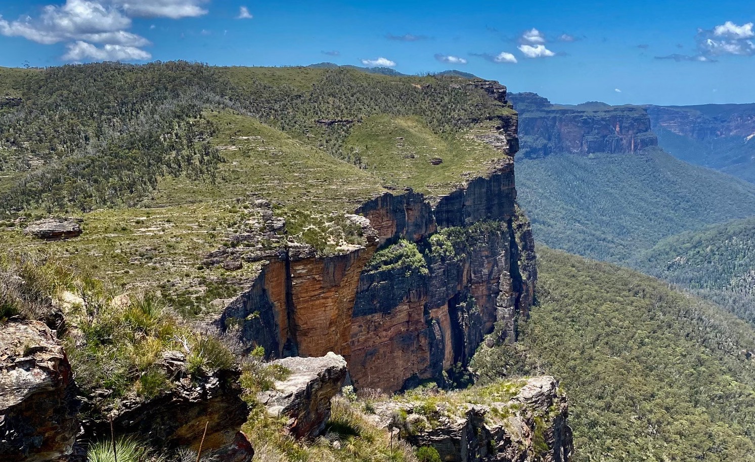
Grand Canyon Walking Track
One of the best walks in Australia. Setting out from Evans lookout, walk the track clockwise. The well-shaded track meanders through luscious native vegetation of ferns and golden wattles, and remains close to Greaves Creek, all of which combine to make this a particularly good walk for the summer months. Although there are loads of semi-ledges that make up this challenging walk, you don’t need specialist hiking equipment. The historic loop track takes you into the heart of this World Heritage-listed landscape. It's an intimate and adventurous track that walkers have trodden since 1907. The NPWS rate this walk as Grade 3 and is about a 3hr return walk and has rated it as Grade 3 and is an approximate 3hr return walk. https://www.askroz.com.au/index.php/event_detail/index/walk-hard-6hrs-grand-canyon-track
Hargraves Lookout
One of the main attractions of Hargraves Lookout is its unobstructed views of the rolling hills, small farms, and orchards that dot the Megalong Valley. The lookout is especially popular during sunrise and sunset, providing a picturesque backdrop for photography enthusiasts. The silence and solitude of the area make it feel like a secret haven, often with few other visitors around. Hargraves Lookout is easily accessible by car, with a well-maintained sealed road leading to the site. It is located approximately 2 kilometres west along Shipley Road from Blackheath. There is an accessible toilet, but very limited picnic areas. For a picnic you're best going to nearby Mount Blackheath. https://www.askroz.com.au/index.php/event_detail/index/hargraves-lookout
Hourn Point (Hornes Point)
Hourn Point is a 2km 1-hour return walk and dog on leash friendly, from the Mount Piddington carpark in Mount Victoria. It offers wonderful views over the Kamimbla Valley. Follow an old fire trail down to Horne Point which is a popular climbing area. Named after Frederick Christopher Hourn, 1862 Station Master of Mount Victoria from 1904 till 1915. Hourn was also a member of the Mount Progress Association 1908. On some maps, and signs it is incorrectly spelled as Hornes Point. Source: Blue Mountains Geographic Encyclopedia Thank you Cath Rendell for the photo. https://www.askroz.com.au/index.php/event_detail/index/hourn-point
Ikara Head Trail
The Ikara Head Track is approximately a 7klm return walk so you should be able to complete it in less than 2.5 hours. There are beautiful wildflowers to be seen and is not a difficult walk. The track is an easy and relatively flat walk. The eastern cliffs of Ikara Head are a popular rock climbing spot. To the east, views out to Mt Banks, Mt Tomah and Mt Wilson. You can access the track after driving down Victoria Falls Road to the locked gate. https://www.askroz.com.au/index.php/event_detail/index/ikara-head-trail
Mermaids Cave
Mermaids Cave is a short 50m walk off the eastern side of Megalong Road, 1km south on Shipley Road intersection. It passes through a narrow cleft as in goes down into the cavern-like amphitheater. Return the same way. Mermaid’s Cave became famous after being used as a location for the film Mad Max Beyond Thunderdome. https://www.askroz.com.au/index.php/event_detail/index/mermaids-cave
Mitchell Ridge Lookout
Mitchell Ridge Lookout is an historic lookout and rest area, named after Sir Thomas Mitchell who supervised the building of the Pass by convict labour in 1832. An obelisk at the lookout commemorates the opening of Victoria Pass in 1832. The Pass is one of the oldest and most significant engineered works in Australia still in use today. From the western end of the lookout, there is a good view of the convict hewn and built sandstone rampart across the Pass.The timber arch surmounted by the figure of an Aboriginal man and the date 1832, was constructed by Hedley Bellette and erected for the unveiling of the Thomas Mitchell obelisk by Joseph Jackson MLA, Minister for Local Government, on 24 October 1932, to commemorate the centenary of the pass. The Mitchell obelisk appears in the background and still stands on the ridge. https://www.askroz.com.au/index.php/event_detail/index/mitchells-ridge-lookout
Mount Banks Summit Walk
This is an easy to medium approximately 3 hour walk. Mount Banks at 1062 metres is a basalt capped mountain which is among the highest peaks of the Blue Mountains and was named by botanist George Cayley after his botanical benefactor Sir Joseph Banks. Mount Banks was the furthest point reached by Cagey in his 1804 expedition. Mount Banks can be seen from most lookouts around the rim of the Grose Valley and from Sydney. https://www.askroz.com.au/index.php/event_detail/index/walk-med-3hrs-mount-banks
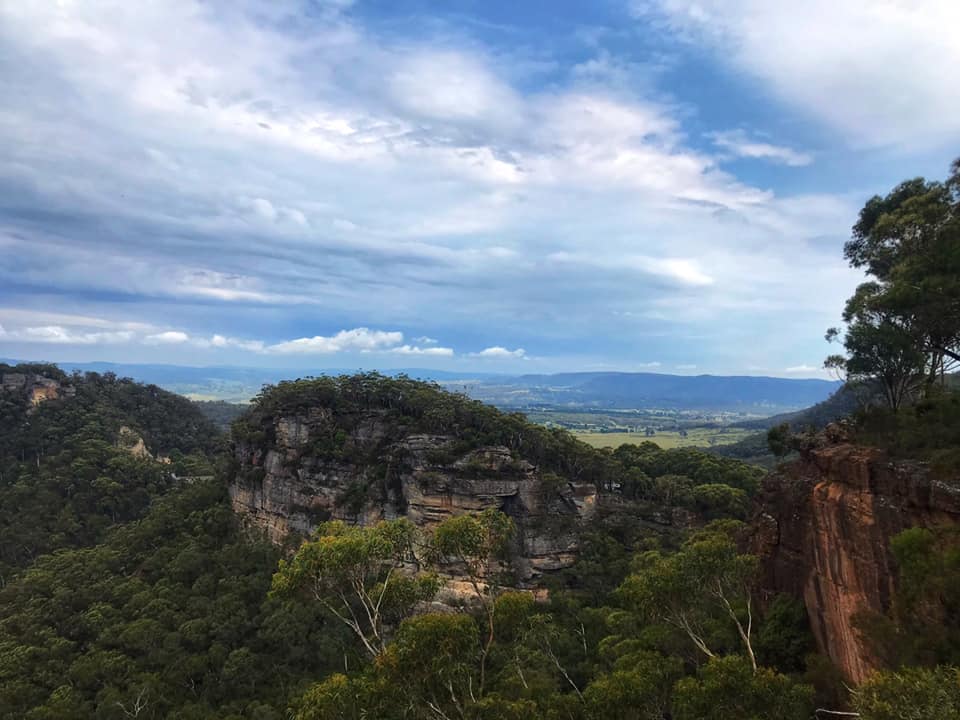
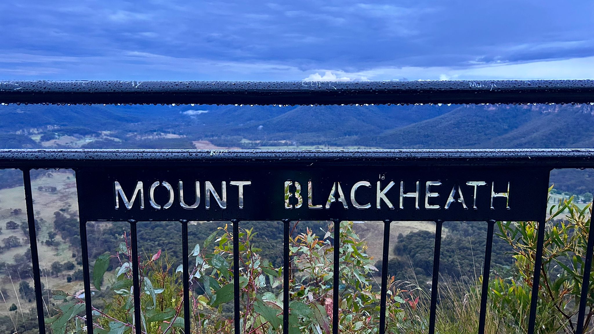
Mount Blackheath
This is much more than your average lookout. It's off the normal tourist trail and is well worth a visit. It's also a great bike ride from Blackheath. Mount Blackheath offers views to the north and west over the Kanimbla Valley. It's a great spot for a picnic and it's dog-on-leash friendly. The track to the lookout is dirt, so drive to the conditions. At 1,076m it is the perfect place to relax and watch the sun go down. It offers views to the north and west to the Kanimbla Valley. https://www.askroz.com.au/index.php/event_detail/index/mount-blackheath
Mount Piddington
Mount Piddington is named after William Richman Piddington, he was the former colonial treasurer under Henry Parkes who owned the land at this site. The land was cleared of many trees on its summit so that visitors could enjoy the view. The land owned by Piddington was bequeathed to the public and named Mount Piddington Reserve. https://www.facebook.com/AskRozBlueMountains/posts/pfbid024kcnJvwjhiC96PGiy7p3EohzEd94bMCjbfoTcaL6giL7mzs65wmcUpDFUzSmzQFol
Panorama Point
Panorama Point at Hargraves Lookout Blackheath is a wonderful spot to visit. It's a historic walk along a 300m ridge line. The track out to the lookout is fairly rough in patches and it does drop away on both sides so take care. ACCESS: Park at Hargraves lookout, walk down to the lower west-facing lookout, and turn left following a very minor track. https://www.askroz.com.au/index.php/event_detail/index/panorama-point
Popes Glen Track
The Popes Glen Track starts in Dell Street and is the beginning of a 7.5 klm loop but you can go as afar as you like and then return the same way. See more using the link listed below. The narrow path leads to a footbridge that crosses Popes Glen Creek. Depending on how far you choose to walk, you will come to Boyds Beach, Horseshoe Falls, George Phillips Lookout and Govetts Leap Lookout. Along the track you will pass ferns and sedges and a forest of Blue Mountains Ash on either side. https://www.askroz.com.au/index.php/event_detail/index/popes-glen-track
Pulpit Rock - Mount Victoria
This walk is 1 hour return, or there are other options for a loop or longer hike to Mount Piddington and includes beautiful views of the Kanimbla Valley, overhangs with Mount York Claystone, autumn fungi, wildflowers, creek crossings and just a beautiful all round calming vibe. https://www.facebook.com/AskRozBlueMountains/posts/pfbid02Tr5bqtQdzqqJ4wJ1FXZnqF9pj6DmYGuYPrVi7D9tUzfxcoZkJJKVYB8AbuRQEYnFl
Rigby Hill Walking Track
The parking area is limited. As always we recommend an early start. Just east of the turnoff to Mount Wilson you'll see a sign to Pierces Pass". Take that and drive for about 700m down the dirt road until you get to the picnic/parking area. Pack a picnic or a snack and enjoy it looking up and down the Grose Valley, the views are amazing. There is no shade, so slip slop slap, wear a hat and carry plenty of water. NOTE: Keep well back from cliff edges, especially when taking photos, and supervise children at all times. Take extreme care as the cliffs are over 200m high and are unfenced. https://www.facebook.com/AskRozBlueMountains/posts/pfbid0pbuNXt7R1RQ95tpBLTvs2ET8FiWu48RJ2SMo1GY56AKjbMUiyZ1Hmsg2oSPtrTYkl
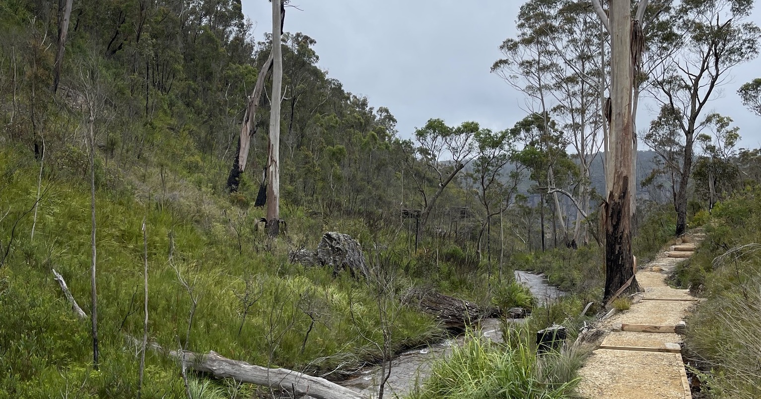
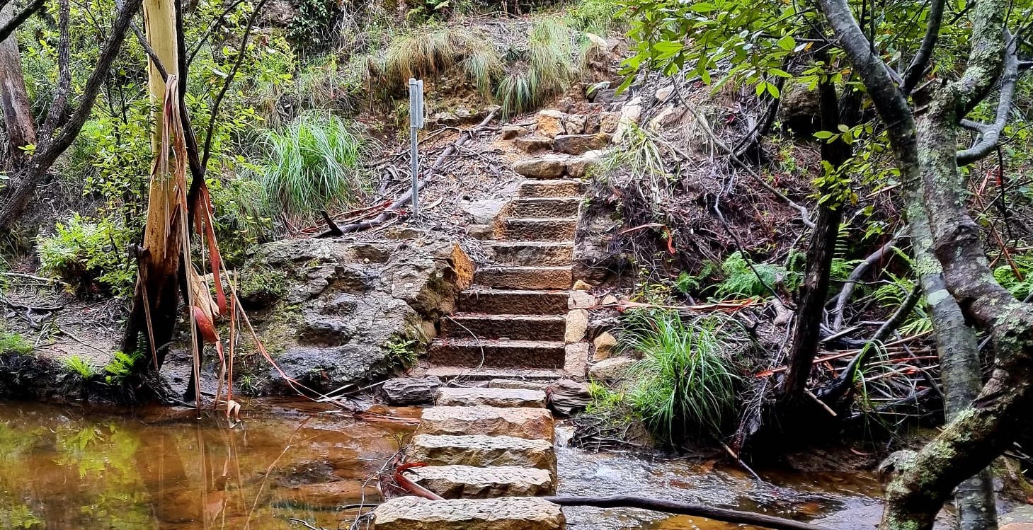
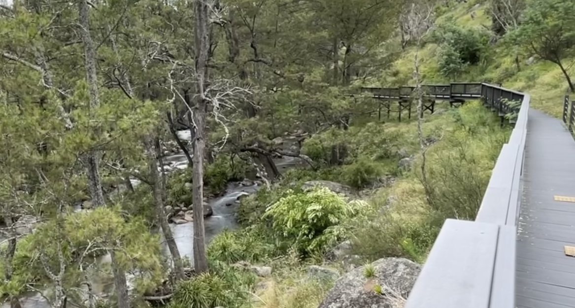
Rowsons River Walk
This walk is a HIDDEN SURPRISE. This is a short surprising walk. The boardwalk follows the river for about 200m to the old remains of the Rowson Huts. You can also walk down to the river and enjoy a picnic. Keep an eye out for Platypus as the river is a known habitat. START: The track begins near a building called Corneys Garage which will be on your right and pass the Court House at the end as you enter the village. The boardwalk is 200 metres long and is made from recycled wood plastic composite material. This is a dog on leash friendly walk.The recycled wood plastic composite material was made from recycled post-consumer timber and plastic waste. The structure is maintenance-free and has a lifespan of 70 years. https://www.askroz.com.au/index.php/event_detail/index/rawsons-river-walk
Walls Lookout Walking Track
This is a wonderful lookout offering great views of the Grose Valley. Take the Pierces Pass turn-off and Park the car at the top car park and follow the track out to the Walls Lookout. This walk offers great views and lots of wildflowers. A one-hour return walk through heath leads to a cliff-top vantage point over the Grose Valley. It's also kid-friendly, but take care there are no safety fences. The Walls Lookout walking track is a relatively easy 2 km return hike, suitable for all skill and fitness levels. It’s important to wear proper shoes, as the surface is a bit rough sometimes. https://www.askroz.com.au/index.php/event_detail/index/walls-lookout
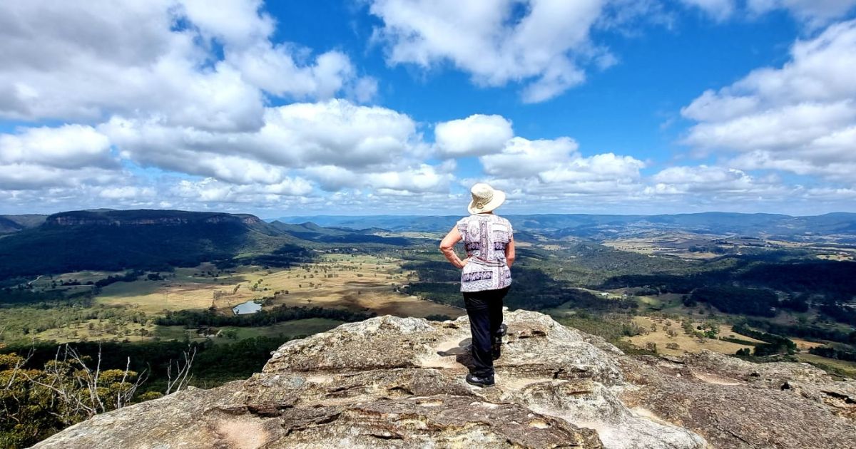
Mount York
Mount York has commanding views over the western plains, many layers of Aboriginal and European heritage, several convict-built roads (now walking tracks), and remnants of the old convict-built roads (1823-1829) can still be seen. Further along, Mount York Road is the historic convict-built Lawson's Long Alley and Lockyers Line of Road; Berghoffers Pass, and Bardens Lookout. It is popular for bushwalking, abseiling, mountain biking, and rock climbing. It's a great spot for a picnic. Limited camping is also available. https://www.askroz.com.au/index.php/event_detail/index/mount-york-walks-lookouts-camping
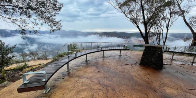
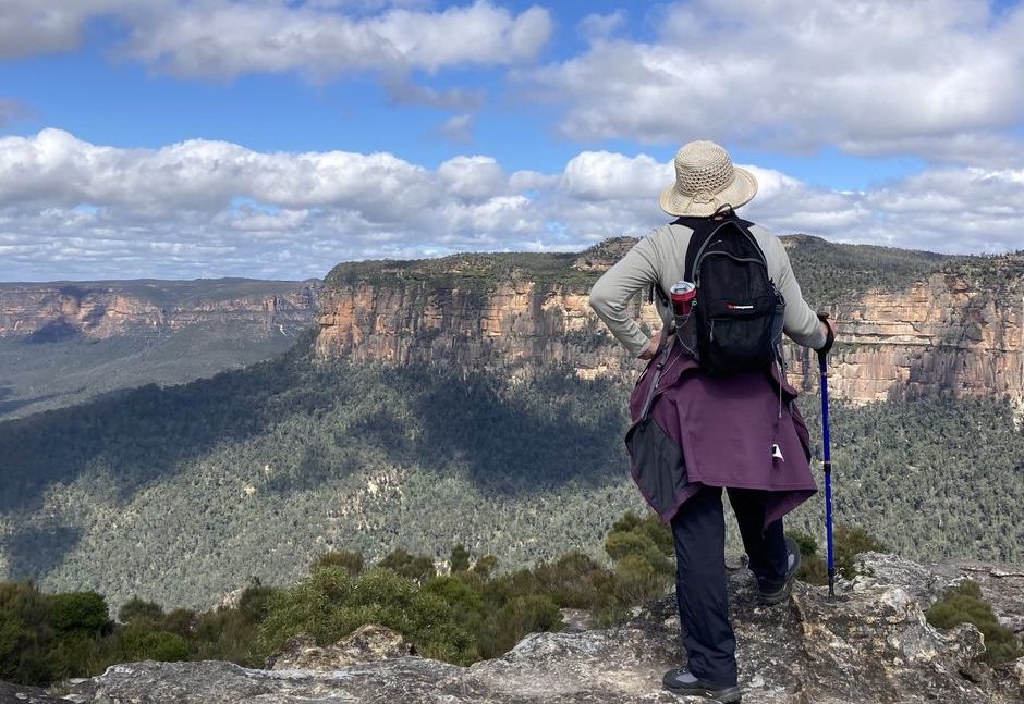
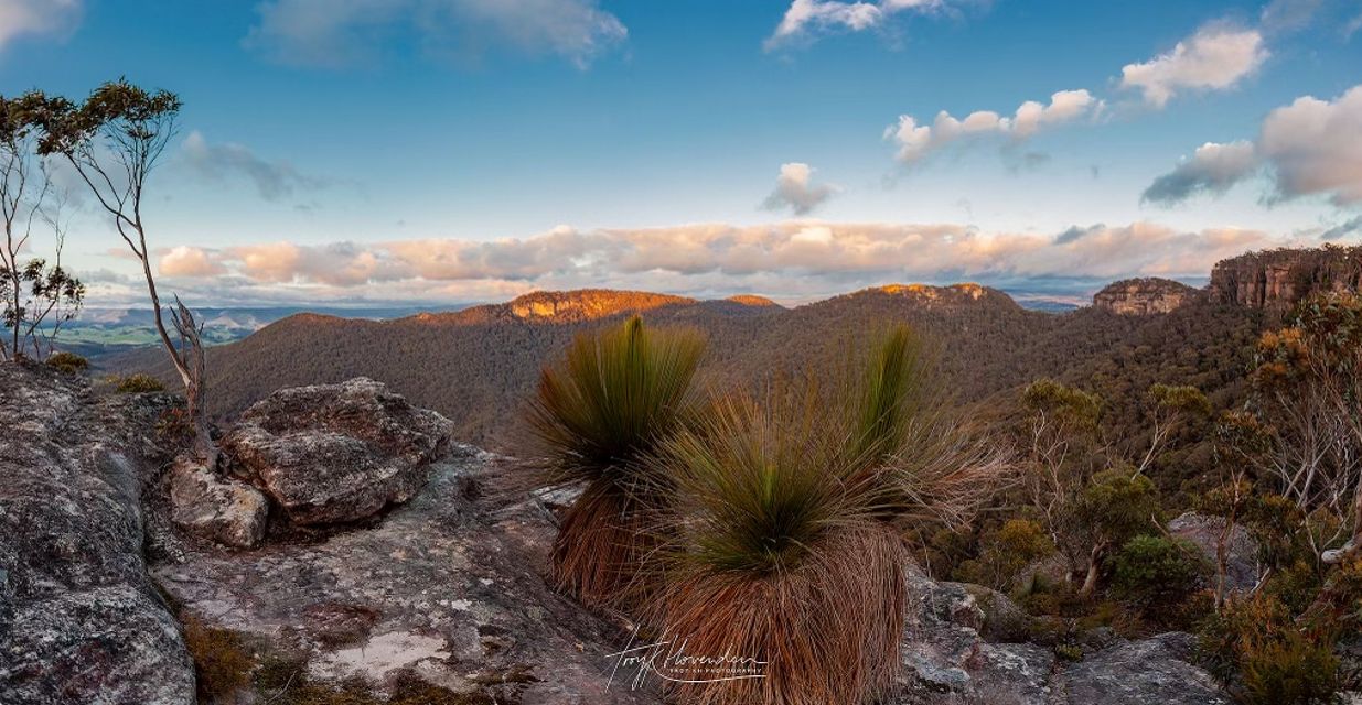
Sunset Rock Lookout
You will need to park away from the actual lookout, then walk downhill and along the path to get to there. The walk is worth the view, and Pulpit Rock Lookout also nearby. Thank you Troy Hovenden for the photo
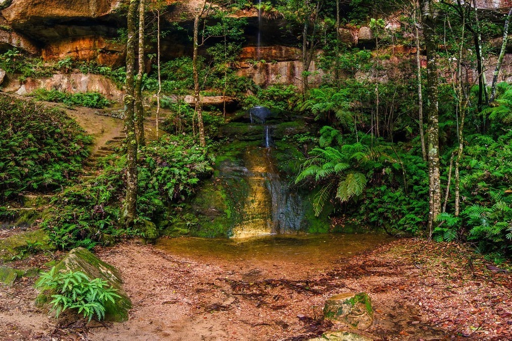
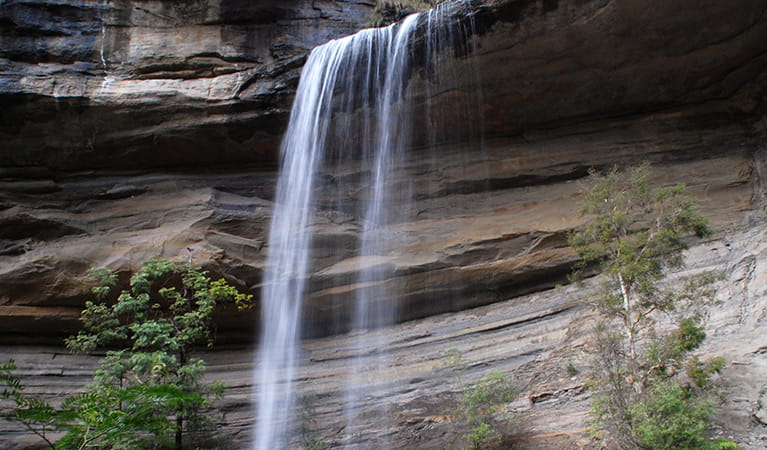
Victoria Falls and Silver Cascades walking track
Starting from the carpark at the end of Victoria Falls Road, this steep return track to Victoria Falls requires moderate fitness. Almost as soon as you start the walk, you’ll reach Victoria Falls lookout. Stop to breathe in the mountain air and extraordinary views across the sandstone escarpment and Grose Wilderness. Listen for the calls of sulphur-crested and yellow-tailed black cockatoos. It’s hard to turn away, but to see the waterfall follow the track to the left of the lookout. The steep path zig zags down the sandstone cliff. Short side paths lead to pretty Victoria Creek Cascades and the top of Victoria Falls, as the main track continues down to the base of the waterfall. Bring a picnic lunch and enjoy the beautiful waterfall, which drops around 20m over a rock overhang. In summer, it’s a serene spot to relax in the shade of the lush canopy. The steep return back up to the carpark takes around 60 to 90mins. https://www.askroz.com.au/index.php/event_detail/index/walk-med-2-hrs-victoria-falls
Amenities
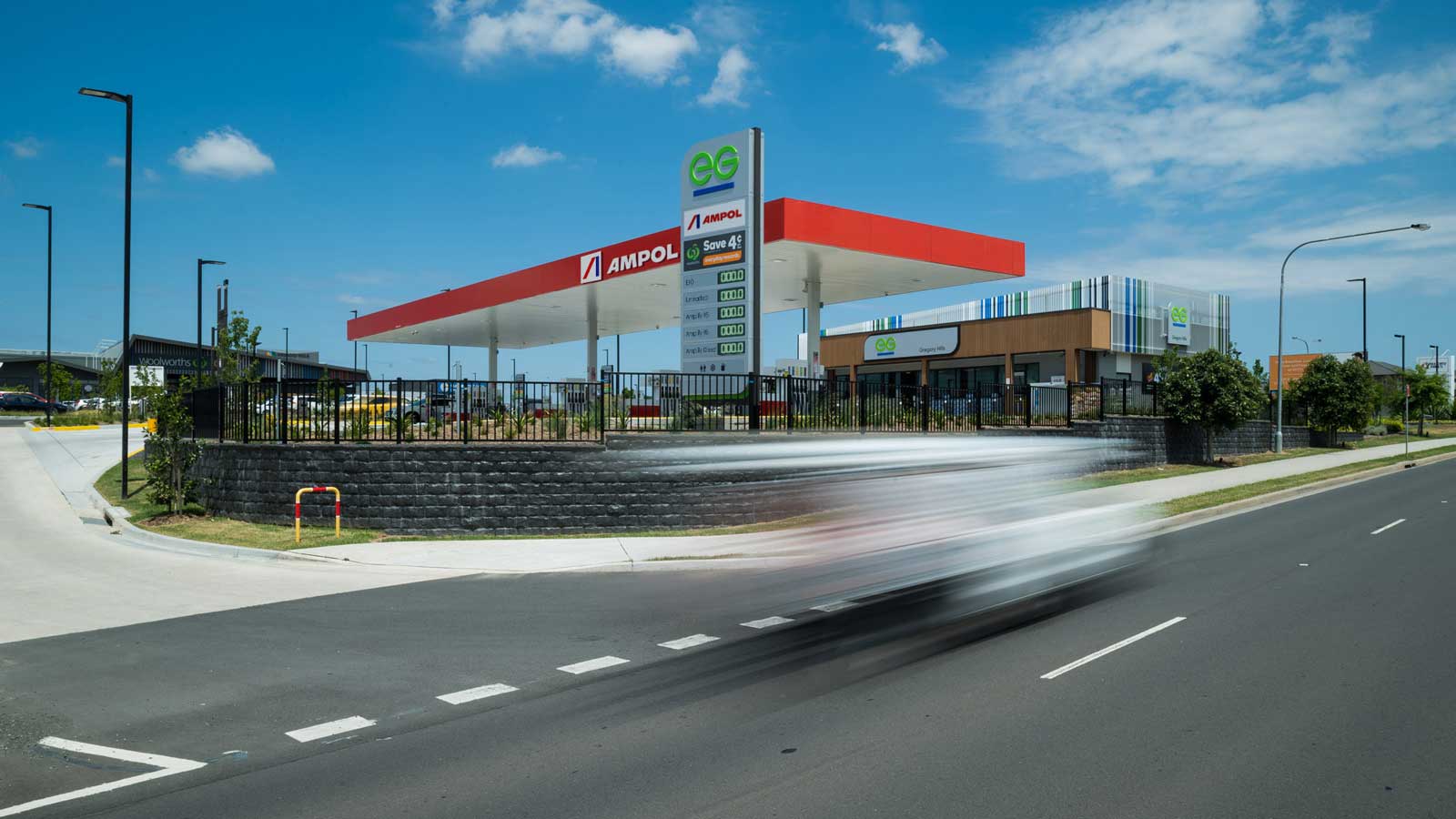
Ampol Foodary Mt Victoria
Wherever you are, a pit stop at Ampol Foodary keeps you moving. Whether you’re heading out on the dusty road or heading home after a night shift, Ampol Foodary is here – early morning ‘til late – to help you on your way. Find everything you need to keep you moving. Go from A to Anywhere with Ampol Foodary. https://www.ampol.com.au/service-stations/convenience-stores/foodary
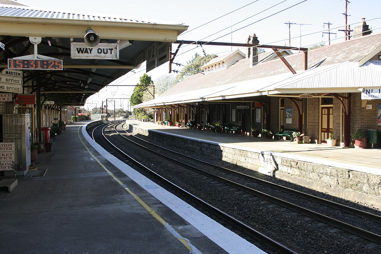
Mount Victoria Railway Station
Mount Victoria Railway Station is located on the Main Western Line in the upper Blue Mountains. The station opened on 1 May 1868 as the last stop on the Great Western Railway. Newspaper reports described it as "a model station and it would be well if the Government would repeat it as often as they have got occasion to build a railway station in the future". In 1868, the station included a single roadside platform, a small sandstone station building, a carriage dock platform, a Station Master’s residence, a goods shed, and a 40-foot locomotive turntable. https://www.transport.nsw.gov.au/sydneytrains/culture-and-heritage/welcome-to-mount-victoria-railway-station-heritage-precinct%C2%A0
Toilet
Public Toilet - Open 7am-5pm Doorway is wide (over 850mm). Inward opening. Light for required. Floor space is large. Seat height between 460-480mm. Grab rails. Wash basin. Located in centre of park, approx 50m distance from car park, with slope. Accessible parking enter park via Montgomery Street https://toiletmap.gov.au/12147