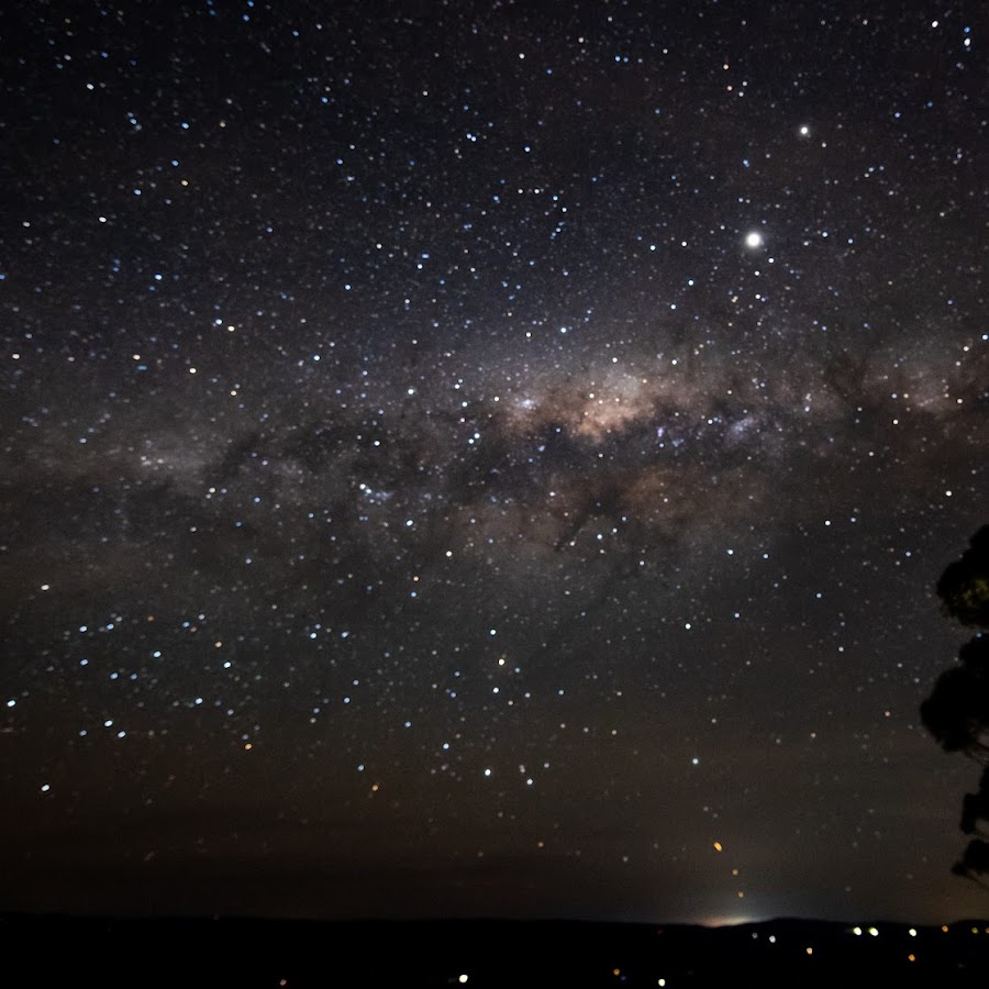
Interactive Guide with 'turn by turn' directions
𝗨𝗻𝗱𝗲𝗿 𝗰𝗼𝗻𝘀𝘁𝗮𝗻𝘁 𝗶𝗺𝗽𝗿𝗼𝘃𝗲𝗺𝗲𝗻𝘁 - 𝗰𝗵𝗲𝗰𝗸 𝗯𝗮𝗰𝗸 𝗧𝗜𝗣: Save this to your 'home screen' and it will always be available to you. Discover the Blue Mountains like never before with the free Ask Roz ‘Gyro' Interactive web app. It’s your ultimate pocket guide to explore hidden gems, stunning lookouts, must-see attractions and local favourites – all at your fingertips. With full Google AI integration, you’ll get smart maps, photos, insider info, and even turn‑by‑turn directions to take you straight to the action. 𝗧𝗵𝗶𝘀 𝗶𝘀 𝗻𝗼𝘁 𝗮 𝗱𝗲𝗳𝗶𝗻𝗶𝘁𝗶𝘃𝗲 𝗴𝘂𝗶𝗱𝗲, 𝗯𝘂𝘁 𝗮 𝗾𝘂𝗶𝗰𝗸 𝗿𝗲𝗳𝗲𝗿𝗲𝗻𝗰𝗲 𝘁𝗼 𝗮𝗹𝗹 𝘁𝗵𝗲 𝗯𝗲𝘀𝘁 𝘀𝗽𝗼𝘁𝘀. 𝗧𝗵𝗲 𝗺𝗮𝗽 𝗶𝘀 𝘂𝗻𝗱𝗲𝗿 𝗱𝗲𝘃𝗲𝗹𝗼𝗽𝗺𝗲𝗻𝘁, 𝘄𝗶𝘁𝗵 𝗺𝗼𝗿𝗲 𝘃𝗶𝗹𝗹𝗮𝗴𝗲𝘀 𝗮𝗿𝗲 𝗯𝗲𝗶𝗻𝗴 𝗮𝗱𝗱𝗲𝗱. This web app is provided by Ask Roz who are the leading providers of visitor information in the Blue Mountains. Each month our content is viewed over 5m times. VISITOR eMag: www.askroz.news/ARBM-Visitor EXPERIENCES: Create your own in 60 seconds: www.askroz.news/BM-Experiences Our Facebook page: https://www.facebook.com/AskRozBlueMountains Web: www.askroz.com.au

Roz's Picks
Quickly find the best spots
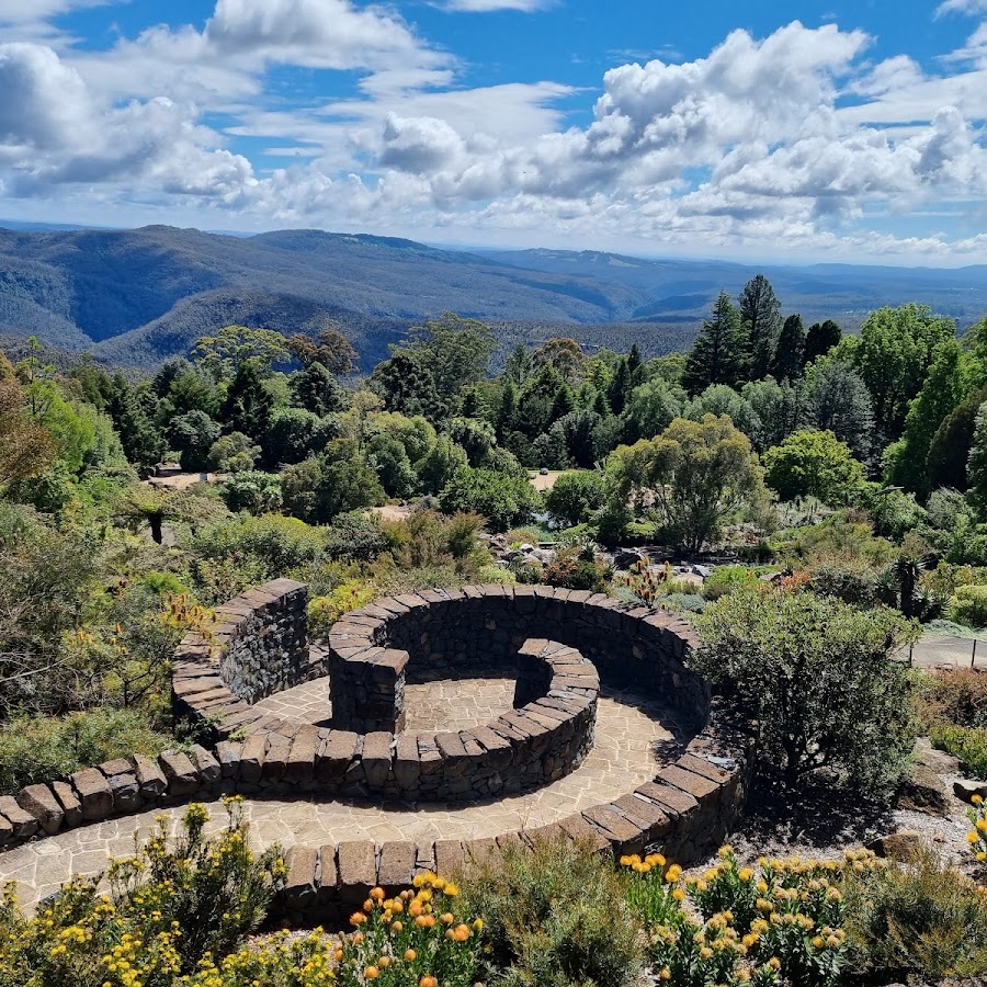
Blue Mountains Botanic Garden Mount Tomah
Discover a showcase of local and imported cool climate plants and basalt cap forests, surrounded by UNESCO World Heritage Area wilderness. Enjoy the tranquillity on the walking trails, wander the plant displays, or take a pitstop at the restaurant with views of the scenic mountains. Open 7days a week. https://www.botanicgardens.org.au/blue-mountains-botanic-garden-mount-tomah
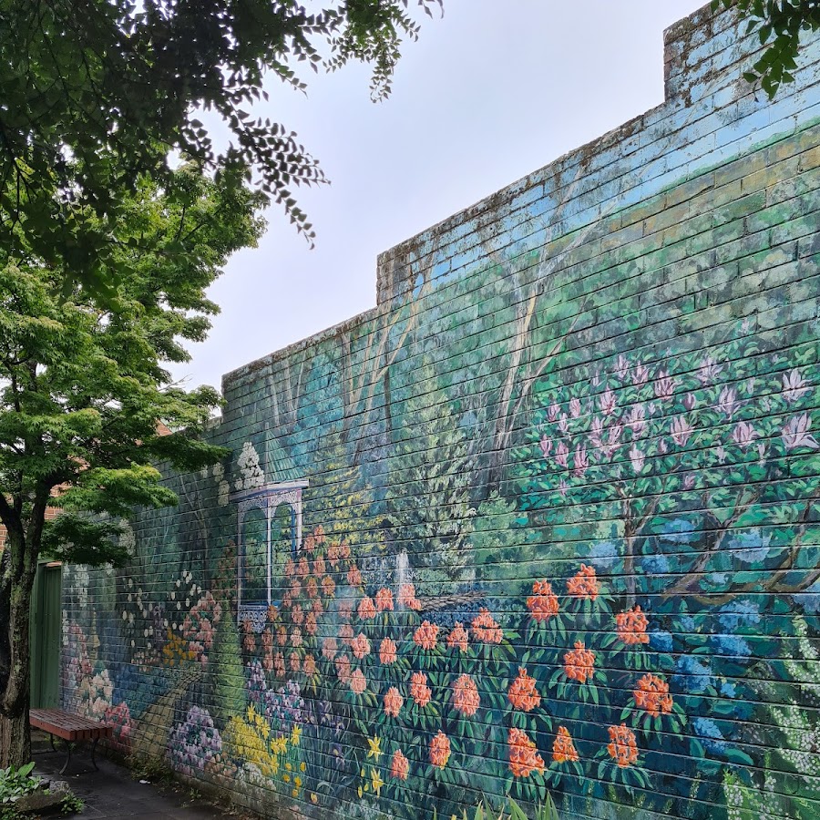
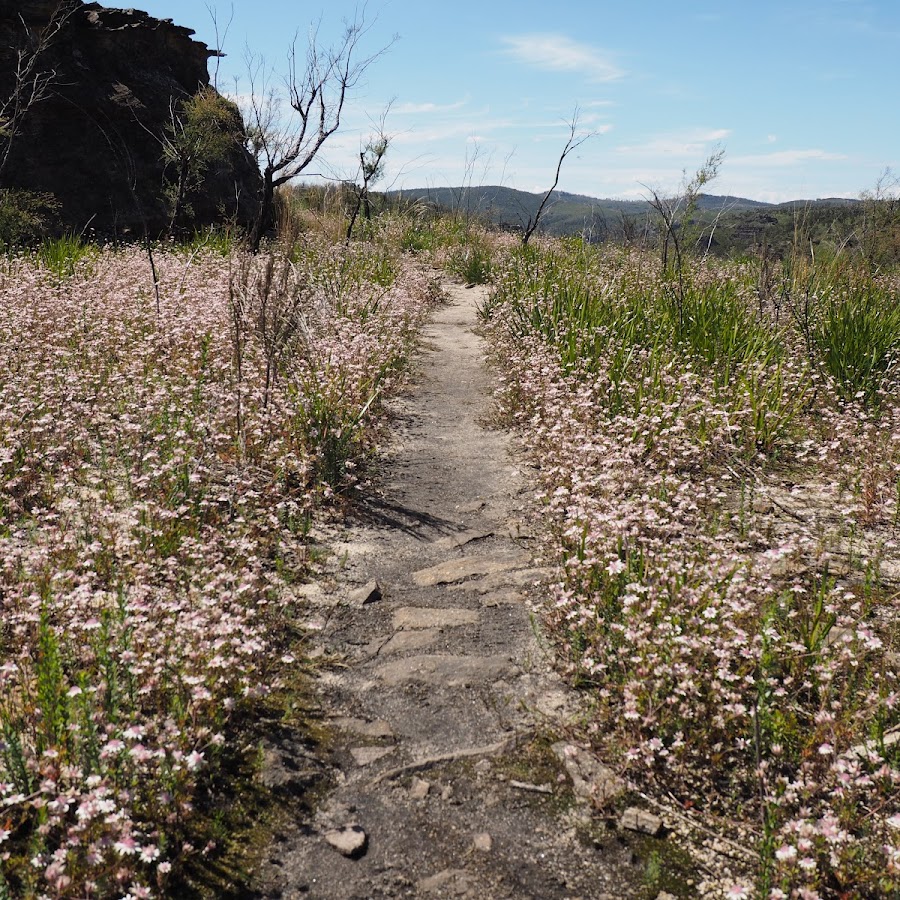
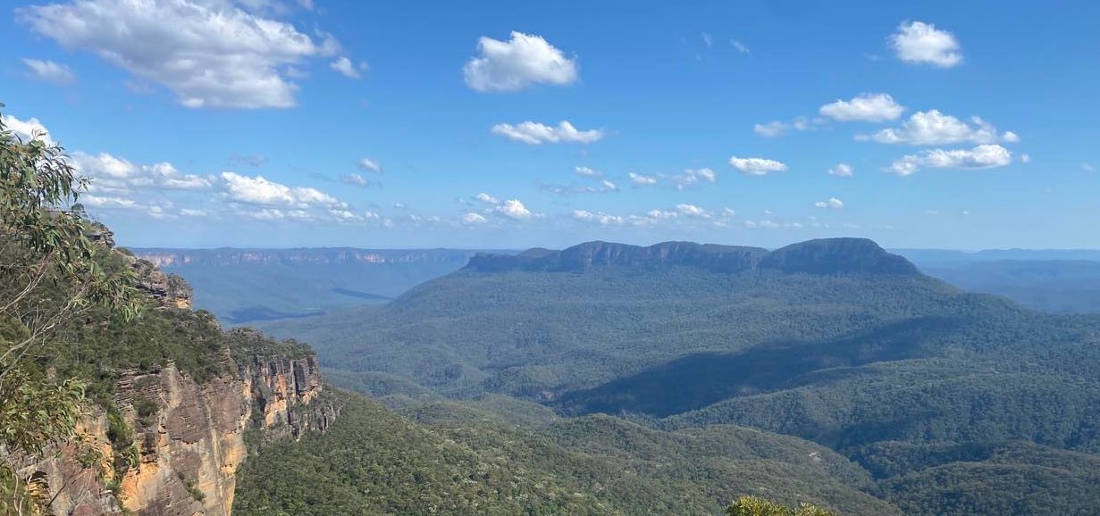
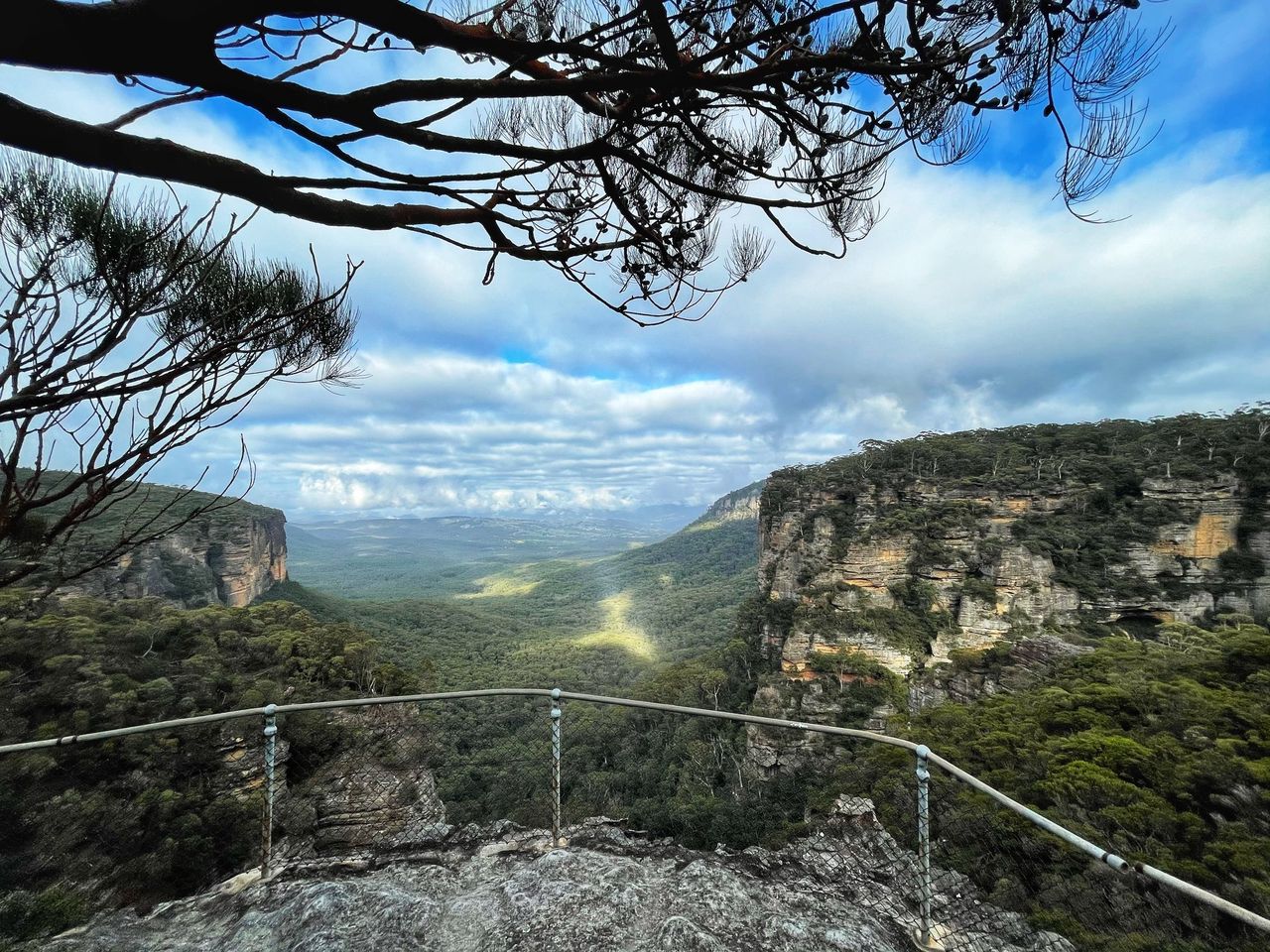
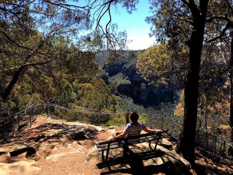
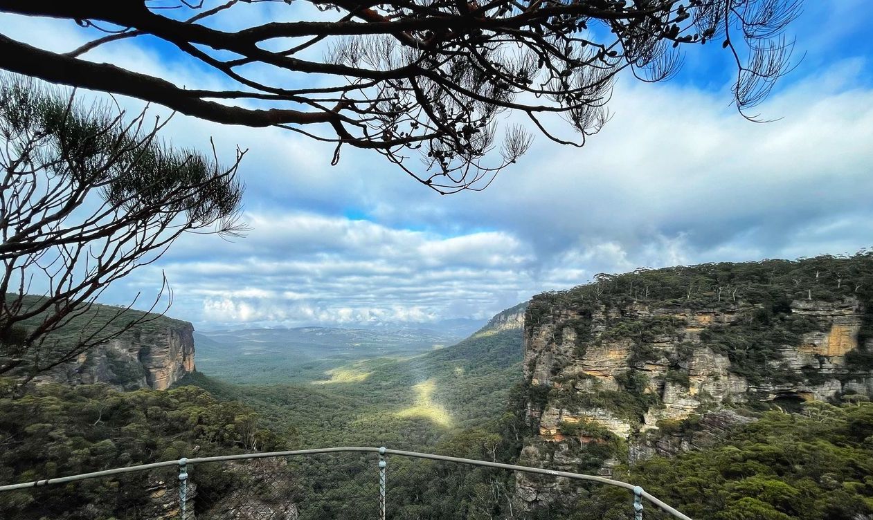
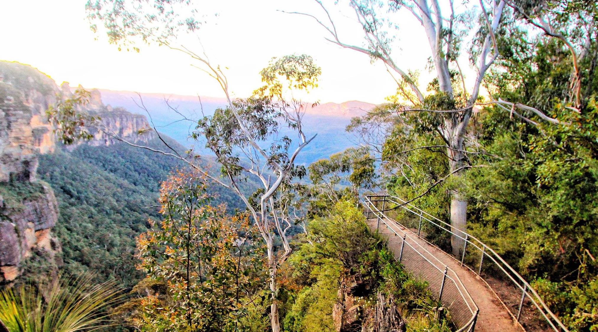
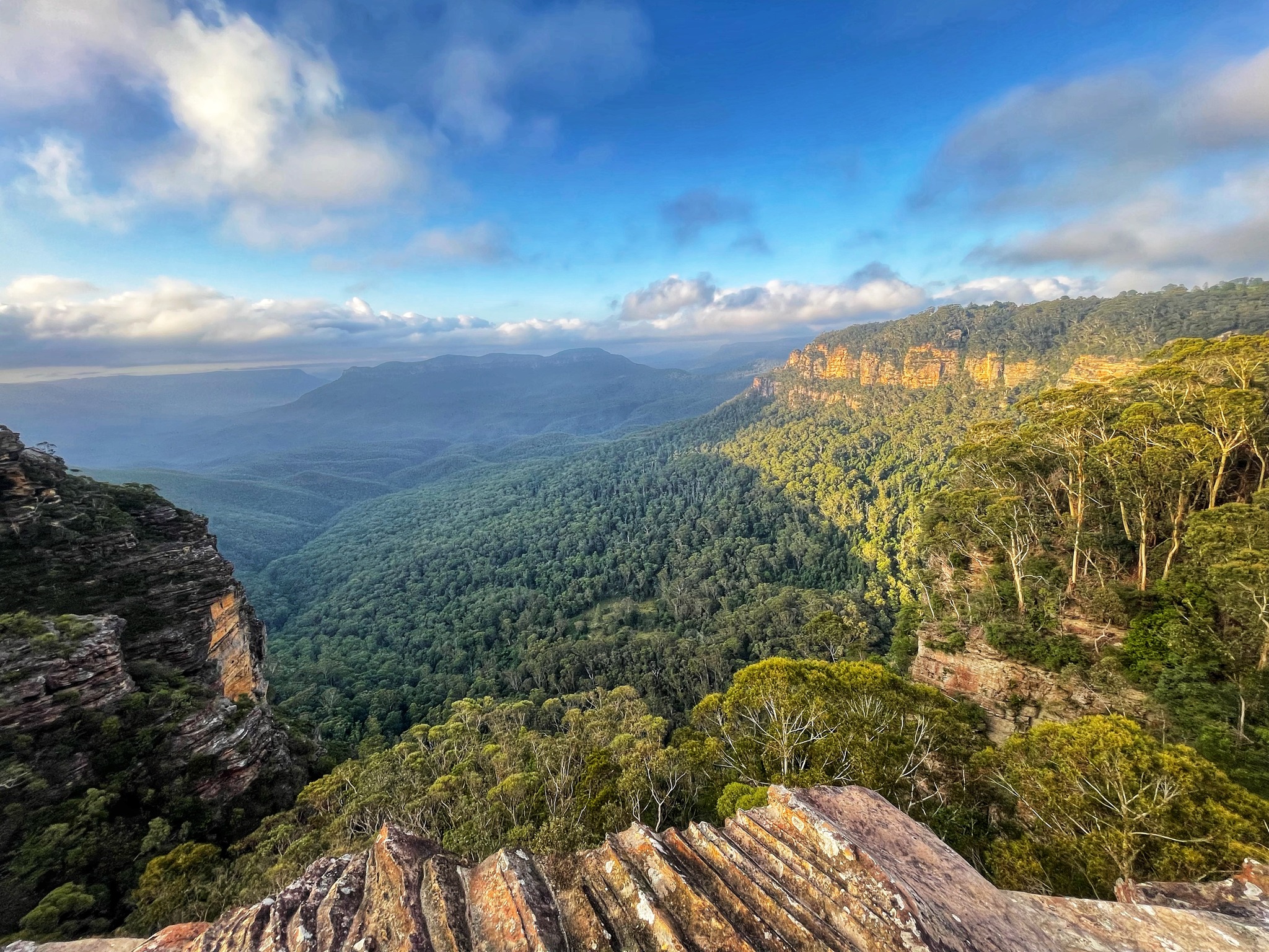
Butterbox Point - Leura
The walk to Butterbox Point is a great family walk that offers outstanding views all the way along the walk. Butterbox Point is a large, high rocky outcrop on the edge of the Grose Gorge, 800m northwest of the northern end of Mount Hay Road, Leura. You can see across the Grose Valley, to Lockleys Pylon on the left, and Perry’s Lookdown and Mount Banks in the distance. This walk offers a real WOW factor from the moment you get out of your car. Butterbox Point is not one of the most widely known lookouts in the Blue Mountains but it is one of the most striking and unusual ones. Distance: 2.2km return - Time: 60 mins return PLUS browsing time. Kid-friendly with supervision. https://www.askroz.com.au/index.php/event_detail/index/butterbox-point_52448
Elysian Rock Lookout - Leura
The 2 Elysian Rock Lookouts offer some of the best views in the Blue Mountains. The lookouts are just a short walk from the street. You can visit the lookout directly or as part of the fantastic Prince Henry Cliff Walk that goes from Scenic World to the eastern side of Leura. Park your car in Olympian Parade and walk down the poorly marked track to the lookout. You can also access it via Gordon Fall Lookout track and from Olympian Rock track. Easy walking but NOT wheelchair friendly. Elysian describes a blissful state, like the one most people hope to enjoy.The name "Elysian" comes from the idyllic Greek mythological place called Elysian Fields. In Greek mythology, Elysian Fields or Elysium is a place of perfect happiness prepared by the gods for the worthy dead. https://www.askroz.com.au/index.php/event_detail/index/elysian-rock-lookout
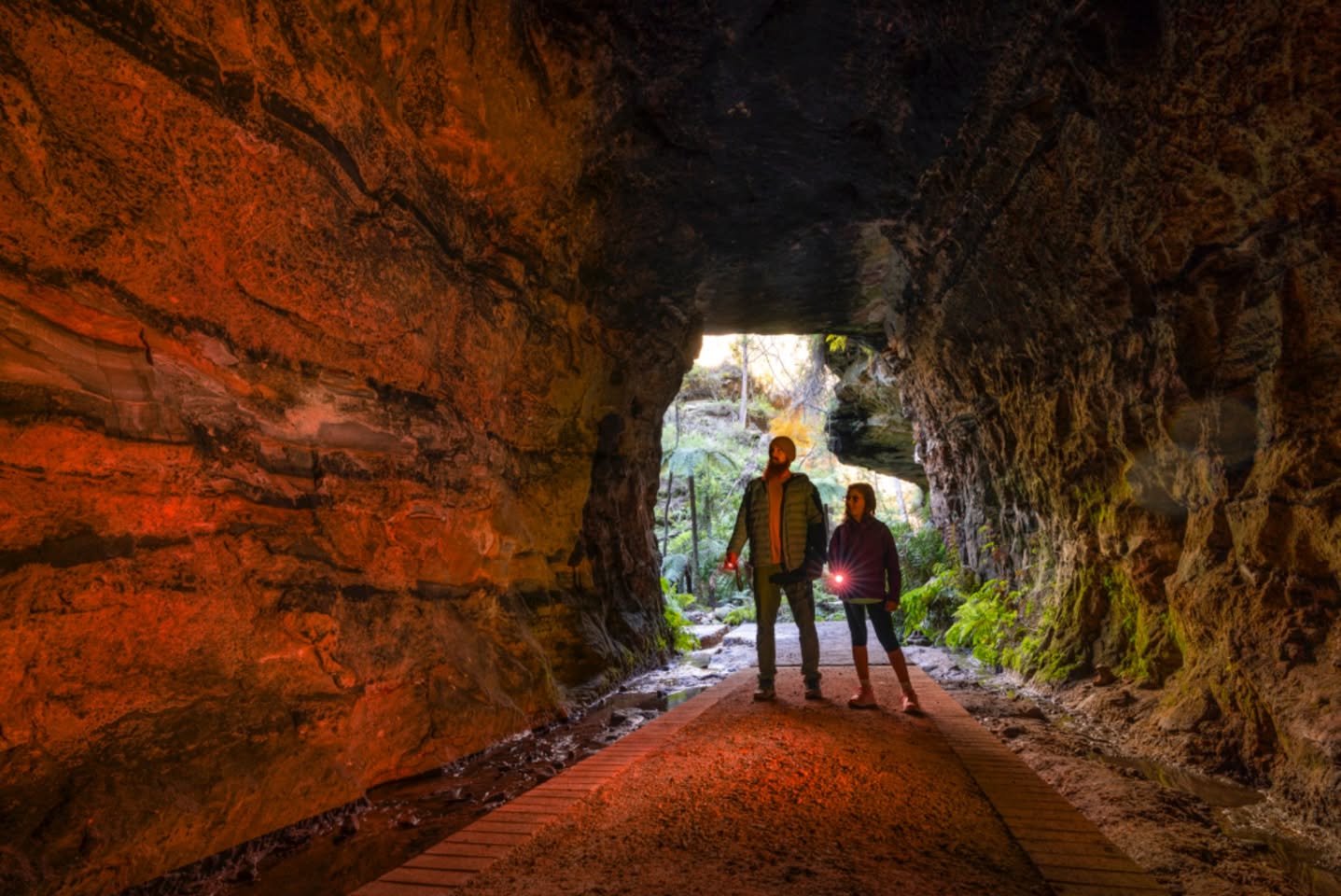
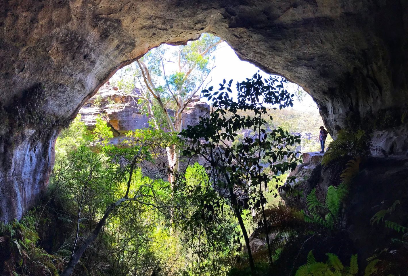
Glowworm Tunnel
This is a wonderful adventure walk the whole family wil enjoy. 𝗞𝗘𝗬 𝗣𝗢𝗜𝗡𝗧𝗦 • Time: 2 hours return • Kid-safe: Yes, with supervision • Dogs on-leash: No • Accessible: No • Heights: No high cliff areas • Must do rating out of 10: 11 The tunnel is here: https://w3w.co/lanky.unworn.gent TIP: Parking is VERY LIMITED. If you plan on going on a weekend, get there EARLY. Park here: https://w3w.co/replaying.solar.grassy If travelling from Clarence (Zig Zag): Start here: https://w3w.co/airing.wished.target 𝗩𝗜𝗦𝗜𝗧𝗢𝗥 𝗲𝗠𝗔𝗚 No.1 Visitor’s Guide Find great things to see & do www.askroz.news/ARBM-Visitor ________________________ 𝗠𝗢𝗨𝗡𝗧 𝗩𝗜𝗖𝗧𝗢𝗥𝗜𝗔 𝗲𝗠𝗔𝗚 📚 Find great things to see & do in and around Mount Victoria www.askroz.news/Mount-Victoria-NSW ________________________ 𝙁𝙄𝙉𝘿 𝙂𝙍𝙀𝘼𝙏 𝙏𝙃𝙄𝙉𝙂𝙎 𝙏𝙊 𝙎𝙀𝙀 𝘼𝙉𝘿 𝘿𝙊 in less than 60 seconds 📚📖 www.askroz.news/BM-Experiences

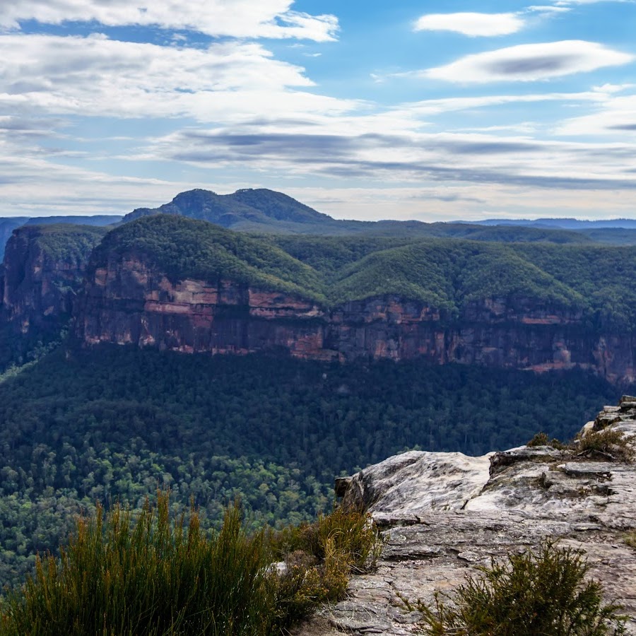
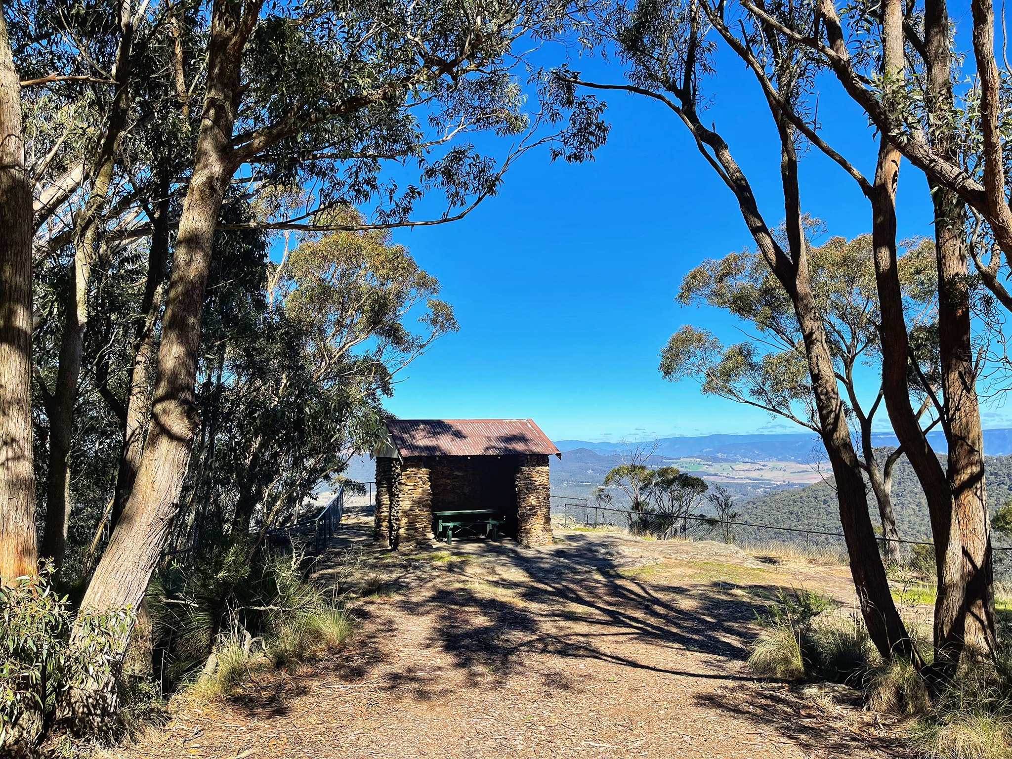
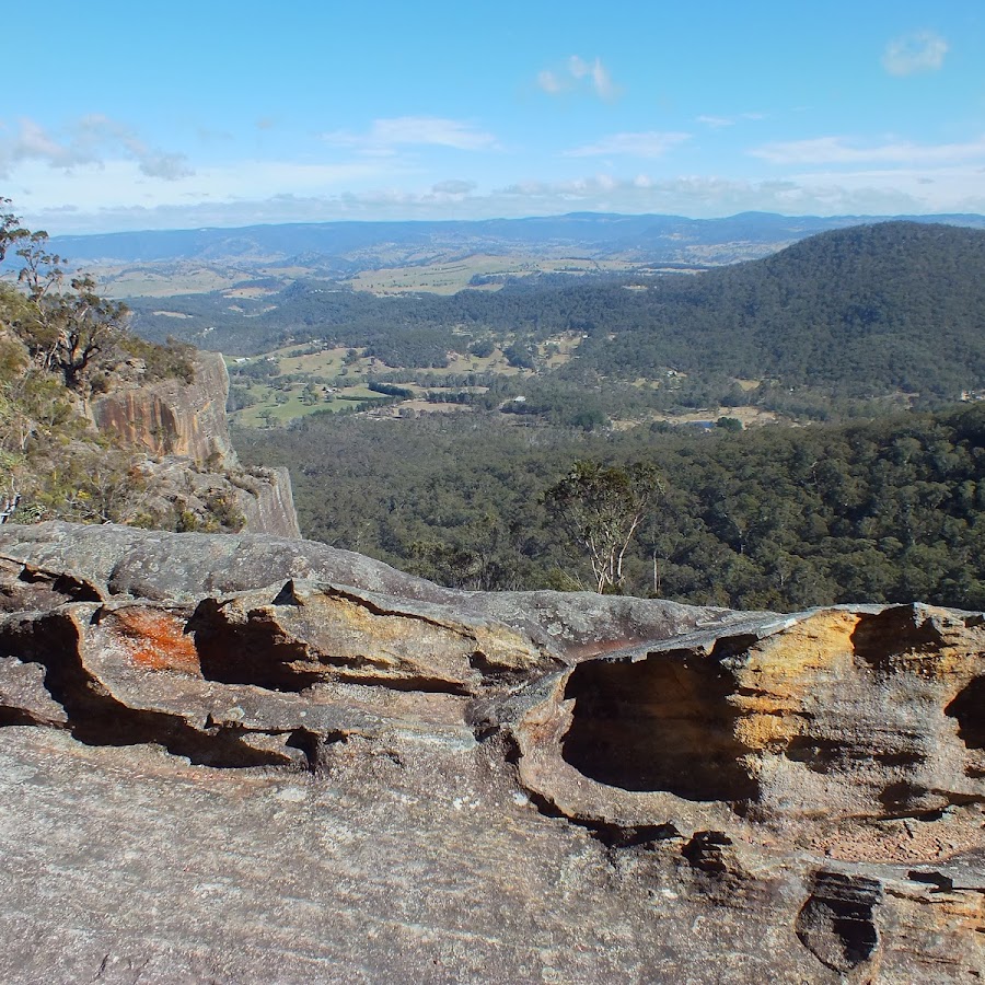
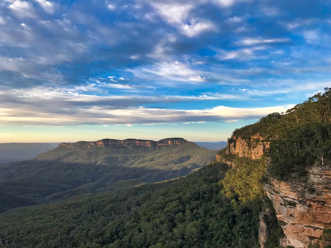
Govetts Leap lookout
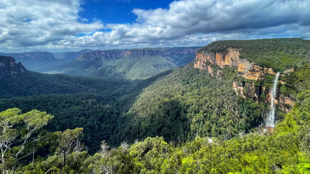
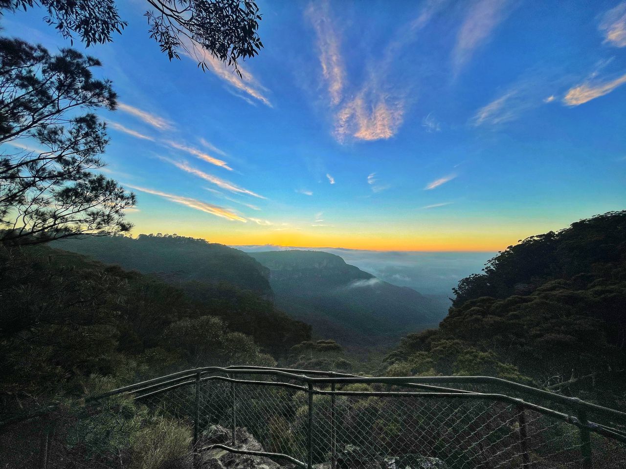
Take in the iconic Blue Mountains views from accessible Govetts Leap lookout, including sandstone escarpments, sheer cliff walls, the deep canyons of the Grose Valley, and tall waterfalls. Accessible lookout. BACKSTORY: Govetts Leap Falls in Blackheath were named after William Romaine Govett, a Government Surveyor who discovered the falls around 1831. The name "Govetts Leap" was given by Major Mitchell, the Surveyor-General, to honour Govett, his assistant surveyor. Contrary to popular local legend about a bushranger named Govett who supposedly leapt to his death at the falls, the name actually refers to the waterfall itself rather than any such dramatic event. The term "leap" in this context derives from an old Scottish word meaning waterfall or cataract. The falls are also known as Bridal Veil Falls and have a single drop of about 180 meters into the Grose Valley. The sculpture near the falls commemorates not the surveyor's leap but a myth connected to the area. https://www.nationalparks.nsw.gov.au/things-to-do/lookouts/govetts-leap-lookout
Hargraves Lookout
Mount Blackheath - Blackheath
GREAT PICNIC SPOT and great views. It is accessible, has multiple picnic tables, a few under the trees and there is plenty of parking and toilets. The road is dirt so drive to the conditions. 𝗞𝗘𝗬 𝗣𝗢𝗜𝗡𝗧𝗦 • Kid-safe: Yes • Views: Yes • Dogs on-leash: Yes • Steps: The first part is accessible • Accessible: Yes • Heights: No https://www.facebook.com/AskRozBlueMountains/posts/pfbid02dDXhaJPYGW4thSGJJUUjTvCuMDronvDf5vtFbYtfrNeCCiiEHzxJD7gTpTngJLLvl
Point Pilcher Lookout - Medlow Bath
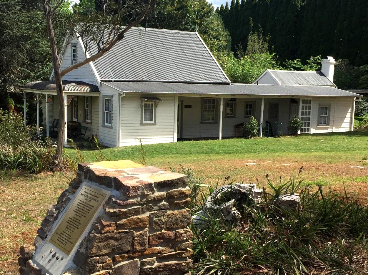
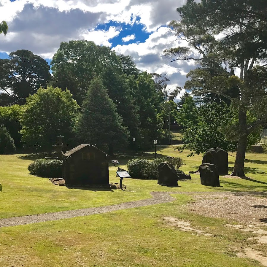
Tarella Cottage & Museum
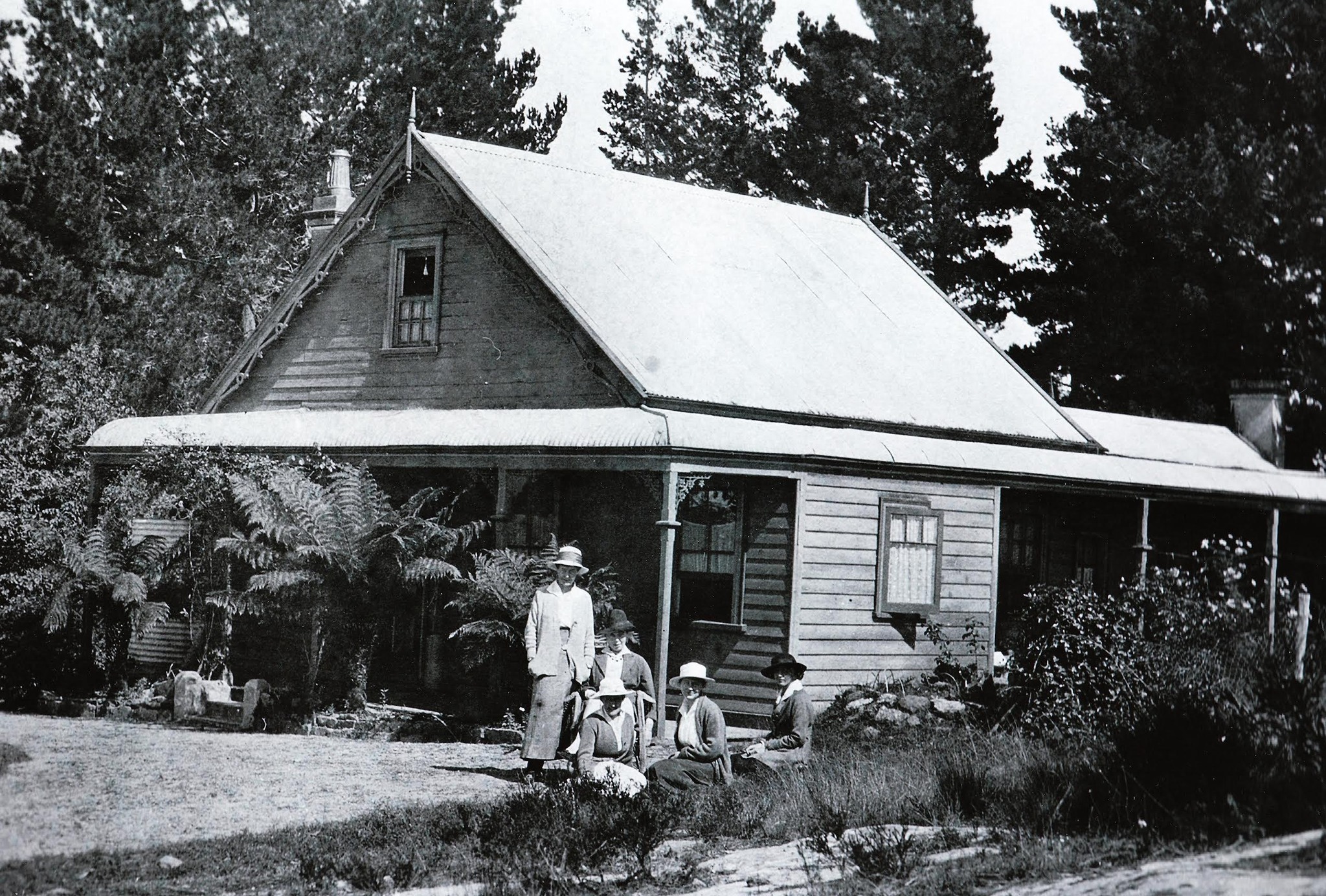
Tarella Cottage & Museum is open on the last Sunday of every month except December. Hours: 10am - 3pm. This cottage was built by John McLaughlin, Sydney solicitor and Member of the Legislative Assembly, in 1890 as a holiday cottage for his family of four children to escape the heat of Sydney summers. His daughter Beryl McLaughlin was the benefactor of the Society, leaving Tarella and the land to the Society on her death in 1988 just two months short of her 100th birthday. The cottage contains an eclectic collection of memorabilia of the late 19th and early 20th centuries. CHECK OUT our 360° Virtual tours of Tarella: www.askroz.com.au/blog/explore-tarella-cottage-wentworth-falls https://bluemountainshistory.com/new_tarella-cottage https://www.facebook.com/profile.php?id=100053261450472

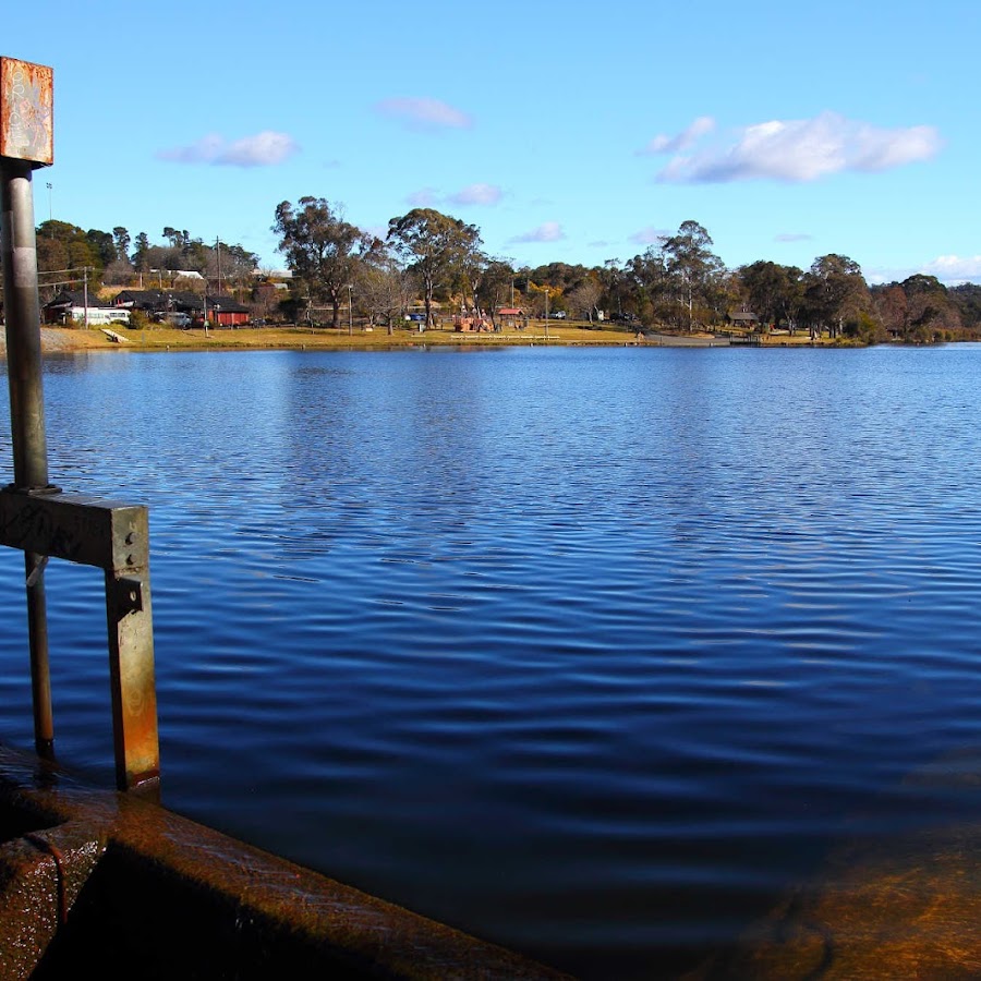
Wentworth Falls Lake
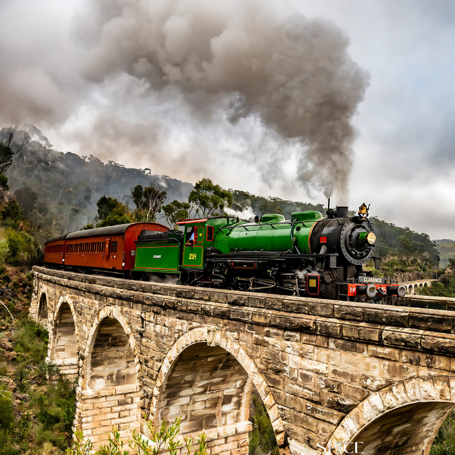
Zig Zag Railway
Resources
Live Traffic NSW
Live Traffic Cameras provide real-time traffic information and updates for the Blue Mountains area, helping travelers stay informed about road conditions and traffic flow. These cameras are strategically placed to give a clear view of major roads and intersections. • Live Traffic Website https://www.livetraffic.com • Live Traffic – Sydney West https://www.livetraffic.com/traffic-cameras/sydney-west • Emu Plains M4 https://www.livetraffic.com/traffic-cameras/sydney-west/m4-western-motorway-emu-plains • Hazelbrook https://www.livetraffic.com/traffic-cameras/sydney-west/great-western-highway-hazelbrook • Katoomba https://www.livetraffic.com/traffic-cameras/sydney-west/great-western-highway-katoomba • Blackheath https://www.livetraffic.com/traffic-cameras/sydney-west/great-western-highway-blackheath • Victoria – Station Street https://www.livetraffic.com/traffic-cameras/sydney-west/great-western-highway-at-station-street • Mount Victoria – Victoria Pass https://www.livetraffic.com/traffic-cameras/sydney-west/great-western-highway-victoria-pass • Bell – Darling Causeway – Bells Line of Road https://www.livetraffic.com/traffic-cameras/sydney-west/bells-line-of-road-bell • Lithgow Live Camera https://www.livetraffic.com/traffic-cameras/sydney-west/great-western-highway-lithgow • Jenolan Caves Road – Hampton https://www.livetraffic.com/traffic-cameras/regional-west/jenolan-caves-road-hampton
Other Resources
Ask Roz offers a wide range of Web Apps and eMags, including these:- 𝗪𝗘𝗕 𝗔𝗣𝗣𝗦 - 𝗜𝗡𝗧𝗘𝗥𝗔𝗖𝗧𝗜𝗩𝗘 Mount Victoria Village: www.askroz.news/Mount-Victoria-NSW Katoomba EAT Street: www.askroz.news/Katoomba-EAT-Street Leura Garden Festival 2025: www.askroz.news/Leura-Gardens-Festival-2025-Map Holley House Apartment: www.askroz.news/Holley-House-Appartment-App 𝗙𝗔𝗖𝗘𝗕𝗢𝗢𝗞 𝗚𝗥𝗢𝗨𝗣𝗦 & 𝗣𝗔𝗚𝗘𝗦 Best Bushwalks: https://www.facebook.com/groups/bluemountainsbestbushwalks
Visitor Enquiries
If you have any questions about finding great things to see and do in the Blue Mountains simply send us a WhatsApp chat to 0414 592 690, between 'sunrise and sunset' 7 days a week.
Other Apps
Road Trip Central West: https://askroz.news/Road-Trip-Central-West Mount Victoria Village: https://askroz.news/Mount-Victoria-Village Katoomba EAT Street: https://askroz.news/Katoomba-EAT-Street
What's on
Featured events. More events here: https://www.facebook.com/AskRozBlueMountains/events
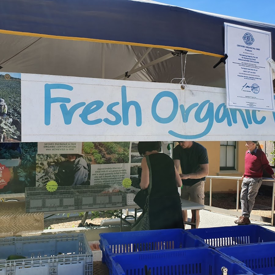
Blackheath Growers Market
2nd Sunday of every month, except January. Blackheath Growers market has been going for over 20 years. Our growers market supports local and regional growers. https://www.facebook.com/katoombagrowers https://www.alleventsmarketsandfestivals.com.au
BMHS Public Talk
1st Saturday of the month. Public Meeting and Talk. The meeting will commence at the Societys Hobbys Reach Research Meeting Room at 99 Blaxland Road, Wentworth Falls, at 10.30am. Morning tea will be available from 10am for $5. BMHS members are free, Visitors entry fee is $5.00. https://bluemountainshistory.com/events https://www.facebook.com/BlueMountainsHistoricalSociety/
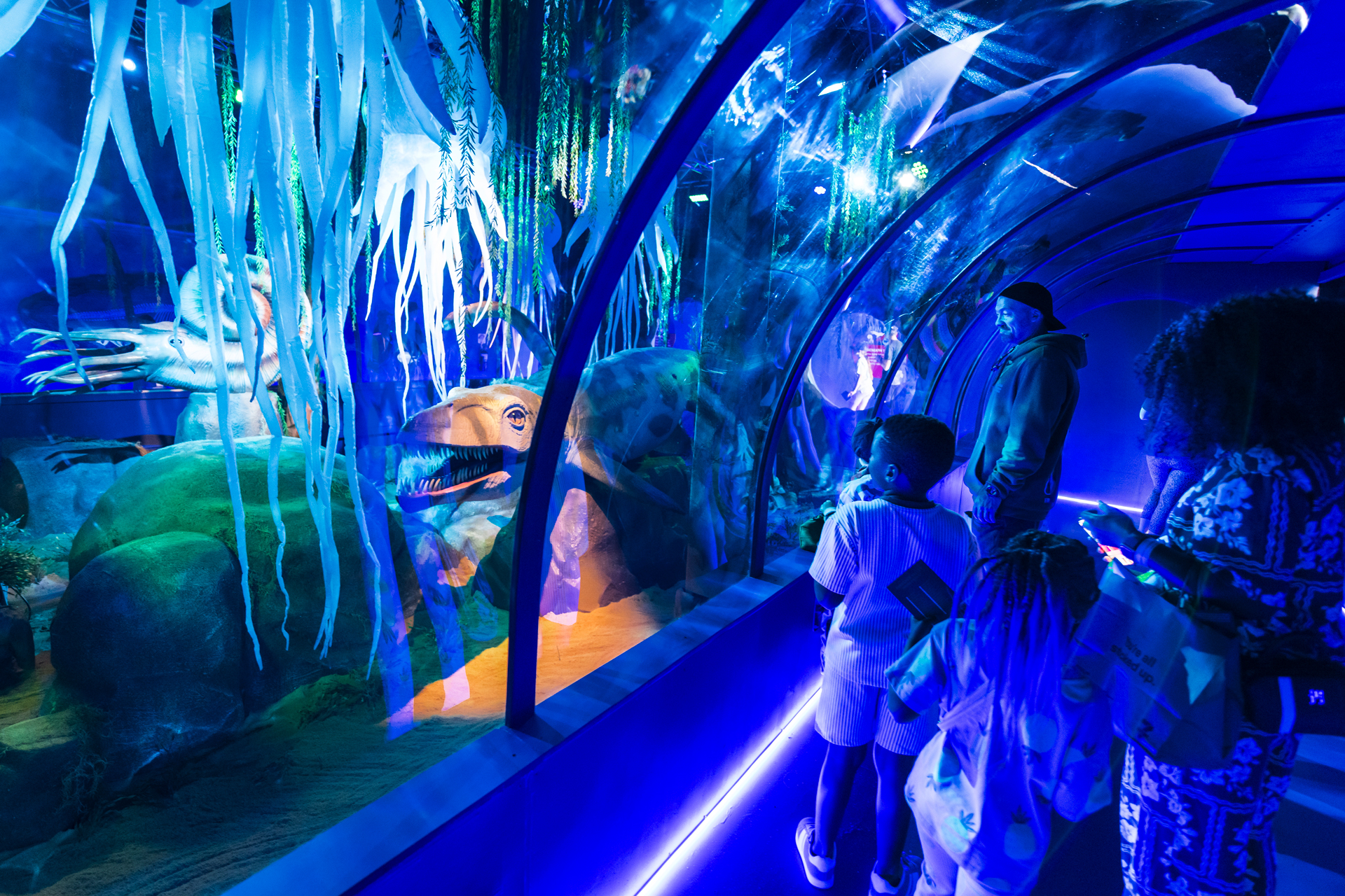
Dinosaur Valley @ Scenic World
Daily until 26 January 2026. Dino Aquarium opens at Scenic World, Katoomba – A prehistoric first at Australia’s biggest dinosaur experience. https://www.facebook.com/AskRozBlueMountains/videos/1448340683130509
Magpie Upstyle Markets
3rd Sunday of the Month (Except January) - 9am to 1pm If you're looking for something, there's a great chance you'll find it at the Magpie Markets! Family friendly and accessible (some stalls on grassed area) https://www.facebook.com/magpiemarketslawson https://www.alleventsmarketsandfestivals.com.au
Octoberfest Collits Inn
11th October - Oktoberfest with Method Brewing! 🍻 Dust off your lederhosen and prep your pretzel grip – we’re throwing down a mountain-style Oktoberfest at Collits Inn with beer, beats, and bratwurst to boot. Here’s what’s on tap: 🍺 Brews by OG Lithgow legends Method Brewing 🎶 Live music from local powerhouse Bonnie Doon and the band 🌭 Hearty German fare to soak it all up 🚍 Shuttle bus from Lithgow & Mt Vic Station running at set times (join the FB event, follow us on Insta or watch our stories for details closer to the day) 🎁 Best Dressed prizes – you know the drill! 📅 October 11th 🕛 Kitchen & live music: 12:00 – 4:00pm 🎟️ Grab your entry tickets and get ready to prost the day away! *under 18 free* 🍖 Pork knuckle lovers, rejoice – pre-orders available until October 3rd! https://www.facebook.com/events/1675839086457419

Springwood Growers Market
4th Sunday of every month (except January) - 8am - 12n Springwood Growers Market has run the 4th Sunday of every month since August 2015 at the Blue Mountains community theatre and hub in Springwood. We trade on the 3rd Sunday in December due to Christmas. We proudly host 50 growers who every month bring array of local and regional foods. We have a wide range of fruits and vegetables organic and chemical free, meats, breads and cheeses, olive oils and local wines, nuts and honey, free range eggs, spices and condiments, plants and seedlings, a wide range of baked good, gluten free and vegan options available. https://www.alleventsmarketsandfestivals.com.au https://www.facebook.com/profile.php?id=100063702302327
Tarella Cottage & Museum - OPEN DAY
Last Sunday of every month except December. Hours: 10am - 3pm. Tarella Cottage & Museum. This cottage was built by John McLaughlin, Sydney solicitor and Member of the Legislative Assembly, in 1890 as a holiday cottage for his family of four children to escape the heat of Sydney summers. His daughter Beryl McLaughlin was the benefactor of the Society, leaving Tarella and the land to the Society on her death in 1988 just two months short of her 100th birthday. The cottage contains an eclectic collection of memorabilia of the late 19th and early 20th centuries. CHECK OUT our 360° Virtual tours of Tarella: www.askroz.com.au/blog/explore-tarella-cottage-wentworth-falls https://www.facebook.com/profile.php?id=100053261450472
Attractions & Activities
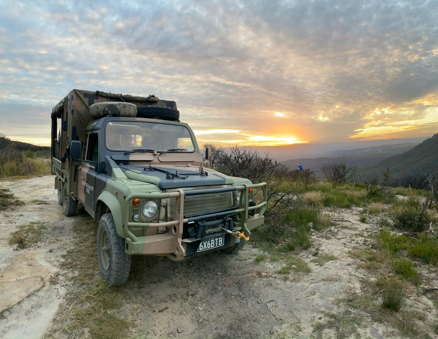
Beyond The Blacktop
Discover the Blue Mountains like never before. We go off the beaten path and away from the crowds and experience the real Blue Mountains. Blue Mountains based and operating from Echo Point, Beyond The Blacktop Adventure Tours offers a range of fun and exciting adventure tours over the upper mountains. Add us to your plans for your day trip from Sydney. Let us 'Share The Adventure!' Take a look at our trip options below, and contact us for further information. REEL: https://www.facebook.com/reel/586524670872652 REEL: https://www.facebook.com/reel/788100236924627 https://www.facebook.com/beyondtheblacktopadventuretours https://www.beyondtheblacktop.com.au/
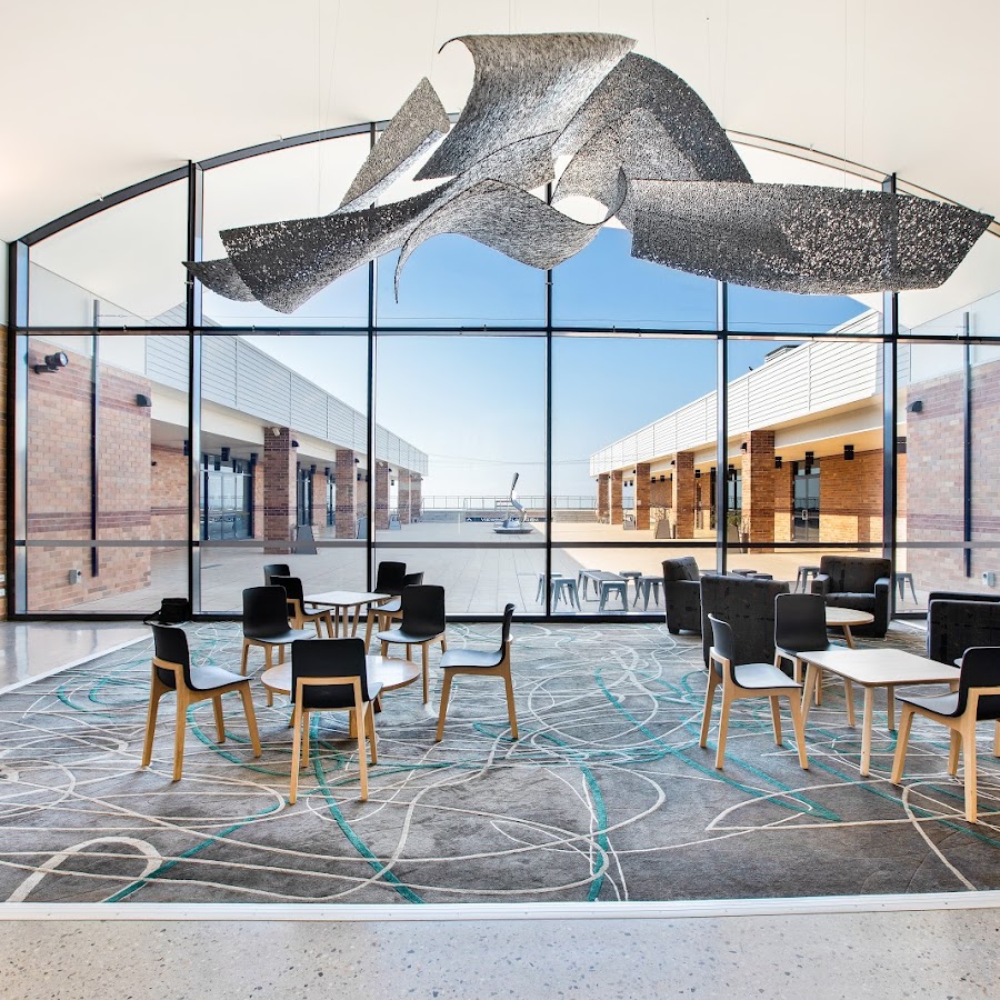
Blue Mountains Cultural Centre
The Cultural Centre showcases innovative, diverse, distinctive and creative cultural programs for enjoyment by residents of, and visitors to, the Blue Mountains. Located in the heart of Katoomba the Blue Mountains Cultural Centre encompasses the Blue Mountains City Art Gallery, Katoomba Library and Into the Blue, an interactive exhibition that explores the history and natural landscape of the Blue Mountains. Visitors can also enjoy the viewing platform that takes in stunning panoramic vistas of Katoomba and the Jamison Valley. The Blue Mountains Cultural Centre is a sister facility to the Blue Mountains Theatre and Community Hub and Braemar Gallery located in Springwood. https://bluemountainsculturalcentre.com.au/virtualinsight/
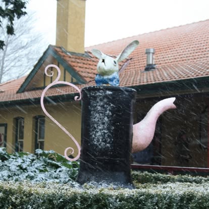
Bygone Beautys Treasured Teapot Museum - Leura
Bygone Beautys is home to the world's largest private collection of teawares. The collection spans five centuries and includes more than 5,500 teapots. https://www.bygonebeautys.com.au/ https://www.facebook.com/BygoneBeautys
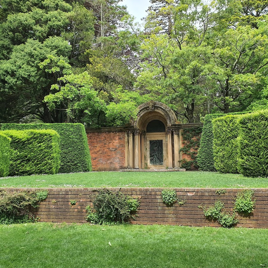
Everglades House & Gardens - Leura
This National Trust NSW property boasts a spectacular garden with sweeping Blue Mountains views. Includes a stunning Art Deco home. https://www.facebook.com/EvergladesNationalTrust https://www.nationaltrust.org.au/places/everglades-house-gardens
Mountains Tales
Walking histoic tours of Leura, Katoomba and Mount Victoria https://www.facebook.com/MountainsTalesNSW
Rex-Livingstone Art + Objects Gallery
Rex Livingstone Art + Object is a popular local establishment known for its unique offerings and vibrant atmosphere. Contemporary Art Gallery, Mount Eyre Art Prize host, insurance valuations, ceramics, sculpture, ART. Open : Thursday to Sunday 11am-5pm https://rex-livingston.com https://www.facebook.com/RexLivingstonArtObjects
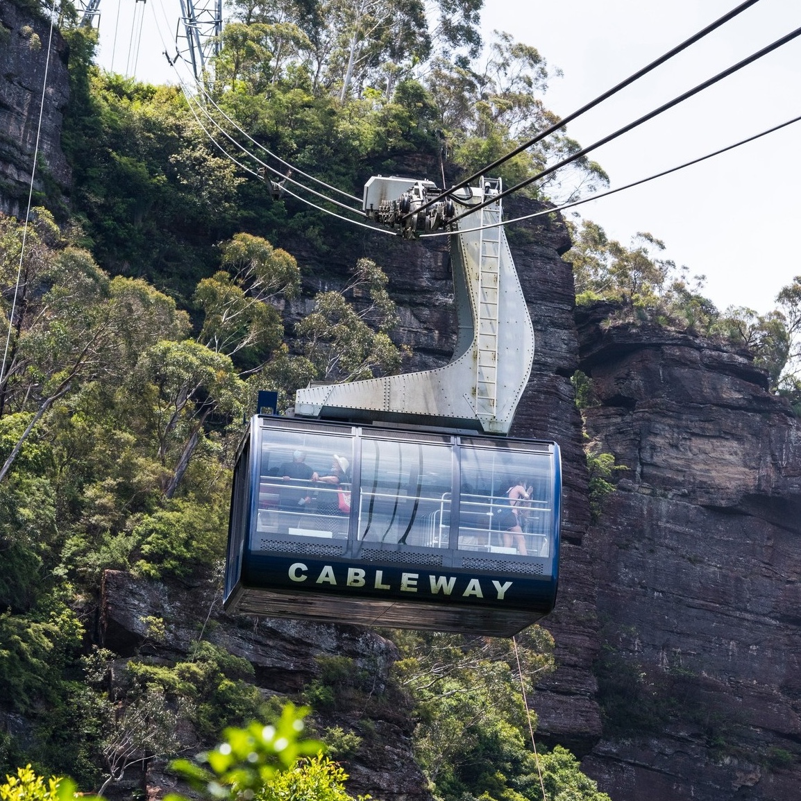
Scenic World Katoomba
The iconic Skyway + the world’s steepest Railway + the southern hemisphere’s steepest Cablecar. https://www.facebook.com/ScenicWorld https://www.scenicworld.com.au/
Wentworth Falls Lake
Wentworth Falls Lake is a picturesque lake located in the Blue Mountains, offering stunning views and a tranquil environment for picnics, walking, and enjoying nature. The area is popular for its scenic walking tracks and is a great spot for families and outdoor enthusiasts. PAID PARKING: Beaware that paid parking applies up to $12pn
United Cinemas 'The Edge' - Katoomba
Escape into the magic of cinema at United Cinemas The Edge Katoomba! With the biggest screen in the Blue Mountains, plush seating, and crystal-clear sound, every film becomes an unforgettable experience. Catch the latest blockbusters, family favourites, and special screenings right in the heart of Katoomba. Looking for a night out or a fun family day? The Edge has you covered – big screen, big sound, big entertainment! OPEN: 9:30am - 11:30pm 7 days https://www.unitedcinemas.com.au https://www.facebook.com/unitedcinemastheedge

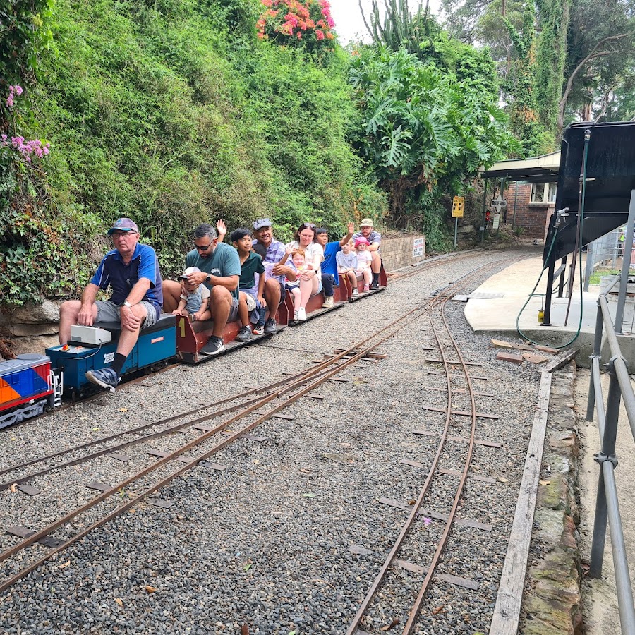
Wascoe Siding Miniature Railway
Zig Zag Railway
Upper Blue Mountains
Bell - Clarence - Newnes Plateau - Mount Tomah - Mount Wilson
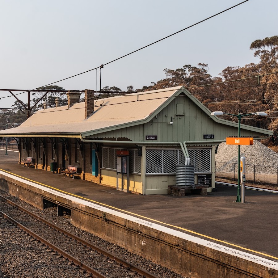
Bell Station
Blue Mountains Botanic Garden Mount Tomah
Discover a showcase of local and imported cool climate plants and basalt cap forests, surrounded by UNESCO World Heritage Area wilderness. Enjoy the tranquillity on the walking trails, wander the plant displays, or take a pitstop at the restaurant with views of the scenic mountains. Open 7days a week. https://www.botanicgardens.org.au/blue-mountains-botanic-garden-mount-tomah
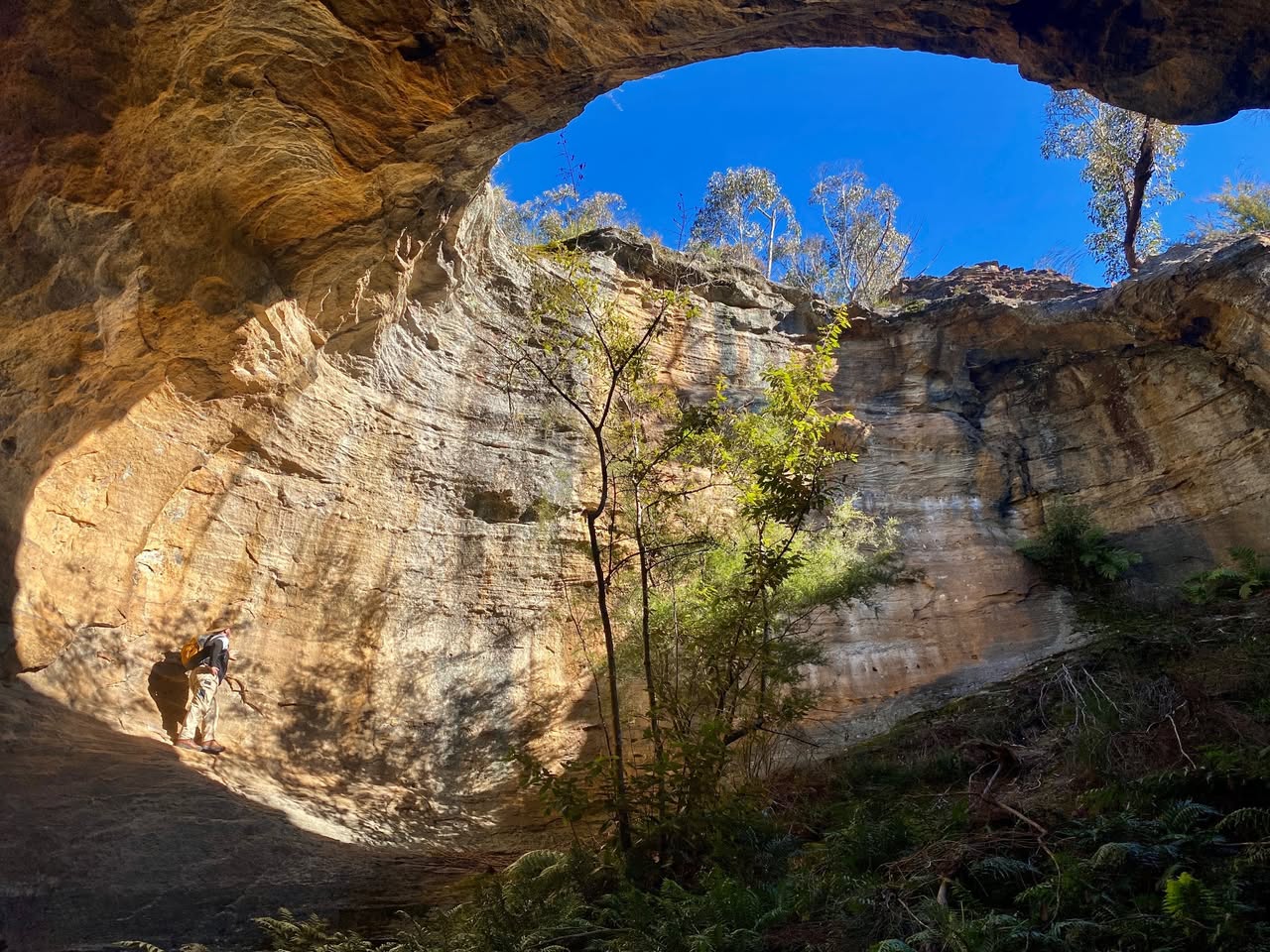
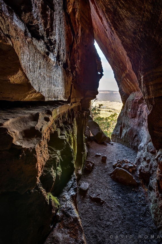
Dargan Arch
Dargan Arch is the remains of a long collapsed cave. It's a natural sandstone arch about 14m long, 8m wide and about 9m high. ACCESS: Once you leave Sandham Road you'll come to a power easement, park there. The track ahead is blocked not far ahead and becomes impassable soon after. Park here: https://w3w.co/spiced.intervals.lenses MORE info and 360° images: https://www.askroz.com.au/blog/dargan-arch-a-great-place-to-visit/ Arch is here: https://w3w.co/excursions.thinking.pluck When you get to the end of the easily defined track it's a bit of a dog breakfast from there. Keep walking straight ahead and you'll see faint tracks down to where you'll see the arch. You can safely walk over the arch. To the left of the arch is a faint track that heads away. Follow that until you see another faint track that will take you down and allow you to walk under the arch. TIPS: This is not a destination for little ones. The rocks are slippery and a fall would be unforgiving. KEY POINTS • Distance: About 2km return • Time: 1 hour return • Best time of the day: Any time • Kid-safe: Yes with very close supervision. Not for the very little. • Steps: Many • Accessible: No • Heights: Yes with big drops and no safety rails • Must do rating out of 10: 10 MORE info: https://www.askroz.com.au/blog/dargan-arch-a-great-place-to-visit https://www.facebook.com/AskRozBlueMountains/posts/pfbid0pnQiUyuSMN9aRPb67cDARDCkTq7tfzZWiLN1ykEnKuD1Y4bBSq2VPg4BTQcJb1cYl
Glowworm Tunnel
This is a wopnerful adventure walk the whole family wil enjoy. 𝗞𝗘𝗬 𝗣𝗢𝗜𝗡𝗧𝗦 • Time: 2 hours return • Kid-safe: Yes, with supervision • Dogs on-leash: No • Accessible: No • Heights: No high cliff areas • Must do rating out of 10: 11 The tunnel is here: https://w3w.co/lanky.unworn.gent TIP: Parking is VERY LIMITED. If you plan on going on a weekend, get there EARLY. Park here: https://w3w.co/replaying.solar.grassy If travelling from Clarence (Zig Zag): Start here: https://w3w.co/airing.wished.target 𝗩𝗜𝗦𝗜𝗧𝗢𝗥 𝗲𝗠𝗔𝗚 No.1 Visitor’s Guide Find great things to see & do www.askroz.news/ARBM-Visitor ________________________ 𝗠𝗢𝗨𝗡𝗧 𝗩𝗜𝗖𝗧𝗢𝗥𝗜𝗔 𝗲𝗠𝗔𝗚 📚 Find great things to see & do in and around Mount Victoria www.askroz.news/Mount-Victoria-NSW ________________________ 𝙁𝙄𝙉𝘿 𝙂𝙍𝙀𝘼𝙏 𝙏𝙃𝙄𝙉𝙂𝙎 𝙏𝙊 𝙎𝙀𝙀 𝘼𝙉𝘿 𝘿𝙊 in less than 60 seconds 📚📖 www.askroz.news/BM-Experiences
Zig Zag Railway
The Zig Zag Railway is a historic railway located in the Blue Mountains, offering scenic rides through beautiful landscapes. It features a unique zig-zag track that allows trains to navigate steep gradients, providing passengers with stunning views of the surrounding area.
Mount Victoria
Mount Victoria unites historic charm with natural attractions. Eat, stay, play. Historic and Unexpected. Mount Victoria eMag: www.askroz.news/Mount-Victoria-NSW
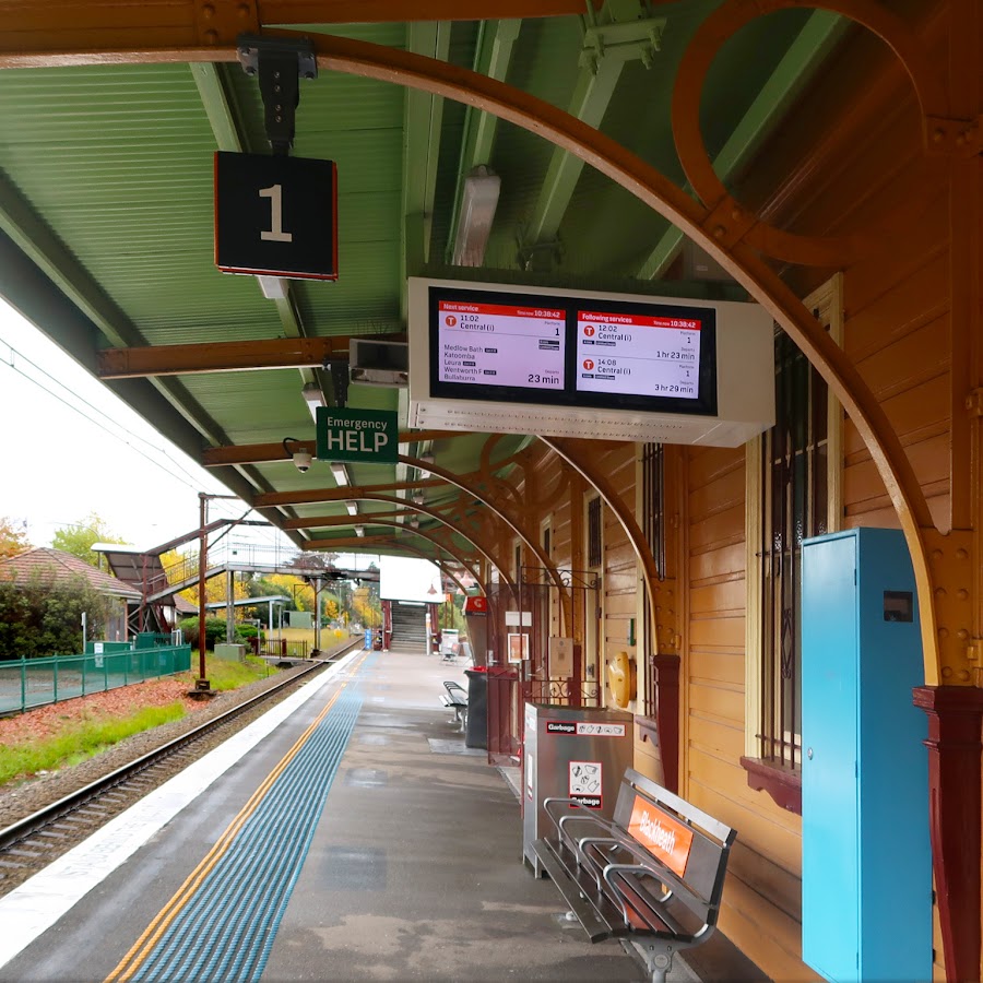
Mount Victoria Railway Station
Mount Victoria Railway Station is a historic railway station located in the Blue Mountains, serving as a key stop for travelers. It provides access to train services connecting Mount Victoria with Sydney and other regional destinations, making it a convenient point
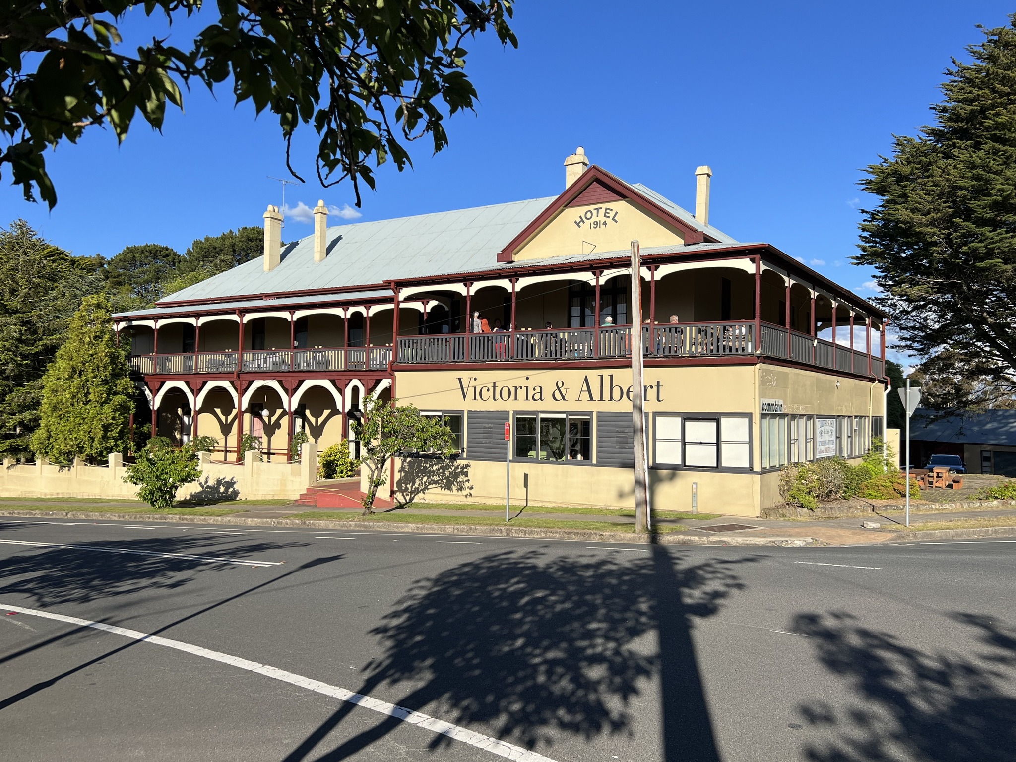
Cafe V&A Victoria & Albert Guesthouse
V&A Cafe for Breakfast, Lunch and Dinner. Check link for open times. The Victoria and Albert Guesthouse is a historic property in Mount Victoria. Key points: • Built in 1868, originally as the Royal Hotel Located near Mount Victoria's train station Offers various room types with period decor • Amenities include shared lounges, fireplaces, and a restaurant • Hosts special events like "Glitzmas" and Sunday roasts • Known for its friendly staff and unique atmosphere • Popular base for exploring Blue Mountains attractions The guesthouse provides a blend of history and comfort for visitors to the Blue Mountains region. https://vaguesthouse.com https://www.facebook.com/vaguesthouse (02) 4787 1348

One Tree Hill Cafe & Kitchen
Cosy café in the heart of mount Victoria Dog friendly veranda. Locally roasted coffee and homestyle cooking. Catering available. https://www.facebook.com/onetreehillcafe
Asgard Mine Track
This is a medium grade and quiet walk through lovely bushland. Head in from the highway at Victoria Falls Road. About 4.5 klm down this road, there is a locked gate and this is where the walk begins. Asgard Plateau is the part of the Grose Valley north of Mt Victoria, between the upper Grose River, and Victoria Creek. While not a large area, there are many interesting features and excellent lookouts that can be visited. This walk has several short off track sections, though the navigation is fairly straightforward. The tracks themselves are not signposted, but are mostly not hard to find or follow. https://www.facebook.com/AskRozBlueMountains/posts/pfbid033MPKoLDowvtDNWc2EqEwCFLwS1dCwm2ebzz2MB2Gf9u7Xz39E3k3o4dFiEbBgxr5l
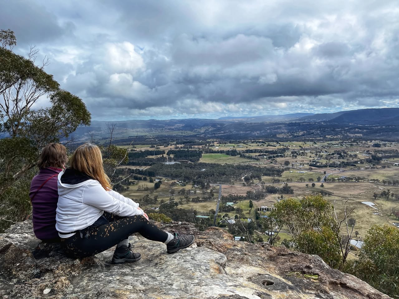
Bardens Lookout
Bardens Lookout is a popular vantage point that offers stunning panoramic views of the Blue Mountains and the surrounding landscape. The lookout provides an excellent opportunity for visitors to take in the natural beauty of the area, including the vast eucalyptus forests and rugged terrain. The lookout provides a peaceful and serene environment for appreciating the natural wonders of the Blue Mountains. The lookout is located on Mount York Road, less than 1 km before the Mount York lookout area. You can, in fact, walk between these two locations and leave your car parked at one end. BACKSTORY: Barden Lookout was named after Herbert Ernest Barden (1880-1924) and Edith Elizabeth Barden 1880- 1956), residents of Mount Victoria. Herbert Barden was the instigator of the Urban Committees in the Blue Mountains Area. The lookout has views to Hartley and the western side of the Blue Mountains. The name was proposed by the Blue Mountains City Council. Ref: The Blue Mountains Advertiser, 31 May 1973. ________________________ 𝗠𝗢𝗨𝗡𝗧 𝗩𝗜𝗖𝗧𝗢𝗥𝗜𝗔 𝗲𝗠𝗔𝗚 📚 Find great things to see & do in and around Mount Victoria www.askroz.news/Mount-Victoria-NSW
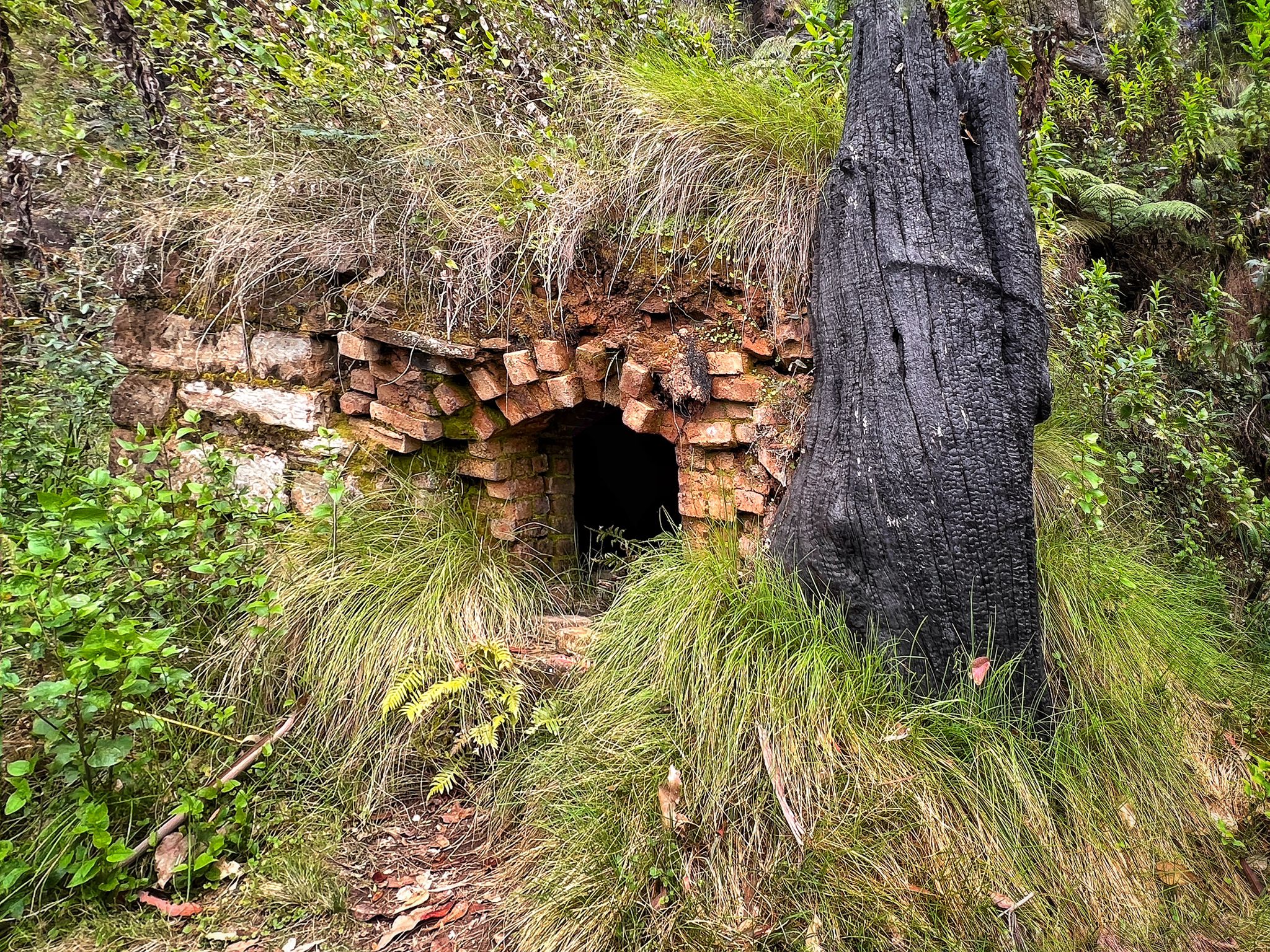
Blair Athol No 4 Coal Mine
If you like a bit of ADVENTURE, this short walk could be great for you. BIGGER KIDS WILL LOVE IT. Park beside the road in and walk down under the powerlines until you see the NPWS sign. 𝗞𝗘𝗬 𝗣𝗢𝗜𝗡𝗧𝗦 • Distance: 1km return • Time: 30 mins return PLUS browsing time • Best time of the day: Any time • Kid-safe: Yes with supervision • Dogs on-leash: No • Steps: Normal bush track • Accessible: No • Heights: None • Must do rating out of 10: 7.5 More info and 360° Virtual Tour: https://www.askroz.com.au/blog/blair-athol-coal-mine-mount-victoria TAKE A GOOD TORCH in case you have the courage to go into the mine. It's VERY DARK, a bit slippery and muddy in places. TAKE CARE. Wear good walking shoes, consider wearing a cap/hat to protect your head and maybe even a mask to eliminate other baddies. ACCESS: Travelling west, just before Mount Victoria take the Victoria Falls Road. Drive down there for about 200m until you get to the overhead power cables. Park here: https://w3w.co/activity.attribute.yearnings Take the right track and walk down the hill for about 150m and take the track. Track start: https://w3w.co/highlander.showing.rewriting The track is well maintained by NPWS. Follow the track for 500m. The mine: https://w3w.co/triangles.ridden.countering The MINE: The tunnel slopes at about 15° and extends about 200m before you reach the 100m flooded section. BACKSTORY: The Blair Athol No. 4 Coal Mine was a coal mining operation located in Mount Victoria, New South Wales, Australia. It was the fourth mine owned by the Blair Athol Coal & Timber Company, a company with links to the Blair Athol coal mine in Queensland. The mine was established in 1920 and operated until 1923, a relatively short lifespan of just three years. The mine adit (horizontal entrance tunnel) runs downwards at an angle of approximately 15 degrees for a distance of 300 meters, with the last 100 meters being flooded. The 1.5-meter-high coal seam was approached from the south side, as this provided easier access to the railway for transportation. There were plans to construct a branch railway line directly to the mine, but it is unclear if this was ever realized. Coal haulage techniques employed at the Blair Athol No. 4 Mine were similar to those used at the Port Kembla mines. The remains of concrete foundations along the track leading to the mine suggest the use of motors for a haulage railway system. YOUTUBE: https://youtu.be/pSYDRdnfqtI DIVING link: https://vimeo.com/90516786 https://www.facebook.com/AskRozBlueMountains/posts/pfbid0uNt76FpRjVXR5K87w4jfxyx4m4CdLwtTTKy5YQjx9gRXzrqgLaxSxgUq8BMBd1Ltl
Bushrangers Cave
This is an amazing place to visit. It is quite a scramble to climb up to and it's not for the faint-hearted or little ones. Here: https://w3w.co/payday.oddness.stockpiles 𝗞𝗘𝗬 𝗣𝗢𝗜𝗡𝗧𝗦 • Time: 60 mins return • Best time of the day: Any time • Kid-safe: Yes with supervision, but not little ones • Steps: Lots • Accessible: No • Heights: The last part of the scramble is a big hairy 🙂 • Must do rating out of 10: 8.5 DIRECTIONS: Park where you can and walk the short distance to the track. Head down the Little Zig Zag track. Continue down until you see the Bushrangers Cave sign. Park near here: https://w3w.co/stable.bleeps.creatively The track to the cave lies some 50 metres to the left off the track at the third zigzag. This track is not well sign-posted and it's steep in patches. Return the same way or continue on the Little Zigzag walk. MORE info: www.askroz.com.au/blog/bushrangers-cave-mount-victoria The track to the cave lies some 50 metres to the left of the track at the third zigzag. he rock shelter as a secret hidey-hole is unjustified, although it was used by someone at some period in the nineteenth century as a camping place where an odd variety of possessions was left for discovery in 1897. https://www.facebook.com/AskRozBlueMountains/posts/pfbid02Q4v6tJiRJRQaZqtgt4kFG7Ur7CEUAEr8bCqvTAzedctiBXvPUPQ2LvQFyuxYAmAsl
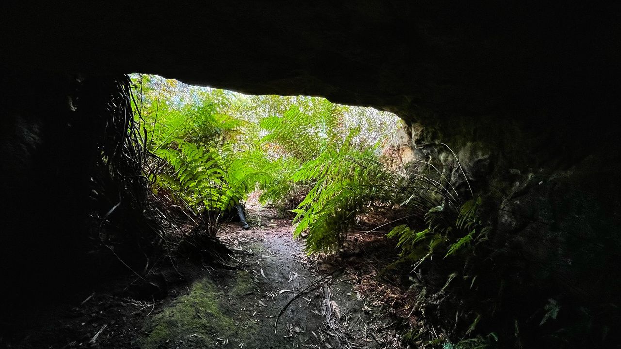
LOOP WALK - Coxs Cave and Fairy Bower Reserve Circuit
This is a wonderful adventurous circuit walk and takes about 90 minutes. Park your car at the Mount Piddington Lookout carpark. Follow the sign to Coxs cave. Coxs Cave, almost certainly named after George Henry Cox, who was a fellow member of Parliament with William Piddington, was reached by a wooden ladder and track after 1879, while the track north along Fairy Bower Creek to the Toll House was formed between 1888 and 1898. Today, you access the cave via a 20 pipe-like rung steel ladder, the view from the cave is great.This involves a potentially perilous climb up the 20 pipe-like rungs of a steel ladder. NB: If you intend to climb into Cox's Cave, be warned it's not suitable for little ones or anyone with a fear of high places. If you have a fear of heights, don't try it. We enjoyed lunch in the upper cave entry. The view was amazing. The walk goes downhill for about 45 minutes and eventually follows a creek through the valley, which is really pretty. You'll then come to a cliff view over the valley, the track follows around to the right, it is hard to see. In about 15 minutes, you'll arrive at Cox's Cave entry ladder. Once you get back down the ladder, you turn left and start the climb out. It's about 500m to the carpark and it's all uphill 😞 SHORT OPTION: You could choose the shorter walk directly to the cave. KEY POINTS • Distance: 2.75km • Time: 90 mins return PLUS browsing time • Best time of the day: Any time • Kid-safe: Yes with supervision, but not up the ladder • Dogs on-leash: Yes • Steps: Lots • Accessible: No • Heights: The ladder is scary • Must do rating out of 10: 11 ACCESS: Park your car at the Mount Piddington Carpark, Mount Victoria and follow the signs. PARK here: https://w3w.co/army.crinkle.wham BACKSTORY: Coxs Cave, was named after George Henry Cox, who was a fellow member of Parliament with William Piddington. https://www.facebook.com/AskRozBlueMountains/posts/pfbid02LfaEA5ufjsk7gX9gWdX2GVuFATKrSE5SYbztSnikQaPV8XhjG9wA9Rj6VFJjzg1jl
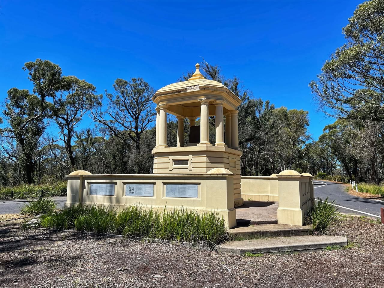
Explorers Monument - Mount York Obelisk
The Mount York Obelisk was erected by public subscription to commemorate the crossing of the Blue Mountains by Blaxland, Lawson and Wentworth in 1813. It was suggested that the obelisk should commemorate not only Blaxand, Lawson and Wentworth but also those others who had assisted in pioneering the route over the Mountains, including Evans, Cox and Macquarie. It stands towards the extremity of the mountain spur, just before the cliff line. The base of the obelisk has inscriptions on all four sides. These commemorate the Explorers, Blaxland, Lawson and Wentworth; the Surveyor, Evans; the Road-builder, Cox; and the Governor, Macquarie. The Macquarie inscription was added during the centenary celebrations in 1913. The names of the Reserve Trustees at the time: Berghofer, Howell and Rienits, are also recorded on the monument. The obelisk was completed in 1900. https://www.facebook.com/AskRozBlueMountains/posts/pfbid02v21fmwXdwzVvcnF7i2LcPuf3UPuXTzTTAv8QaynGzpNHfHe1yjzUW1qHAEKs2LABl
Hourn Point
Hourn Point is a 2km 1-hour return walk and dog on leash friendly, from the Mount Piddington carpark in Mount Victoria. It offers wonderful views over the Kamimbla Valley. Follow an old fire trail down to Horne Point which is a popular climbing area. Named after Frederick Christopher Hourn, 1862 Station Master of Mount Victoria from 1904 till 1915. Hourn was also a member of the Mount Progress Association 1908. On some maps, and signs it is incorrectly spelled as Hornes Point. Source: Blue Mountains Geographic Encyclopedia https://www.facebook.com/AskRozBlueMountains/posts/pfbid02FEPmPBk6TniikvJgS1b9K14XmcAmGanR88nGZhBQLqaVvDD3VYwMMR4xFYGPWHk6l
Ikara Head Trail
The Ikara Head Track is approximately a 7klm return walk so you should be able to complete it in less than 2.5 hours. There are beautiful wildflowers to be seen and is not a difficult walk. The track is an easy and relatively flat walk. The eastern cliffs of Ikara Head are a popular rock climbing spot. To the east, views out to Mt Banks, Mt Tomah and Mt Wilson. You can access the track after driving down Victoria Falls Road to the locked gate.
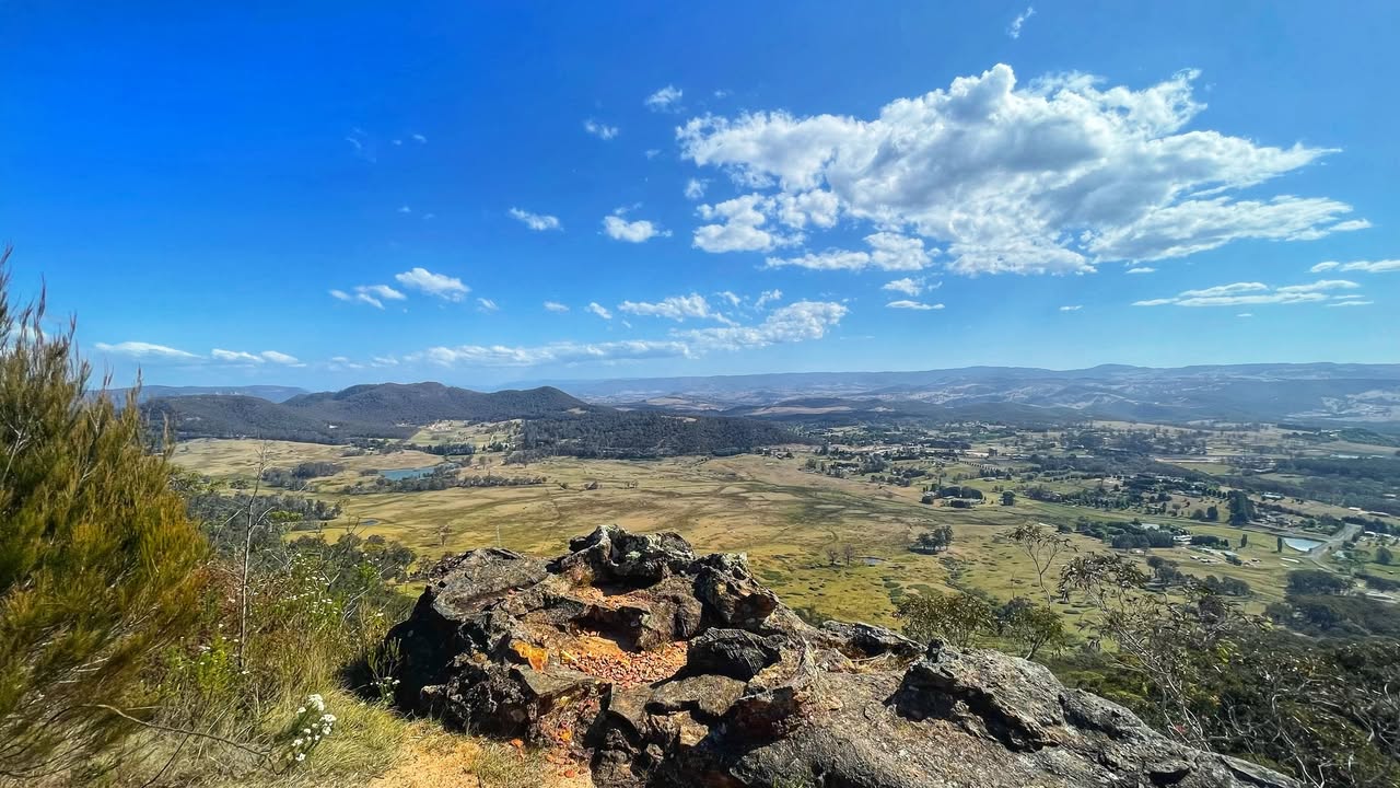
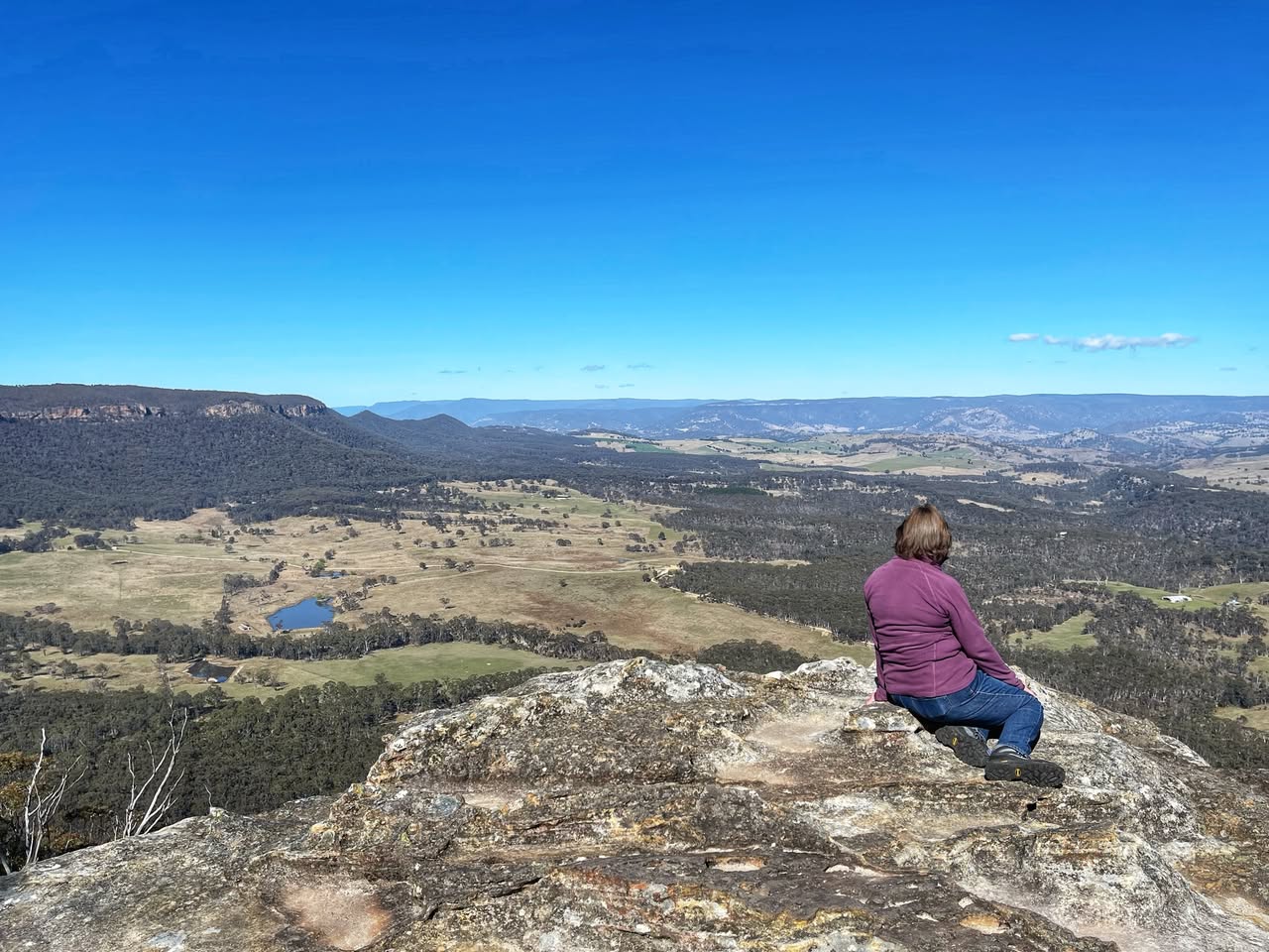
Mitchell Ridge Lookout
This is a seldom-visited lookout that offers wonderful views over the Kanimbla Valley. There are actually about 5 lookouts there, each offering wonderful views. Access is just before the huge speed cameras on Victoria Pass. Here: https://w3w.co/spouses.manages.hillside There are limited picnic areas and there is a "pit toilet" that would be best left alone. With a bit of BMCC TLC, this could be an amazing spot. TAKE CARE with little ones, some areas don't have safety rail and the first step is a big one. It is also a popular spot for abseiling. MORE info and photos and 360° Virtual Tours: https://www.askroz.com.au/blog/mitchells-ridge-lookout-mount-victoria/ BACK STORY: Mitchells Ridge Lookout is an historic lookout and rest area, named after Sir Thomas Mitchell who supervised the building of the Victoria Pass by convict labour in 1832. An obelisk at the lookout commemorates the opening of Victoria Pass in 1832. The Pass is one of the oldest and most significant engineered works in Australia still in use today. From the western end of the lookout there is a good view of the convict-hewn and built sandstone rampart across the Pass. ________________________ 𝗩𝗜𝗦𝗜𝗧𝗢𝗥 𝗲𝗠𝗔𝗚 No.1 Visitor’s Guide Find great things to see & do www.askroz.news/ARBM-Visitor ________________________ 𝗠𝗢𝗨𝗡𝗧 𝗩𝗜𝗖𝗧𝗢𝗥𝗜𝗔 𝗲𝗠𝗔𝗚 📚 Find great things to see & do in and around Mount Victoria www.askroz.news/Mount-Victoria-NSW
Mount Piddington
Mount Piddington is named after William Richman Piddington, he was the former colonial treasurer under Henry Parkes who owned the land at this site. The land was cleared of many trees on its summit so that visitors could enjoy the view. The land owned by Piddington was bequeathed to the public and named Mount Piddington Reserve. https://www.facebook.com/AskRozBlueMountains/posts/pfbid024kcnJvwjhiC96PGiy7p3EohzEd94bMCjbfoTcaL6giL7mzs65wmcUpDFUzSmzQFol
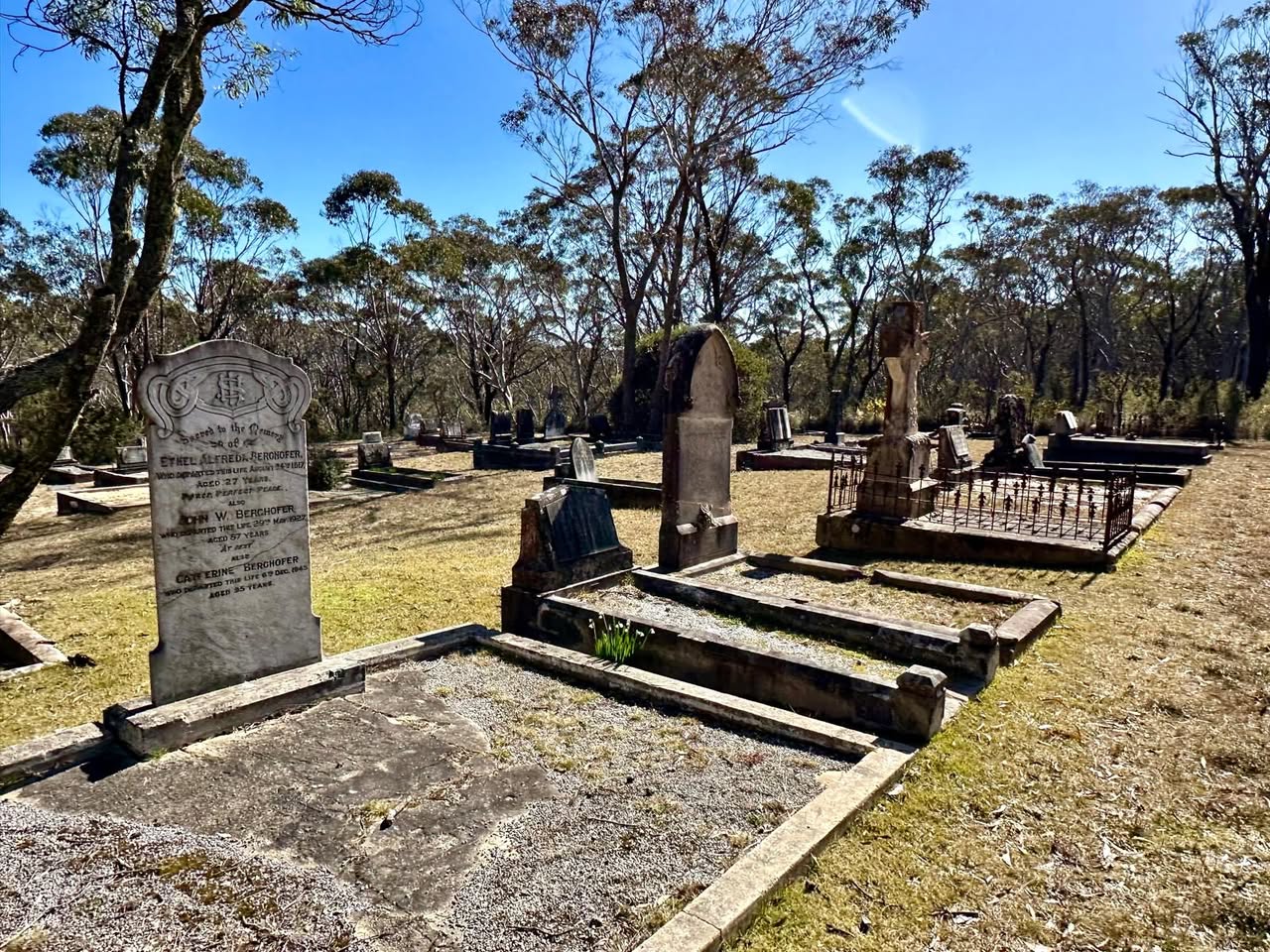
Mount Victoria Cemetery
This is one of three cemeteries near the Great Western Highway and possibly the oldest according to Blue Mountains City Council. Located on 3.25 hectares, the earliest known burial is 1881. John Berghofer, who built Berghofers Pass is buried in the Mount Victoria cemetery. https://www.bmcc.nsw.gov.au/community/cemeteries/our-cemeteries#Victoria
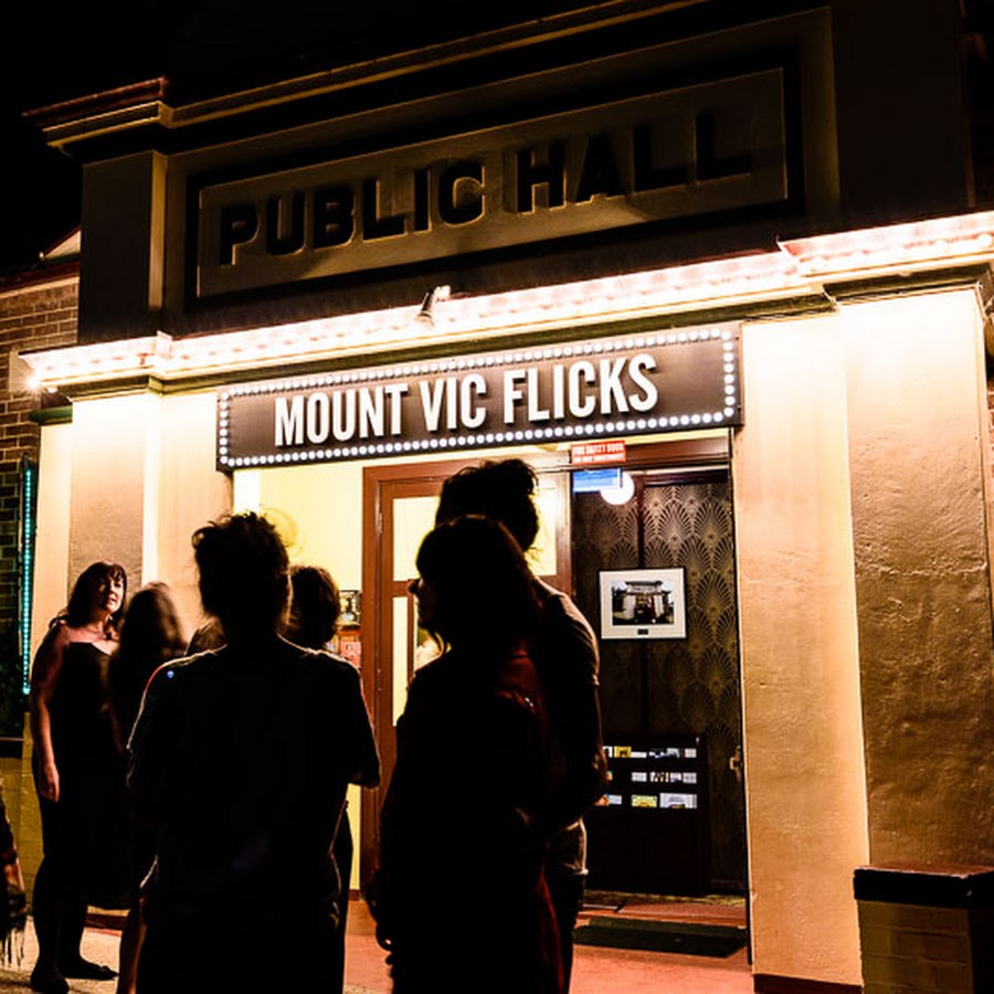
Mount Vic Flicks
For session times and movie information, use the web link listed below ... Old fashioned movie theatre. Check movie times by clicking web link below. Movies may not be on every day of the week. Mount Vic Flicks is located in heritage-listed Mount Victoria, one of the highest towns in the Blue Mountains and is a much loved and treasured icon of the Upper Blue Mountains.Built in 1934, the cinema is a window into the golden age of Australian country picture theatre culture. https://mountvicflicks.com.au/sessions/
Mount York
Mount York has commanding views over the western plains, many layers of Aboriginal and European heritage, several convict-built roads (now walking tracks), and remnants of the old convict-built roads (1823-1829) can still be seen. There is also a nice picic area. Further along, Mount York Road is the historic convict-built Lawson's Long Alley and Lockyers Line of Road; Berghoffers Pass, and Bardens Lookout. It is popular for bushwalking, abseiling, mountain biking, and rock climbing. It's a great spot for a picnic. Limited camping is also available. HISTORY: Mount York was the point where Gregory Blaxland, William Lawson and William Wentworth viewed the Hartley Valley and the 'west' for the first time during their successful crossing of the Blue Mountains in 1813, although some Europeans had already reached the valley before them. However, the 'first crossing' and opening of the west to farming in 1813 is commemorated with several memorials atop the summit, one with their faces set in stone. There are two metal fenced lookouts, a west-facing and a north-facing one plus multiple "unofficial lookouts". Mount York was the site of various attempts to build a pass to the plains west of the Blue Mountains. The first was Coxs Road, constructed in 1813. The next was Lockyers Road, which was begun not long after Coxs Road, but which was never finished. Still another was Lawsons Long Alley, which was a little east of Lockyers Road. These roads were all abandoned eventually, but in recent years they have been developed into multi-use tracks by the Department of Lands in New South Wales and Blue Mts City Council. Also still visible is Berghofers Pass, which was abandoned because of later developments, and which has also been turned into a walking track. https://www.facebook.com/AskRozBlueMountains/posts/pfbid0Zm2CDRbVDKfqL9Worb4ik9TRZsbNChkEMAWYNVe1SWdoB578vNP5o3ezGC55ACsRl
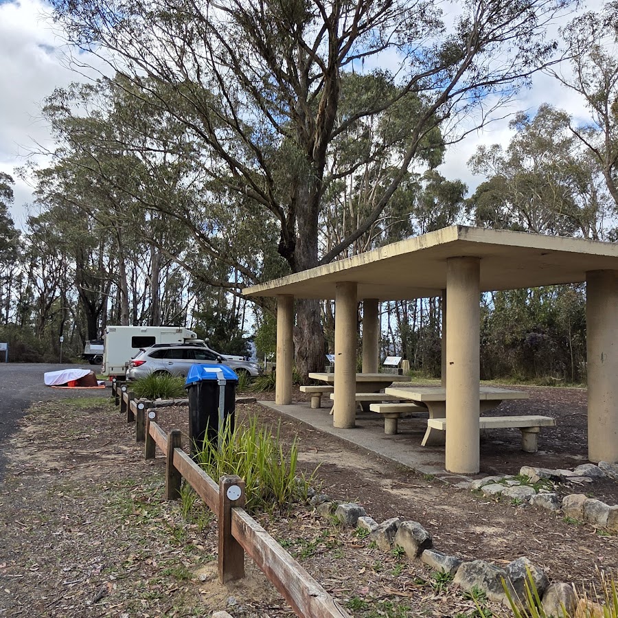
Mount York Campground
5km from Mt Victoria village at the end of Mt York Rd - small camping area (limited sites) suitable for tents. A popular climbing area with historic roads. Please note: Campground stays are limited to a maximum of ten days only (four days only at Mt York). Water is not available – you must bring your own washing and drinking water. Pack a gas or fuel stove for cooking. If planning to cook on an open fire, purchase firewood from local outlets beforehand. Collecting timber from bushland is prohibited. Check fire ban danger ratings and total fire ban information at the NSW Rural Fire Service website for fire safety information. Use rubbish bins provided or take your rubbish out with you. https://www.bmcc.nsw.gov.au/camping (02) 4780 5000
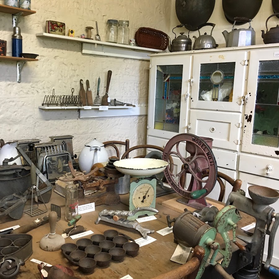
Mount Victoria & District Historical Society Museum
OPEN: Saturdays: 12:00 pm to 3:00 pm. Set in sixteen rooms of the heritage-listed 1868 Mount Victoria Railway Station. It is part of the railway to the west which was built across the rough terrain of the Blue Mountains. Entry fees apply. A display to commemorate the bicentenary of the crossing of the Blue Mountains has sketches, paintings, and artifacts showing the work of the explorers, road builders, tradesmen, and convicts. The struggle of the settlers is shown by the nature of the tools and farm equipment, whose construction, use and maintenance required enormous physical effort.The changing domestic scene is illustrated by costumes and accessories, pottery, historic railway tableware, musical instruments, and furniture. Development of the area as a tourism destination and industries such as mining are also depicted. Displays and information on unique local schools are a highlight. Many natural history items depict local and exotic wildlife. Watch the 360° images: www.askroz.news/Mount-Victoria-Museum-360 Groups are welcome out of hours, by arrangement. https://www.facebook.com/MountVictoriaMuseum
Mount Victoria Memorial Park
The Mt. Victoria Memorial Park has a high degree of historical and social significance, a beautiful place to stop and rest and a great place for the kids to play. There is a bbq on the north side of the tennis court (our tennis court is free by the way), play equipment, bubblers, picnic tables and toilets. You will see the old grottos that once housed a zoo belonging to the Imperial Hotel, the first War Memorial in the Blue Mountains and a great old bandstand. It has become a valued recreational resource, which has been utilized by many generations of tourists and residents alike. Just off the Highway, turn into Station St. https://mountvictoria.nsw.au/our-great-places/the-imperial-park-zoo https://www.facebook.com/AskRozBlueMountains/posts/pfbid0xLZSrrG98i7R3VqZWN9nNPsekRttZrz7DEwzKJ94EJkNYZLgAzDoiKTN5EXdaYQAl
One Tree Hill
One Tree Hill was originally originally mapped by surveyor General Thomas Mitchell and then when the railway line came through to the village, the town was given the name of Mount Victoria in 1868 after the young Princess Victoria. Highest Point in the Blue Mountains at 1,111m.
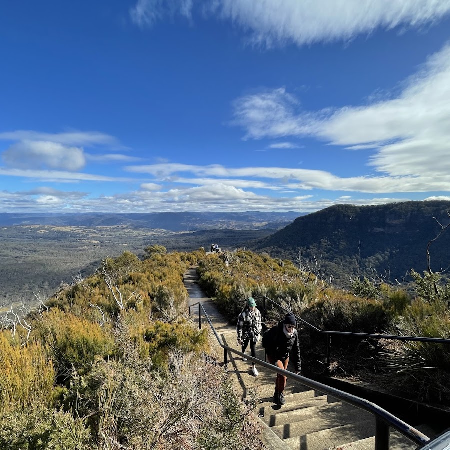
Pulpit Rock Lookout
This walk is 1 hour return, or there are other options for a loop or longer hike to Mount Piddington and includes beautiful views of the Kanimbla Valley, overhangs with Mount York Claystone, autumn fungi, wildflowers, creek crossings and just a beautiful all round calming vibe. https://www.facebook.com/AskRozBlueMountains/posts/pfbid02Tr5bqtQdzqqJ4wJ1FXZnqF9pj6DmYGuYPrVi7D9tUzfxcoZkJJKVYB8AbuRQEYnFl
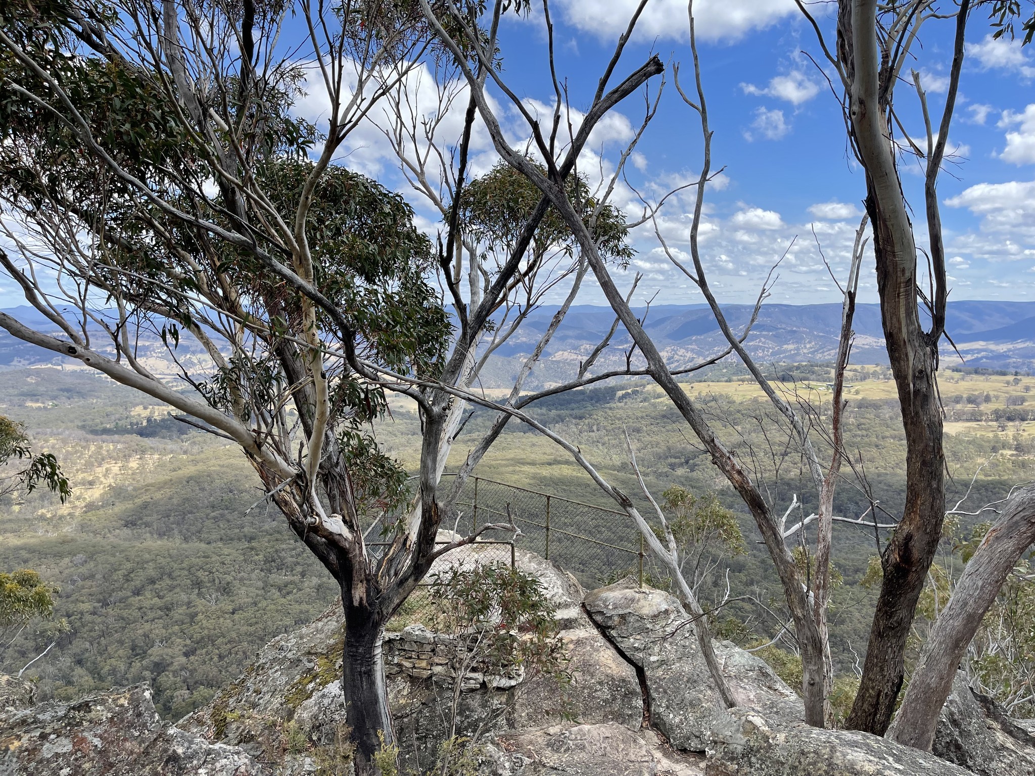
Sunset Rock Lookout
You will need to park away from the actual lookout, then walk downhill and along the path to get to there. The walk is worth the view, and Pulpit Rock Lookout also nearby. Photo by: Rob Moore
Victoria & Albert Guesthouse - Stays - Cafe and Restaurant
The Victoria and Albert Guesthouse is a historic property in Mount Victoria. V&A Cafe for Breakfast, Lunch and Dinner. Check link for open times. Key points: • Built in 1868, originally as the Royal Hotel Located near Mount Victoria's train station Offers various room types with period decor • Amenities include shared lounges, fireplaces, and a restaurant • Hosts special events like "Glitzmas" and Sunday roasts • Known for its friendly staff and unique atmosphere • Popular base for exploring Blue Mountains attractions The guesthouse provides a blend of history and comfort for visitors to the Blue Mountains region. https://vaguesthouse.com https://www.facebook.com/vaguesthouse (02) 4787 1348
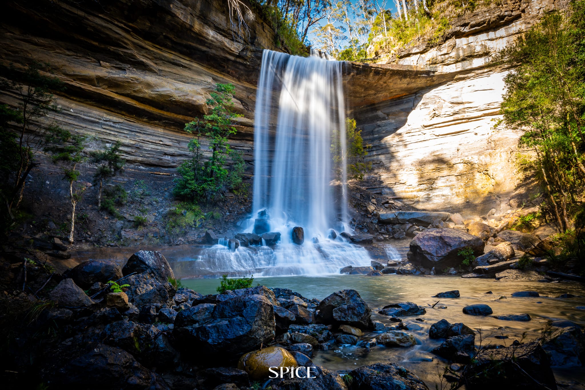
Victoria Falls & Silver Cascades
Starting from the carpark at the end of Victoria Falls Road, this steep return track to Victoria Falls requires moderate fitness. Almost as soon as you start the walk, you’ll reach Victoria Falls lookout. Stop to breathe in the mountain air and extraordinary views across the sandstone escarpment and Grose Wilderness. Listen for the calls of sulphur-crested and yellow-tailed black cockatoos. It’s hard to turn away, but to see the waterfall follow the track to the left of the lookout. The steep path zig zags down the sandstone cliff. Short side paths lead to pretty Victoria Creek Cascades and the top of Victoria Falls, as the main track continues down to the base of the waterfall. Bring a picnic lunch and enjoy the beautiful waterfall, which drops around 20m over a rock overhang. In summer, it’s a serene spot to relax in the shade of the lush canopy. The steep return back up to the carpark takes around 60 to 90mins. https://www.facebook.com/AskRozBlueMountains/posts/pfbid0B4iGhuR1R2DriYRkQzkpYw3eKcGjJCzu476fgBDQEianaRYZiLD5pyFpRoswttLkl Photo: Logan Spice
Blackheath - Megalong Valley
Blackheath Station
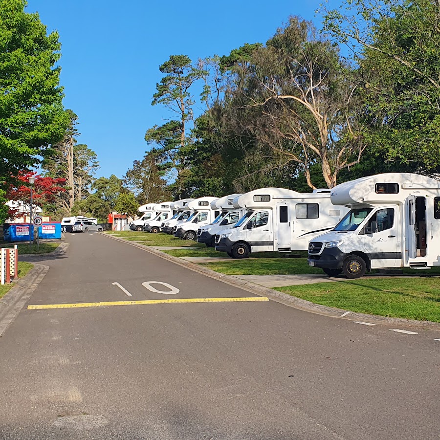
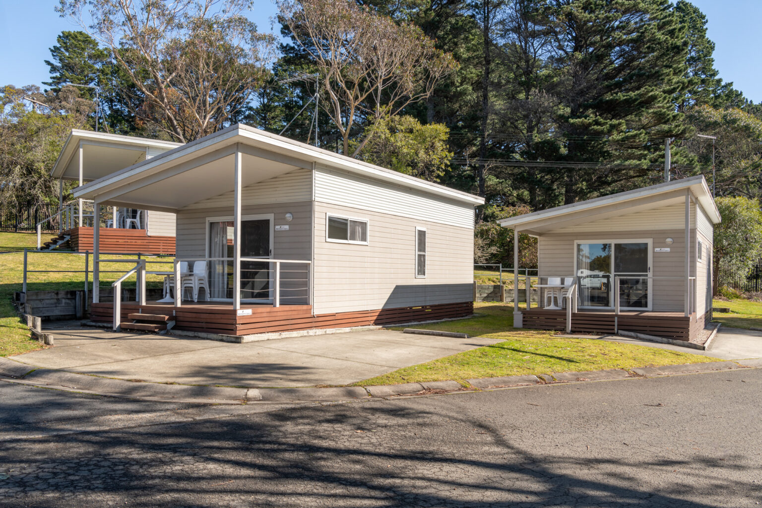
Blackheath Tourist Park
A family-friendly caravan park located in Blackheath, offering a range of accommodation options and facilities for visitors to enjoy the beautiful Blue Mountains region. https://www.facebook.com/profile.php?id=100076089554838
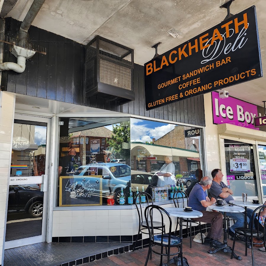
Blackheath Deli
Megalong Valley Tea Rooms
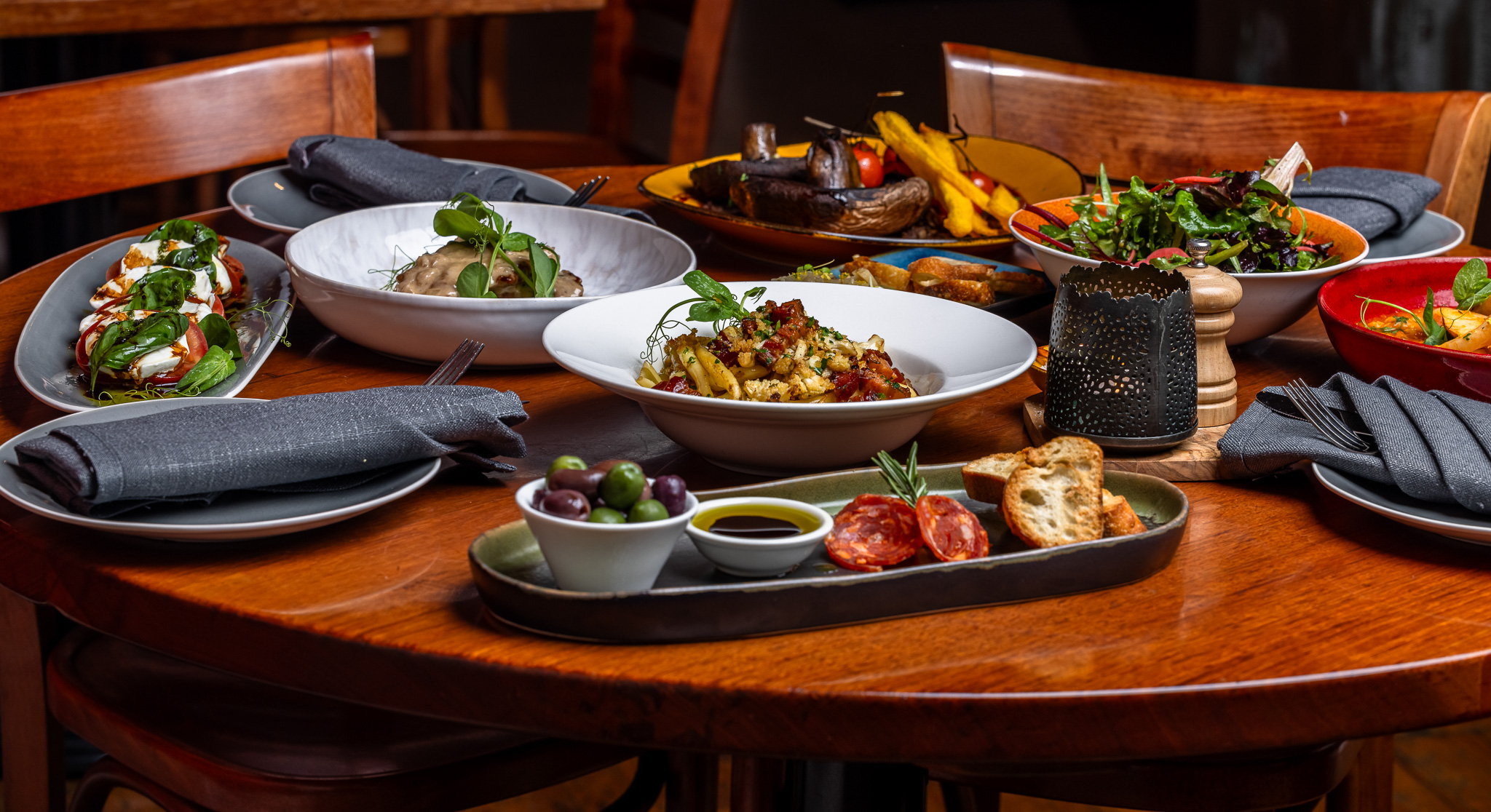
Osteria 2785
Osteria 2785 is a charming Italian restaurant located in the picturesque Megalong Valley, known for its delicious homemade pasta and stunning views of the surrounding mountains. A perfect spot for a cozy meal. Menu: https://www.osteria2785.com.au/eat Booking: https://www.osteria2785.com.au/reservations https://www.facebook.com/osteria2785 https://www.osteria2785.com.au
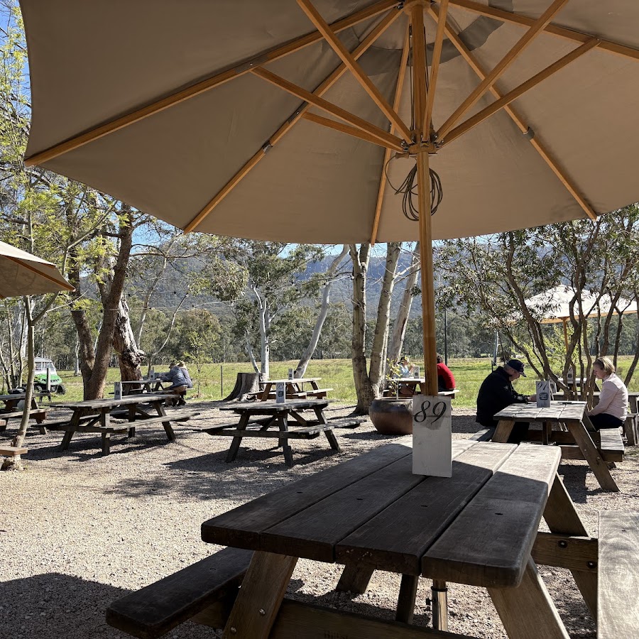
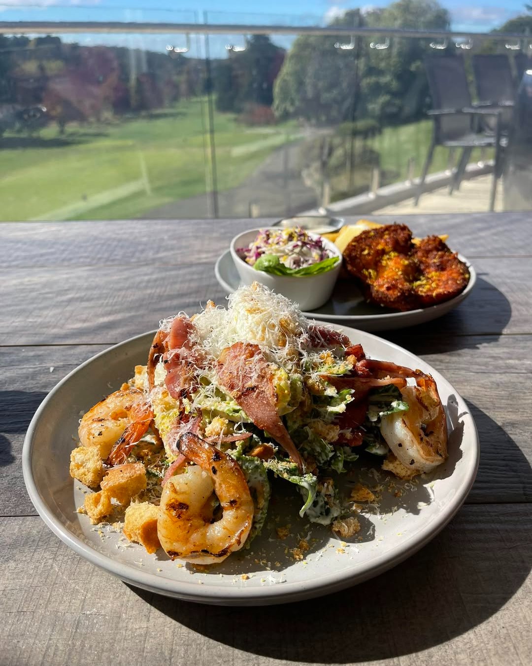
Spikes Bistro Blackheath
Spikes Bistro is a casual restaurant that serves simple and flavorful meals. The menu is not too complicated, focusing on comfort food made with fresh, quality ingredients. https://blackheathgolf.com.au/bistro https://www.facebook.com/profile.php?id=61574548437651
Blackheath Growers Market
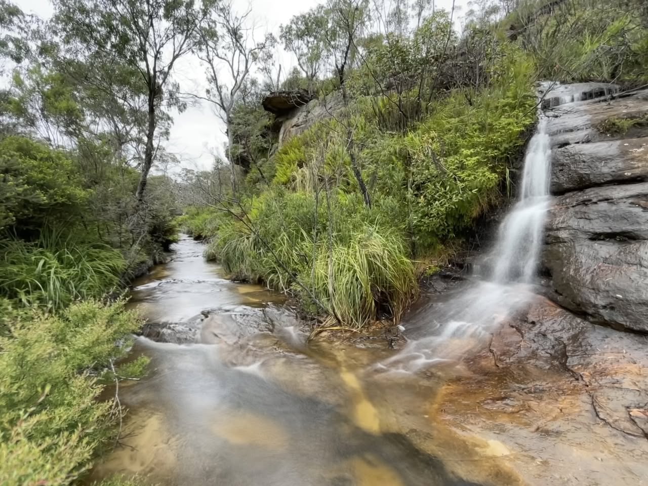
Braeside Track
The Braeside Track follows Govetts Leap Brook down to Barrow Lookout Junction is a great all-weather track that's suitable for the whole family. When you join the Cliff Top Track, you can either turn right and head up to Barrow Lookout and on to Evans Lookout or turn left and go up to Govetts Leap Lookout, or return the same way. PARK here: https://w3w.co/homework.busier.lightless There are 2 picnic tables near the dam as you start the walk. KEY POINTS • Distance: 2.4km • Time: 50 mins return PLUS browsing time • Best time of the day: Any time • Kid-safe: Yes • Dogs on-leash: No • Steps: Many • Accessible: No • Heights: No cliffs • Must do rating out of 10: 8 https://www.facebook.com/AskRozBlueMountains/posts/pfbid021F59Q36bHR1WL93LWYsvjfKZfMtf6TwgjYgZyA3uAyjh8sShpx97S8dAicVxStLFl
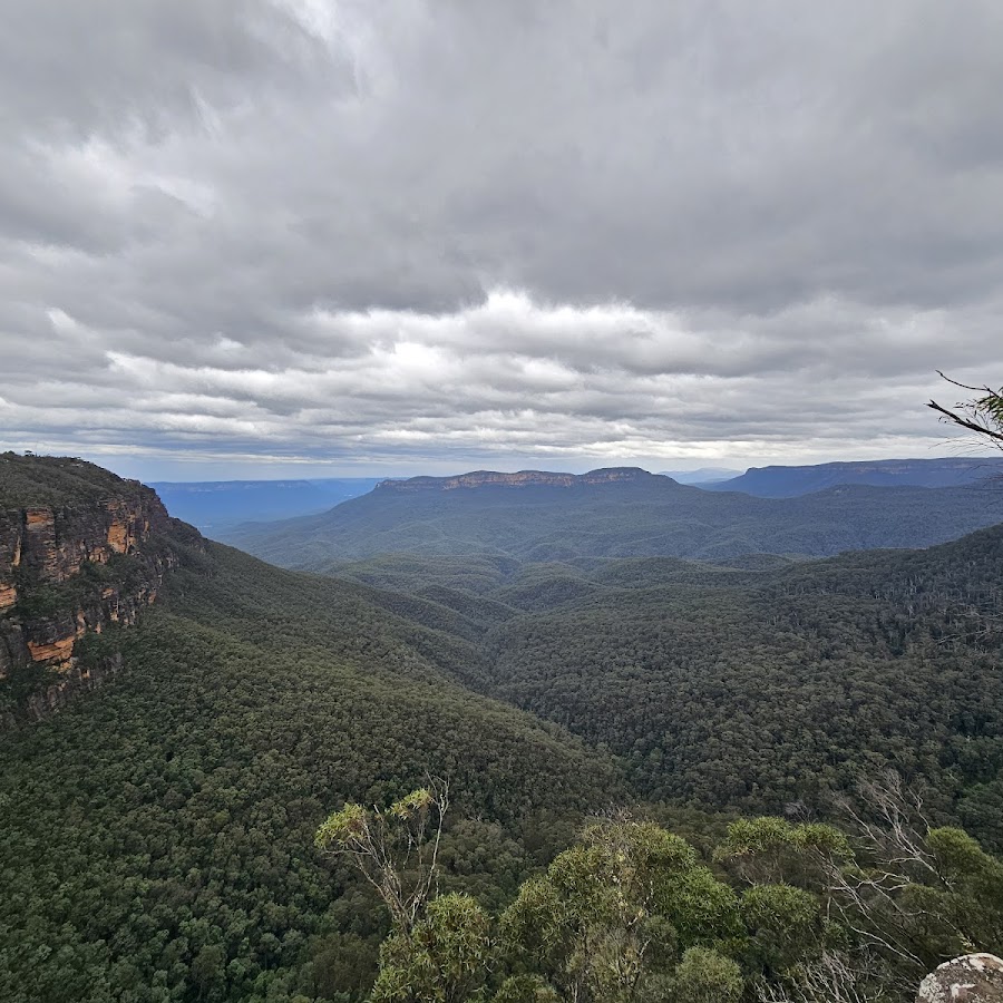
Evans Lookout
Evans Lookout is a popular lookout point in the Blue Mountains, offering stunning views of the Grose Valley and surrounding landscapes. It is a great spot for photography and is accessible via walking trails that lead to various scenic viewpoints. It's also accessible. Can be the start or end to the Grand Canyon walk. BACKSTORY: The lookout is named after George William Evans, a British surveyor and explorer who was the first European to discover the area in 1813. Evans was tasked with finding a new grazing land for the colony, and he is credited with discovering the Grose Valley, of which Evans Lookout is a part. During the 19th century, the Blue Mountains became a popular tourist destination, and Evans Lookout was a popular spot for visitors. In the early years, visitors had to hike to the lookout, but in the 1930s, a road was built to make it more accessible. Today, Evans Lookout is a popular spot for hiking, with several trails leading to the lookout, including the Grand Canyon Walk and the Grose Valley. The views from the lookout are stunning, with panoramic vistas of the surrounding mountains and valleys. Take a 360° virtual tour: www.askroz.news/Evans-Lookout-360 https://www.nationalparks.nsw.gov.au/things-to-do/lookouts/evans-lookout
Govetts Leap lookout
Take in the iconic Blue Mountains views from accessible Govetts Leap lookout, including sandstone escarpments, sheer cliff walls, the deep canyons of the Grose Valley, and tall waterfalls. Accessible lookout. BACKSTORY: Govetts Leap Falls in Blackheath were named after William Romaine Govett, a Government Surveyor who discovered the falls around 1831. The name "Govetts Leap" was given by Major Mitchell, the Surveyor-General, to honour Govett, his assistant surveyor. Contrary to popular local legend about a bushranger named Govett who supposedly leapt to his death at the falls, the name actually refers to the waterfall itself rather than any such dramatic event. The term "leap" in this context derives from an old Scottish word meaning waterfall or cataract. The falls are also known as Bridal Veil Falls and have a single drop of about 180 meters into the Grose Valley. The sculpture near the falls commemorates not the surveyor's leap but a myth connected to the area. https://www.nationalparks.nsw.gov.au/things-to-do/lookouts/govetts-leap-lookout

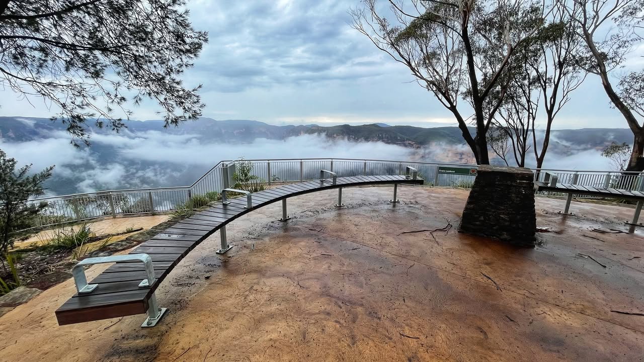
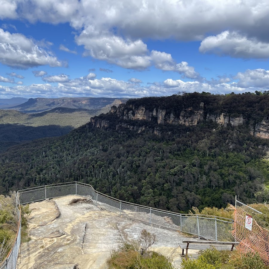
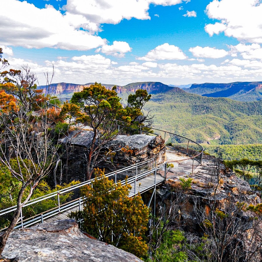
Panorama Point Lookout
MONDAY WALK - Panorama Point at Hargraves Lookout Blackheath. It's a historic walk along a 300m ridge line. The track out to the lookout is fairly rough in patches, and it does drop away on both sides so take care. Here: https://w3w.co/endless.guarding.despairing This is not a good walk on a windy day. KEY POINTS • Distance: 600m return • Time: 30-40 mins return • Best time of the day: Any time • Kid-safe: Yes with supervision, but not little ones • Dogs on-leash: Yes, but you shouldn't • Steps: Lots • Accessible: No • Heights: Trick most of the way • Must do rating out of 10: 10 ACCESS: Park at Hargraves lookout, and walk down to the lower west-facing lookout and turn left following a very minor track. Here: https://w3w.co/lightened.folded.famines Hargraves Lookout has accessible toilet facilities but no real picnic area. MORE info and 360° Images: https://www.askroz.com.au/blog/hargraves-lookout-blackheath MORE info on Hargraves LO: https://www.facebook.com/AskRozBlueMountains/posts/4689007874475929 PICNIC: Its picnic facilities are very limited and there is nothing for anyone in a wheelchair. Nearby Mount Blackheath is a better option. TIP: Visit the lookout and enjoy the views and the walk out the Panorama Point, then drive over to nearby Mount Blackheath and picnic there. It has great picnic facilities and different, wonderful views. Here: http://w3w.co/experiences.earthworm.dishwater BACK STORY: In the 1900s the focus of track projects switched to west of the railway line. Shipley too was developing as a tourist destination with Hargraves Lookout being opened on 17 March 1915. In the 1920s tourist attractions were increased at Shipley with the signposting of Amphitheatre Lookout in 1928, and the opening of Mount Blackheath Lookout in 1929. Panorama Point Lookout was opened later in 1935. But most tourism development in the 1930s returned to the east side of the railway line. The most famous vantage point, Govetts Leap Lookout, was named in 1934. ________________________ 𝙁𝙄𝙉𝘿 𝙂𝙍𝙀𝘼𝙏 𝙏𝙃𝙄𝙉𝙂𝙎 𝙏𝙊 𝙎𝙀𝙀 𝘼𝙉𝘿 𝘿𝙊 in less than 60 seconds 📚📖 www.askroz.news/BM-Experiences https://www.facebook.com/AskRozBlueMountains/posts/pfbid0sBYUBBSK6a14r2EiUJjhu65LE7QyvRBqAiDznS5eunWxrYWx1WzC6wfACwMCnygyl;
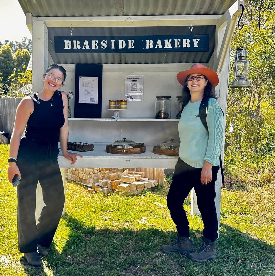
Braeside Bakery
WEEKENDS ONLY. Have you heard of the 'Braeside Bakery' in Blackheath? Mylah has set up an 'honesty box' bakery kiosk for bushwalkers. Edna Frougas said: "I had the pleasure of meeting Mylah from a super cute Braeside Bakery, so good to have enjoyed a slice of brownie cake after exiting the trail!" Fresh bakes every weekend | 8am till sold out. Cash & card welcome 💛 CHECK OUT THEIR TREATS Be sure to follow them: www.instagram.com/braesidebakery Be sure to follow Edna on instagram: www.instagram.com/edna.frougas https://www.facebook.com/AskRozBlueMountains/posts/pfbid02oLyMzA2ZV4WQUZLp5QGCkxnGNBKs8KAxMjhwAGDHPjbPUEsEiuZu5tkVHS3uAbVQl
Medlow Bath
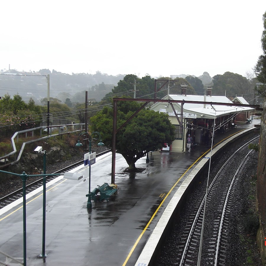
Medlow Bath Station
Point Pilcher Lookout
Katoomba
Lookouts
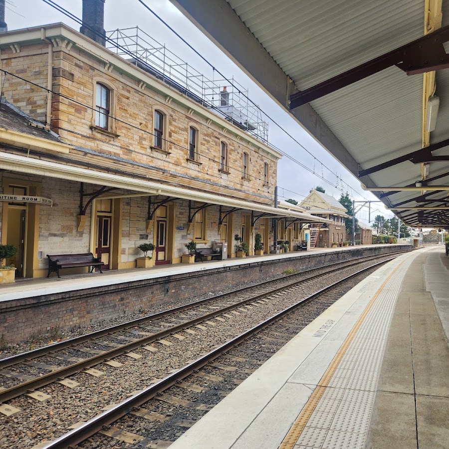
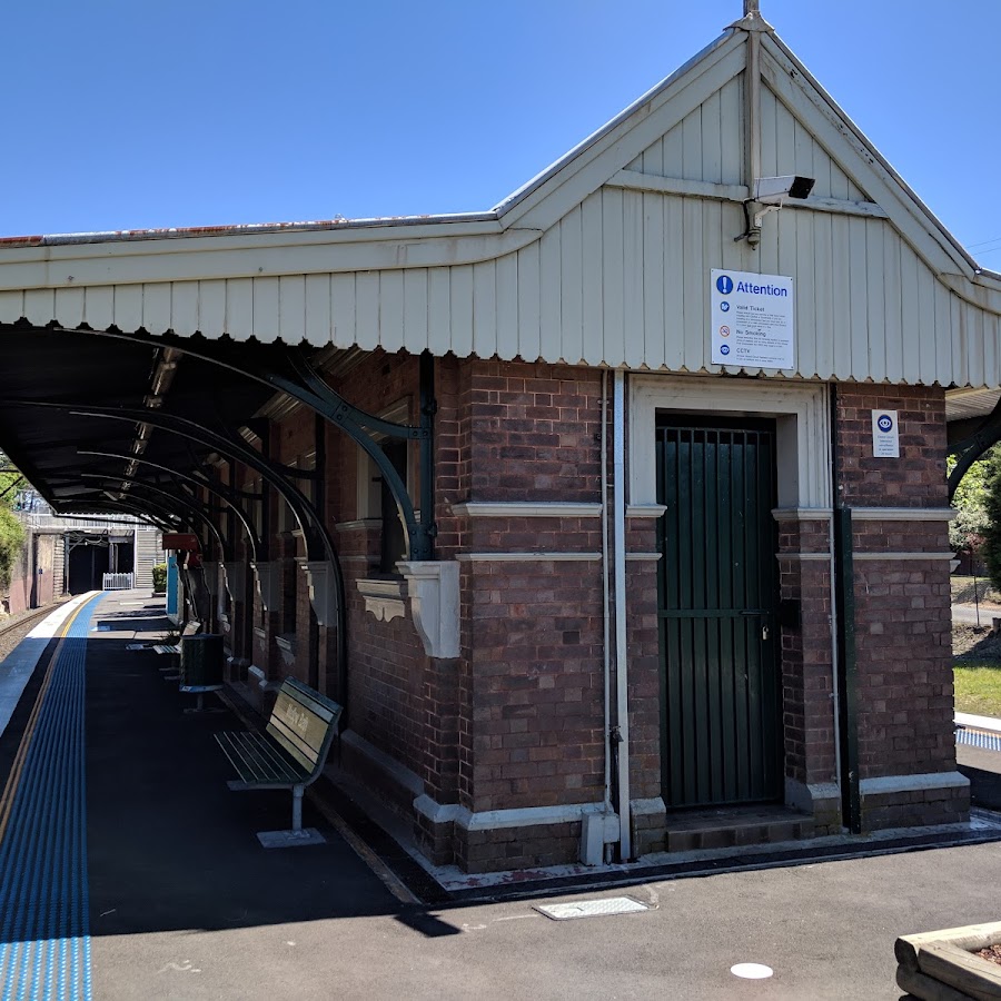
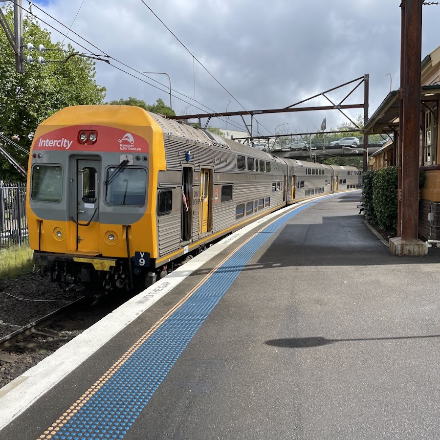
Katoomba Railway Station
Katoomba Railway Station is a key transport hub in the Blue Mountains, providing access to train services connecting Katoomba with Sydney and other regional destinations. The station is located near the town center and is a convenient starting point for exploring the area. https://transportnsw.info/routes/details/intercity-trains-network/bmt/02bmt
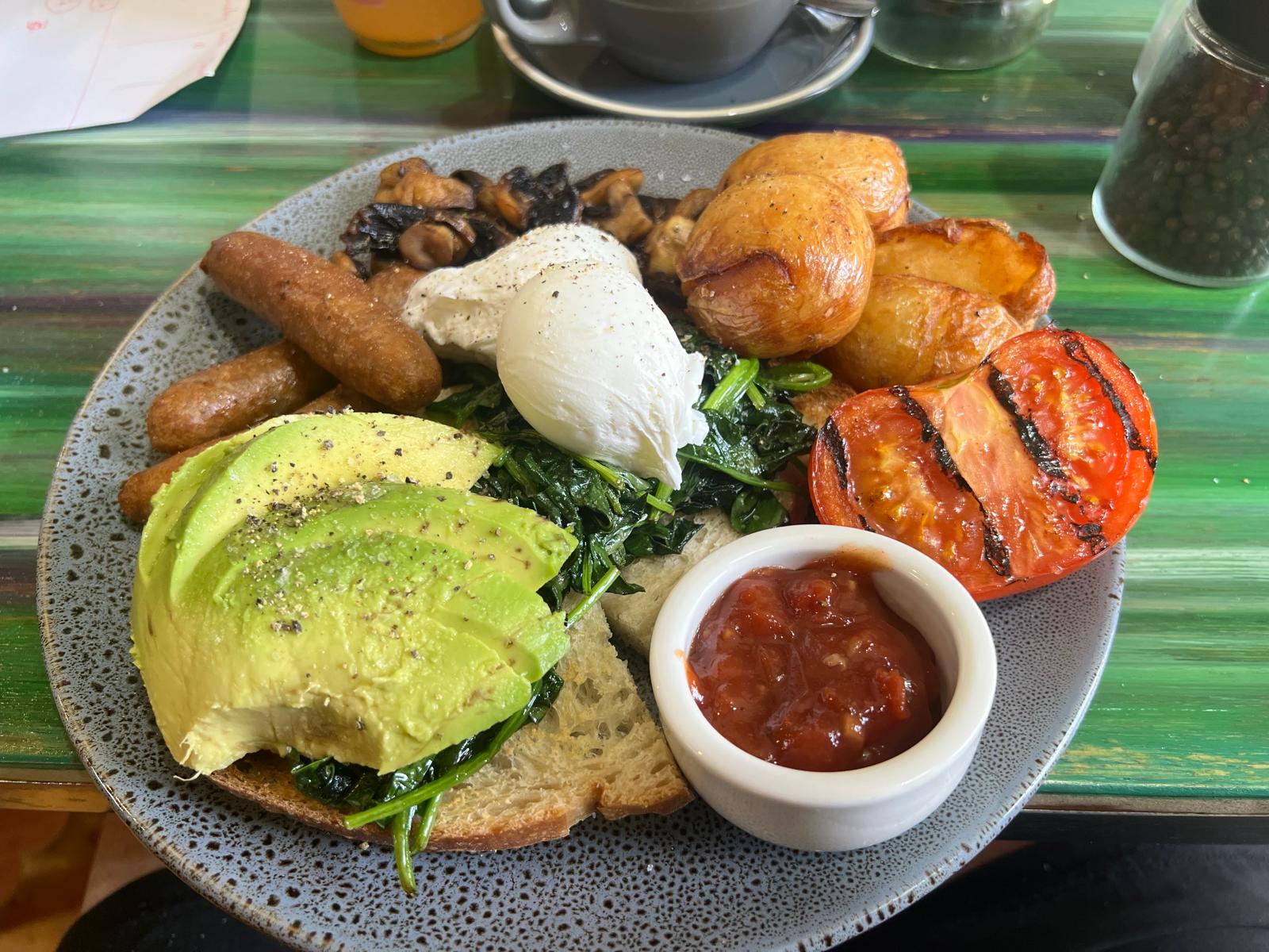
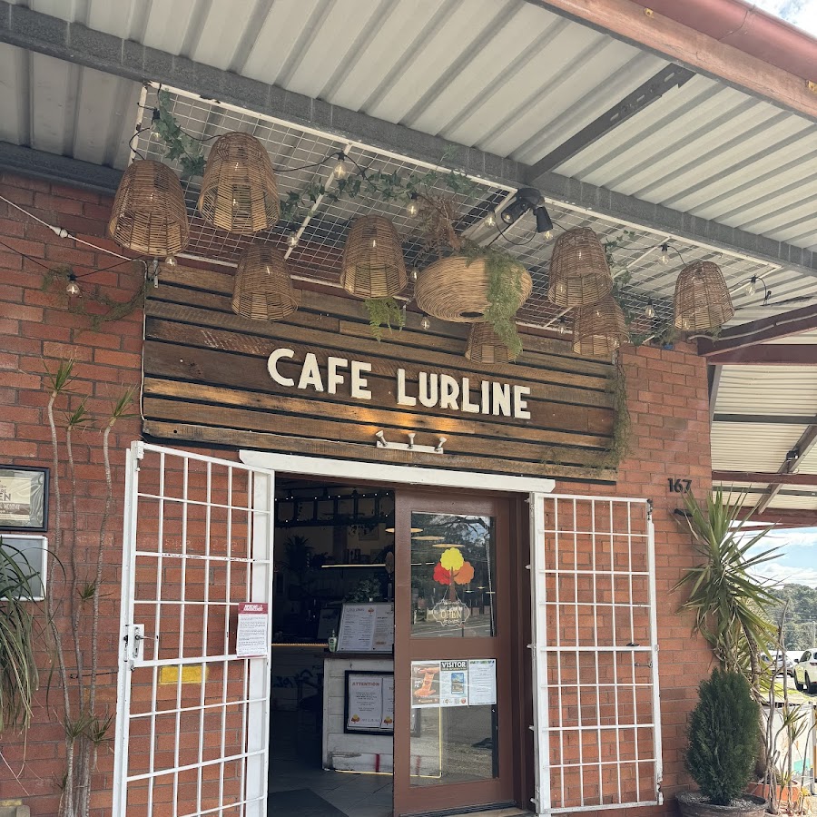
Café Lurline - Katoomba
Café Lurline is a charming, locally loved eatery on Lurline Street in Katoomba, offering a refined yet welcoming dining experience in the heart of the Blue Mountains. Known for warm smiles, strong coffee, and thoughtfully crafted menus, it’s a favourite for both locals and visitors. Our menu is a global hug on a plate — from hearty, feel-good breakfasts to vibrant, flavour-packed lunches — all made with fresh, locally sourced ingredients and a generous pinch of passion. Whether you’re fuelling up for a Blue Mountains adventure or catching up with friends, Café Lurline is where great food, honest flavours, and good vibes meet. It’s the perfect spot to unwind over brunch, enjoy a great coffee, or share a relaxed meal with family and friends. Whether you’re a local or just passing through the Blue Mountains, Café Lurline offers a true taste of comfort and community- a local gem! Hours : 8am-3pm Closed Tuesdays https://cafelurline.com.au/menu https://www.facebook.com/cafelurline
Hatter's Cafe - Katoomba
Discover the Finest Cafes in Katoomba for Modern Cuisine. At the Hatter’s Cafe & Restaurant, we are proud to be a premier destination among cafes in Katoomba, serving a distinctive fusion of modern cuisine inspired by the vibrant flavours of the Blue Mountains. Whether you’re a local or a visitor, our cafe offers an unforgettable dining experience. https://thehatterscafe.com.au Mon/Tues/Thurs 7.30am-3pm Frii/Sat/Sun 7.30am-3pm and 5pm to 10pm Wed CLOSED https://www.facebook.com/profile.php?id=61557960875171 https://thehatterscafe.com.au

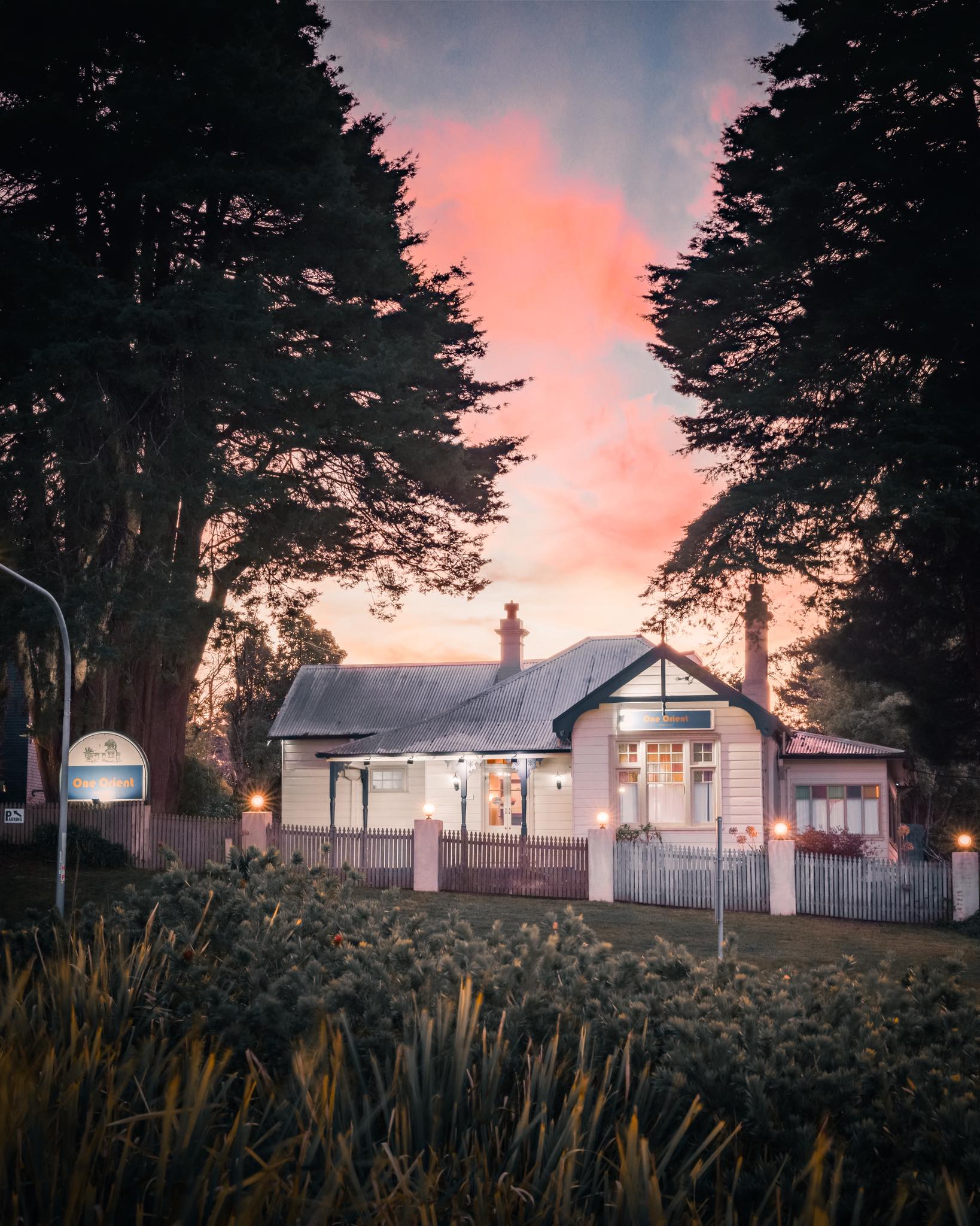
One Orient - Katoomba
One Orient is a popular dining destination known for its exquisite Asian cuisine and vibrant atmosphere a favorite among locals and visitors alike. A brasserie-style experience in the heart of Blue Mountains. Lunch Tuesday-Sunday 11:30am-2:30pm Dinner Tuesday-Saturday 5:30pm-8:30pm https://www.facebook.com/profile.php?id=61575623528088# https://oneorient.com.au/
Smokey Bundits
Smokey Bundits is a vibrant burger joint in Katoomba, offering a fresh twist to the Blue Mountains dining scene. Known for its signature smashed burgers with unique, tasty flavors, it also serves milkshakes, ice cream swirls, and buttery pocket pies. The rustic, playful interior and friendly service create a welcoming atmosphere for friends and families. Whether you're a burger purist or an adventurous eater, Smokey Bundits delivers bold flavours and good vibes every day. https://www.facebook.com/profile.php?id=61562974350776

Katoomba Falls Tourist Park
Katoomba Falls Tourist Park is a family-friendly camping and caravan park located near the stunning Katoomba Falls. It offers a range of accommodation options, including cabins and powered sites, making it a great base for exploring the Blue Mountains. https://www.katoombatouristpark.com.au/
Radio Blue Mountains 89.1 FM - Katoomba Studio
89.1 Radio Blue Mountains - The Heart and Soul of The Mountains. On your radio or live stream. https://www.facebook.com/891RBM https://www.rbm.com.au

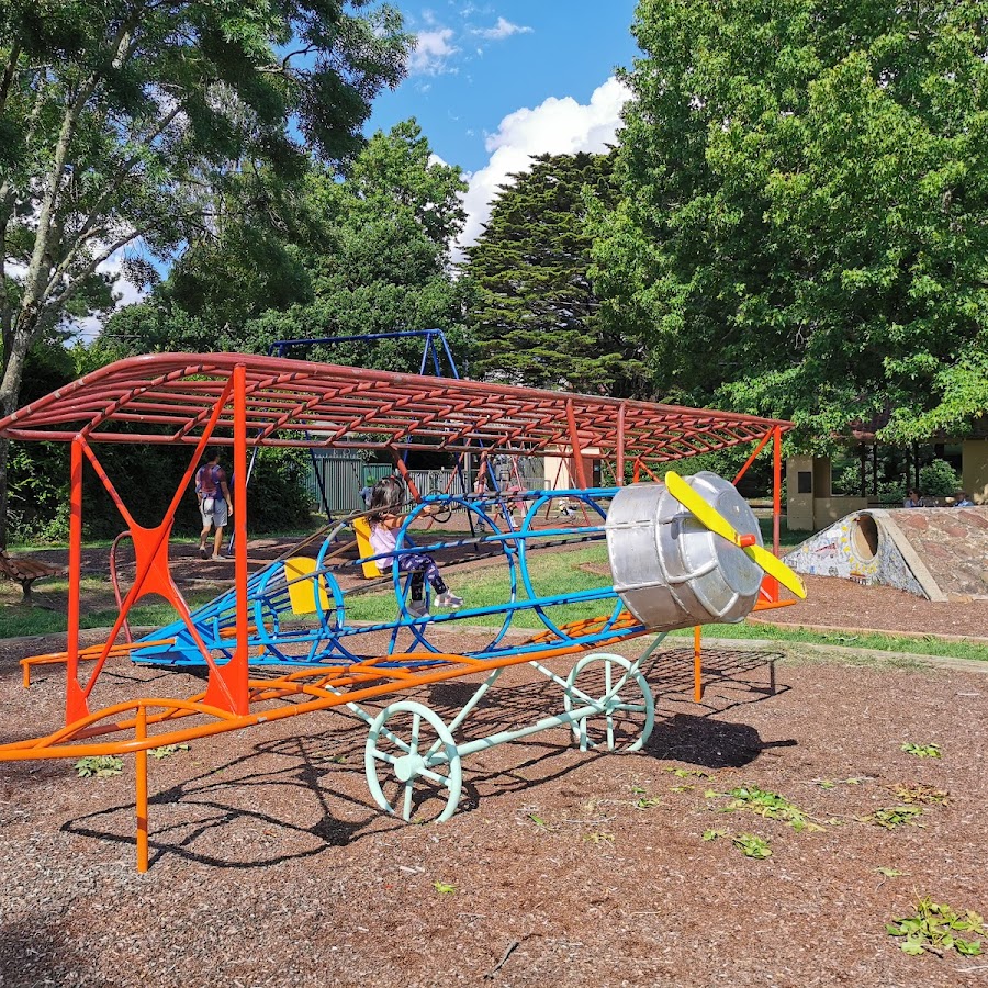
Bert Hinkler Park Katoomba
https://bluemountainsmums.com/listing/hinkler-park-katoomba/
Burrabarroo Lookout Walking Track
This small, fenced lookout is just off the Prince Henry Cliff Walk, near Carrington Park. The view looks over the valley and out to Sublime Point and Kings Tablelands in the distance. The lookout is perched on the top of a rocky buttress at the end of a small point, giving great views. Allow 30mins for the return walk or visit it as part of your walk along the Prince Henry Cliff walk. A good spot for sunrise photos and when you take a photo looking straight into the sun at sunrise you can get some dramatic results. https://www.askroz.com.au/index.php/event_detail/index/burrabarroo-lookout
Cahill's Lookout
Cahills lookout offers a spectacular panoramic view of the Megalong Valley and there are views of unique rock formations. This lookout is a great spot for sunset photography. https://www.facebook.com/profile/100064323152639/search?q=cahills%20lookout
Cliff View Lookout
This lookout is located on top of the escarpment on the Prince Henry Cliff walk, is well sign posted and has good hand rails and fencing. The lookout is not far from the eastern side of the Scenic Skyway station. It offers great views over the Jamison Valley and Mount Solitary. You can access it directly, or as part of your walk to or from Echo Point. Direct access is wheelchair friendly and is a lovely walk that starts from where you can park your car at the Katoomba Cascades carpark. https://www.askroz.com.au/index.php/event_detail/index/cliff-view-lookout
Copeland Lookout
Copeland Lookout is a historic lookout that offers is a great viewing point with a short, sandstone wall around much of it. The lookout provides fantastic views over the Jamison Valley past Sublime Point, along Kings Tableland and past Mount Solitary. Park your car near the Solitary Restaurant and walk down. Allow 40 minutes for the return walk. It's also been known as "Copeland's Outlook" and "Copeland's View". It was named after a Katoomba "storekeeper" William Raeburn Copeland in the early 1930's. https://www.askroz.com.au/index.php/event_detail/index/copelands-lookout
Eagle Hawk Lookout
Eagle Hawk Lookout offers commanding views to the east over the Jamison Valley and onto the 3 Sisters. In the afternoon gives you the classic 3 Sisters postcard view that we've all seen. Great spot for sunrise and sunset photos. At both sunrise and sunset the changing colours over Mt Solitary are also very beautiful. https://www.askroz.com.au/index.php/event_detail/index/eagle-hawk-lookout
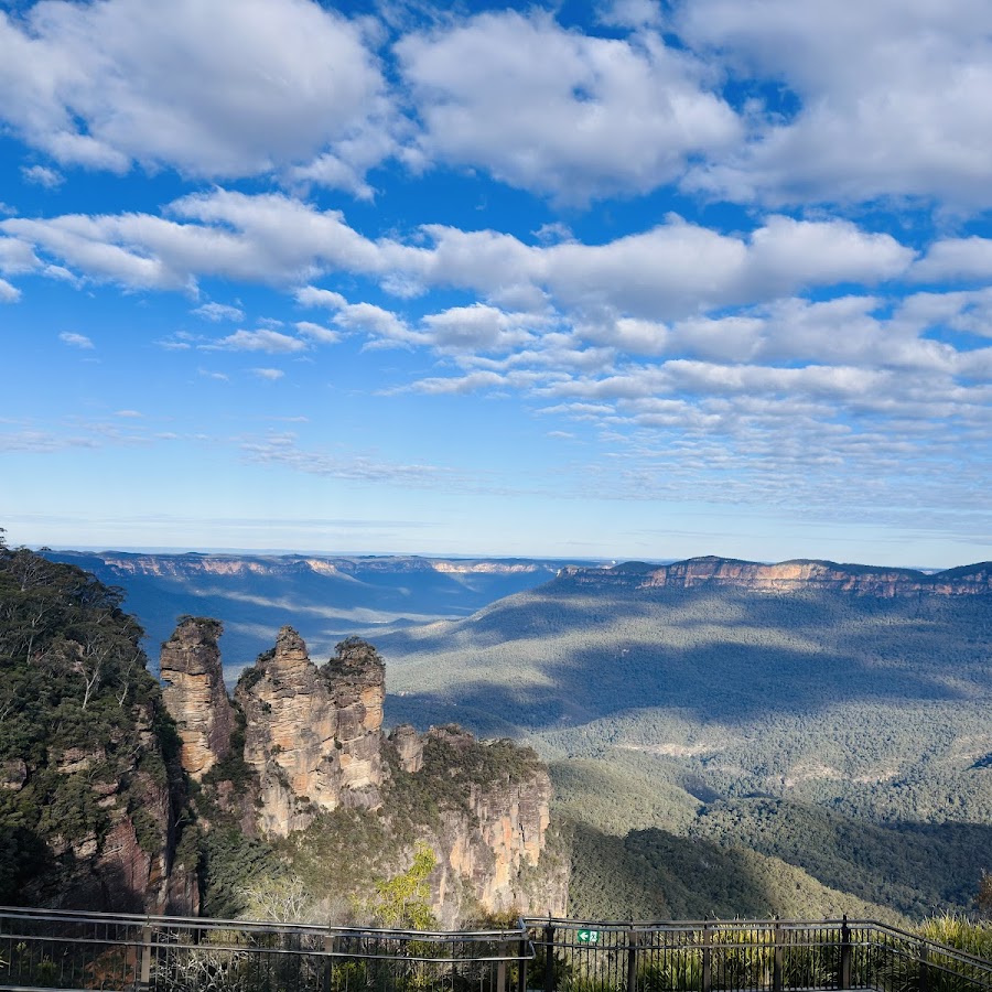
Echo Point Lookout - 3 Sisters
Echo Point lookout is the gateway to many great walks and nature experiences in the area. Standing proudly in the land of the Gundungurra and Darug People, the traditional custodians of this declared Aboriginal Place, the imposing Three Sisters is best seen from Echo Point lookout, on the edge of the plateau above. Enjoy the new Prince of Wales Lookout providing a closer view of The Three Sisters, and the140-metre accessible, elevated, night-lit boardwalk.
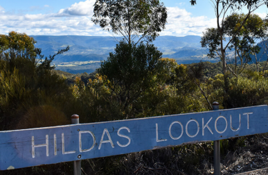
Hildas Lookout
Hildas Lookout is a small one just off Cliff Drive, 50 metres from Cyclorama Point. Views are limited due to plant growth. This lookout is easy to get to by either car, bike or walking. There is no formed foot path so much care should be taken if you choose to walk. The lookout was developed in 1992. It was named after Hilda Radic who was on the Katoomba Leura Parks committee for 13 years. https://www.askroz.com.au/index.php/event_detail/index/hildas-lookout
LOOP WALK - Katoomba Round Walk
A scenic walking track that offers a loop around the beautiful landscapes of Katoomba, perfect for a leisurely stroll or a more vigorous hike. Start your walk beside the Katoomba Kiosk. Park opposite in Katoomba Falls Reserve where there is free parking or catch the 686 or 686G buses. A short yet spectacular track through a lush rainforest gully leading to lookouts that boast some of the most iconic views in Blue Mountains National Park. Excellent for adventurous walkers looking for a shorter route, Round walking track packs in a swag of spectacular vistas and waterfalls, that highlight the dramatic beauty of the Katoomba escarpment. Take in the spectacular waterfall views from Reids Plateau before making your descent down the stairs into the shadowy gorge. In the spring the new fern shoots brush your legs and flocks of rosellas and lorikeets flit through the rainforest canopy. At Vanimans lookout you’ll have unsurpassed views of The Three Sisters and Katoomba Falls. The medium difficulty track skirts the cliff edge leading to romantically named Juliets Balcony overlooking Witches Leap waterfall. Take the shot detour to Katoomba Falls mid level. If you’re keen to further explore the dense valley, join Furber Steps which leads to Scenic World via Federal Pass. 𝗞𝗘𝗬 𝗣𝗢𝗜𝗡𝗧𝗦 • Distance: 1.2km round walk • Time: 60 mins • Kid-safe: Yes, with supervision • Dogs on-leash: No • Steps: Lots and lots of them • Grade: NPWS grades this as a Grade 3 walk • Accessible: No • Heights: No dramatic heights that can't be avoided. If you can handle lookouts with safety rails and a couple of flights of metal stairs, you'll be fine. https://www.facebook.com/AskRozBlueMountains/posts/pfbid0FCXyJKLPEcEsfAfHYYzmpPn2RWgDy7gdzAFiTHoycb3iG7MYvgZwwAJ7ixTYNur4l https://www.nationalparks.nsw.gov.au/things-to-do/walking-tracks/round-walking-track
Lady Darley Lookout
This short walk starts at the short and incredibly steep Lady Darley Track that is opposite Lillianfels and leads down to Lady Darley's Lookout on the Prince Henry Cliff Walk, part of the Grand Cliff Top Walk. You head down the steps to Lady Darleys lookout, turn left, and walk around to Echo Point and then back via Lillianfels Park. https://www.askroz.com.au/index.php/event_detail/index/lady-darley-loop-walk
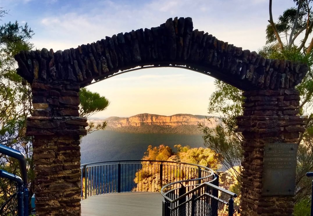
Lady Game Lookout
Lady Game is located at the top of the Giant Stairway between the stone archway and the first of The Three Sisters, Katoomba. The lookout has also been called Three Sisters Lookout and Jamieson Valley Lookout. The lookout offers spectacular views of the Three Sisters and the sweeping Jamison Valley below, making it a popular stop along the family-friendly Three Sisters Walk. Named after Gwendolen Margaret Game—the wife of NSW Governor Sir Philip Game (1930–1935)—this lookout is easily reached via a short, accessible path from Echo Point, and provides one of the closest perspectives on the dramatic cliff scenery for visitors to the Blue Mountains. https://www.nationalparks.nsw.gov.au/things-to-do/walking-tracks/three-sisters-walk
Landslide Lookout
This lookout is not a view of the 1921 landslide, it actually is on top of the landslide. It provides a great view of Narrow Neck to the right and the Jamison Valley to the left. Allow 15 mins for the return walk. You'll see a faint track to the left that takes you over to some great unofficial lookouts. Take care as there are no handrails. The lookout is on a 100m side track at the top of the cliff line overlooking the landslide, opposite Cyclorama Pt. https://www.askroz.com.au/index.php/event_detail/index/landslide-lookout
Malaita Lookout
Malaita Lookout is a scenic viewpoint located in Katoomba. It offers breathtaking vistas of the Jamison Valley and the iconic rock formation known as the Three Sisters. The lookout gets its name from the nearby Malaita Point and Malaita Wall, a series of sandstone cliffs that were formed millions of years ago through erosion and geological processes. These cliffs are popular destinations for abseiling and rock climbing adventures. https://www.askroz.com.au/index.php/event_detail/index/malaita-point-lookout
Megalong Head - Ngula Bulgaraba Regional Park
Megalong Head is at the western end of the Ngula Bulgaraba Regional Park, the old Radiata Plateau. Allow 90 minutes for the 4.5km walk and this is a dog-on-leash-friendly walk. Park your car here: https://w3w.co/lulls.removable.ridges and keep following the walking track keeping to the left tracks. At the end of the main track, you'll see a minor track going straight on. Follow that down to Megalong Head. Return the same way. Great walk. Thanks to Cath Rendell from Natures Creation Photography for photo https://www.askroz.com.au/index.php/event_detail/index/megalong-head
Narrow Neck Lookout
Narrow Neck Lookout offers an excellent view of the Landslide, Narrow Neck and the Megalong Valley. There is also a picnic area. Narrow Neck Lookout, as the name implies, has views over the Narrow Neck Peninsula, a plateau which divides the Jamison and Megalong Valleys. https://www.askroz.com.au/index.php/event_detail/index/narrow-neck-lookout
Norths Lookout
This lookout is located behind the Explorers Marked Tree and overlooks Nellies Glen. Park in the carpark just past the Explorers Tree. This is a pleasant walk down the first part of the 6 Foot track. North's Lookout is named after J.B. North who opened the first Coal Mine in Katoomba in 1879. Allow 1 hour for the return walk. It's not a hard walk and the kids will love it. Pack morning tea or lunch and enjoy it when you get to Therabulat or Norths Lookout. You can also walk onto other lookouts. https://www.askroz.com.au/index.php/event_detail/index/norths-lookout
Oreades Lookout
Oreades Lookout in Katoomba is a accessible, spacious, circular viewing platform set amid bushland along the Three Sisters Walk, around 400–450 metres from Echo Point. It features secure fencing and offers sweeping views over the Jamison Valley and towards Mount Solitary, making it a perfect spot for panoramic photos and birdwatching—including sightings of lyrebirds and crimson rosellas. The path to Oreades Lookout is very accessible, with a gentle, downhill concrete path suitable even for those not prepared for bushwalking, providing a tranquil introduction to the native landscape and dramatic escarpment scenery before continuing on to Lady Game Lookout or the Giant Stairway. https://www.facebook.com/profile/100064323152639/search/?q=oreades%20lookout
Peckman's Lookout
The plateau and lookout are named for Harry Peckman, one of the great characters of early Katoomba. He moved there in 1884 and spent most of his time as a horse cab and coach driver where his skills as a storyteller kept visitors entertained and informed about the Blue Mountains. Access to the lookout is marked by a sign on Cliff Drive, Katoomba, just a few minutes past Cahills Lookout, heading north. The track is a little rocky and eroded and there are a few steps so average fitness is required but it’s well worth the 10-15 minute walk each way for the peace and beauty of the lookout at the end of the track.
Reids Plateau Lookout
Reids Plateau offers commanding views over the Jamison Valley, Orphan Rock and Katoomba Falls You can access this from multiple directions. Going directly from the carpark is only a 5-minute walk. The loop around Reids Plateau explores several lookouts and the bush through the area. There are a couple of short side trips out to extra lookouts, including one that passes through a natural tunnel. Reids Plateau Picnic area has a few seats, shelter, and a great view making a great spot for a picnic lunch. From Reids Plateau, you can walk down to the Katoomba Cascades. Reids Plateau is also part of the Katoomba Night Lit Walk. https://www.askroz.com.au/index.php/event_detail/index/reids-plateau
Spooners Lookout
Park your car and walk to the Tourist Information Centre at Echo Point. Take the path to the left of the Information Centre toward the 3 Sisters. Almost immediately you'll see the track to Spooners Lookout on the right. The lookout overlooks Jamison Valley. To your right, you can see the Echo Point lookout and to the left you can see 2 of the 3 Sisters. The lookout was named after Eric Sydney Spooner (2 March 1891 – 3 June 1952) who was an Australian politician.Eric Spooner played a significant part in Katoomba and Leura history. https://www.askroz.com.au/index.php/event_detail/index/spooners-lookout
Tallawalla Lookout
Tallawalla Lookout is on the Prince Henry Cliff walk and is easily accessible via Silver Mist Reserve. It offers great views over the Jamison Valley, looking toward the canyon that has Bridal Veil Falls. If going direct, allow 20 minutes for the return walk. A great walk to do is to check out the lookout and then head down the track to Echo Point and then either retrace your steps or walk back along the road to your car. https://www.askroz.com.au/index.php/event_detail/index/tallawalla-lookout
Therabulat Lookout
Look out for the sign. Park your car where you can at the end of Stuarts Road and follow the track for about 15min. Lookout for a poorly marked sidetrack that will take you to the lookout. Parking is limited. GO HERE>> https://w3w.co/hugged.entertainer.satins If you’re looking for a great “out of the way” walk to do, check out this wonderful walk.It’s an easy walk that the whole family could enjoy. Allow 90 mins for the 3.5km return walk. Therabulat is the named in 1988 after the name of the aboriginal tribe which once lived in the Megalong Valley. https://www.askroz.com.au/index.php/event_detail/index/therabulat-lookout
Vaniman's Lookout
Vaniman was an American photographer, balloonist, inventor and artist Chester Melvin Vaniman (1866-1912) visited the Blue Mountains in 1903. This lookout was named in his honour in 1905. Described in the Sydney Mail 1905 as 'Perhaps the finest point to obtain a view of the Three Sisters, Katoomba Falls and the Jamison Valley'. Vaniman was an American photographer, balloonist, inventor and artist Chester Melvin Vaniman (1866-1912) visited the Blue Mountains in 1903. This lookout was named in his honour in 1905. Park your car opposite the Katoomba Kiosk where there is free parking and walk in. It's an easy walk. https://www.facebook.com/AskRozBlueMountains/posts/pfbid0FCXyJKLPEcEsfAfHYYzmpPn2RWgDy7gdzAFiTHoycb3iG7MYvgZwwAJ7ixTYNur4l https://www.askroz.com.au/index.php/event_detail/index/vanimans-lookout
Leura
Lookouts
Leura Railway Station
Leura Railway Station serves as a convenient stop for travelers in the Blue Mountains, providing access to train services connecting Leura with Sydney and other regional areas. It is located close to the town centre, making it an ideal starting point for exploring the beautiful surroundings. https://transportnsw.info/routes/details/intercity-trains-network/bmt/02bmt
Gia Cafe & Bistro - Leura
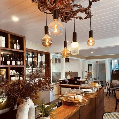
Whether you're hosting a corporate event, cocktail party, luncheon, dinner, meeting, shower, bat/bar mitzvah or rehearsal dinner, we know we can offer you and your guests a truly memorable event. We have a variety of private event spaces that can accommodate up to 50 guests. Stunning refreshments served just around the corner in Leura. Hours : Thurs-Mon 9am-3pm Dinner Thurs-Mon 5.30pm-8pm Tues and /wed CLOSED https://www.facebook.com/profile.php?id=61559597372125 https://www.giacafebistro.com.au
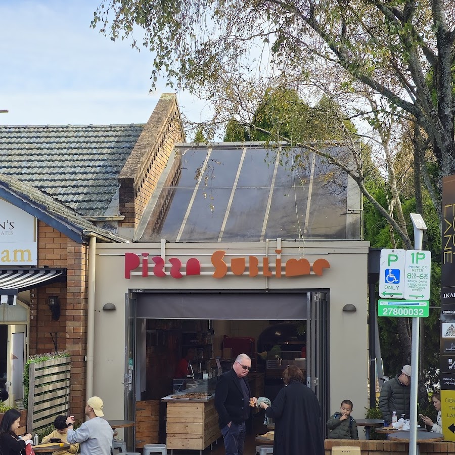
Pizza Sublime - Leura
BENVENUTO Pizza Sublime offers authentic artisan style pizza slices in Roman style. Pizza in pala Romana is light with a crispy base and easy to digest. You may order your whole board and half board of pizza online in 3 easy steps! Enjoy your pizza with friends and family on a bushwalk or in the comfort of your home. Enjoy and Buon Appetito! HOURS : 11am-8pm Every day ORDER ONLINE https://pizzasublime.com.au
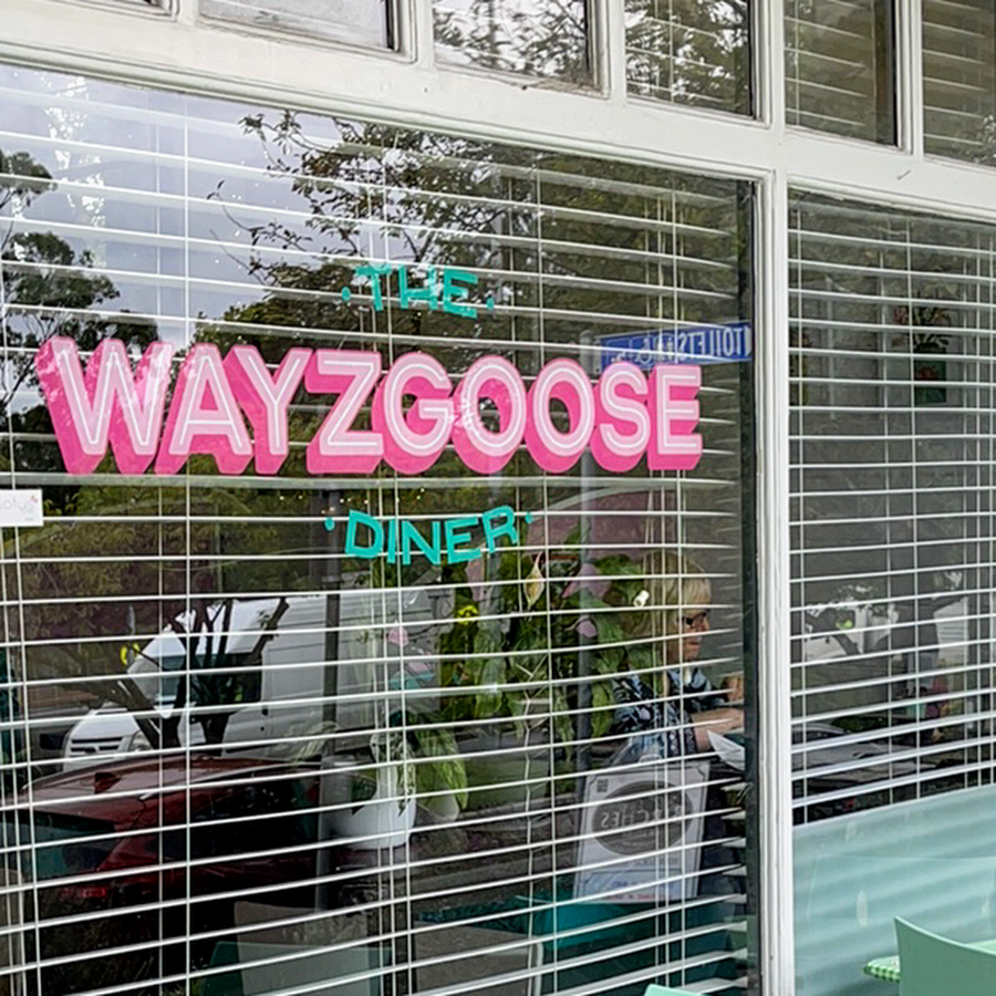
Wayzgoose Diner - Leura
The oldest commercial building in Leura. Our little town of Leura is rich with history. The Wayzgoose Diner happens to reside in the oldest commercial building in town. Built in 1901 by the Milgate family, who owned the land that would one day become the town of Leura, It was originally the family’s residence and well as a business, and then went on to become the local printing press. The building even survived the disastrous fire of 1957, where over 100 homes, 2 churches and many shops in Leura were destroyed. A quick thinking local hero saw the side of the building catch fire, and without any water to fight the blaze, used his axe to chop out the part of the building that was on fire! In 1982 the building was transformed into a cafe named The Pumpkin Inn, serving hearty vegetarian food. Since then it has become a favourite food spot for locals and visitors alike. Open 9am-5pm EVERY DAY ! https://www.thewayzgoosediner.com https://www.facebook.com/TheWayzgooseDiner
Holley House Apartment - Leura
Holley House Leura - offers a Self-Contained Serviced Two Bedroom Apartment (100 sqm) located only 4 minutes from Wentworth Bakehouse & 9 minutes from Leura station. Just minutes from the Grand Cliff Top Walk. Experience serenity and relaxation at the beautiful Holley House, tucked away in the picturesque town of Leura, NSW. This charming holiday rental comfortably accommodates up to 4 guests within its 2 bedrooms and 1 bathroom layout. Privately situated away at the REAR of the property you are greeted by a tastefully decorated open-plan living, brimming with comfort and style. Drift into relaxation mode with cosy seating around the 55" TV and stay connected with free Wi-Fi during your stay. If you prefer indoor cooking, the house features a full-equipped kitchen complete with high-quality appliances, including a dishwasher and microwave oven. Our VISITOR eMag: https://askroz.news/Holley-House-Apartment-eMag www.bluemountainsescapes.com.au/listings/holley-house https://www.facebook.com/people/Holley-House-Leura-Apartment/61562447713041/?_rdr
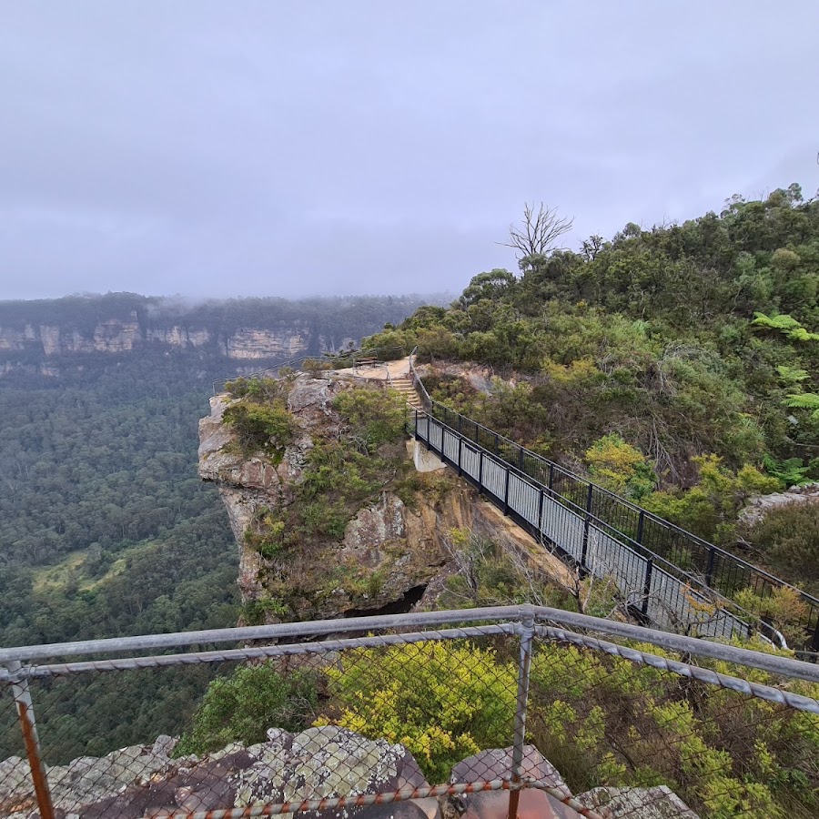
Bridal Veil Lookout
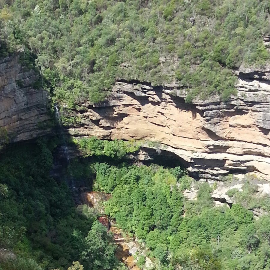
Bridal Veil Lookout offers great views of the Jamison Valley, Mount Solitary and back to Bridal Veil Falls. Allow 30 mins for the return walk. The lookout is accessed via the Prince Henry Cliff Walk. You can access it directly by parking near Solitary Lookout and walk down past Fossil Rock Lookout and the turnoff to Copelands Lookout. The lookout offers excellent views of the Jamison Valley and of Bridal Veil Falls. Directly opposite you can see Bridal Veil View Lookout. https://www.askroz.com.au/index.php/event_detail/index/bridal-veil-lookout
Bridal Veil View
Bridal Veil View Lookout, Leura should not be confused with Bridal Veil Lookout, which is across the valley. Bridal Veil View Lookout offers the best view of the Bridal Veil Falls. The viewing platform is accessed down a metal ladder, which could be challenging for some people. NPWS have done an outstanding job upgrading the track. https://www.askroz.com.au/blog/bridal-veil-view-lookout-leura-the-prettiest-lookout-in-the-blue-mountains
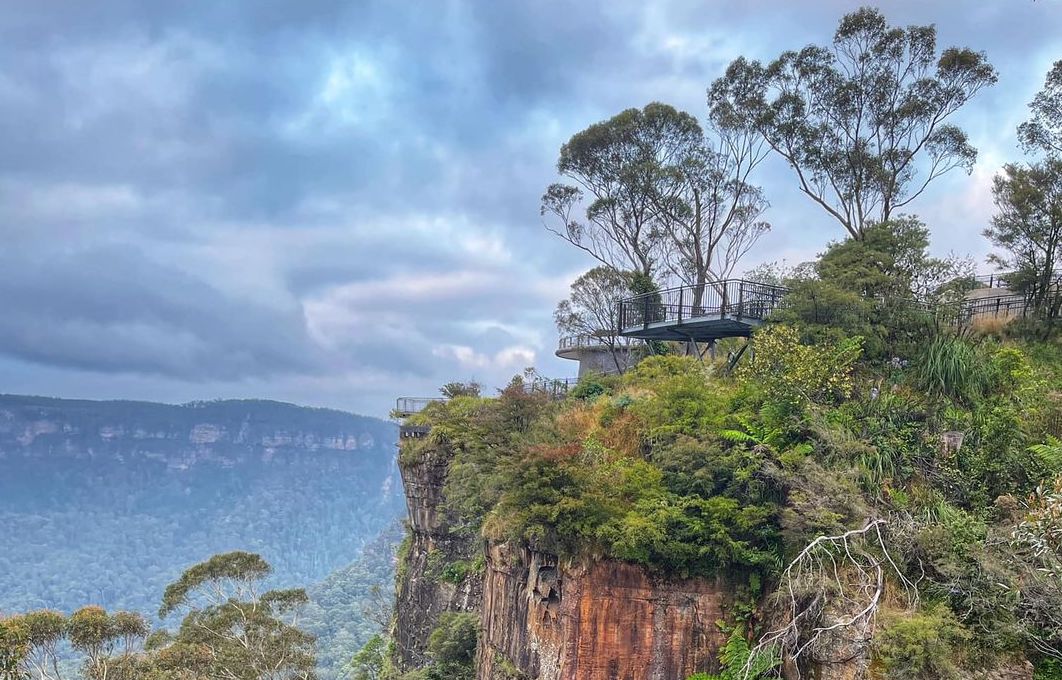
Butterbox Point
The walk to Butterbox Point is a great family walk that offers outstanding views all the way along the walk. Butterbox Point is a large, high rocky outcrop on the edge of the Grose Gorge, 800m northwest of the northern end of Mount Hay Road, Leura. You can see across the Grose Valley, to Lockleys Pylon on the left, and Perry’s Lookdown and Mount Banks in the distance. This walk offers a real WOW factor from the moment you get out of your car. Butterbox Point is not one of the most widely known lookouts in the Blue Mountains but it is one of the most striking and unusual ones. Distance: 2.2km return - Time: 60 mins return PLUS browsing time. Kid-friendly with supervision. https://www.askroz.com.au/index.php/event_detail/index/butterbox-point_52448
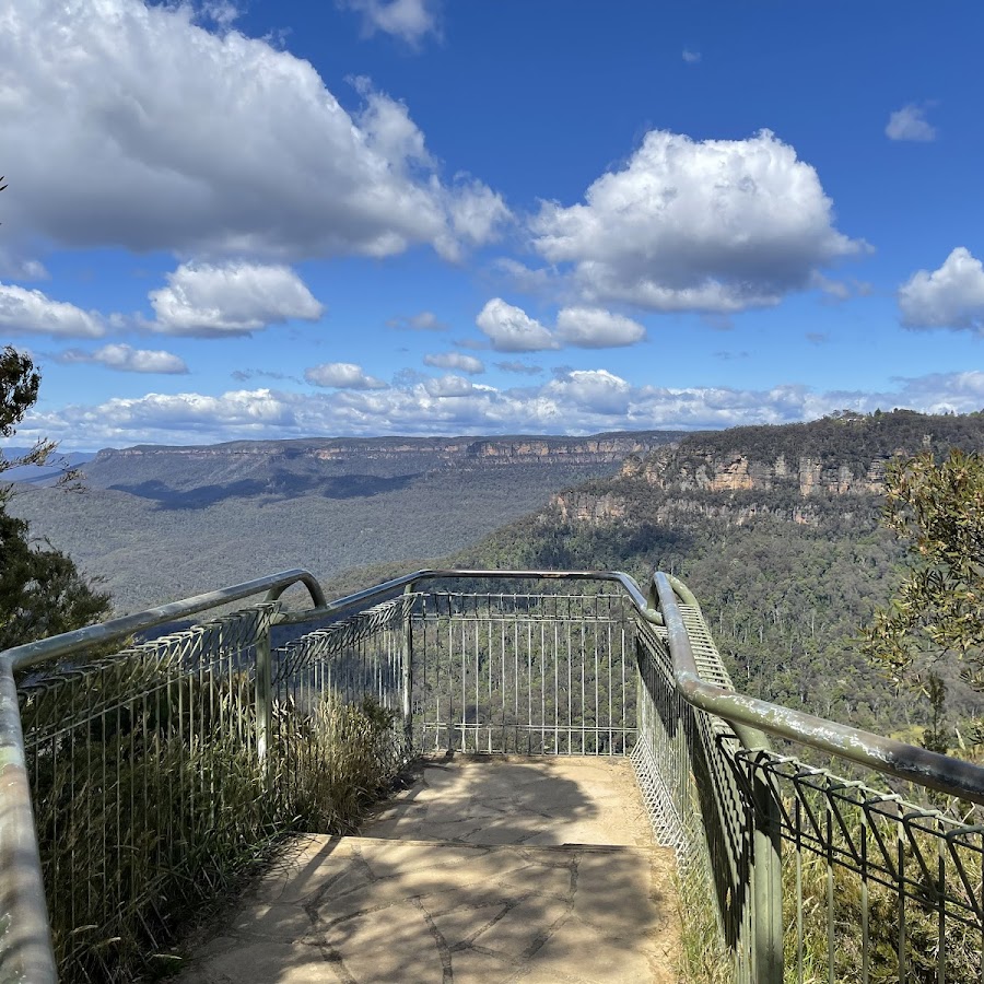
Elysian Rock Lookout
The 2 Elysian Rock Lookouts offer some of the best views in the Blue Mountains. The lookouts are just a short walk from the street. You can visit the lookout directly or as part of the fantastic Prince Henry Cliff Walk that goes from Scenic World to the eastern side of Leura. Park your car in Olympian Parade and walk down the poorly marked track to the lookout. You can also access it via Gordon Fall Lookout track and from Olympian Rock track. Easy walking but NOT wheelchair friendly. Elysian describes a blissful state, like the one most people hope to enjoy.The name "Elysian" comes from the idyllic Greek mythological place called Elysian Fields. In Greek mythology, Elysian Fields or Elysium is a place of perfect happiness prepared by the gods for the worthy dead. https://www.askroz.com.au/index.php/event_detail/index/elysian-rock-lookout
Golf Links Lookout
Park your car at the end of the road from where you'll see the sign to the lookout. The lookout is located on the escarpment and to walk is about 400m steadily downhill until you get to the lookout. From the lookout, there are great views across the Jamison Valley. It has views out and over Jamison Valley towards The Three Sisters. Return the same way or take the track to the Pool of Siloam Track and Gordon Falls. The walk starts here: https://w3w.co/venture.leafing.gambits in Leura. While you can do it as a loop walk, we wouldn't recommend it, as the entire return walk is along suburban streets. ACCESS: Follow the sign and head to "Golf Links Lookout". That's about a 10-minute easy walk. After enjoying the lookout, turn left and down into the adjoining valley. The sign says "No through Track" but it is open. That track forms part of the Grand Cliff Top Walk. The track is STEEP with lots of steps and follows the cliff face down. The views are wonderful. https://www.askroz.com.au/index.php/event_detail/index/golf-links-lookout_46374
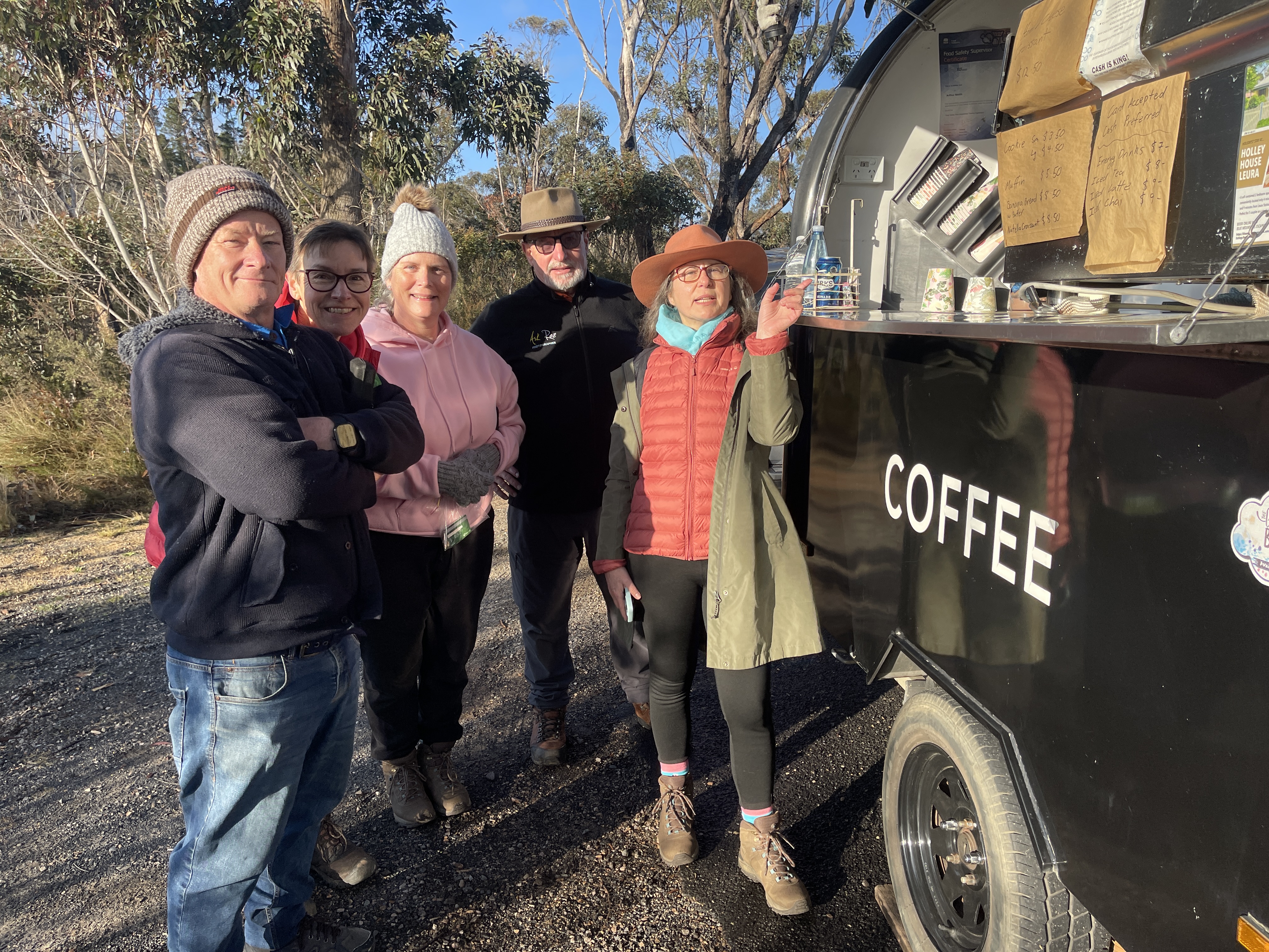
Gordon Falls- Coffee & snack van
Arthur's coffee and snack van is available 7 days a week. Gordon Falls Reserve is about half walk along the Grand Cliff Top Walk.
Gordon Falls Lookout
Gordon Falls lookout offers excellent views over the Jamison Valley. Gaze across to the impressive views of Mount Solitary and Kings Tableland. While taking in the magnificent panorama, look to the skies for peregrine falcons, circling high on valley thermals. Closer to ground, lyrebirds are often seen foraging in the forest litter. If you’re keen to stretch your legs, there’s no shortage of walks including Lyrebird Dell - Pool of Siloam.
Gordon Falls Reserve
Gordon Falls Reserve is family friendly, has a fully set up picnic area with BBQ's, play ground, picnic tables and toilets. There are National Park walking tracks close by to the Pool of Siloam and Lyrebird Dell. Most days there is a coffee cart on site. https://www.nationalparks.nsw.gov.au/things-to-do/picnic-areas/gordon-falls-picnic-area
Lyrebird Dell
At Lyrebird Dell, there is a sandstone cave that provides shelter for a lovely picnic area. There is also a waterfall next to the cave. The cave was used as an Aboriginal shelter at least 12,000 years ago. You can start and end your walk here at Gordon Falls Reserve: https://www.w3w.co/dapper.octopus.headless We recommend doing it along with Lyrebird Bell as a loop walk. We recommend walking down to the Pool of Siloam and then around to Lyrebird Dell and then up to the Lone Pine Avenue entrance as the walk back out from the Pool of Siloam is very steep. LOOP WALK: Follow the signs and return to the Gordon Falls Reserve. KEY POINTS • Distance: 2km • NPWS Grade 3 walk • Time: 60 mins return PLUS browsing time • Best time of the day: Any time • Kid-safe: Yes, with supervision • Dogs on-leash: No • Steps: Lots • Accessible: No • Heights: No cliffs • Must do rating out of 10: 9.5 https://www.facebook.com/AskRozBlueMountains/posts/pfbid02ATDehHWHwawkVZFW3gLusFaPx1GpJPQ5A6qVY6bBAvESphxgS8QQSsc31HuQkU6Tl
Olympian Rock
This is a small outstanding lookout on the Prince Henry Cliff Walk that is also accessible from Olympian Parade via a short walk or via the Prince Henry Cliff Walk. The lookout faces south, so the view is best at sunrise and sunset. Having said that, the view is outstanding all day. https://www.askroz.com.au/index.php/event_detail/index/olympian-rock-lookout
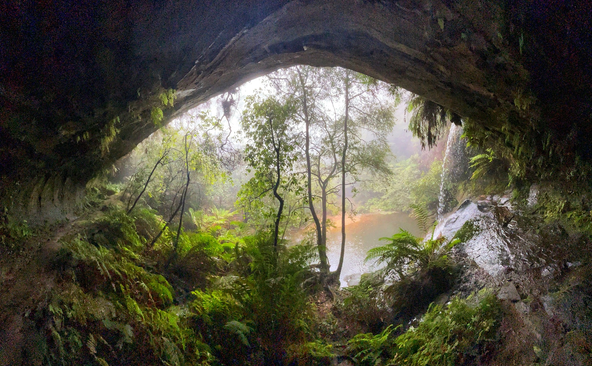
Pool of Siloam
The Pool of Siloam is a wonderful waterhole and waterfall on Gordon Creek. The Lyrebird Dell walking track offers Aboriginal heritage, waterfalls, caves with birdwatching and picnicking. We recommend doing it along with Lyrebird Bell as a loop walk. We recommend walking down to the Pool of Siloam and then around to Lyrebird Dell and then up to the Lone Pine Avenue entrance as the walk back out from the Pool of Siloam is very steep. https://www.facebook.com/AskRozBlueMountains/posts/pfbid02ATDehHWHwawkVZFW3gLusFaPx1GpJPQ5A6qVY6bBAvESphxgS8QQSsc31HuQkU6Tl First photo: © Elaine Yeoh
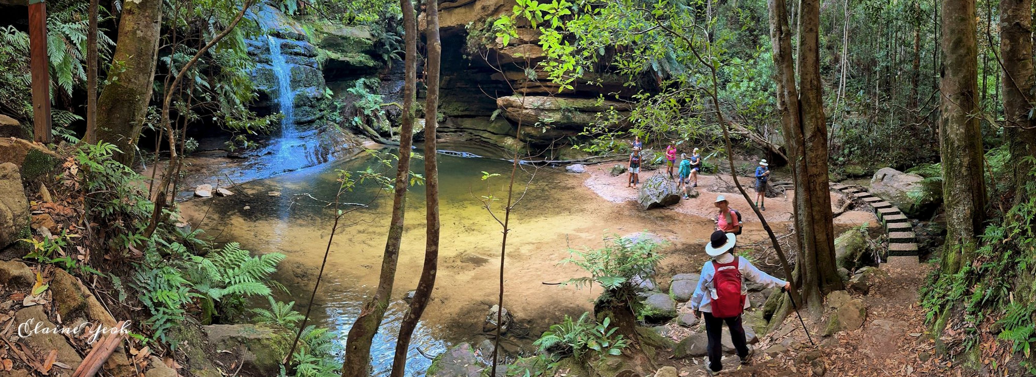
LOOP WALK - Pool of Siloam - Lyrebird Dell
The Pool of Siloam and Lyrebird Dell walking track is a wonderful loop walk in Leura. We recommend walking down to the Pool of Siloam and then around to Lyrebird Dell and then up to the Lone Pine Avenue entrance as the walk back out from the Pool of Siloam is very steep. The Pool of Siloam is a wonderful waterhole and waterfall on Gordon Creek. The Lyrebird Dell walking track offers Aboriginal heritage, waterfalls, caves with birdwatching and picnicking. At Lyrebird Dell, there is a sandstone cave that provides shelter for a lovely picnic area. There is also a waterfall next to the cave. The cave was used as an Aboriginal shelter at least 12,000 years ago. Follow the signs and return to the Gordon Falls Reserve. KEY POINTS • Distance: 2km • NPWS Grade 3 walk • Time: 60 mins return PLUS browsing time • Best time of the day: Any time • Kid-safe: Yes, with supervision • Dogs on-leash: No • Steps: Lots • Accessible: No • Heights: No cliffs • Must do rating out of 10: 9.5 The pool derives its name from the Pool of Siloam (Birkhat Hashiloah – Hebrew) in the City of David, and in the Bible is where Jesus sends a man to heal him of his blindness. https://www.facebook.com/AskRozBlueMountains/posts/pfbid02ATDehHWHwawkVZFW3gLusFaPx1GpJPQ5A6qVY6bBAvESphxgS8QQSsc31HuQkU6Tl First photo: © Elaine Yeoh

Sublime Point Lookout
You'll feel like you’re on the edge of the world as the views go on forever at Sublime Point lookout. Located in Leura, overlooking Blue Mountains National Park, this spot offers sensational views of the Jamison Valley and is popular with picnickers and birdwatcher. The more adventurous know it as a haven for rock climbing. https://www.askroz.com.au/index.php/event_detail/index/sublime-point-lookout_49639
Tarpeian Rock
Tarpeian Rock Lookout is just off the Grand Cliff Top Walk and can also be accessed directly. 𝗞𝗘𝗬 𝗣𝗢𝗜𝗡𝗧𝗦 • Parking: Free • Time: 30 minutes return • Kid-safe: Yes, with supervision • Dogs on leash: No • Accessible: No • Heights: Only at lookouts • Must do rating out of 10: 11 BACKSTORY: Tarpeian Rock Lookout was named after an Ancient Roman execution site. Murderers, traitors, perjurors, and larcenous slaves, if convicted they were flung from the cliff to their deaths. It was mentioned in tourist publications as early as 1889. https://www.facebook.com/AskRozBlueMountains/posts/pfbid02rwEagwPUNNmvfMBY9Ny2fDFMx18vfwaec4npjbjWTUr6TC8rxE5f55dUDpTxcVgdl
Wentworth Falls
Rocket Point
Rocket Point is a scenic lookout that overlooks Wentworth Falls. It offers stunning views of the surrounding landscape and waterfalls. It is a popular spot for photography.
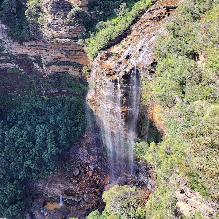
Princes Rock Lookout
This lookout offers the best views of Wentworth Falls in full flow.
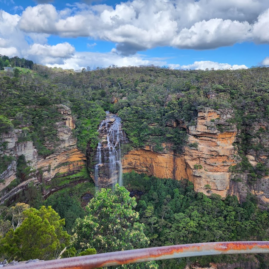
Rocket Point Lookout
Wentworth Falls Lake
Wentworth Falls picnic area
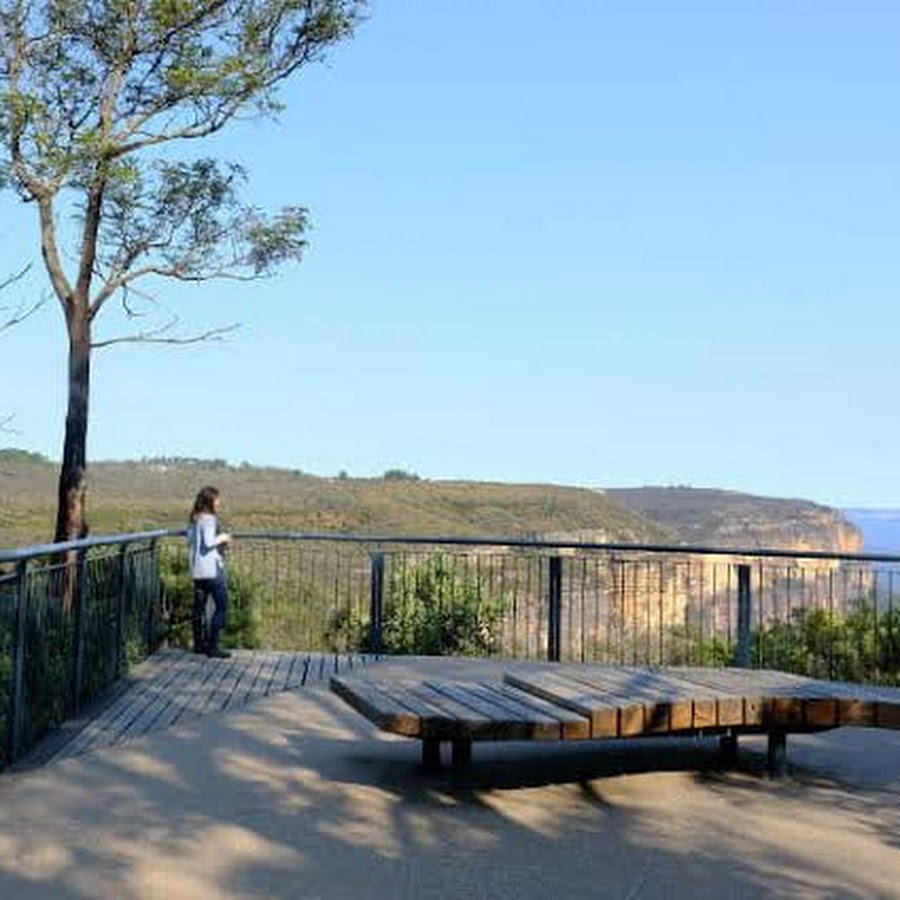
Lawson - Hazelbrook - Woodford
Lawson - Hazelbrook - Woodford
Horseshoe, Oaklads & Burgess Falls Walking Track
This return walk takes in Horseshoe Falls, Oaklands Falls and Burgess Falls. There isn't carpark for the start of this walk, you park on the side of Oaklands Rd. Allow 1 hour for the return walk plus browsing time. The first Waterfall you will come to is Horseshoe falls which has a cave behind it and is in the shape of a horseshoe. The falls are very pretty and you are able to walk through the small cave and explore the area. There were a number of small tracks behind the falls which lead to another mini waterfall and allowed for beautiful photos of the stream, the walk does take you up-hill. In a few places the track is pretty rough, so take care. KEY POINTS • Distance: 3.5km for the whole walk • Time: 2 hours + return from Burgess Falls. 60 mins return walk from Horseshoe Falls. • Kid-safe: Yes, with supervision • Dogs on-leash: Yes • Steps: Lots of them and some of them are big and some spots are slippery • Accessible: No • Heights: There are no heights on this walk. The first Waterfall you will come to is Horseshoe falls which has a cave behind it and is in the shape of a horseshoe. In the right conditions, you can also see Glow worms in the cave behind the falls. The next waterfall is Oakland Falls which is only about a 10-minute walk down the track. The last and least impressive falls are Burgess. Return the same way. ACCESS The track is a little rough in patches. This is a wonderful mid-mountains walk that’s suitable for the whole family. Start your walk from Oaklands Rd in Hazelbrook. Park your car HERE>> https://w3w.co/almost.unzips.tower There is only street parking available, so think of the neighbours when you park.
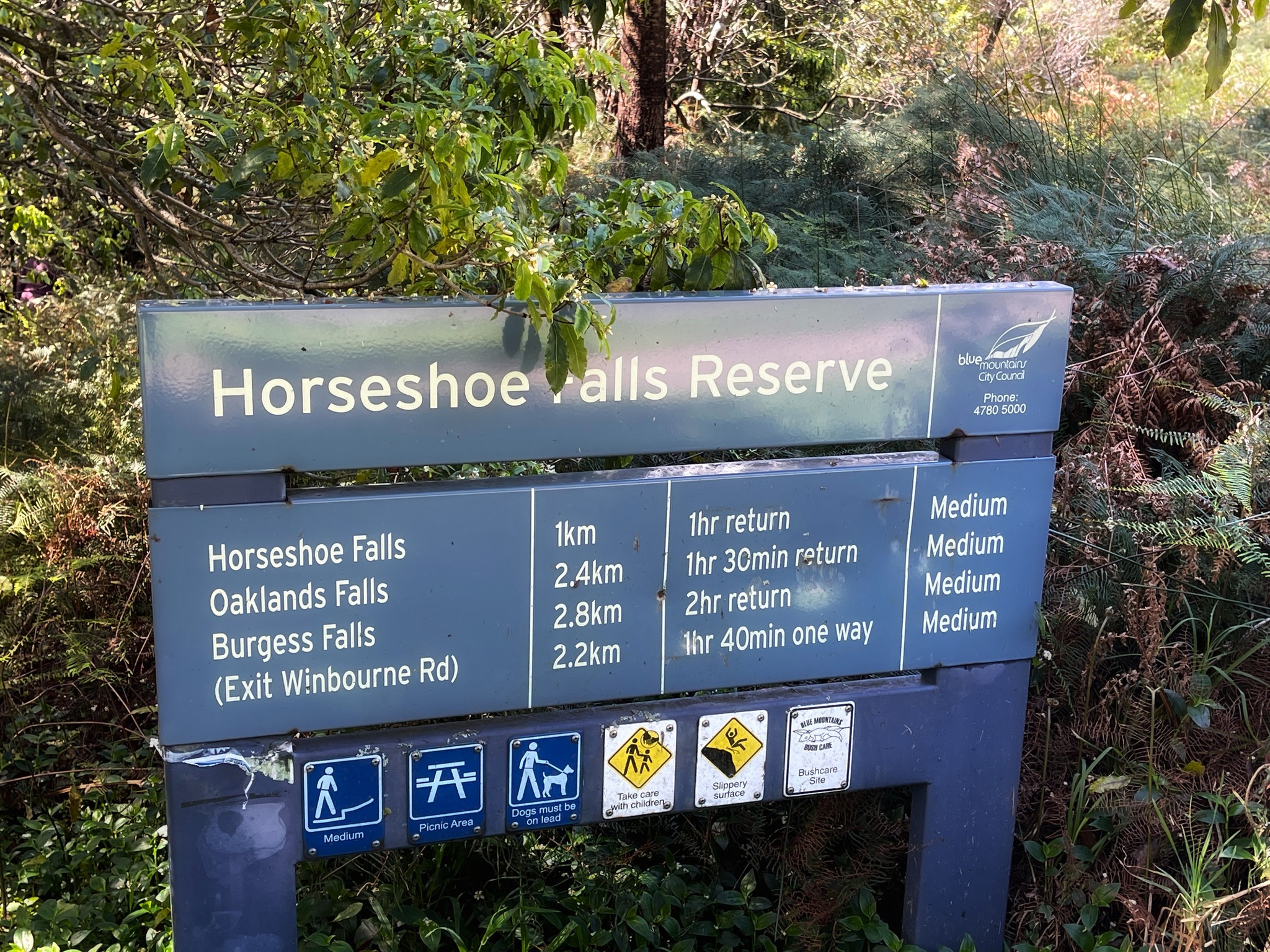
Dantes Glen Walking Track
North Lawson Waterfall Loop along the Dantes Glen Walking Track. Visitors have been coming to Dante’s Glen since about 1879. KEY POINTS • Time: 60 mins return PLUS browsing time • Best time of the day: Any time • Kid-safe: Yes with supervision, but not little ones • Dogs on-leash: No • Steps: Lots • Accessible: No • Heights: It's a bit tricky on the steps • Must do rating out of 10: 8.5 https://www.askroz.com.au/blog/dantes-glen-walking-track/ https://www.facebook.com/AskRozBlueMountains/posts/pfbid02zJaH3DJgvHLg8LSX7ZZNAAmJaUwatg19sYb9fVqB6qCHm9LaPfiMBRRBdXVYdFR7l
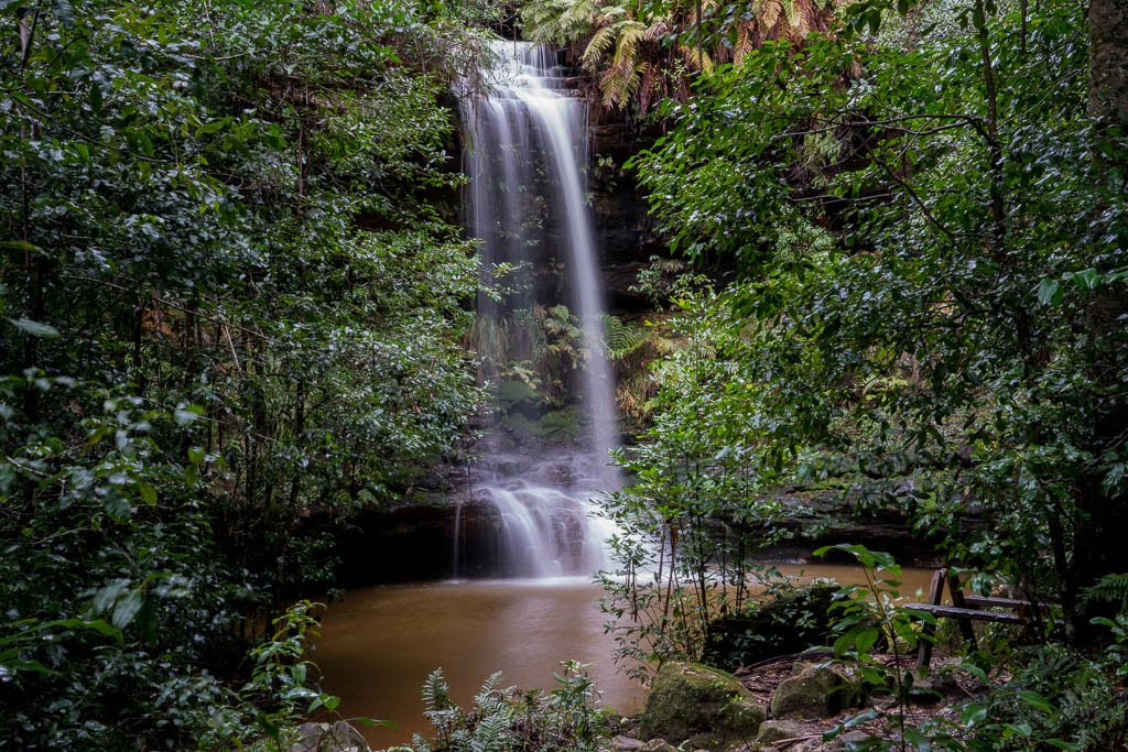
Lawson Swamp Walking Track
This is a seldom-walked track that is a wonderful surprise. It has no cliff views, but it does have beautiful bushland and beautiful bush colours. For the best colours, walk it soon after sunrise. There are often Flannel Flowers everywhere on the first part of the walk. TIP: Don't rush the walk, look out for the spring colours and the amazing rock formations in the early part of the walk. The track heads out from there across some amazing rocks. Follow the track for about 30 mins down into the valley until you get to a sign about the Blue Mountains Water Skink. At that point, turn right follow the track up to the road and turn right. Follow that up until you the letterbox where you turn right and return to your car. https://www.facebook.com/AskRozBlueMountains/posts/pfbid0WnoBXpNuAvmyFbYoSPiucBmdQKv74YM1prbHvYgw34wmLa4mb92giAEzmFopqby2l
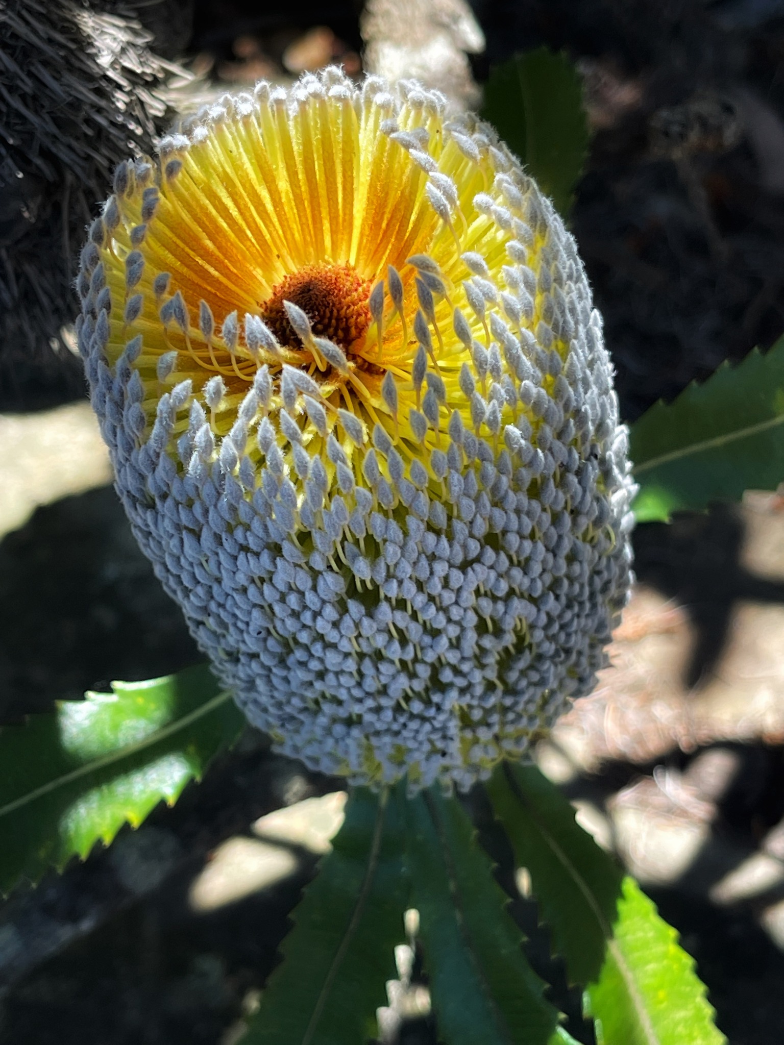
Frederica Falls
When you park your car the track entry is ahead of you. Walk to the sign and tack the rough-looking track on the right. Don't go straight ahead. Follow the narrow track for about 30 minutes until the track crosses a fire trail. The falls are about 50m ahead on the right. It's fairly overgrown and there are limited spots to set up for a picnic. In summer the lagoon offers great swimming and just about any time of year, it is a lovely spot to relax and have lunch. Return the same way or follow the often very steep fire trail uphill to the right to the end of San Jose Street. You can visit Frederica Falls as part of the longer Dante's Glen walk. Thank you Aliki Jones for the photos. https://www.facebook.com/AskRozBlueMountains/posts/pfbid0ghF2X5vYEcqsqJPJD3kub7qJPQBWZ64piFDZupynA5GVYNtFs1Ps4n5A4dbGrEc9l
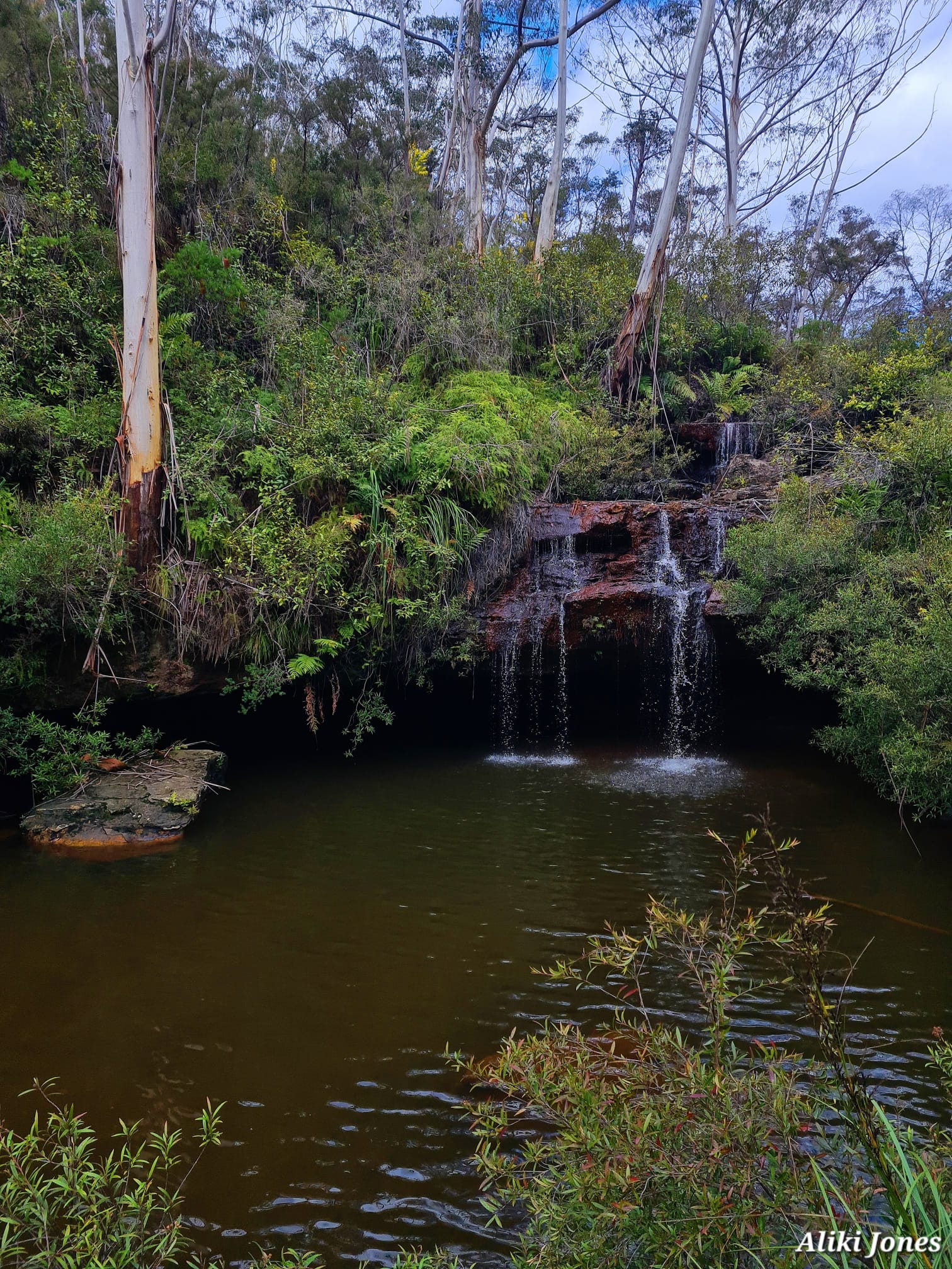
Fairy Falls
Fairy Falls are within Fairy Falls Creek. You can visit as part of your Dante's Glen walk. Fairy Falls are a small waterfall that becomes powerful after heavy rain. NOTE: This is a dog on leash friendly walk but if you extend the walk past Fairy Fall you may enter the Nation Park and dogs are not allowed within National Parks. Access: Drive St Bernards Drive past the pool until you come to a small carpark.Park your car & walk across the field where you'll see an NPWS sign. Follow the track for 200m to the Falls. Thank you to Cath Rendell for some of these photos. https://www.askroz.com.au/index.php/event_detail/index/fairy-falls
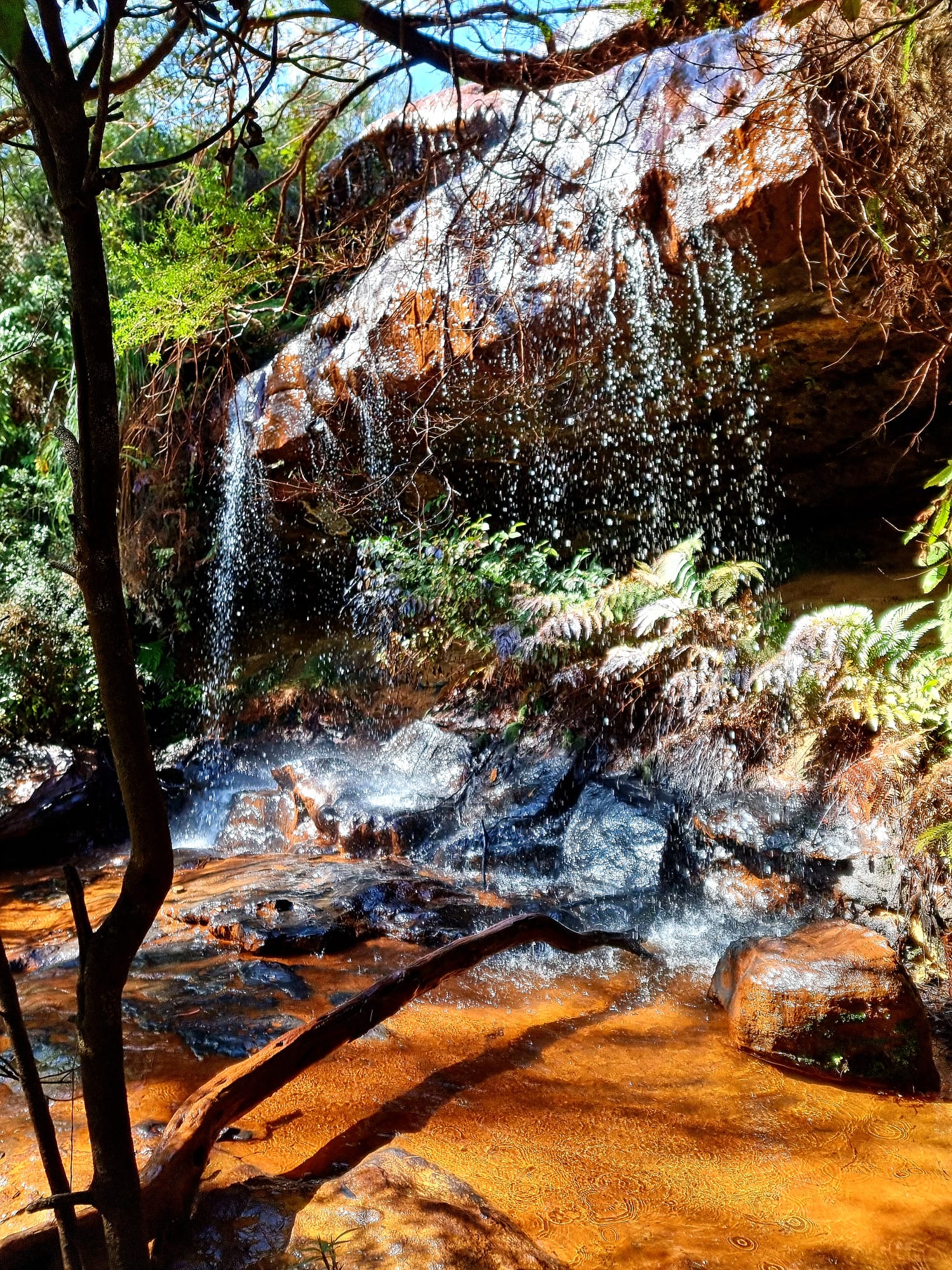
South Lawson Waterfall Circular Walking Track
The Lawson 5 Waterfall Loop walk. This has to be one of the BEST WALKS IN THE MOUNTAINS. It was on and off misty rain the date we did it earlier this year and that just enhanced the colours of the bush. The return walk is about 4km, so allow up to 2 hours for the return walk. YOUR KIDS WILL LOVE THIS WALK. It's a great walk for the School Holidays. While there are a few places you can start the walk from from we suggest that you start from the main carpark. From HERE>> https://w3w.co/rooks.reclaim.tall It's a dog ON-LEASH friendly walk. STOP OFF at one of Lawson's great eateries and grab something to snack on during the walk. Lunch/Morning Tea at the base of one of the 5 waterfalls would be magical:) TIP: This is a very popular walk, so start early. https://www.facebook.com/AskRozBlueMountains/posts/pfbid02YTtEp15UuKEuASYNTGxkiaR59odeu8AVZaazpow4E23Nht6sj6KTmeMYj1tLcmWbl
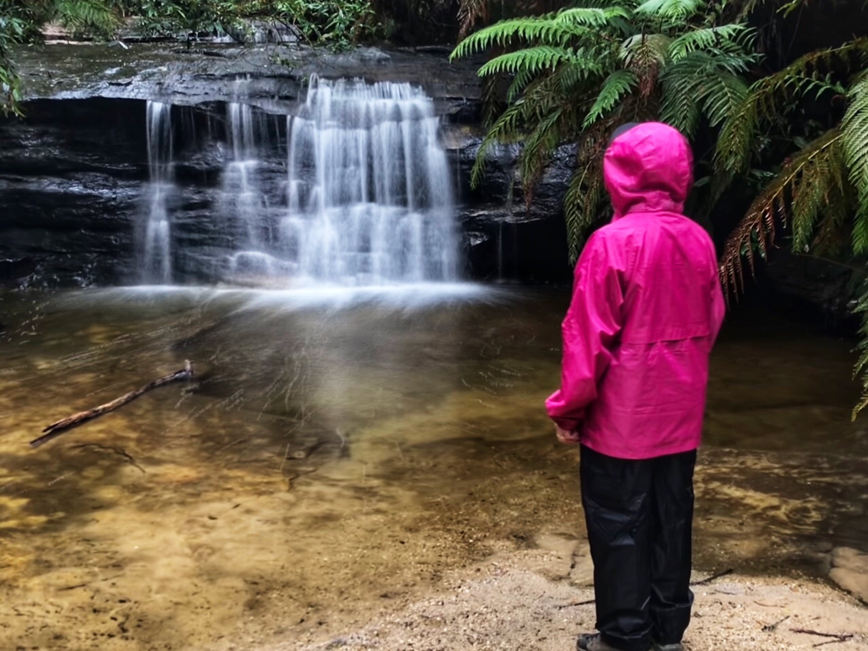
St Michael’s Falls
Drive to the carpark at the end of St Bernards Drive and follow the signs to St Michael's Falls. Visit these fall as part of the Dante's Glen Walk, Allow 1-hour return walk and return on the same track. St Michaels Falls was named in 1882 by Joseph Hay, possibly after St Michael, Archangel of God. The track is a curious example of joint management, with the northern half 'managed' by NPWS and the southern half managed by Blue Mountains City Council.
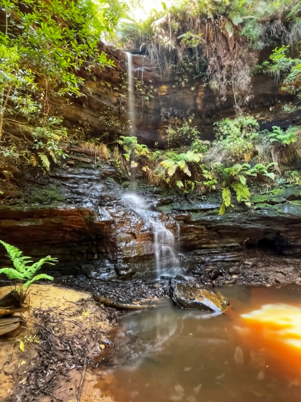
Terrace Falls Reserve Walking Track
This is a great 3 hour walk. Drive as far as the locked gate on Terrace Falls Road and park. Then walk down the hill and along the track until you find the direction signs. The first waterfall is Victor Falls. The Terrace Falls walk is one of Blue Mountains best. The track follows the valley floor and offers amazing scenery. Be sure to pack your lunch. At the end of the walk, there is a steep climb out up to a fire trail. Turn left there and walk back to your car. https://www.facebook.com/AskRozBlueMountains/posts/pfbid02KrPrnXs2gcrLWwz1EY1ozWn3a98p1cbwTVYcjTGZbrD7fJFzUe6fBMVQUAFnPWZzl
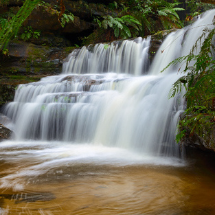
Mid Mountains
Linden - Faulconbridge - Springwood - Winmalee - Valley Heights
Faulconbridge Station, Great Western Hwy
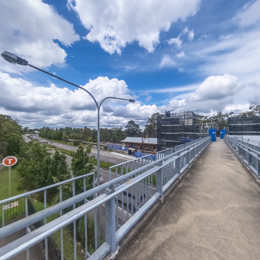
Kings Cave - Linden
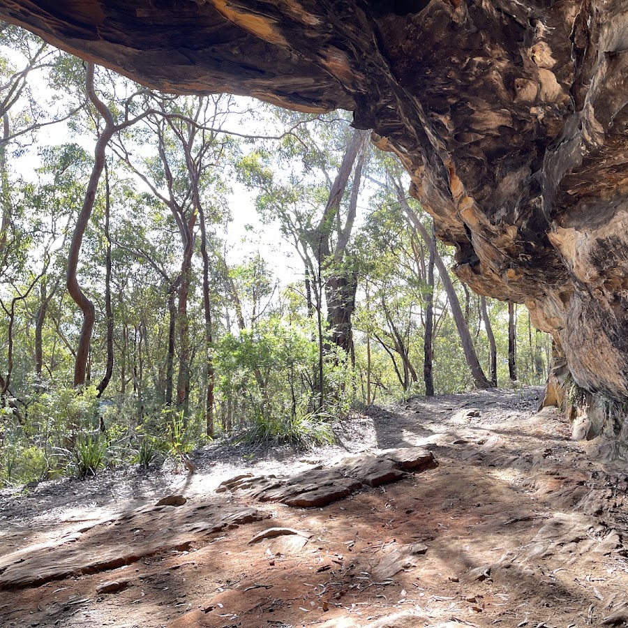
Linden Station
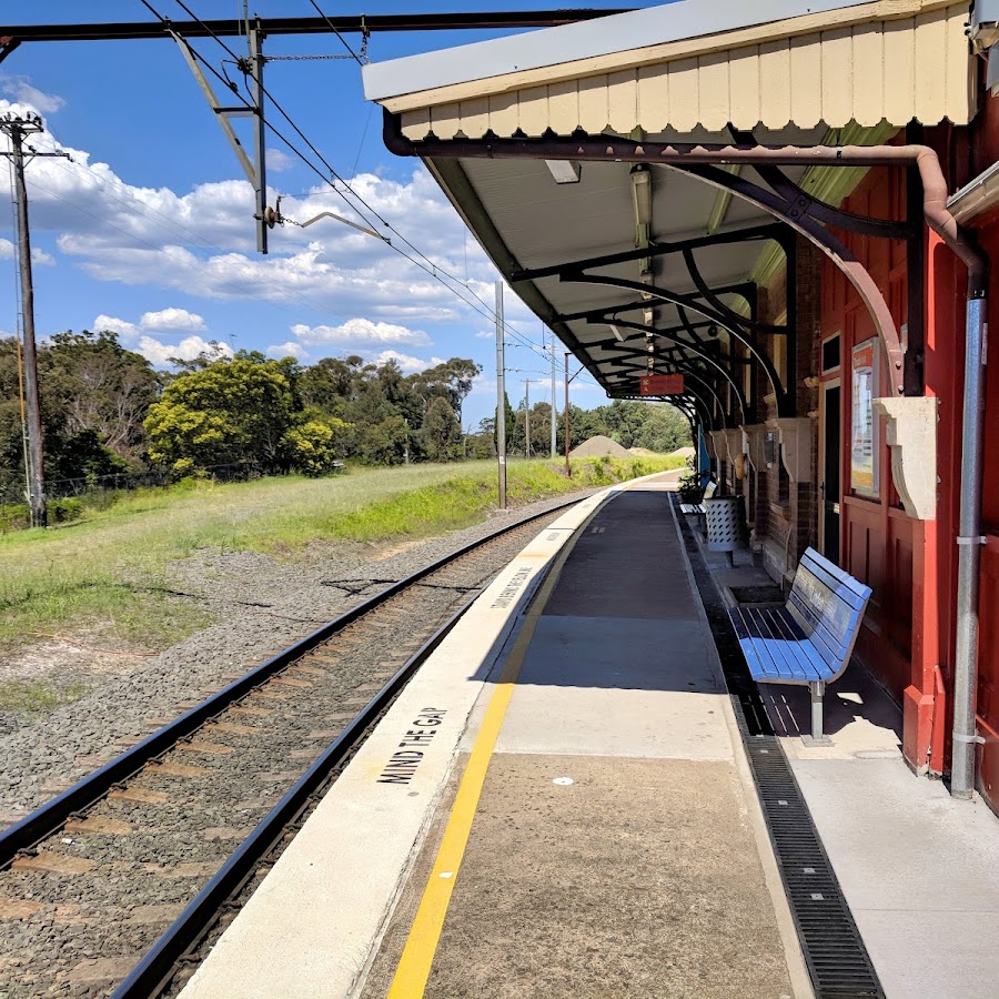
Springwood Station, Macquarie Rd
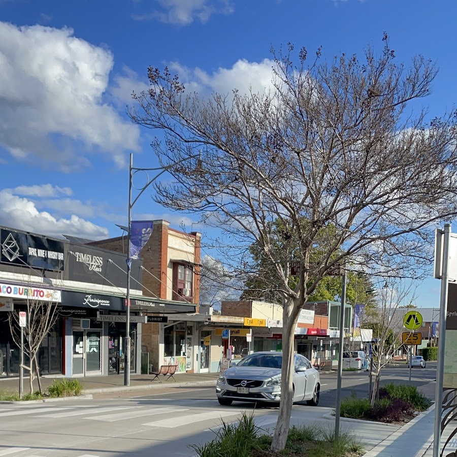
Valley Heights Rail Museum
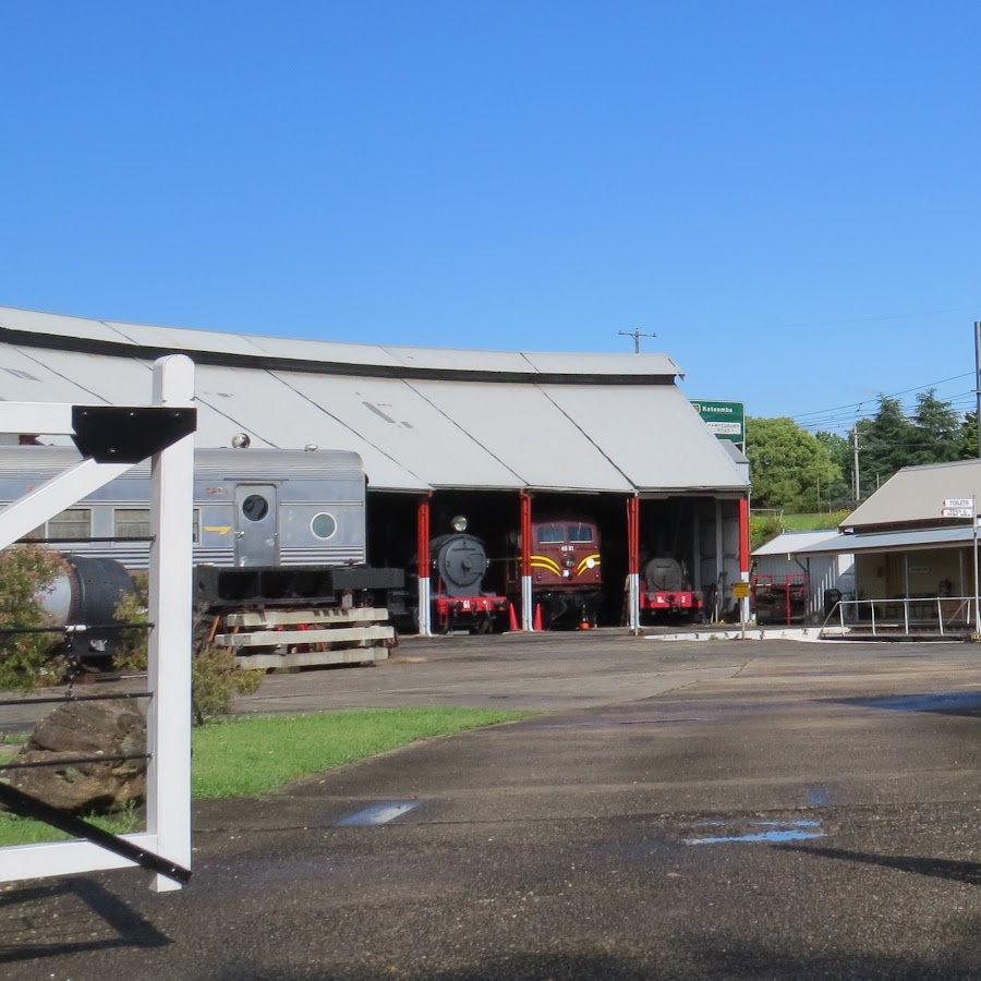
Valley Heights Station
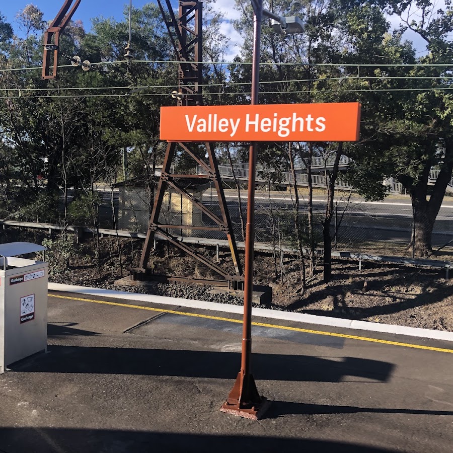
Lower Mountains
Warrimoo - Blaxland - Glenbrook - Lapstone
Wascoe Siding
Wascoe Siding is a small railway siding located in Blaxland, providing access to the Blue Mountains railway line. It serves as a convenient stop for travelers in the area.
Blaxland Station
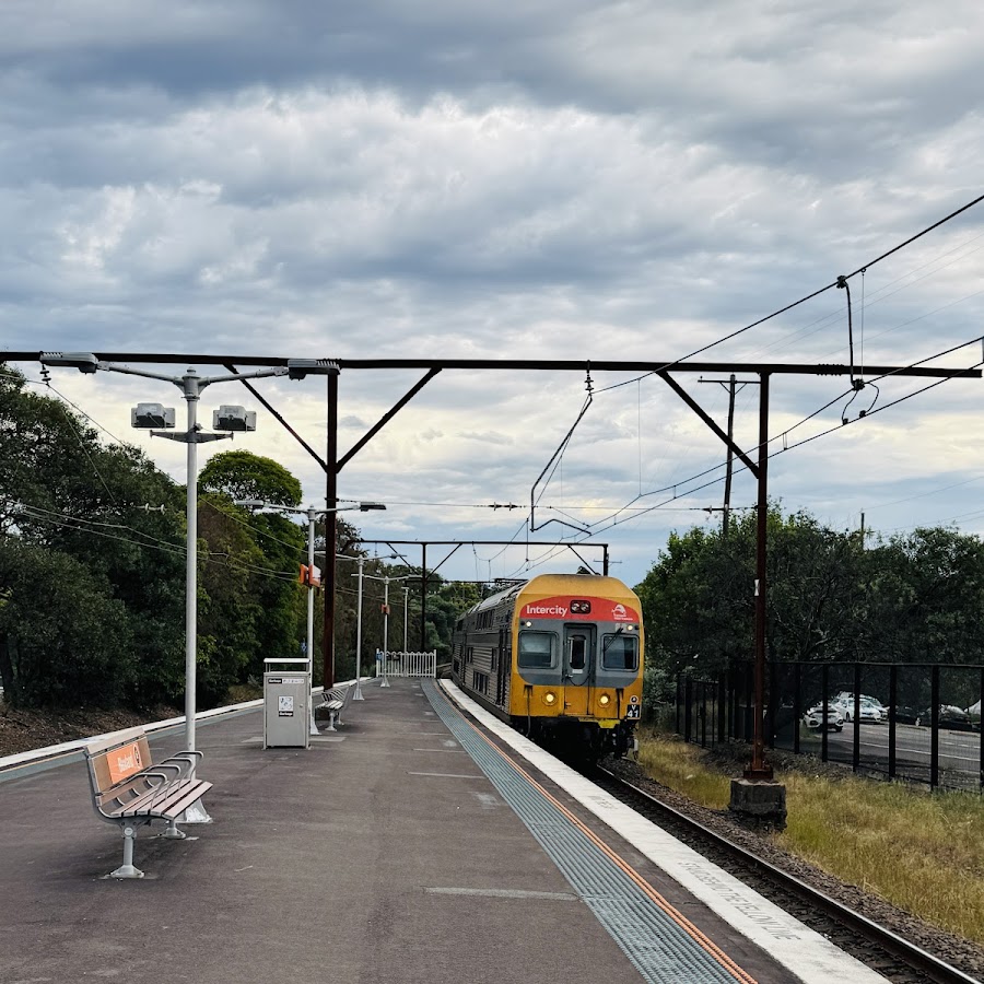
Glenbrook Lagoon
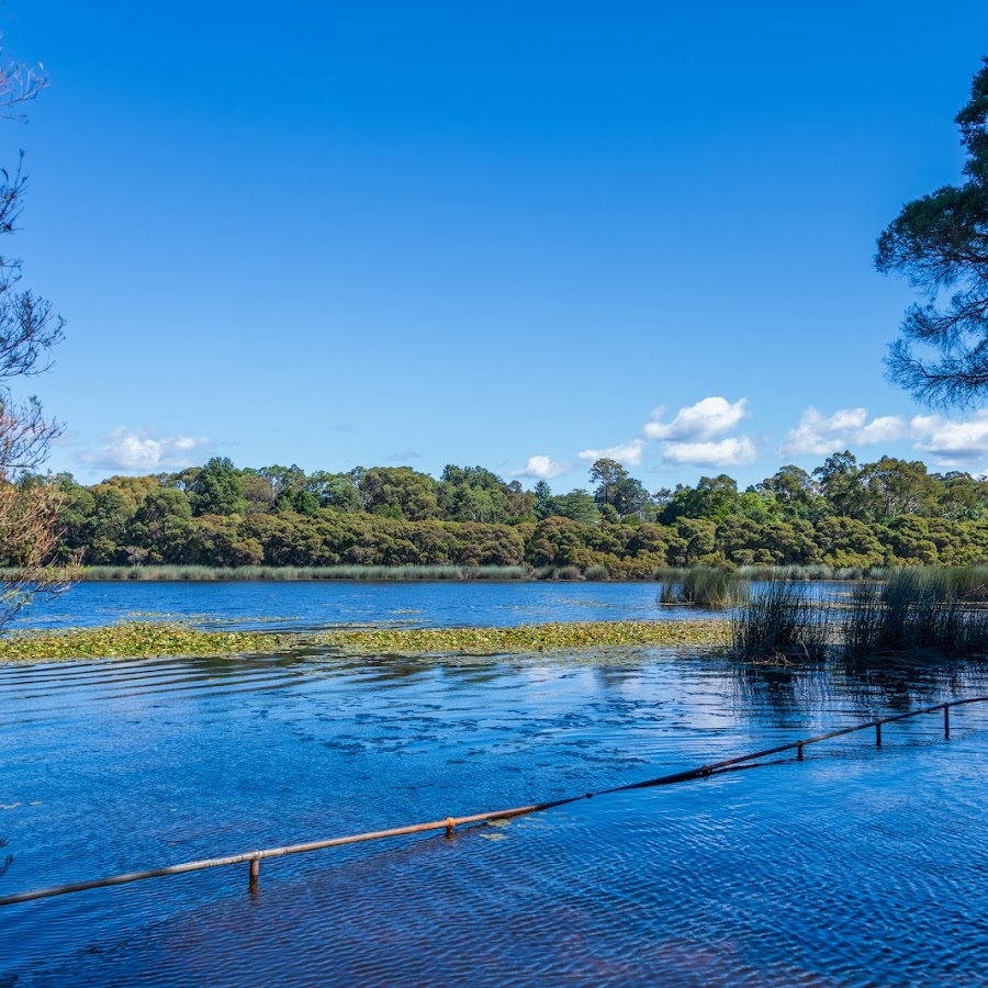
Glenbrook Station
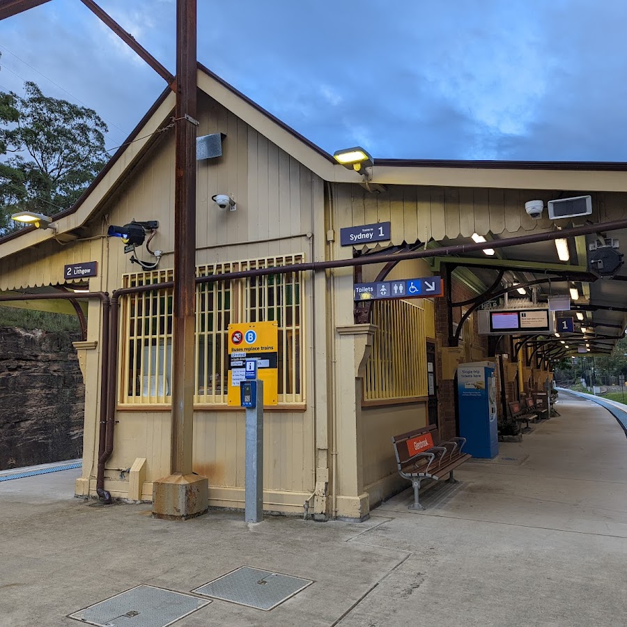
Warrimoo Station
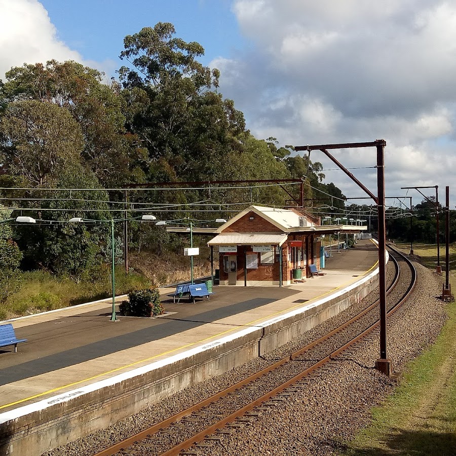
Lapstone Station
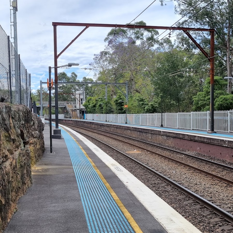
Accessible
Accessible walks and lookouts
Boars Head Lookout
Boar's Head is one of the mountains unusual rock formations. You can view Boars Head half way down the path to Cahill's Lookout. Unfortunately once you get down to Cahill's Lookout, it is no longer not accessible. https://www.facebook.com/profile/100064323152639/search/?q=boars%20head
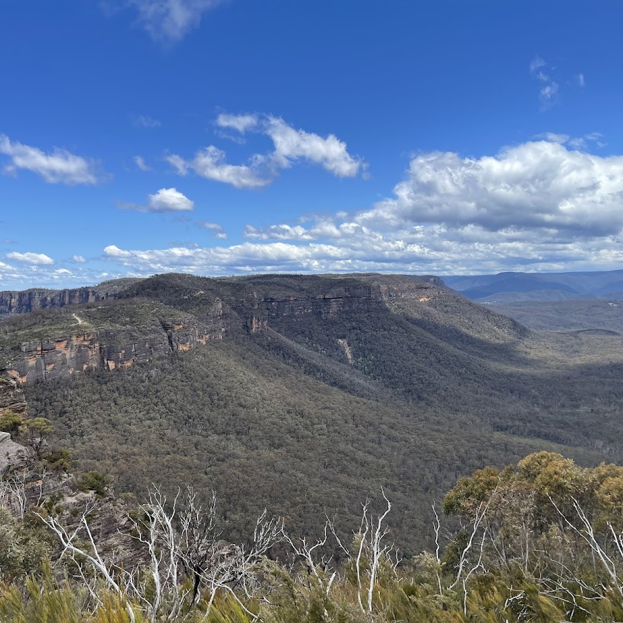
Cliff View Lookout
Direct access is wheelchair friendly and is a lovely walk that starts from where you can park your car at the Katoomba Cascades carpark. This lookout is located on top of the escarpment on the Prince Henry Cliff walk, is well sign posted and has good hand rails and fencing. The lookout is not far from the eastern side of the Scenic Skyway station. It offers great views over the Jamison Valley and Mount Solitary. You can access it directly, or as part of your walk to or from Echo Point. https://www.askroz.com.au/index.php/event_detail/index/cliff-view-lookout
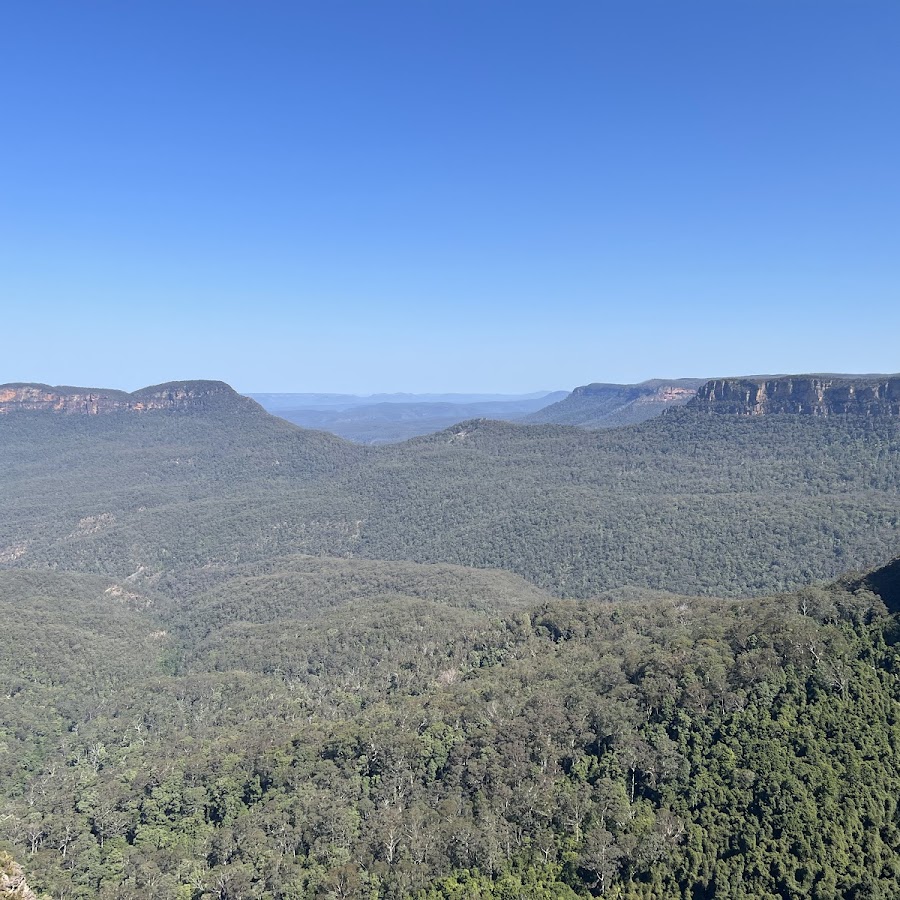
Echo Point Lookout - 3 Sisters
Echo Point lookout is the gateway to many great walks and nature experiences in the area. Standing proudly in the land of the Gundungurra and Darug People, the traditional custodians of this declared Aboriginal Place, the imposing Three Sisters is best seen from Echo Point lookout, on the edge of the plateau above. Enjoy the new Prince of Wales Lookout providing a closer view of The Three Sisters, and the140-metre accessible, elevated, night-lit boardwalk.
Oreades Lookout
Oreades Lookout in Katoomba is a accessible, spacious, circular viewing platform set amid bushland along the Three Sisters Walk, around 400–450 metres from Echo Point. It features secure fencing and offers sweeping views over the Jamison Valley and towards Mount Solitary, making it a perfect spot for panoramic photos and birdwatching—including sightings of lyrebirds and crimson rosellas. The path to Oreades Lookout is very accessible, with a gentle, downhill concrete path suitable even for those not prepared for bushwalking, providing a tranquil introduction to the native landscape and dramatic escarpment scenery before continuing on to Lady Game Lookout or the Giant Stairway. https://www.facebook.com/profile/100064323152639/search/?q=oreades%20lookout
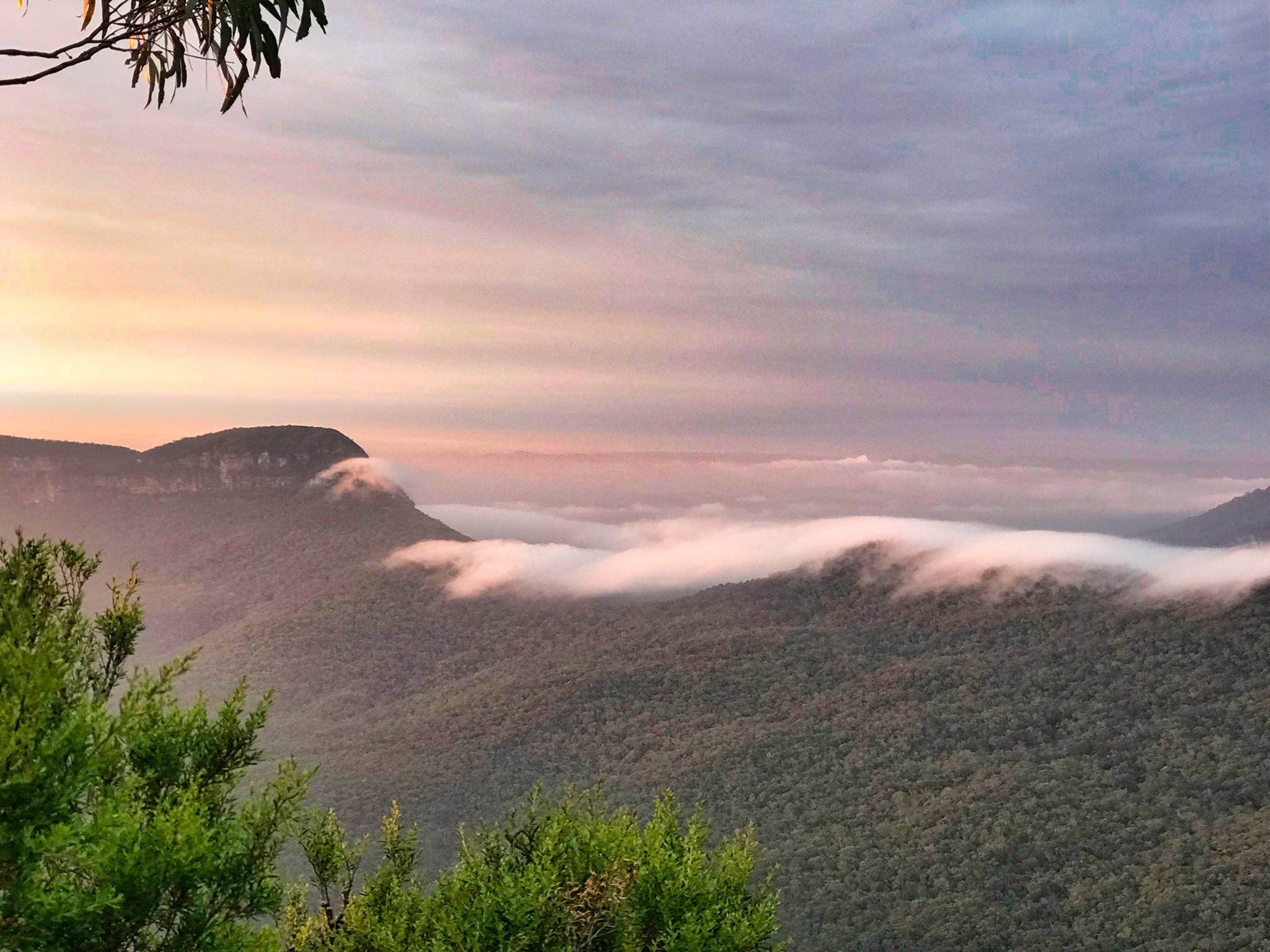
Spooners Lookout
Park your car and walk to the Tourist Information Centre at Echo Point. Take the path to the left of the Information Centre toward the 3 Sisters. Almost immediately you'll see the track to Spooners Lookout on the right. The lookout overlooks Jamison Valley. To your right, you can see the Echo Point lookout and to the left you can see 2 of the 3 Sisters. The lookout was named after Eric Sydney Spooner (2 March 1891 – 3 June 1952) who was an Australian politician.Eric Spooner played a significant part in Katoomba and Leura history. https://www.askroz.com.au/index.php/event_detail/index/spooners-lookout
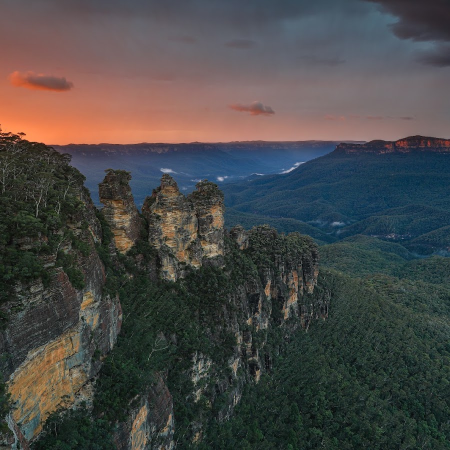
Govetts Leap lookout
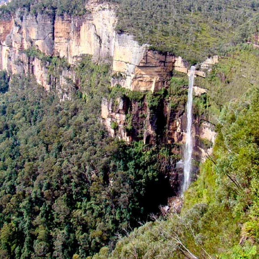
Evans Lookout
Evans Lookout is a popular lookout point in the Blue Mountains, offering stunning views of the Grose Valley and surrounding landscapes. It is a great spot for photography and is accessible via walking trails that lead to various scenic viewpoints. Can be the start or end to the Grand Canyon walk. BACKSTORY: The lookout is named after George William Evans, a British surveyor and explorer who was the first European to discover the area in 1813. Evans was tasked with finding a new grazing land for the colony, and he is credited with discovering the Grose Valley, of which Evans Lookout is a part. During the 19th century, the Blue Mountains became a popular tourist destination, and Evans Lookout was a popular spot for visitors. In the early years, visitors had to hike to the lookout, but in the 1930s, a road was built to make it more accessible. Today, Evans Lookout is a popular spot for hiking, with several trails leading to the lookout, including the Grand Canyon Walk and the Grose Valley. The views from the lookout are stunning, with panoramic vistas of the surrounding mountains and valleys. Take a 360° virtual tour: www.askroz.news/Evans-Lookout-360 https://www.nationalparks.nsw.gov.au/things-to-do/lookouts/evans-lookout

Bookshop Trail
A guide to independent bookshops in the Blue Mountains, NSW https://www.facebook.com/bluemountainsbookshoptrail
Blue Dragon Books
Quality Second Hand Book Shop. Find rare books and best sellers! https://www.facebook.com/BlueDragonBooks
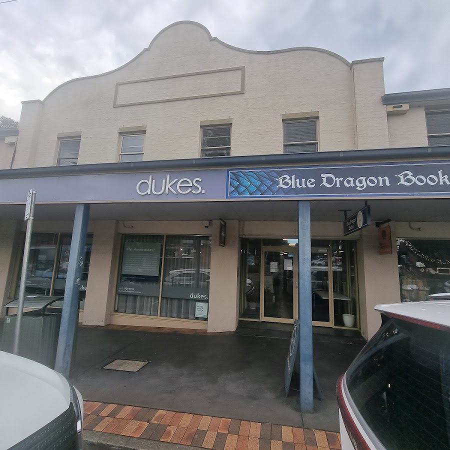
The Turning Page Bookshop
A Springwood icon, The Turning Page has been around as long as I can remember, celebrating 40 years of business in 2023. Selling new books and a selection of games and novelties, it features a great children’s area. https://www.indies.com.au/TheTurningPageBookshop
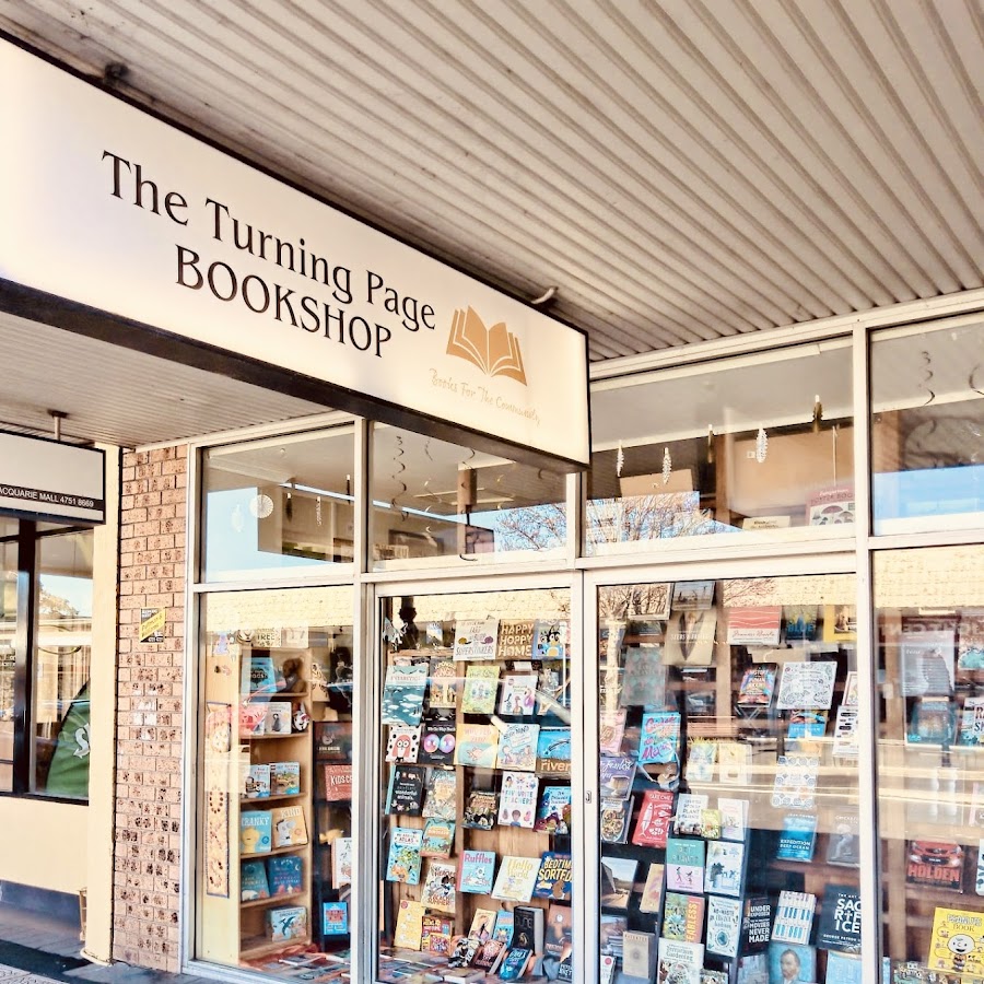
RoseyRavelston Books
RoseyRavelston was definitely the highlight of my day. The bookshop is warm and inviting, with wooden floors, a large table in the centre of the room, armchairs tucked into the corner and a resident dog. While I didn’t try the coffee myself there is an adjoining shop which sells produce and coffee. https://roseyravelstonbooks.com.au
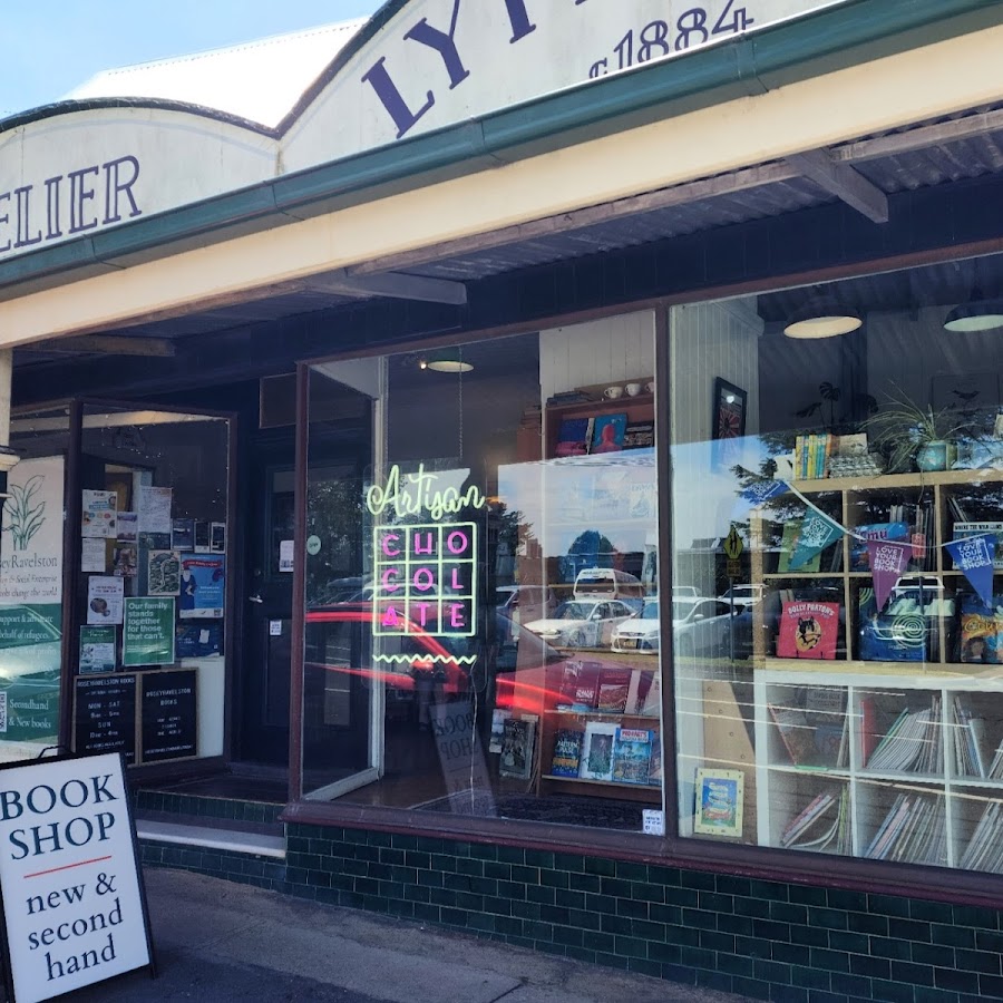
Good Earth Bookshop
Making the world better with books https://www.facebook.com/goodearthbookshop/ https://www.goodearthbookshop.com/
Wyrdbooks
Collecting and dealing in fantasy, science fiction and horror books, is our passion - this site is where we showcase some of our specialised hardcover range and share some new arrivals or general information. https://www.wyrdbooks.com/home/index.html
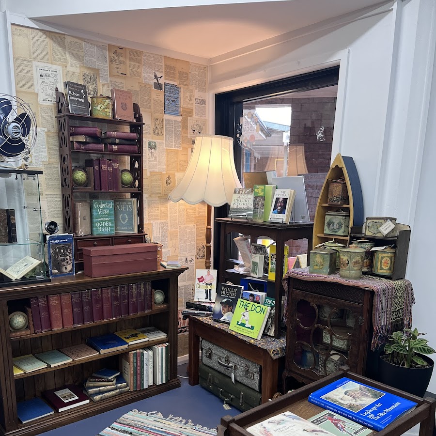
Megalong Books
Leura is another great option for a lunch stop with cafe options spread all along the Mall. Megalong Books is found on the Katoomba side and stocks new books. https://megalongbooks.com.au/
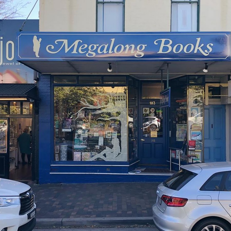
The Little Lost Bookshop Katoomba
Charming bookshop with a split level located in a little alleyway between the main street and the shopping centre. The upstairs features a piano and chairs for perusing and they sell a selection of games and new books. A place full of old thoughts, strange ideas and beautiful books. It is The Little Lost Bookshop. https://www.littlelostbookshop.com.au/
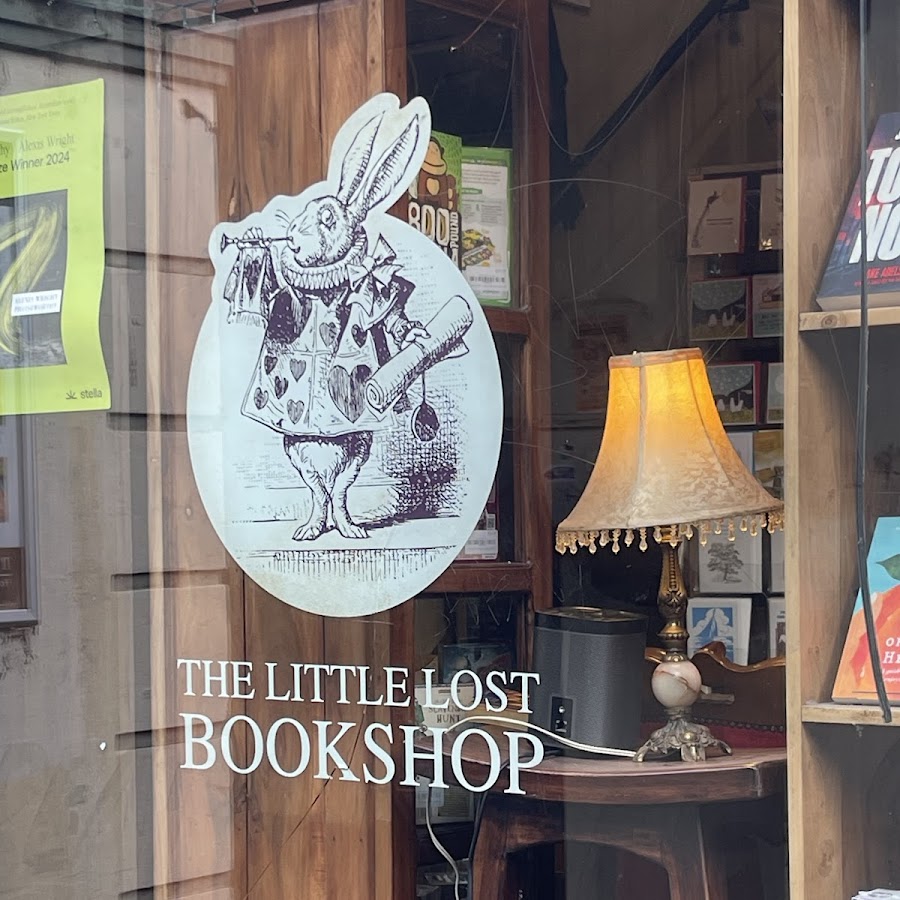
Mr Pickwick's Fine Old Books
Its the lower level of a large antiques and collectables store and only a small sign out the front indicates it’s presence. They have a good selection of classics and Australiana. Opening Hours: 7 Days 10am – 5pm
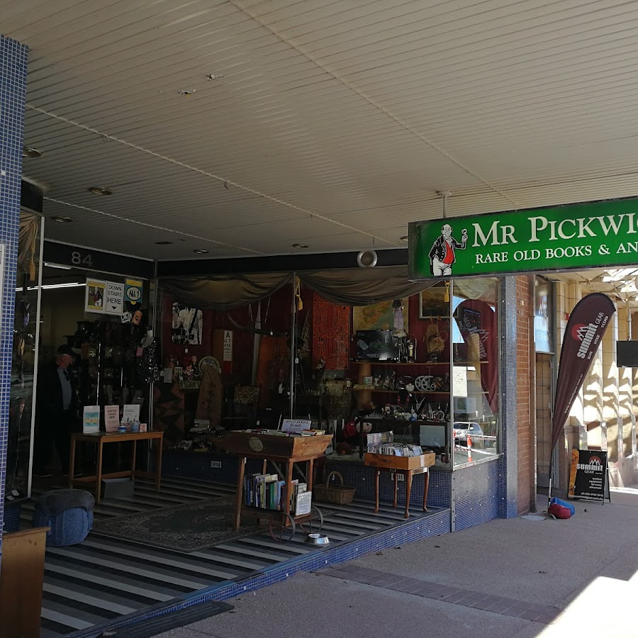
Gleebooks at Blackheath
Tucked away in Colliers Arcade which runs off Govetts Leap Road, there is a new and secondhand part of Gleebooks. Each has their own store but they face each other across the walkway of the arcade. We did arrive to find the secondhand store had closed earlier than the new but got to have a wander in this light and airy bookshop! https://gleebooks.com.au/
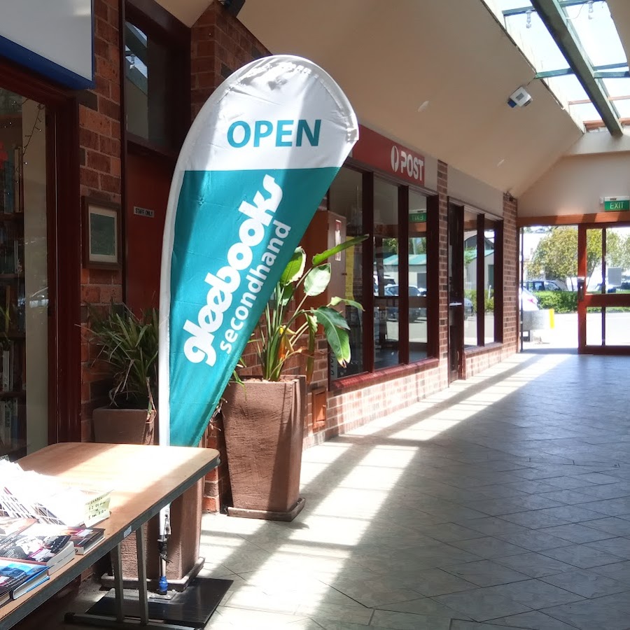
Reader's Heaven
A Readers Heaven was another of my favourites on the day with a good space and selection to choose from. Make sure you have a rummage through the bargain shelf by the window which has some great books for just $1! https://areadersheaven.wordpress.com/
Dog Friendly
Your dog/s must be on a leash.
Cahill's Lookout
Cahills lookout offers a spectacular panoramic view of the Megalong Valley and there are views of unique rock formations. This lookout is a great spot for sunset photography. https://www.facebook.com/profile/100064323152639/search?q=cahills%20lookout
Echo Point Lookout - 3 Sisters
Echo Point lookout is the gateway to many great walks and nature experiences in the area. Standing proudly in the land of the Gundungurra and Darug People, the traditional custodians of this declared Aboriginal Place, the imposing Three Sisters is best seen from Echo Point lookout, on the edge of the plateau above. Enjoy the new Prince of Wales Lookout providing a closer view of The Three Sisters, and the140-metre accessible, elevated, night-lit boardwalk.
Elysian Rock Lookout
The 2 Elysian Rock Lookouts offer some of the best views in the Blue Mountains. The lookouts are just a short walk from the street. You can visit the lookout directly or as part of the fantastic Prince Henry Cliff Walk that goes from Scenic World to the eastern side of Leura. Park your car in Olympian Parade and walk down the poorly marked track to the lookout. You can also access it via Gordon Fall Lookout track and from Olympian Rock track. Easy walking but NOT wheelchair friendly. Elysian describes a blissful state, like the one most people hope to enjoy.The name "Elysian" comes from the idyllic Greek mythological place called Elysian Fields. In Greek mythology, Elysian Fields or Elysium is a place of perfect happiness prepared by the gods for the worthy dead. https://www.askroz.com.au/index.php/event_detail/index/elysian-rock-lookout
Katoomba Cascades
The loop from Katoomba Cascades around to Reids Plateau explores several lookouts and the bush through the area. There are a couple of short side trips out to extra lookouts, including one that passes through a natural tunnel. Reids Plateau Picnic area has a few seats, shelter, and a great view making a great spot for a picnic lunch. From Katoomba Cascades, you can walk over to the Reids Plateau. Katoomba Cascades to Reids Plateau is also part of the Katoomba Night Lit Walk. Many thanks to Logan Spice for the photo. https://www.facebook.com/profile/100064323152639/search/?q=katoomba%20cascades
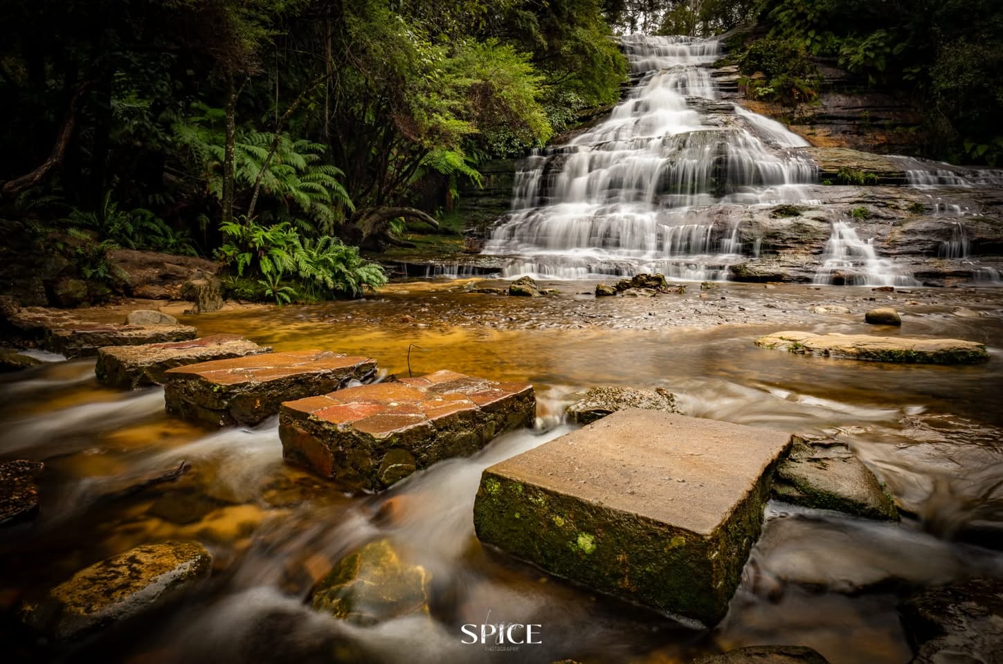
Olympian Rock
This is a small outstanding lookout on the Prince Henry Cliff Walk that is also accessible from Olympian Parade via a short walk or via the Prince Henry Cliff Walk. The lookout faces south, so the view is best at sunrise and sunset. Having said that, the view is outstanding all day. https://www.askroz.com.au/index.php/event_detail/index/olympian-rock-lookout
Reids Plateau Lookout
Reids Plateau offers commanding views over the Jamison Valley, Orphan Rock and Katoomba Falls You can access this from multiple directions. Going directly from the carpark is only a 5-minute walk. The loop around Reids Plateau explores several lookouts and the bush through the area. There are a couple of short side trips out to extra lookouts, including one that passes through a natural tunnel. Reids Plateau Picnic area has a few seats, shelter, and a great view making a great spot for a picnic lunch. From Reids Plateau, you can walk down to the Katoomba Cascades. Reids Plateau is also part of the Katoomba Night Lit Walk. https://www.askroz.com.au/index.php/event_detail/index/reids-plateau
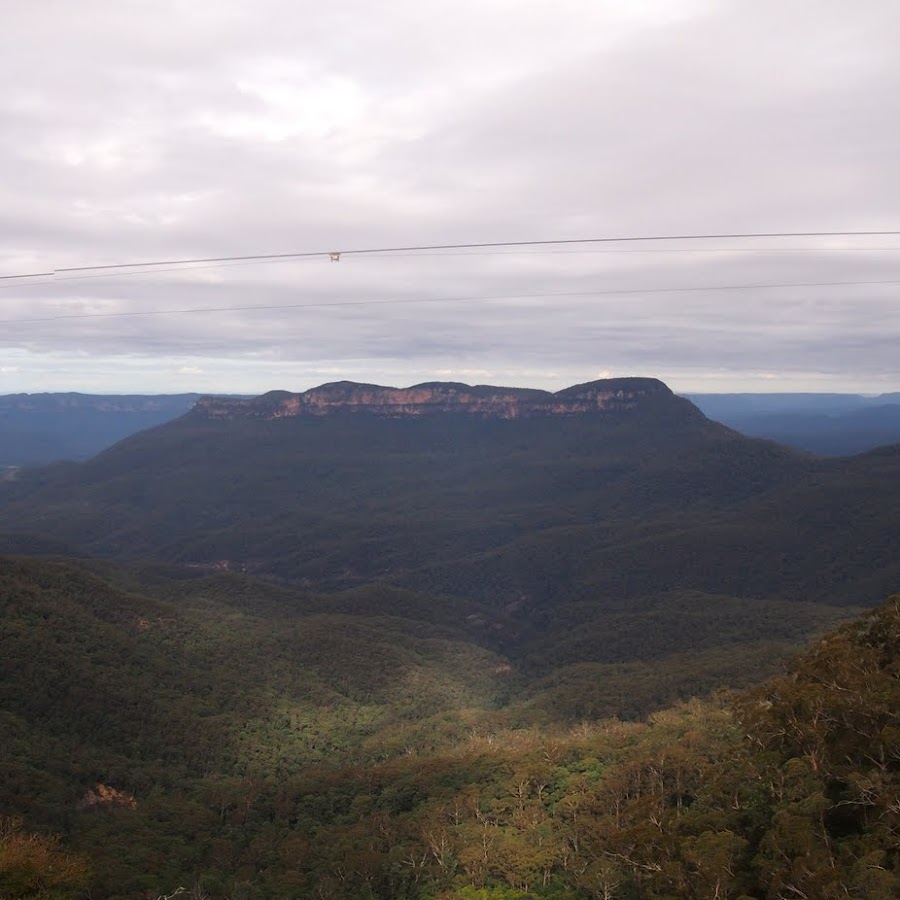
Spooners Lookout
Park your car and walk to the Tourist Information Centre at Echo Point. Take the path to the left of the Information Centre toward the 3 Sisters. Almost immediately you'll see the track to Spooners Lookout on the right. The lookout overlooks Jamison Valley. To your right, you can see the Echo Point lookout and to the left you can see 2 of the 3 Sisters. The lookout was named after Eric Sydney Spooner (2 March 1891 – 3 June 1952) who was an Australian politician.Eric Spooner played a significant part in Katoomba and Leura history. https://www.askroz.com.au/index.php/event_detail/index/spooners-lookout
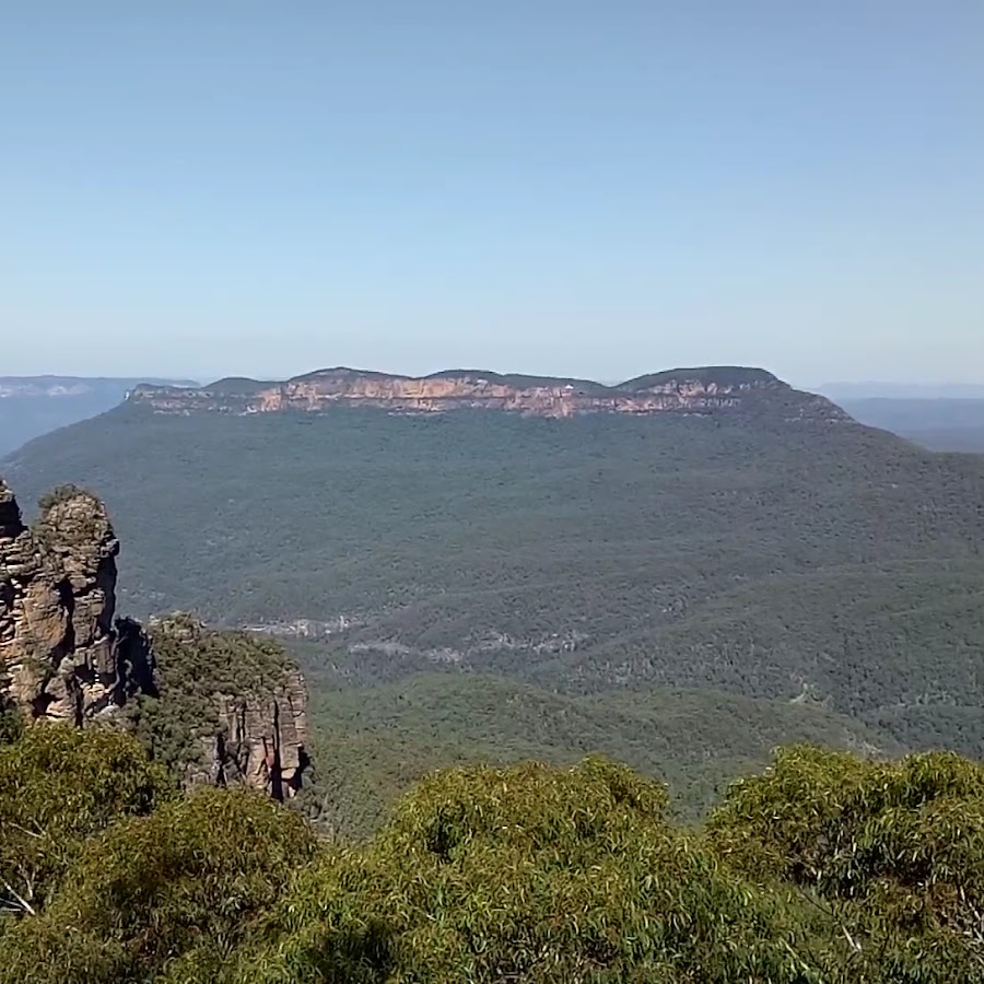
Farm Gate - Cellar Door - Fruit & Nuts
Megalong Creek Estate
Megalong Creek in the stunning Megalong Valley. Known for its picturesque setting. https://www.facebook.com/megalongcreekestate
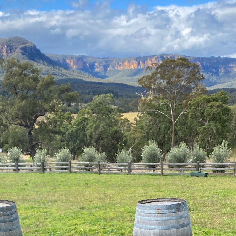
Dryridge Estate
Come & visit us in the beautiful Megalong Valley! Open for wine tasting Saturday & Sunday from 11am. https://www.facebook.com/DryridgeEstateMegalong https://dryridge.com.au/
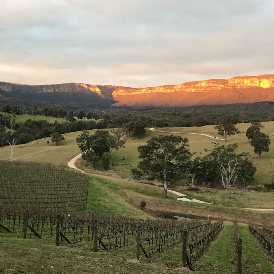
Markets
Blackheath Crafts and Creatives Market
Blackheath Craft and Creatives Market is a small community market on the 4th weekend of each month https://www.facebook.com/profile.php?id=61578148523602
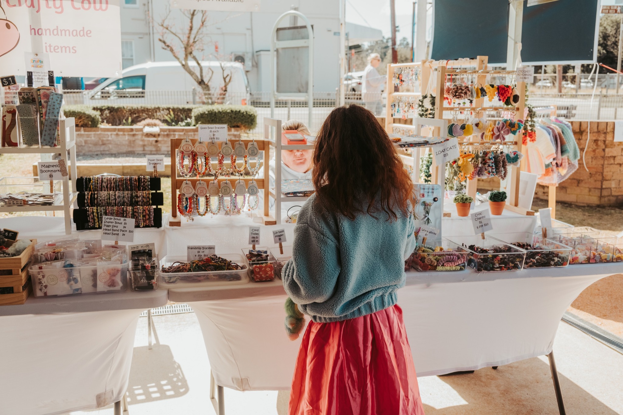
Blackheath Growers Market
Glenbrook Rotary Markets
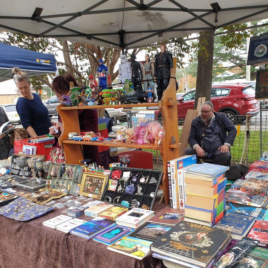
Magpie Upstyle Markets
Springwood Growers Market
4th Sunday of every month
Megalong Makers Market
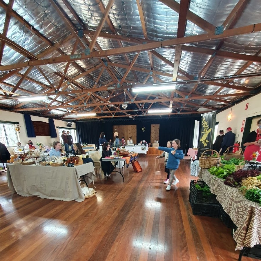
Megalong Farm Gate Market
Every Saturday Produce Market 9am -3pm. Amazing seasonal produce from the farm next door to the Megalong Tearooms - Lot 101. Local vegetables are offered to the mountains and beyond. Bring your basket or bag and come down to check it out.

Picnic & BBQ Spots
Cahills Picnic Spot
There are several picnic tables, but no toilets. There is also PAID parking.
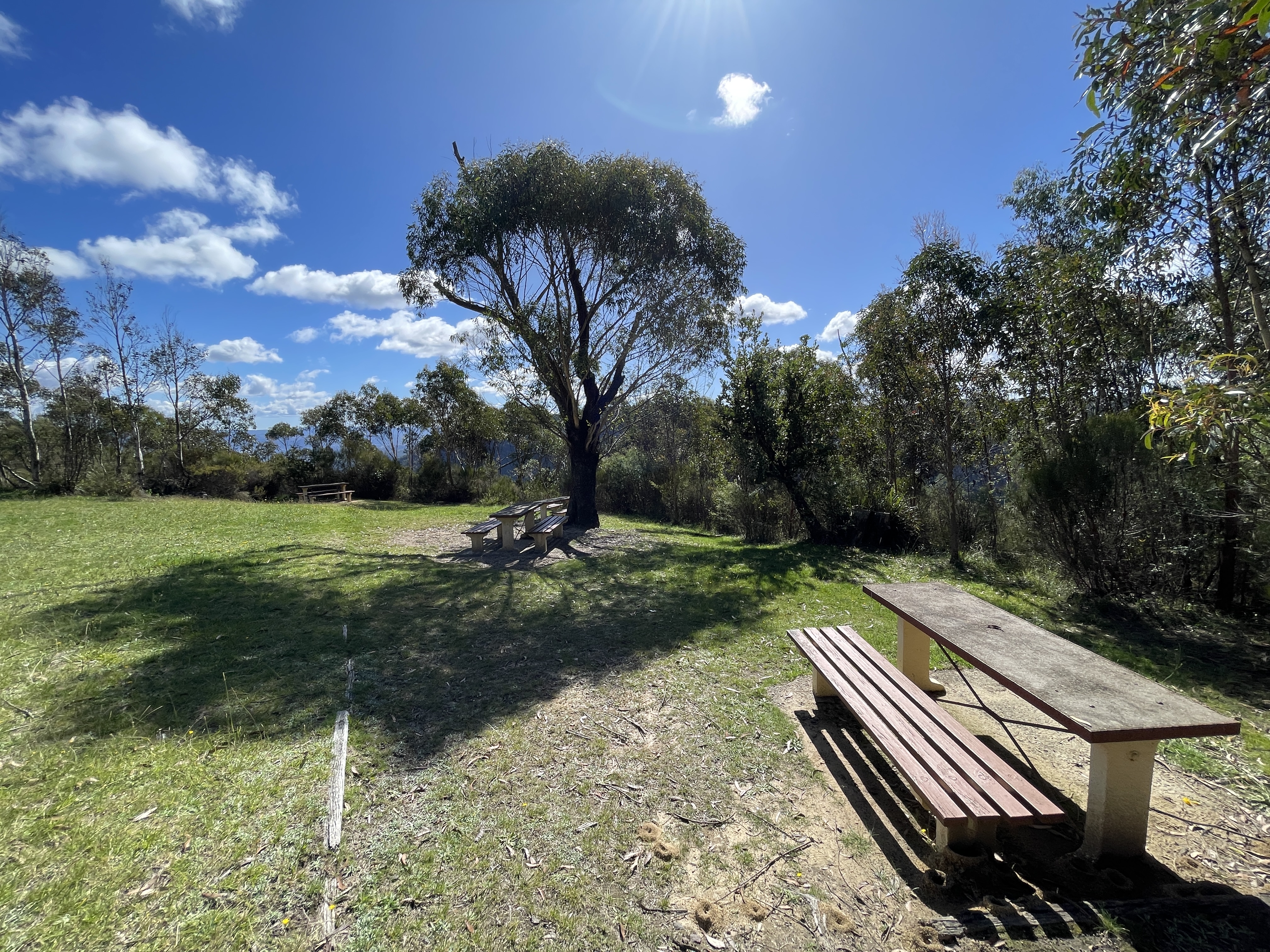
Large Picnic Table with a view
The is a small private picnic area with excellent views over the Megalong Valley. Park your car in the small clearing on Cliff Drive at the Peckmans Plateau sign and walk down the track a short distance and turn left. The picnic table is about 50 metres further on and don't forget to take your hat as there is no shelter. https://www.askroz.com.au/index.php/event_detail/index/peckmans-picnic-table
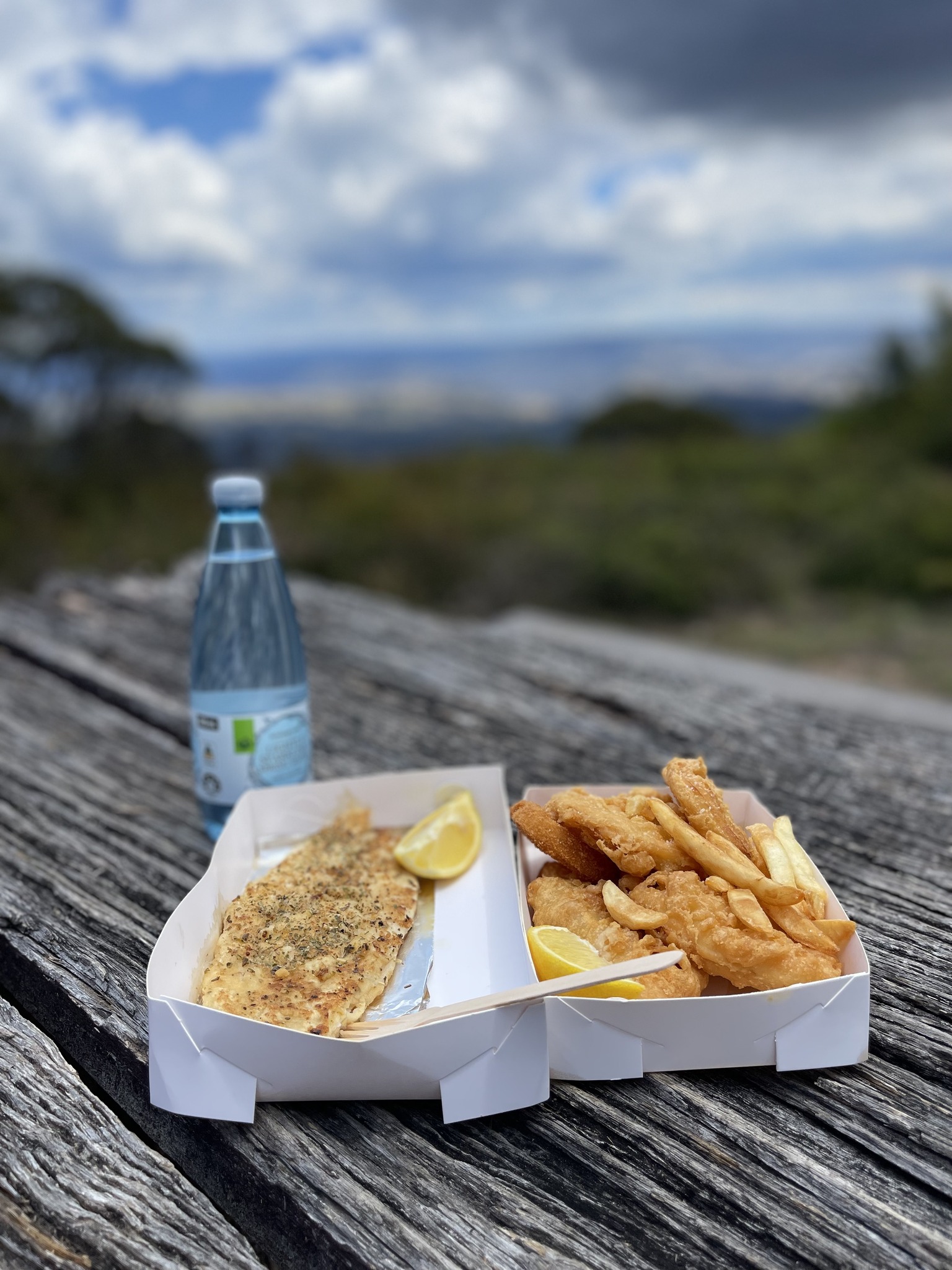
Blue Mountains Botanic Garden Mount Tomah
Discover a showcase of local and imported cool climate plants and basalt cap forests, surrounded by UNESCO World Heritage Area wilderness. Enjoy the tranquillity on the walking trails, wander the plant displays, or take a pitstop at the restaurant with views of the scenic mountains. Open 7days a week. https://www.botanicgardens.org.au/blue-mountains-botanic-garden-mount-tomah
Gordon Falls Reserve
Picnic and free BBQ facilities.
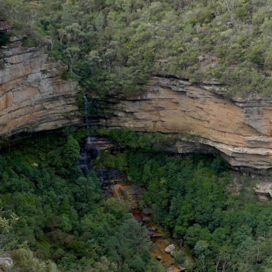
Hinkler Park - Katoomba
Bert Hinkler park is a smaller sized park with heritage play equipment, big swings (popular with all ages) and some lovely features such as mosaic faces to a tunnel and vintage cabin-style public toilets. There is a good picnic shelter, picnic tables and seats and a separate garden area to the east. Toilet located in the park https://bluemountainsmums.com/listing/hinkler-park-katoomba/
Maple Grove Park - Katoomba
Popular spot for family picnics. Two free electric BBQs, plenty of tables, lots of shady spots, a pretty creek, a short walk to Katoomba Falls, and lots of PAID parking. There is free parking in Katoomba Falls Reserve, nearby. There are tables on both sides of the road. The 686 bus from Katoomba train station runs regularly on weekends and stops nearby.
Mount York - Mount Victoria
Mount York has commanding views over the western plains, many layers of Aboriginal and European heritage, several convict-built roads (now walking tracks), and remnants of the old convict-built roads (1823-1829) can still be seen. Excellent picnic area.
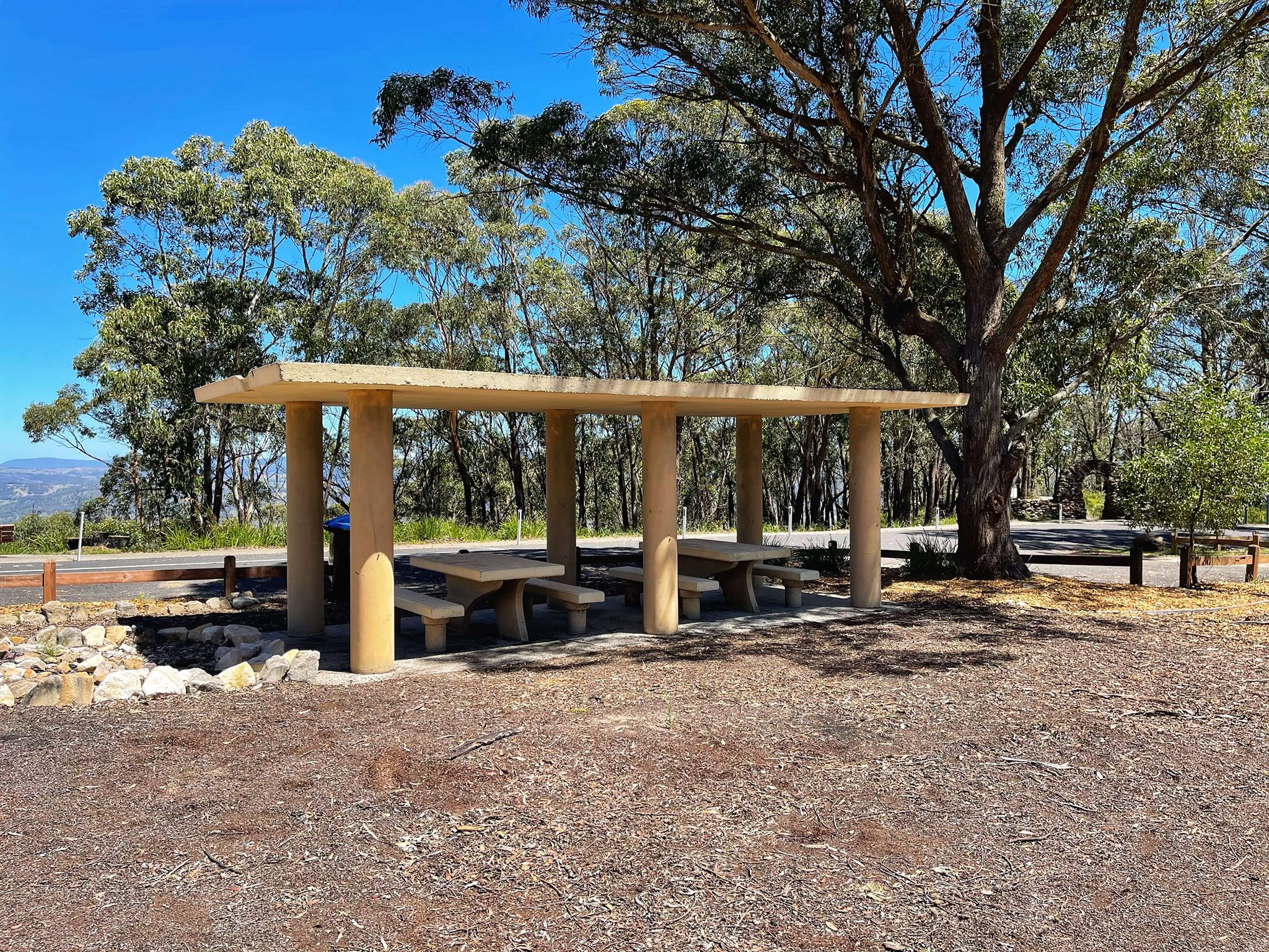
Wentworth Falls Lake - Picnic
There are 2 playgounds and a number of picnic tables. Paid parking at up $12ph applies after 8am.
Railway Stations
Bell Railway Station
Mount Victoria Railway Station
Blackheath Station
Katoomba
Leura Station
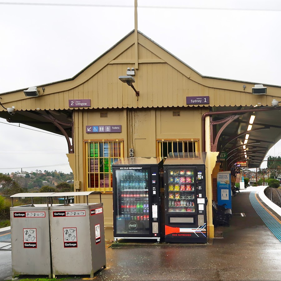
Wentworth Falls Station
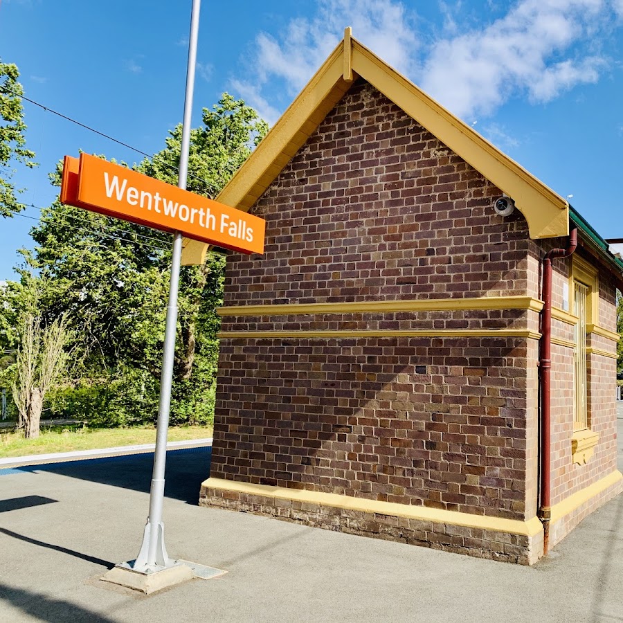
Lawson Station
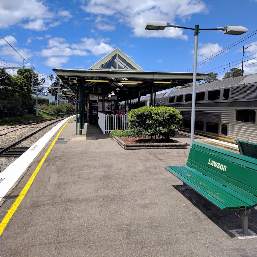
Hazelbrook Station
Woodford Station
Linden Station
Faulconbridge Station
Springwood Station
Valley Heights Station
Warrimoo Station
Blaxland Station
Glenbrook Station
Lapstone Station
Sunrise & Sunset spots
Elysian Rock Lookout - Leura
The 2 Elysian Rock Lookouts offer some of the best views in the Blue Mountains. The lookouts are just a short walk from the street. You can visit the lookout directly or as part of the fantastic Prince Henry Cliff Walk that goes from Scenic World to the eastern side of Leura. Park your car in Olympian Parade and walk down the poorly marked track to the lookout. You can also access it via Gordon Fall Lookout track and from Olympian Rock track. Easy walking but NOT wheelchair friendly. Elysian describes a blissful state, like the one most people hope to enjoy.The name "Elysian" comes from the idyllic Greek mythological place called Elysian Fields. In Greek mythology, Elysian Fields or Elysium is a place of perfect happiness prepared by the gods for the worthy dead. https://www.askroz.com.au/index.php/event_detail/index/elysian-rock-lookout
Wentworth Falls Lake
Toilets - Public
Blackheath - Hargraves Lookout
Public Accessible Toilet
Hinkler Park Park
Bert Hinkler park is a smaller sized park with heritage play equipment, big swings (popular with all ages) and some lovely features such as mosaic faces to a tunnel and vintage cabin-style public toilets. There is a good picnic shelter, picnic tables and seats and a separate garden area to the east. Toilet located in the park https://bluemountainsmums.com/listing/hinkler-park-katoomba/
Katoomba - Studleigh Place Public Toilet
Toilet located at entrance to Studleigh Place car park
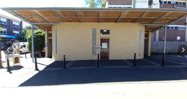
Leura - Leura Carpark
Toilet located in the carpark behind the shops and Woolworths
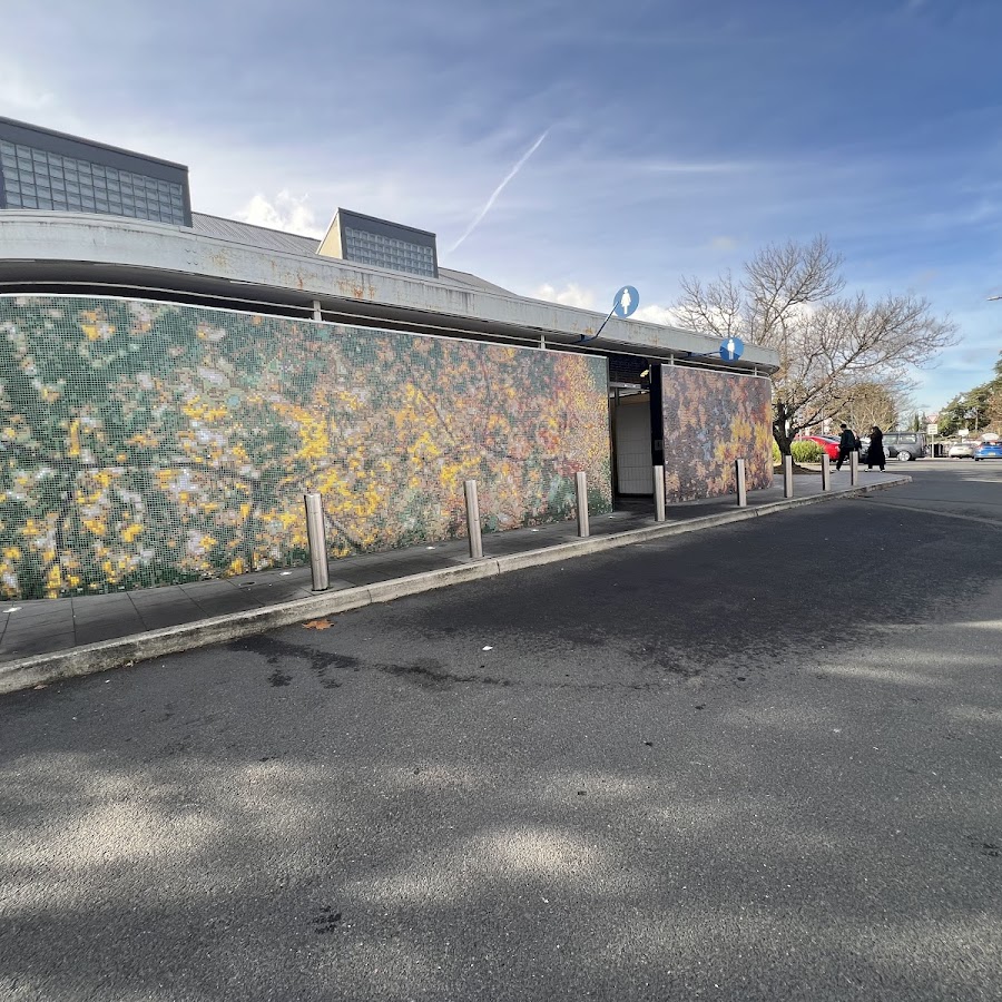
Leura - Gordon Falls Reserve
Toilets are located in the park on Lone Pine Avenue.
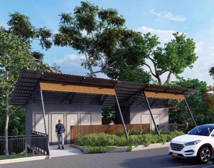
Katoomba - The Town Centre Arcade Toilets
Toilets located at the rear of The Town Centre Arcade
Katoomba - Melrose Park
Toilet located in the park
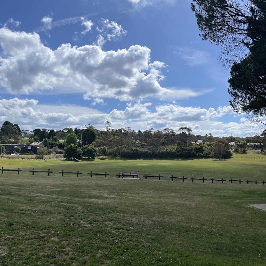
Katoomba - Lilianfels Park
Toilet located in the park
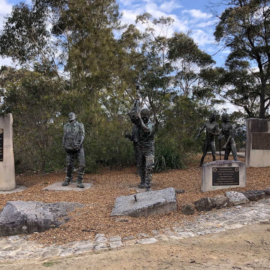
Katoomba - Katoomba Village
Toilet located in the sopping centre near Coles
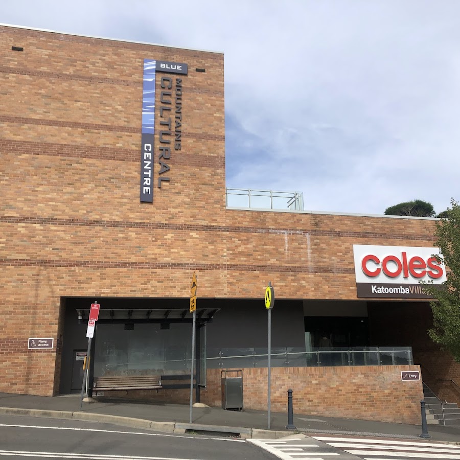
Katoomba - Katoomba Falls Reserve Public Toilets
Toilet located in the Katoomba Falls Reserve
Katoomba - Echo Point
Toilet located on the left as you walk towards the Echo Point Visitors Information Centre
Katoomba - Blue Mountains Cultural Centre
Toilet located in the Blue Mountains Cultural Centre upstairs from Coles
Mount Victoria - Mount York
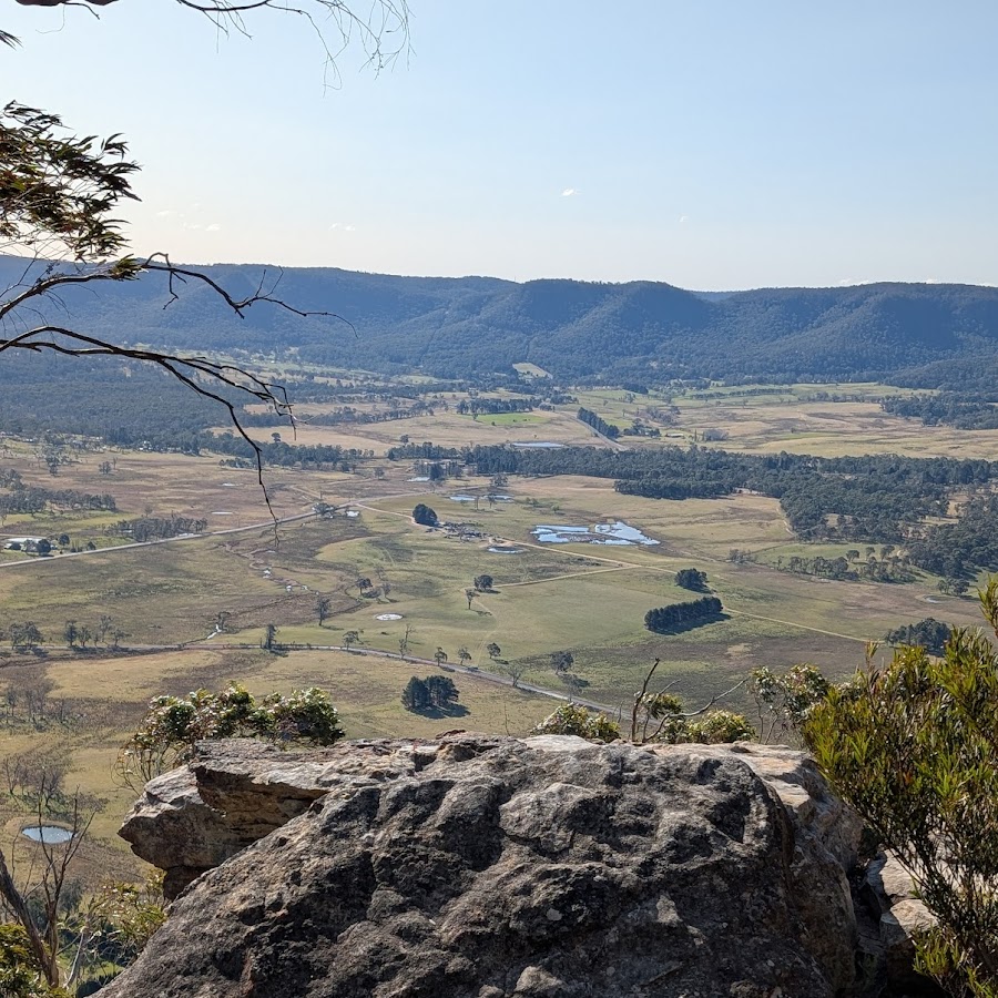
Mount Victoria - Memorial Park
Waterfall Views
Weather
Moon Phases: https://www.timeanddate.com/moon/phases/australia/sydney Sunrise - Sunset: https://sunrisesunset.willyweather.com.au/nsw/greater-western-sydney/katoomba.html Dark Sky: https://www.lightpollutionmap.info/#zoom=10.00&lat=-33.7261&lon=150.5395&state=eyJiYXNlbWFwIjoiTGF5ZXJCaW5nUm9hZCIsIm92ZXJsYXkiOiJ3YV8yMDE1Iiwib3ZlcmxheWNvbG9yIjpmYWxzZSwib3ZlcmxheW9wYWNpdHkiOiI2MCIsImZlYXR1cmVzb3BhY2l0eSI6Ijg1In0= Lightning Map: https://www.lightningmaps.org/#m=ses;t=3;s=0;o=0;b=;ts=0;y=-34.6463;x=149.2628;z=12;d=2;dl=2;dc=0;