McMahons Point Lookout
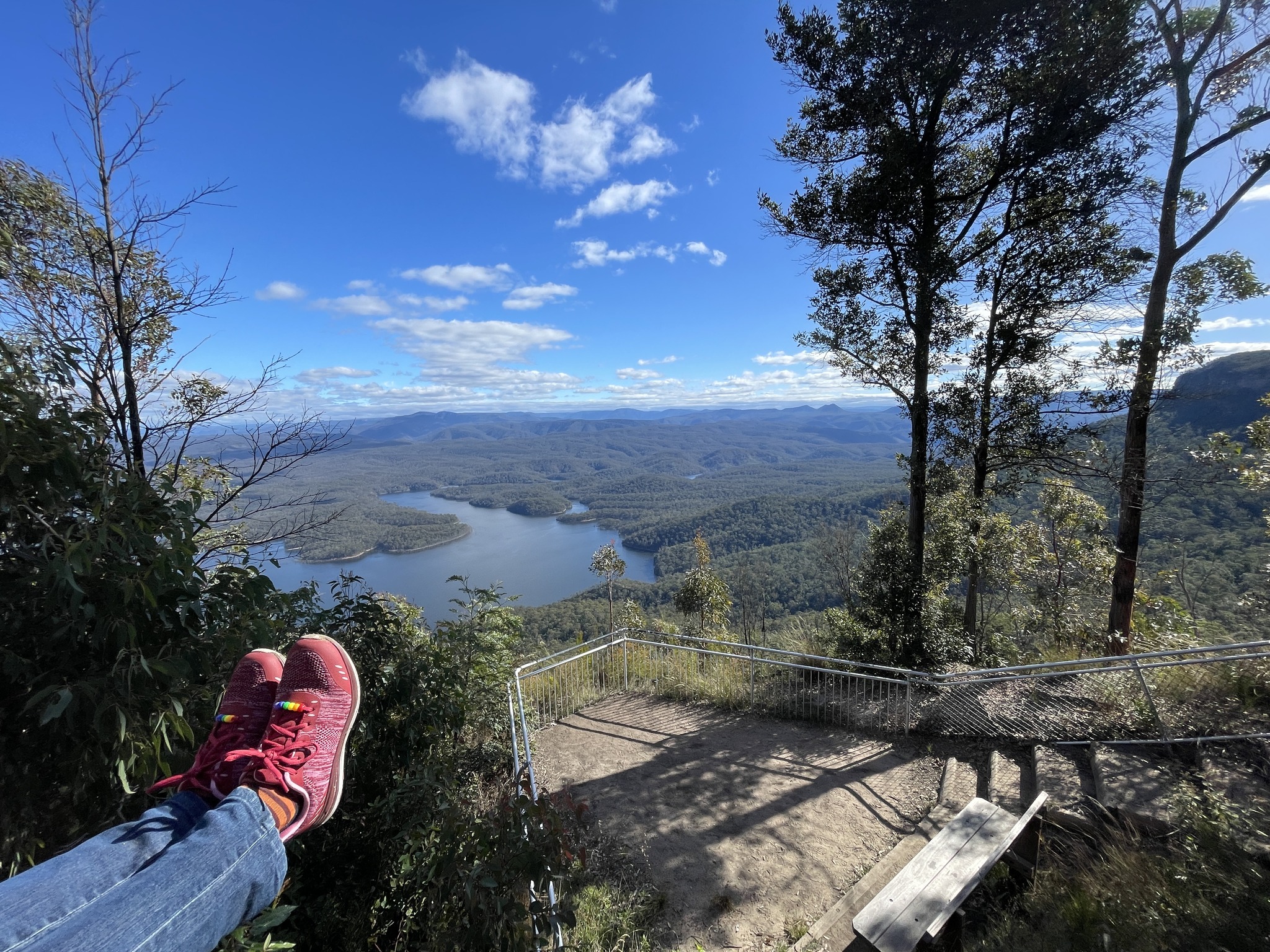
McMahons Lookout, Wentworth Falls. If you're looking for a great place for a walk, and have some picnic spots this could be the one. Pack a picnic and have a great day out. See MORE info and MORE PHOTOS and 360° VIRTUAL TOURS. https://www.askroz.com.au/blog/mcmahons-point-wentworth-falls KEY POINTS for the walk • Distance: 1.6km return • Time: 60 mins return PLUS browsing time • Best time of the day: Any time • Kid-safe: Yes with supervision • Dogs on-leash: No • Steps: Very uneven ground • Accessible: No • Heights: Nothing really • Must do rating out of 10: 9 ACCESS: Head down Tablelands Road, Wentworth Falls past the old Hospital for 20km. McMahons Point's carpark is small. Park here: www.w3w.co/granite.saints.fault There is a toilet and picnic area. The road is about 20km of dirt so drive to the conditions. After rain the NPWS recommends 4wd. ALONG THE WAY: Check out “Battleship Tops“, there’s a small parking area. BACKSTORY: McMahons Lookouts’ are two observation points on the top of the cliff line on the most south point of Kings Tableland. Near these lookouts was the access track into the Burragorang Valley from the Kings Tableland. The packhorse track was in use from the 1860s and was upgraded to horse and cart in the 1870s. In the 1920s it was a road and known as the “one in four” gradient. The first men to travel on this track to Wentworth Falls were George and William Pearce. John McMahon moved into the Burragorang Valley in 1824 as a bonded employee of Denis Green. If you're looking for a great place for a walk, and have some picnic spots this could be the one. Pack a picnic and have a great day out. His ascendants lived on their property called Strathmore below McMahons Lookout. Thomas (Tom) and May McMahon were the postmasters for the Coxs River Post Office during the 1880s.| https://www.facebook.com/AskRozBlueMountains/posts/pfbid0oh534qzkwL23JXE7BBvAEwARWjWbmBxukgzPCvw4bPso8PxrGJ7V9AAg91HdRbF6l
 maps.app.goo.gl