Blue Mountains Local Government Area
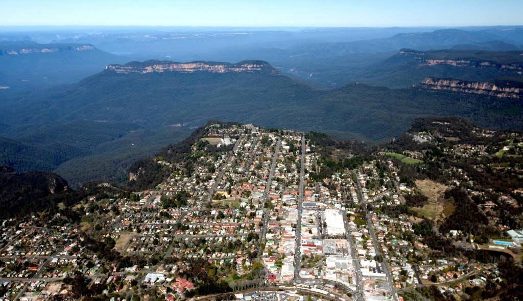
The Blue Mountains Local Government Area (LGA) stretches across a dramatic ridge 100 km west of Sydney, covering 1,431 square kilometres. The population is about 78,000 people, living in 26–27 towns and villages, with a concentration around Katoomba, Leura, and Springwood. Walking Tracks and Lookouts The LGA manages over 120 km of walking tracks, ranging from short scenic strolls to multi-day bushwalks. Iconic hiking routes include the Grand Canyon Track, Six Foot Track, Charles Darwin Walk, and the Clifftop Track between Govetts Leap and Evans Lookout. There are numerous formal lookouts, with premier sites including Echo Point (Three Sisters), Govetts Leap, Wentworth Falls, Evans Lookout, and Sublime Point—all easily accessed by road or track. Roads and Infrastructure The Blue Mountains LGA contains about 665 km of sealed roads and 120 km of unsealed roads, supporting both local travel and tourism. The landscape is serviced by 34 bridges, 175 km of footpaths, and more than 70,000 square metres of sealed car parks to support the high number of visitors throughout the year. The Great Western Highway, a key arterial road, runs the length of the ridge and links townships throughout the area. Area Characteristics About 70% of the LGA is within national park boundaries, reflecting the area's outstanding environmental heritage and World Heritage status. The region is known for extensive bushland, dramatic escarpments, and valleys covered in dense forests and heath. The Blue Mountains LGA combines small-town character, abundant natural attractions, and well-maintained infrastructure, earning its reputation as a gateway to wilderness, recreation, and heritage in NSW. MAP: https://www.bmcc.nsw.gov.au/documents/city-of-blue-mountains-ward-boundaries Photo: BMCC
 bmcc.nsw.gov.au