Hat Hill loop walk
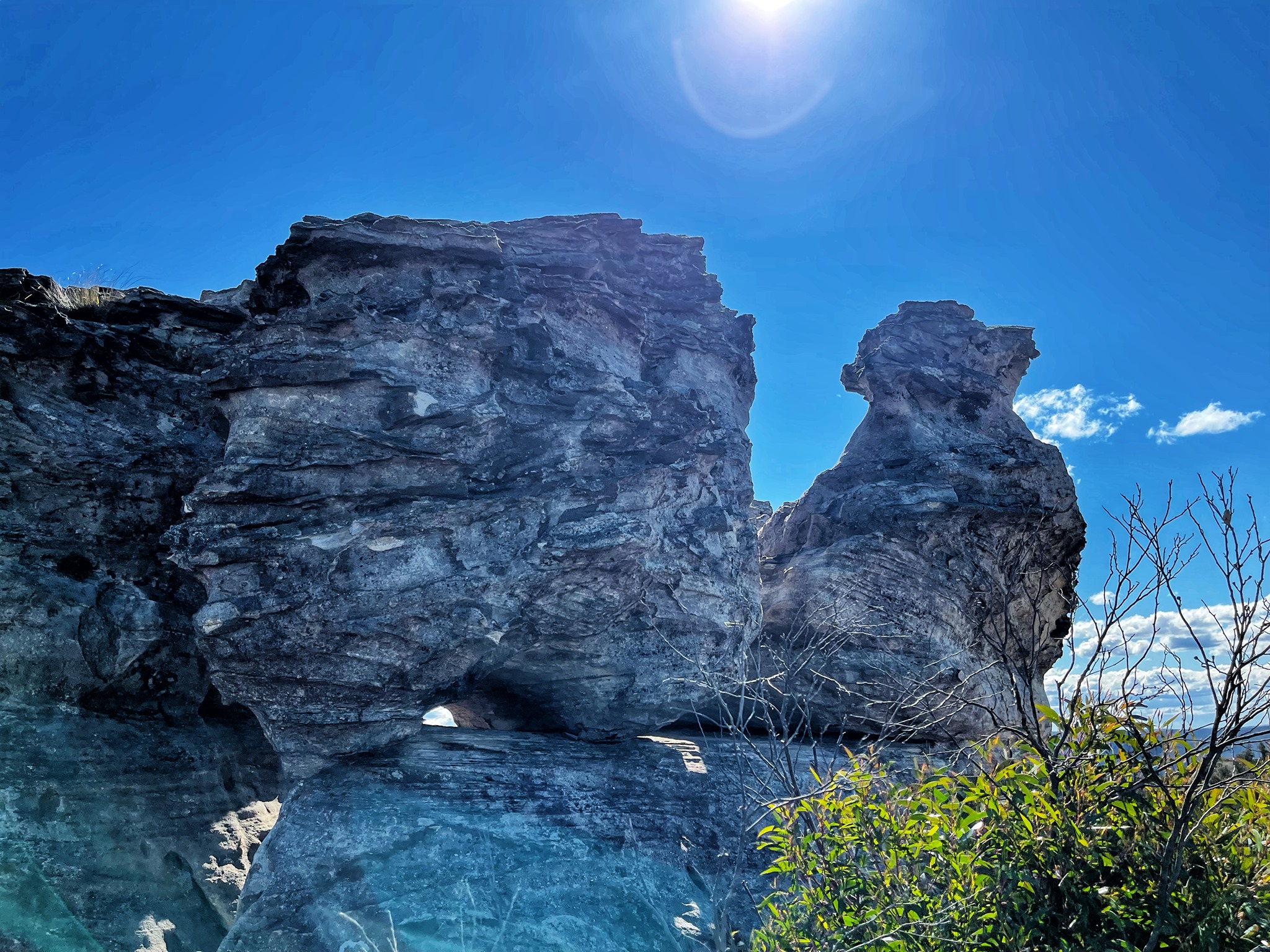
2km: Also Known as 'Hen & Old Mans Hat ~ Hen and Chicken Rock ~ The Rooster ~ Hat Hill to Aboriginal engravings, loop walk. It is the highest point on the Blackheath Plateau at an elevation 1035.17m. From the top, there are GREAT views over Govett Gorge and the Grose Valley. This loop walk goes from the carpark up to Hat Hill and then over the hill down to some Aboriginal engravings and back to your car. KEY POINTS • Distance: About 2km • Time: 1-hour return PLUS browsing time • Best time of the day: Any time • Kid-safe: Yes with supervision, but not little ones • Dogs on-leash: No • Steps: Many • Accessible: No • Heights: There are a few high spots • Must do rating out of 10: 8.5 ACCESS: Park in the small carpark at the entry to the National Park. Here: https://w3w.co/sailors.redefined.lender Walk up Hat Hill and enjoy the view. From there you can return the same way or walk on for about 15 minutes until you get to a right turn. Take that. It heads back to the road. Just before you get to the road you'll see some rock formations on the right. Check out the faint Aboriginal engravings. Here: https://what3words.com/dipper.negotiates.soon OPTION: You can also continue on to Bald Head. That is about a 6km return walk. MORE info: https://www.askroz.com.au/event_detail/index/old-mans-hat-~-hen-and-chicken-~-hat-hill BACKSTORY: Between 1913-1926 William Andrew Murphy (1841-1927), the Hermit of Hat Hill Road, lived nearby in a small house he built from bush rock and corrugated iron. In the 1890s a horse coach service ran to the foot of Hat Hill where a picnic shelter provided a starting point for walking parties to Anvil Rock and Pulpit Rock, beginning with a scramble to the top of Hat Hill to take in the views. https://www.facebook.com/AskRozBlueMountains/posts/pfbid0DEByjERNfBRa1HCh3MBPBepRZJTCL4aPiseBFvYVAjLAiBZ4nkxqGYicpFXMXaLZl
 google.com